Waller County, Texas
| Waller County, Texas | |
|---|---|
|
The Waller County Courthouse in Hempstead | |
 Location in the U.S. state of Texas | |
 Texas's location in the U.S. | |
| Founded | 1873 |
| Named for | Edwin Waller |
| Seat | Hempstead |
| Largest city | Hempstead |
| Area | |
| • Total | 518 sq mi (1,342 km2) |
| • Land | 513 sq mi (1,329 km2) |
| • Water | 4.4 sq mi (11 km2), 0.8% |
| Population | |
| • (2010) | 43,205 |
| • Density | 84/sq mi (32/km²) |
| Congressional district | 10th |
| Time zone | Central: UTC-6/-5 |
| Website |
www |

Waller County is a county in the U.S. state of Texas. As of the 2010 census, the population was 43,205.[1] Its county seat is Hempstead.[2] The county was named for Edwin Waller, a signer of the Texas Declaration of Independence and first mayor of Austin.
Waller County is included in the Houston-The Woodlands-Sugar Land, TX Metropolitan Statistical Area.
Geography
According to the U.S. Census Bureau, the county has a total area of 518 square miles (1,340 km2), of which 513 square miles (1,330 km2) is land and 4.4 square miles (11 km2) (0.8%) is water.[3]
Adjacent counties
- Grimes County (north)
- Montgomery County (northeast)
- Harris County (east)
- Fort Bend County (south)
- Austin County (west)
- Washington County (northwest)
Demographics
| Historical population | |||
|---|---|---|---|
| Census | Pop. | %± | |
| 1880 | 9,024 | — | |
| 1890 | 10,888 | 20.7% | |
| 1900 | 14,246 | 30.8% | |
| 1910 | 12,138 | −14.8% | |
| 1920 | 10,292 | −15.2% | |
| 1930 | 10,014 | −2.7% | |
| 1940 | 10,280 | 2.7% | |
| 1950 | 11,961 | 16.4% | |
| 1960 | 12,071 | 0.9% | |
| 1970 | 14,285 | 18.3% | |
| 1980 | 19,798 | 38.6% | |
| 1990 | 23,390 | 18.1% | |
| 2000 | 32,663 | 39.6% | |
| 2010 | 43,205 | 32.3% | |
| Est. 2015 | 48,656 | [4] | 12.6% |
| U.S. Decennial Census[5] 1850–2010[6] 2010–2014[1] | |||
As of the 2000 Census,[7] there were 32,663 people, 10,557 households, and 7,748 families residing in the county. The population density was 64 people per square mile (25/km²). There were 11,955 housing units at an average density of 23 per square mile (9/km²). The racial makeup of the county was 57.83% White, 29.25% Black or African American, 0.49% Native American, 0.38% Asian, 0.02% Pacific Islander, 10.28% from other races, and 1.76% from two or more races. 19.42% of the population were Hispanic or Latino of any race.
There were 10,557 households out of which 35.10% had children under the age of 18 living with them, 55.70% were married couples living together, 13.00% had a female householder with no husband present, and 26.60% were non-families. 21.00% of all households were made up of individuals and 7.50% had someone living alone who was 65 years of age or older. The average household size was 2.79 and the average family size was 3.25.
In the county, the population was spread out with 25.70% under the age of 18, 18.10% from 18 to 24, 26.40% from 25 to 44, 20.50% from 45 to 64, and 9.40% who were 65 years of age or older. The median age was 30 years. For every 100 females there were 98.70 males. For every 100 females age 18 and over, there were 96.10 males.
The median income for a household in the county was $38,136, and the median income for a family was $45,868. Males had a median income of $34,447 versus $25,583 for females. The per capita income for the county was $16,338. About 11.50% of families and 16.00% of the population were below the poverty line, including 20.00% of those under age 18 and 12.30% of those age 65 or over.
Economy
Igloo Corporation, a manufacturer of cooling and portable refrigeration products, is headquartered in unincorporated Waller County between Brookshire and Katy.[8] In 2004 Igloo announced that it was consolidating its corporate, distribution, and manufacturing operations in Waller County.[9]
Goya Foods has its Texas offices in an unincorporated area of the county near Brookshire.[10]
Politics
United States Congress
| Senators | Name | Party | First Elected | Level | |
|---|---|---|---|---|---|
| Senate Class 1 | John Cornyn | Republican | 2002 | Senior Senator | |
| Senate Class 2 | Ted Cruz | Republican | 2013 | Junior Senator | |
| Representatives | Name | Party | First Elected | Area(s) of Waller County Represented | |
| District 10 | Michael McCaul | Republican | 2004 | Entire county | |
Texas Legislature
Texas Senate
District 18: Lois Kolkhorst (R)- first elected in 2014.
Texas House of Representatives
District 28: John Zerwas (R)- first elected in 2006.
Voting controversies
There has been a history of controversies regarding the reluctance of county officials to allow students attending historically-black Prairie View A&M University to vote in Waller County.[11][12]
As reported by the US District Court (Southern District of Texas, Corpus Christi Division) in Veasey v Perry, October 2014 (CIVIL ACTION NO. 13-CV-00193), pp 6–7 verbatim:
- In 1971, after the 26th Amendment extended the vote to those 18 years old and older, Waller County which was home to Prairie View A&M University (PVAMU), a historically Black university, became troubled with race issues. Waller County’s tax assessor and voter registrar prohibited students from voting unless they or their families owned property in the county. This practice was ended by a three-judge court in 1979.
- In 1992, a county prosecutor indicted PVAMU students for illegally voting, but dropped the charges after receiving a protest from the DOJ.
- In 2003, a PVAMU student ran for the commissioner’s court. The local district attorney and county attorney threatened to prosecute students for voter fraud—for not meeting the old domicile test. These threatened prosecutions were enjoined, but Waller County then reduced early voting hours, which was particularly harmful to students because the election day was during their spring break. After the NAACP filed suit, Waller County reversed the changes to early voting and the student narrowly won the election.
- In 2007-08, during then Senator Barack Obama’s campaign for president, Waller County made a number of voting changes without seeking preclearance. The county rejected “incomplete” voter registrations and required volunteer deputy registrars (VDRs) to personally find and notify the voters of the rejection. The county also limited the number of new registrations any VDR could submit, thus limiting the success of voter registration drives. These practices were eventually prohibited by a consent decree.
Education
School districts serving Waller County include:
- Hempstead Independent School District
- Royal Independent School District
- Katy Independent School District (portions of the district are in other counties)
- Waller Independent School District (portions of the district are in other counties)
Prairie View A&M University is the only university located within the county.
Transportation
.jpg)
Major highways
The TTC-69 component (recommended preferred) of the once-planned Trans-Texas Corridor went through Waller County.[13]
Airports
Houston Executive Airport is located between Brookshire and Katy in an unincorporated area. Skydive Houston Airport (Skylake Airport) is located south of Waller in an unincorporated area.
The Houston Airport System stated that Waller County is within the primary service area of George Bush Intercontinental Airport, an international airport in Houston in Harris County.[14] In addition William P. Hobby Airport in Houston and in Harris County has commercial airline service.
Media
The Waller Times publishes local community news, school news, and sports news weekly on Mondays.[15] It was founded in 1991 and is still family owned and operated.
Communities
Cities
- Brookshire
- Hempstead (county seat)
- Katy (partly in Harris and Fort Bend counties)
- Pattison
- Prairie View
- Waller (partly in Harris County)
Town
Unincorporated areas
- Cedar Creek – north of Hempstead[16]
- Fields Store
- Monaville
- Second Corinth
- Shiloh
See also
- List of museums in the Texas Gulf Coast
- National Register of Historic Places listings in Waller County, Texas
References
- 1 2 "State & County QuickFacts". United States Census Bureau. Retrieved December 29, 2013.
- ↑ "Find a County". National Association of Counties. Retrieved 2011-06-07.
- ↑ "2010 Census Gazetteer Files". United States Census Bureau. August 22, 2012. Retrieved May 12, 2015.
- ↑ "County Totals Dataset: Population, Population Change and Estimated Components of Population Change: April 1, 2010 to July 1, 2015". Retrieved July 2, 2016.
- ↑ "U.S. Decennial Census". United States Census Bureau. Retrieved May 12, 2015.
- ↑ "Texas Almanac: Population History of Counties from 1850–2010" (PDF). Texas Almanac. Retrieved May 12, 2015.
- ↑ "American FactFinder". United States Census Bureau. Retrieved 2011-05-14.
- ↑ "Igloo Worldwide Headquarters." Igloo Corporation. Accessed September 5, 2008. "Igloo Products Corp. 777 Igloo Road Katy, Texas 77494"
- ↑ "Igloo consolidating operations in Katy facility." Houston Business Journal. Monday October 18, 2004. Retrieved on March 2, 2011. "1001 W. Sam Houston Parkway North" for the old Houston facility
- ↑ "Contact Us." Goya Foods. Retrieved on March 26, 2016. "Goya Foods of Texas 30602 McAllister Road Brookshire, TX 77423"
- ↑ "2 Voter Rights Cases, One Gripping a College Town, Stir Texas" by Ralph Blumenthal, New York Times, May 28, 2008
- ↑ "Judges slap Waller voter rules, give hand to Prairie View" by Cindy George, Houston Chronicle October 24, 2008
- ↑ TxDoT, TTC Section C & S, Detailed Map 1, 2007-12-17
- ↑ "Master Plan Executive Summary." George Bush Intercontinental Airport Master Plan. Houston Airport System. December 2006. 2-1 (23/130). Retrieved on December 14, 2010.
- ↑ McLemee, Scott (February 6, 2004). "Justice Department to Look Into Alleged Threat to Students' Voting Rights", The Chronicle of Higher Education 50 (22): A30.
- ↑ "Cedar Creek, TX (Waller County)" by Paul M. Lucko, in the Handbook of Texas; uploaded 12 June 2010, retrieved 15 Dec. 2015.
External links
- Waller County government's website
- Waller County from the Handbook of Texas Online
- The Waller Times official website
 |
Washington County | Grimes County | Montgomery County | |
| Austin County | |
Harris County | ||
| ||||
| | ||||
| Fort Bend County |
Municipalities and communities of Waller County, Texas, United States | ||
|---|---|---|
| Cities | | |
| Town | ||
| Unincorporated communities | ||
| Footnotes | ‡This populated place also has portions in an adjacent county or counties | |
| Counties | 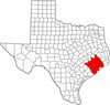 | |
|---|---|---|
| "Principal" cities | ||
| Other cities |
For a complete listing, see list of cities and towns in Houston–The Woodlands–Sugar Land MSA | |
| Unincorporated areas | ||
| Bodies of water | ||

Coordinates: 30°01′N 95°59′W / 30.01°N 95.98°W