Cloverleaf, Texas
| Cloverleaf, Texas | |
|---|---|
| Census-designated place | |
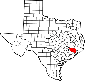
 Location of Cloverleaf, Texas | |
| Coordinates: 29°47′5″N 95°10′23″W / 29.78472°N 95.17306°WCoordinates: 29°47′5″N 95°10′23″W / 29.78472°N 95.17306°W | |
| Country | United States |
| State | Texas |
| County | Harris |
| Area | |
| • Total | 3.3 sq mi (8.6 km2) |
| • Land | 3.3 sq mi (8.6 km2) |
| • Water | 0.0 sq mi (0.0 km2) |
| Elevation | 26 ft (8 m) |
| Population (2010) | |
| • Total | 22,942 |
| • Density | 6,900/sq mi (2,700/km2) |
| Time zone | Central (CST) (UTC-6) |
| • Summer (DST) | CDT (UTC-5) |
| ZIP code | 77015 |
| Area code(s) | 713 |
| FIPS code | 48-15628[1] |
| GNIS feature ID | 1373144[2] |
Cloverleaf is a census-designated place (CDP) in east central Harris County, Texas, United States.[3] The population was 22,942 at the 2010 census.[4]
History
Cloverleaf originated as a stop on the Beaumont, Sour Lake and Western Railway. A 1936 county highway map indicates an unnamed development which became Cloverleaf. The Handbook of Texas states that a post office may have existed for a short period of time around 1950. In 1990, Cloverleaf had 18,230 residents and 18 churches.[3]
Geography

Cloverleaf is located at 29°47′5″N 95°10′23″W / 29.78472°N 95.17306°W (29.784676, -95.172959).[5] The community is located between the city of Jacinto City and the Channelview CDP along Interstate 10.[3]
According to the United States Census Bureau, the CDP has a total area of 3.3 square miles (8.6 km2), all of it land.
Demographics
| Historical population | |||
|---|---|---|---|
| Census | Pop. | %± | |
| 1980 | 17,317 | — | |
| 1990 | 18,230 | 5.3% | |
| 2000 | 23,508 | 29.0% | |
| 2010 | 22,942 | −2.4% | |
| source:[4][6] | |||
As of the census[1] of 2000, there were 23,508 people, 7,287 households, and 5,800 families residing in the CDP. The population density was 6,589.2 people per square mile (2,542.4/km²). There were 7,865 housing units at an average density of 2,204.5/sq mi (850.6/km²). The racial makeup of the CDP was 58.77% White, 16.11% African American, 0.59% Native American, 1.51% Asian, 0.05% Pacific Islander, 20.27% from other races, and 2.71% from two or more races. Hispanic or Latino of any race were 44.34% of the population.
There were 7,287 households out of which 46.7% had children under the age of 18 living with them, 57.9% were married couples living together, 14.9% had a female householder with no husband present, and 20.4% were non-families. 16.1% of all households were made up of individuals and 3.9% had someone living alone who was 65 years of age or older. The average household size was 3.23 and the average family size was 3.61.
In the CDP the population was spread out with 33.7% under the age of 18, 11.6% from 18 to 24, 30.7% from 25 to 44, 18.2% from 45 to 64, and 5.8% who were 65 years of age or older. The median age was 28 years. For every 100 females there were 101.8 males. For every 100 females age 18 and over, there were 98.4 males.
The median income for a household in the CDP was $37,449, and the median income for a family was $40,231. Males had a median income of $30,958 versus $25,044 for females. The per capita income for the CDP was $16,245. About 15.6% of families and 20.3% of the population were below the poverty line, including 26.8% of those under age 18 and 4.9% of those age 65 or over.
Education
Cloverleaf is zoned to schools in the Galena Park Independent School District.
Elementary schools in the Cloverleaf CDP include Cloverleaf Elementary School,[7] Green Valley Elementary School,[8] Havard Elementary School,[9] Sam Houston Elementary School,[10] and North Shore Elementary School.[11] All residents are zoned to Cobb 6th Grade School, which is located outside of the CDP.[12] Most residents are zoned to North Shore Middle School, in the CDP,[13] for grades 7 through 8; some residents are zoned to Cunningham Middle School, outside of the CDP, instead.[14] All residents are zoned to North Shore Senior High School, with two campuses in the CDP, for grades 9 through 12.[15] In 1990 Cloverleaf had two elementary schools, one junior high school, and one high school.[3]
See also
References
- 1 2 "American FactFinder". United States Census Bureau. Archived from the original on 2013-09-11. Retrieved 2008-01-31.
- ↑ "US Board on Geographic Names". United States Geological Survey. 2007-10-25. Retrieved 2008-01-31.
- 1 2 3 4 Cloverleaf, Texas from the Handbook of Texas Online
- 1 2 "Profile of General Population and Housing Characteristics: 2010 Demographic Profile Data (DP-1): Cloverleaf CDP, Texas". U.S. Census Bureau, American Factfinder. Archived from the original on September 11, 2013. Retrieved June 27, 2012.
- ↑ "US Gazetteer files: 2010, 2000, and 1990". United States Census Bureau. 2011-02-12. Retrieved 2011-04-23.
- ↑ "CENSUS OF POPULATION AND HOUSING (1790-2000)". U.S. Census Bureau. Retrieved 2010-07-17.
- ↑ "Cloverleaf.pdf." Galena Park Independent School District. Retrieved on December 20, 2008.
- ↑ "GreenValley.pdf." Galena Park Independent School District. Retrieved on December 20, 2008.
- ↑ "Havard.pdf." Galena Park Independent School District. Retrieved on December 20, 2008.
- ↑ "SamHouston.pdf." Galena Park Independent School District. Retrieved on December 20, 2008.
- ↑ "NorthShoreElem.pdf." Galena Park Independent School District. Retrieved on December 20, 2008.
- ↑ "Cobb.pdf." Galena Park Independent School District. Retrieved on December 20, 2008.
- ↑ "NorthShoreMiddle.pdf." Galena Park Independent School District. Retrieved on December 20, 2008.
- ↑ "Cunningham.pdf." Galena Park Independent School District. Retrieved on December 20, 2008.
- ↑ "NorthShoreHighandSenior.pdf." Galena Park Independent School District. Retrieved on December 20, 2008.
External links
- Cloverleaf, Texas from the Handbook of Texas Online
| Counties | 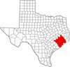 | |
|---|---|---|
| "Principal" cities | ||
| Other cities |
For a complete listing, see list of cities and towns in Houston–The Woodlands–Sugar Land MSA | |
| Unincorporated areas | ||
| Bodies of water | ||