Denton County, Texas
| Denton County, Texas | |
|---|---|
|
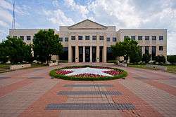
The new Denton County Courthouse, built 1998 | |
 Location in the U.S. state of Texas | |
 Texas's location in the U.S. | |
| Founded | April 11, 1846 |
| Named for | John B. Denton |
| Seat | Denton |
| Largest city | Denton |
| Area | |
| • Total | 953 sq mi (2,468 km2) |
| • Land | 878 sq mi (2,274 km2) |
| • Water | 75 sq mi (194 km2), 7.8% |
| Population (est.) | |
| • (2015) | 780,612 |
| • Density | 858/sq mi (331/km²) |
| Congressional districts | 24th, 26th |
| Time zone | Central: UTC-6/-5 |
| Website |
www |
Denton County is a county in the U.S. state of Texas. As of the 2010 census, its population was 662,614,[1] making it the ninth-most populous county in Texas. The county seat is Denton.[2] The county, which was named for John B. Denton, was established in 1846.
Denton County is included in the Dallas-Fort Worth-Arlington, TX Metropolitan Statistical Area. In 2007, it was one of the fastest-growing counties in the United States.[3]
History
Before the arrival of white settlers, various Native American peoples, including the Kichai and the Lenape, infrequently populated the area.[4] The area was settled by Peters Colony landowners in the early 1840s.[5] Until the annexation of Texas, the area was considered part of Fannin County.[6] On April 11, 1846, the First Texas Legislature established Denton County.[7] The county was named for John B. Denton, who was killed while raiding a Native American village in Tarrant County in 1841.[8] Originally, the county seat was set at Pickneyville. This was later changed to Alton, where the Old Alton Bridge currently stands, and then moved finally to Denton.
By 1860, the population of the county had increased to 5,031.[9] On March 4, 1861, residents of the county narrowly voted for secession from the Union, with 331 votes cast for and 264 against.[10] The Missouri–Kansas–Texas Railroad reached Lewisville, located in the southern portion of the county, by the early 1880s.[5] The Denton County Courthouse-on-the-Square was built in 1896, and today the building currently houses various government offices as well as a museum.[11]
A 2010 documentary, Gasland, claims that DISH, a small town in Denton County, has been polluted extensively by natural gas drilling.
Geography
| Denton, Texas | ||||||||||||||||||||||||||||||||||||||||||||||||||||||||||||
|---|---|---|---|---|---|---|---|---|---|---|---|---|---|---|---|---|---|---|---|---|---|---|---|---|---|---|---|---|---|---|---|---|---|---|---|---|---|---|---|---|---|---|---|---|---|---|---|---|---|---|---|---|---|---|---|---|---|---|---|---|
| Climate chart (explanation) | ||||||||||||||||||||||||||||||||||||||||||||||||||||||||||||
| ||||||||||||||||||||||||||||||||||||||||||||||||||||||||||||
| ||||||||||||||||||||||||||||||||||||||||||||||||||||||||||||
According to the U.S. Census Bureau, the county has a total area of 953 square miles (2,470 km2), of which 878 square miles (2,270 km2) is land and 75 square miles (190 km2) (7.8%) is water.[13] Denton County is located in the northern part of the Dallas-Fort Worth metroplex, approximately 35 miles south of the border between Texas and Oklahoma.[14] It is drained by two forks of the Trinity River.[15] The largest body of water in Denton County is Lewisville Lake, which was formed in 1954 when the Garza–Little Elm Reservoir was merged with Lake Dallas. The county is on the western edge of the Eastern Cross Timbers and also encompasses parts of the Grand Prairie portion of the Texas blackland prairies. Portions of Denton County sit atop the Barnett Shale, a geological formation believed to contain large quantities of natural shale gas. Between 1995 and 2007, the number of natural gas wells in the county increased from 156 to 1,820, which has led to some controversy over the pollution resulting from hydraulic fracturing.[16]
Adjacent counties
- Cooke County (north)
- Grayson County (northeast)
- Collin County (east)
- Dallas County (southeast)
- Tarrant County (south)
- Wise County (west)
Demographics
| Historical population | |||
|---|---|---|---|
| Census | Pop. | %± | |
| 1850 | 641 | — | |
| 1860 | 5,031 | 684.9% | |
| 1870 | 7,251 | 44.1% | |
| 1880 | 18,143 | 150.2% | |
| 1890 | 21,289 | 17.3% | |
| 1900 | 28,318 | 33.0% | |
| 1910 | 31,258 | 10.4% | |
| 1920 | 35,355 | 13.1% | |
| 1930 | 32,822 | −7.2% | |
| 1940 | 33,658 | 2.5% | |
| 1950 | 41,365 | 22.9% | |
| 1960 | 47,432 | 14.7% | |
| 1970 | 75,633 | 59.5% | |
| 1980 | 143,126 | 89.2% | |
| 1990 | 273,525 | 91.1% | |
| 2000 | 432,976 | 58.3% | |
| 2010 | 662,614 | 53.0% | |
| Est. 2015 | 780,612 | [17] | 17.8% |
| U.S. Decennial Census[18] 1850–2010[19] 2010–2014[1] | |||
As of the 2010 United States Census,[20] there were 662,614 people, 224,840 households and 256,139 housing units in the county. The population density was 754.3 people per square mile. The racial makeup of the county was 75% White, 8.4% Black or African American, 0.7% Native American, 6.6% Asian, 0.1% Pacific Islander, and 2.9% from two or more races. 18.2% of the population were of Hispanic or Latino origin.[1] Denton County ranked twenty-ninth on the US Census Bureau's list of fastest-growing counties between 2000 and 2007, with a 41.4% increase in population.[3]
A Williams Institute analysis of 2010 census data found there were about 5.2 same-sex couples per 1,000 households in the county.[21]
Government
County Commissioners
| Office | Name | Party | |
|---|---|---|---|
| County Judge | Mary Horn | Republican | |
| Commissioner, Precinct 1 | Hugh Coleman | Republican | |
| Commissioner, Precinct 2 | Ron Marchant | Republican | |
| Commissioner, Precinct 3 | Bobby Mitchell | Republican | |
| Commissioner, Precinct 4 | Andy Eads | Republican | |
County government
| Office | Name | Party | |
|---|---|---|---|
| District Attorney | Paul Johnson | Republican | |
| County Clerk | Juli Luke | Republican | |
| District Clerk | Sherri Adelstein | Republican | |
| Sheriff | Tracy Murphree | Republican | |
| Tax Assessor | Michelle French | Republican | |
| Treasurer | Cindy Yeatts Brown | Republican | |
Politics
Denton County, like most suburban counties in Texas, votes reliably for Republican candidates in statewide and national elections. The last Democratic presidential candidate to win the county was Lyndon Johnson in 1964.[22]
| Party | Candidate | Votes | % | |
|---|---|---|---|---|
| Republican | Greg Abbott | 93,506 | 65.1 | |
| Democratic | Wendy Davis | 47,134 | 32.8 | |
| Party | Candidate | Votes | % | |
|---|---|---|---|---|
| Republican | Donald Trump | 169,776 | 57.17 | |
| Democratic | Hillary Clinton | 110,149 | 37.09 | |
Education
The following school districts lie entirely within Denton County:
- Argyle Independent School District
- Aubrey Independent School District
- Denton Independent School District
- Lake Dallas Independent School District
- Lewisville Independent School District
- Little Elm Independent School District
- Ponder Independent School District
- Sanger Independent School District
The following private educational institutions serve Denton County:
- Denton Calvary Academy
- Coram Deo Academy
- Lakeland Christian School
- Liberty Christian School
- Selwyn College Preparatory School
The following higher education institutions serve Denton County:
Transportation
The Denton County Transportation Authority (DCTA) operates a bus service in the county that includes Denton, Lewisville, and Highland Village. SPAN Transit covers areas outside of Denton and Lewisville.
DCTA also operates the A-train, a commuter rail service runs from Denton to Carrollton, at which station passengers can switch to the Green Line train owned and operated by Dallas Area Rapid Transit (DART). Passengers can transfer to other DART lines (denominated by different colors) at the downtown Dallas DART station.
The county is home to the Denton Municipal Airport and the Northwest Regional Airport in Roanoke. Dallas/Fort Worth International Airport is located a few miles south of the county.
Major Highways
Communities
Cities (multiple counties)
- Carrollton (partly in Dallas County and a small part in Collin County)
- Celina (mostly in Collin County)
- Coppell (mostly in Dallas County)
- Dallas (mostly in Dallas County with small parts in Collin, Kaufman, Rockwall and Denton counties)
- Fort Worth (mostly in Tarrant County with small parts in Parker, Wise and Denton counties)
- Frisco (partly in Collin County)
- Grapevine (mostly in Tarrant County and a small part in Dallas County)
- Haslet (mostly in Tarrant County)
- Lewisville (small part in Dallas County)
- Plano (mostly in Collin County)
- Southlake (mostly in Tarrant County)
Cities
Towns (multiple counties)
- Flower Mound (small part in Tarrant County)
- Hebron (small part in Collin County)
- Prosper (mostly in Collin County)
- Trophy Club (small part in Tarrant County)
- Westlake (mostly in Tarrant County
Towns
Census-designated places
Unincorporated community
- Alliance (partly in Tarrant County)
- Bolivar
- Navo
Ghost Town
Notable People
- Pat Boone, American pop singer, briefly attended UNT
- Terry Bradshaw, former Pittsburgh Steelers quarterback
- Phyllis George, 1971 Miss America, sportscaster and former First Lady of Kentucky
- Jim Hightower, former Texas Agriculture Commissioner
- Gordon McLendon, radio broadcaster and pioneer, B Movie producer and conservative political financier
- Laina Morris aka Overly Attached Girlfriend
- Bill Moyers, White House Press Secretary in the Johnson Administration (1965–67)
- Anne Rice, author, attended TWU and UNT, married in Denton
- Sly Stone, musician and frontman of Sly and the Family Stone
- Von Erich family
- Charles Denton Watson, central member of the Manson Family and leader of the Sharon Tate Murder
- #75 "Mean Joe" (Charles Edward) Greene, – defensive tackle, 1969–1981 (1969 Defensive Rookie of the Year; 1972 & 1974 Defensive Player of the Year; NFL 1970s All-Decade Team; Hall of Fame)
See also
- Denton County Sheriff's Office (Texas)
- List of museums in North Texas
- National Register of Historic Places listings in Denton County, Texas
References
- 1 2 3 Quickfacts 2012.
- ↑ Naco 2011.
- 1 2 Census 2007.
- ↑ Bridges 1978, pp. 1–26.
- 1 2 Odom 2010.
- ↑ Bates 1918, p. 2.
- ↑ Bolz & Bolz 2010, p. 7.
- ↑ Bates 1918, pp. 18–24.
- ↑ Hervey 2002, p. 9.
- ↑ Bridges 1978, p. 96.
- ↑ Bolz & Bolz 2010, p. 9.
- ↑ Weather 2012.
- ↑ Gazetteer 2010.
- ↑ Cowling 1936, p. 1.
- ↑
 Ripley, George; Dana, Charles A., eds. (1879). "Denton". The American Cyclopædia.
- ↑ Sales 2007, pp. 4–5.
- ↑ "County Totals Dataset: Population, Population Change and Estimated Components of Population Change: April 1, 2010 to July 1, 2015". Retrieved July 2, 2016.
- ↑ Census.
- ↑ Almanac 2010.
- ↑ "American FactFinder". United States Census Bureau. Retrieved 2011-05-14.
- ↑ Where Same-Sex Couples Live, June 26, 2015, retrieved July 6, 2015
- ↑ Sullivan, Robert David; ‘How the Red and Blue Map Evolved Over the Past Century’; America Magazine in The National Catholic Review; June 29, 2016
Books
- Bates, Edward (1918). History and Reminiscences of Denton County. Denton, Texas: McNitzky Printing Company. LCCN 19004337. OCLC 2133818. OL 23400877M.
- Bolz, Jim; Bolz, Tricia (2010). Denton County. Postcard History. Charleston, South Carolina: Arcadia Publishing. ISBN 978-0-7385-8452-2. OCLC 620741494. Retrieved 2011-10-26.
- Bridges, Clarence (1978). History of Denton, Texas From Its Beginning to 1960. Waco, Texas: Texian Press. ASIN B0006CU42G. OCLC 004235340. Retrieved 2011-11-04.
- Cowling, Mary Jo (1936). Geography of Denton County. Dallas, Texas: Banks, Upshaw, and Company. ASIN B003F8JBE0. LCCN 36-15037. OCLC 2672035. Archived from the original on 2011-01-01. Retrieved 2011-09-23.
- Hervey, Hollace (2002). Historic Denton County: An Illustrated History. San Antonio, Texas: Historical Pub Network. ISBN 978-1-893619-07-4. LCCN 2002101353. OCLC 52948987. OL 3572319M. Retrieved 2011-09-17.
- Odom, E. Dale (1996). An Illustrated History of Denton County, Texas: From Peters Colony to Metroplex (First ed.). ISBN 0-9651324-0-4.
- Sales, Joshua (August 2007). Determining the Suitability of Functional Landscapes and Wildlife Corridors Utilizing Conservation GIS Methods in Denton County, Texas (M.S. thesis). University of North Texas. OCLC 191674292. Archived from the original on 2010-01-01. Retrieved 2012-04-16.
Maps
- Mapbook 450 (PDF) (Map). 1:120,000. Texas County Map Book. Texas Department of Transportation. 2010. p. 450. Retrieved 2012-04-17.
- Mapbook 451 (PDF) (Map). 1:120,000. Texas County Map Book. Texas Department of Transportation. 2010. p. 451. Retrieved 2012-04-17.
- Mapbook 480 (PDF) (Map). 1:120,000. Texas County Map Book. Texas Department of Transportation. 2010. p. 480. Retrieved 2012-04-17.
- Mapbook 481 (PDF) (Map). 1:120,000. Texas County Map Book. Texas Department of Transportation. 2010. p. 481. Retrieved 2012-04-17.
Websites
- Odom, Dale (2010). "Denton County". Texas State Historical Association. Retrieved 2012-04-16.
- "State & County QuickFacts". United States Census Bureau. Retrieved December 10, 2013.
- "Table 8: Population Estimates for the 100 Fastest Growing U.S. Counties with 10,000 or More Population in 2007: April 1, 2000 to July 1, 2007" (XLS). United States Census Bureau. Retrieved 2008-07-15.
- "Texas Almanac: Population History of Counties from 1850–2010" (PDF). Texas Almanac. Retrieved April 22, 2015.
- "Monthly Averages for Denton, TX". The Weather Channel. Retrieved 2012-04-17.
- "Find a County". National Association of Counties. Retrieved 2011-06-07.
- "U.S. Decennial Census". United States Census Bureau. Retrieved April 22, 2015.
- "2010 Census Gazetteer Files". United States Census Bureau. August 22, 2012. Retrieved April 22, 2015.
External links
| Wikimedia Commons has media related to Denton County, Texas. |
- Denton County government's website
- Headlines about Denton County from The Dallas Morning News
- Denton County entry in the Handbook of Texas Online at the University of Texas
- Denton County Texas Almanac Page
- Historic Denton County materials, hosted by the Portal to Texas History.
- Captain John B. Denton, preacher, lawyer and soldier. His life and times in Tennessee, Arkansas and Texas by Wm. Allen., published 1905, hosted by the Portal to Texas History
- A Guide to Things to Do and See in Denton County
- Denton County on DentonWiki
 |
Cooke County | Grayson County | | |
| Wise County | |
Collin County | ||
| ||||
| | ||||
| Tarrant County | Dallas County |
Municipalities and communities of Denton County, Texas, United States | ||
|---|---|---|
| Cities | | |
| Towns | ||
| CDPs | ||
| Unincorporated communities | ||
| Ghost towns | ||
| Footnotes | ‡This populated place also has portions in an adjacent county or counties | |

Coordinates: 33°12′N 97°07′W / 33.20°N 97.12°W