Zinfandel, California
| Zinfandel | |
|---|---|
| Unincorporated community | |
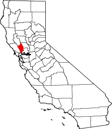
 Zinfandel Location within the state of California | |
| Coordinates: 38°28′58″N 122°26′32″W / 38.48278°N 122.44222°WCoordinates: 38°28′58″N 122°26′32″W / 38.48278°N 122.44222°W | |
| Country |
|
| State |
|
| County | Napa |
| Elevation[1] | 197 ft (60 m) |
| Time zone | Pacific (UTC-8) |
| • Summer (DST) | PDT (UTC-7) |
| ZIP codes | 94567 |
| Area code | 707 |
| FIPS code | 06-87157 |
| GNIS feature ID | 1660226[1] |
Zinfandel (formerly, Bell Station and Pine Station) is a small unincorporated community in Napa County, California just south of the city of St. Helena in the North Bay region of the San Francisco Bay Area.[1] It is part of the Wine Country. It is located at the intersection of the St. Helena Highway (State Route 29) and Zinfandel Lane and comprises about 14 square blocks, most of which are rural and residential in character. The ZIP Code is 94567. The community is inside area code 707.
The town was named after a grape and a variety of wine produced from that grape.
History
The place was first called Pine Station, and later as Bell Station, before bearing its present name.[2]
Government
In the California State Legislature, Zinfandel is in the 3rd Senate District, represented by Democrat Bill Dodd, and in the 4th Assembly District, represented by Democrat Cecilia Aguiar-Curry.[3]
In the United States House of Representatives, Zinfandel is in California's 5th congressional district, represented by Democrat Mike Thompson.[4]
References
- 1 2 3 "Zinfandel". Geographic Names Information System. United States Geological Survey. Retrieved March 24, 2015.
- ↑ Durham, David L. (1998). California's Geographic Names: A Gazetteer of Historic and Modern Names of the State. Clovis, Calif.: Word Dancer Press. p. 725. ISBN 1-884995-14-4.
- ↑ "Statewide Database". UC Regents. Retrieved December 6, 2014.
- ↑ "California's 5th Congressional District - Representatives & District Map". Civic Impulse, LLC. Retrieved March 3, 2013.
External links
| Bodies of water |
|  |
|---|---|---|
| Counties | ||
| Major cities | ||
| Cities and towns 100k–250k | ||
| Cities and towns 50k–99k | ||
| Cities and towns 25k-50k | ||
| Cities and towns 10k–25k |
| |
| Sub-regions | ||