Livermore, California
| City of Livermore | ||
|---|---|---|
| City | ||
.JPG) | ||
| ||
 Location of Livermore within Alameda County, California | ||
 City of Livermore Location in the United States | ||
| Coordinates: 37°40′55″N 121°46′05″W / 37.68194°N 121.76806°WCoordinates: 37°40′55″N 121°46′05″W / 37.68194°N 121.76806°W | ||
| Country | United States | |
| State | California | |
| County | Alameda | |
| Established | 1869 | |
| Incorporated | April 1, 1876[1] | |
| Government | ||
| • Type | Council-manager[2] | |
| • Mayor | John Marchand[3] | |
| • Vice mayor | Laureen Turner[3] | |
| • City manager | Marc Roberts[2] | |
| • U. S. rep. | Eric Swalwell (D)[4] | |
| • State senator | Steve Glazer (D)[5] | |
| Area[6] | ||
| • City | 25.176 sq mi (65.204 km2) | |
| • Land | 25.173 sq mi (65.198 km2) | |
| • Water | 0.003 sq mi (0.007 km2) 0.010% | |
| • Metro | 2,474 sq mi (6,410 km2) | |
| Elevation[7] | 495 ft (151 m) | |
| Population (July 1, 2014)[8] | ||
| • City | 86,870 | |
| • Estimate (January 1, 2016) | 88,138 | |
| • Density | 3,500/sq mi (1,300/km2) | |
| • Metro | 4,516,276 | |
| • Metro density | 1,800/sq mi (700/km2) | |
| Time zone | Pacific (UTC−8) | |
| • Summer (DST) | PDT (UTC−7) | |
| ZIP codes | 94550, 94551 | |
| Area code | 925 | |
| FIPS code | 06-41992 | |
| GNIS feature IDs | 277542, 2410848 | |
| Website |
www | |
Livermore (formerly Livermores, Livermore Ranch, and Nottingham)[9] is a city in Alameda County, California, in the United States. With an estimated 2014 population of 86,870,[8] Livermore is the most populous city in the Tri-Valley. Livermore is located on the eastern edge of California's San Francisco Bay Area.
Livermore was founded by William Mendenhall and named after Robert Livermore, his friend and a local rancher who settled in the area in the 1840s. Livermore is the home of the Lawrence Livermore National Laboratory, for which the chemical element livermorium is named (and thus, placing the city's name in the periodic table).[10] Livermore is also the California site of Sandia National Laboratories, which is headquartered in Albuquerque, New Mexico. Its south side is home to local vineyards. The city has redeveloped its downtown district and is considered part of the Tri-Valley area, comprising Amador, Livermore and San Ramon valleys.

History


Before its incorporation in 1796 under the Franciscan Mission San Jose, located in what is now the southern part of Fremont, the Livermore area was home to some of the Ohlone (or Costanoan) native people. Each mission had two to three friars and a contingent of up to five soldiers to help keep order in the mission and to help control the natives. Like most indigenous people in California, the natives in the vicinity of Mission San Jose were mostly coerced into joining it, where they were taught Spanish, the Catholic religion, singing, construction, agricultural trades and herding—the Native Californian people originally had no agriculture and no domestic animals except dogs. Other tribes were coerced into other adjacent missions. The Mission Indians were restricted to the mission grounds where they lived in sexually segregated "barracks" that they built themselves with padre instruction. The population of all California missions plunged steeply as new diseases ravaged the Mission Indian populations—they had almost no immunity to these "new to them" diseases, and death rates over 50% were not uncommon.[12]
The Livermore-Amador Valley after 1800 to about 1837 was primarily used as grazing land for some of the Mission San Jose's growing herds of mission cattle, sheep and horses. The herds grew wild with no fences and were culled about once a year for cow hides and tallow—essentially the only money-making products produced in California then. The dead animals were left to rot or feed the California grizzly bears which then roamed the region. The secularization and closure of the California missions, as demanded by the government of Mexico, from 1834 to 1837 transferred the land and property the missions claimed on the California coast (about 1,000,000 acres (400,000 ha) per mission) to about 600 extensive ranchos. After the missions were dissolved, most of the surviving Indians went to work on the new ranchos raising crops and herding animals where they were given room and board, a few clothes and usually no pay for the work they did—the same as they had had while working in the missions. Some Indians joined or re-joined some of the few surviving tribes.
The about 48,000-acre (19,000 ha) Rancho Las Positas grant, which includes most of Livermore, was made to ranchers Robert Livermore and Jose Noriega in 1839.[13][14] Most land grants were given with little or no cost to the recipients. Robert Livermore (1799-1858)[15] was a British citizen who had jumped from a British merchant sailing ship stopping in Monterey, California, in 1822. He became a naturalized Mexican citizen who had converted to Catholicism in 1823 as was required for citizenship and legal residence. After working for a number of years as a majordomo (ranch foreman), Livermore married on 5 May 1838 the widow Maria Josefa de Jesus Higuera (1815–1879), daughter of Jose Loreto Higuera, grantee of Rancho Los Tularcitos, at the Mission San José. Livermore, after he got his rancho in 1839, was as interested in viticulture and horticulture as he was in cattle and horses, despite the fact that about the only source of income was the sale of cow hides and tallow. In the early 1840s he moved his family to the Livermore valley to his new rancho as the second non-Indian family to settle in the Livermore valley area, and after building a home he was the first in the area in 1846 to direct the planting of vineyards and orchards of pears and olives. Typical of most early rancho dwellings, the first building on his ranch was an adobe on Las Positas Creek near the western end of today's Las Positas Road. After the Americans took control of California in 1847 and gold was discovered in 1848, he started making money by selling California longhorn cattle to the thousands of hungry California Gold Rush miners who soon arrived. The non-Indian population exploded, and cattle were suddenly worth much more than the $1.00-$3.00 their hides could bring. With his new wealth and with goods flooding into newly rich California, in 1849 Livermore bought a two-story "Around the Horn" disassembled house that had been shipped about 18,000 miles (29,000 km) on a sailing ship around Cape Horn from the East Coast. It is believed to be the first wooden building in the Livermore Tri-Valley.
During the Gold Rush, Livermore's ranch became a popular "first day" stopping point for prospectors and businessmen leaving San Francisco or San Jose and headed for Sacramento and the Mother Lode gold country. Most horse traffic went by way of Altamont Pass just east of Livermore. Robert Livermore was a very accommodating host and welcomed nearly all that stopped by with lodging and meals.
Robert Livermore died in 1858 and was buried at Mission San Jose before the establishment of the town that bears his name. His ranch included much of the present-day city. The city of Livermore, named in honor of Robert Livermore, was established in 1869 by William Mendenhall,[16] who had first met Livermore while marching through the valley with John C. Fremont's California Battalion in 1846 as they were recruited to occupy the surrendering Californio towns captured by the U.S. Navy's Pacific Squadron.
California became the 31st state in 1850 when California's non-Indian population jumped from about 8,000 in 1846 to about 120,000 in 1850 as shown in a corrected 1850 U.S. California Census.[17] California had enough population and enough wealth in 1850 that they bypassed the territorial status of most other states and were allowed to more or less choose their own (large) boundaries.
The Livermore Ranch post office, in Robert Livermore's home, operated from 1851 to 1853.[9] The first significant settlement of Livermore was Laddsville, on what is now Junction Avenue, which grew up around the hotel established by Alphonso Ladd in 1864. The official U.S. post office in Livermore opened in 1869.[9] The original Western Pacific Railroad Company in 1869 built its railroad connection from Oakland to Sacramento over the nearby Altamont Pass in the east and Niles Canyon on the west with a stop in Livermore on land donated by William M. Mendenhall. This made Livermore a "railroad town"[18] and greatly accelerated town growth. The population of Livermore in 1869, before the railroad arrived, is thought to have been about 75.[19] By 1870 the Western Pacific had been absorbed by the Central Pacific Railroad as part of the First Transcontinental Railroad. Central Pacific was later acquired by the Southern Pacific Railroad and then the Union Pacific Railroad, which owns the tracks through town today, although these are primarily the tracks of the "second" Western Pacific Railroad that was founded in 1903 and absorbed into the UP in 1983.
Private grade schools were operating in Livermore from the 1860s on. The Livermore Collegiate Institute was founded in 1870, and the Union High School (later called Livermore High) graduated its first class of students in 1896. Petroleum was discovered near Livermore and become a valuable asset. Extensive coal deposits were mined near Corral Hollow by the Livermore Coal Company. In September 1871 Laddsville mostly burned down, and the people rebuilt their homes and businesses nearer the railroad in what is now downtown Livermore. Until 1875 the townspeople enjoyed bull fights in a small bullring on many Sundays, and on other occasions a captured grizzly bear might be pitted against a longhorn bull. Apparently, roping a grizzly was thought then to be a great sport. As the town grew there were a fire company, churches, a bank, and a library that were formed by 1876. Livermore was officially incorporated by the state as a city on April 15, 1876, its original city limits being the line a block north of 1st Street on the north and Livermore Avenue (then Lizzie Street) on the east. The part of the west side north of 5th Street was bounded by Q Street, and the part of it south of 5th Street by I Street. The part of the south side east of I Street was bounded by 6th Street, and the part of it west of I Street by 5th Street.[20]
During Livermore's early years, it was well known for large hotels that graced the downtown street corners, before new buildings replaced them. Livermore after the 1880s is also notable for the Wente Vineyards, Concannon Vineyard, Cresta Blanca Winery and many other wineries. Since it has a Mediterranean climate, gravelly soil, warm days and cool nights, it was a good location to grow wine grapes. By 1880 the extensive winter wheat and hay crop lands were being replaced by vineyards. Extensive chromite deposits were found and exploited for a time. In 1885 the Remillard Brick Company was producing an extensive line of bricks and employing over 100 men. A telephone line connected Livermore to Arroyo Valley by 1886, and electric lights were introduced by 1889. By 1890 Livermore had over 20 miles (32 km) of streets.[21] Livermore originally had a Boot Hill called the Old Knoll Cemetery.[22]
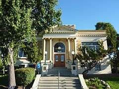
In 1909 the Livermore Carnegie Library and Park opened after taking advantage of a Carnegie library grant. As the city grew and larger libraries were needed, other libraries were built, and the original site was converted into a historic center[23] and park.
In 1942, the U.S. government bought 692 acres (280 ha) of ranch land, bounded by Vasco and Greenville roads and East Avenue, and built the Livermore Naval Air Station. The primary mission of the base was to train Navy pilots. This facility operated until it was decommissioned in 1946 after the end of World War II. On 5 January 1951, the Bureau of Yards and Docks, U.S. Navy, formally transferred the former NAS Livermore in its entirety to the Atomic Energy Commission (AEC) for use by the University of California's Radiation Laboratory. In 1952, the government established Lawrence Livermore National Laboratory (LLNL), named after famous physicist Ernest O. Lawrence, as the site of a second laboratory for the study of nuclear energy like the research being done at the Los Alamos National Laboratory. The laboratory was run by the University of California. Edward Teller was a co-founder of LLNL and was both its director and associate director for many years.[24] In 1956, the California campus of Sandia National Laboratories opened across East Avenue from LLNL. Both LLNL and Sandia are technically on U.S. government property just outside the city's jurisdiction limits, but with employment at LLNL at about 6,800 and Sandia/California at about 1,150 they are Livermore's largest employers.
For pictures of early Livermore, check the Livermore Heritage Guild[25] photo site.[26]
Geography
The Livermore Valley is located about 30 miles (48 km) east of and behind the first coastal range of foot hills that surround the San Francisco Bay Area. The Livermore Valley has an east-west orientation with mountain passes on the west and east connecting the Bay Area and the Central Valley. The passes are used by railroads and highways to connect the two regions. Livermore Valley is about 15 miles (24 km) long (east to west), 10 miles (16 km) wide (north to south), and surrounded by California coastal range mountains and foothills.
Watercourses draining the city of Livermore include Arroyo Mocho, Arroyo Valle, Arroyo Seco and Arroyo Las Positas. The principal aquifer underlying the city is the Mocho Subbasin. According to the United States Census Bureau, the city has a total area of 25.2 square miles (65 km2), over 99% of it land. Several local seismic areas of activity lie near the city, including the Greenville Fault and the Tesla Fault.
The soil is primarily gravel with excellent drainage. The gravel is used in several gravel extraction sites outside the city. The gravelly soil and Mediterranean climate increases the flavor concentration in the grapes planted in the soil.

Climate

Livermore has a Mediterranean climate,[27] although it is close to a semi-arid climate because of its relatively low annual precipitation. It features with warm to hot, dry summers and mild to cool, wet winters (Köppen climate classification Csa). Summer (June–October) daytime temperatures average in the 75 to 85 °F (24 to 29 °C) range, but sometimes reach 100 °F (38 °C) and can occasionally approach 110 °F (43 °C). Summer nights, however, are normally much cooler, with lows in the 50 to 60 °F (10 to 16 °C) range. The valley's passes direct the normal west to east flow of air through the valley. Usually there is a strong evening wind in the summer that brings cool air off the Pacific Ocean into the Livermore valley as it heads towards the much hotter Central Valley. This wind is strong enough with an average summer wind speed of about 9 miles per hour (14 km/h) and predictable enough to make the Livermore hills covered with wind turbines mounted in Altamont Pass. The period from June to September is extremely dry and is characterized by clear skies, but in late summer, subtropical moisture occasionally surges into the Livermore Valley, bringing high humidity, monsoon clouds, and, much less commonly, thunderstorms.
Nearly all of the 14.6 inches (370 mm) of annual Livermore rainfall comes in the September to May time period, but about 50% of the days are sunny during this period with no appreciable cloud cover. The peak rainy months are December to March. Most rainstorms are classified as 50% light rain, 32% moderate rain, 11% heavy rain and less than 6% thunder showers.[28] The coldest months are December and January, with a mean high of about 56 °F (13 °C) and a low of about 38 °F (3 °C) with some occasional frost possible on clear mornings. The temperature can drop to as low as the 20 to 25 °F (−7 to −4 °C) range on an exceptionally cold night. Snow is very rare, but light dustings do occur on the surrounding hills and occasionally in the valley.
The record high temperature is 115 °F (46 °C), recorded on September 3, 1950, and the record low temperature is 18 °F (−8 °C), recorded on January 5, 1961, and December 9, 1972.[29]
| Climate data for Livermore, California (1903-2013) | |||||||||||||
|---|---|---|---|---|---|---|---|---|---|---|---|---|---|
| Month | Jan | Feb | Mar | Apr | May | Jun | Jul | Aug | Sep | Oct | Nov | Dec | Year |
| Record high °F (°C) | 77 (25) |
80 (27) |
88 (31) |
96 (36) |
108 (42) |
113 (45) |
113 (45) |
112 (44) |
113 (45) |
106 (41) |
93 (34) |
79 (26) |
113 (45) |
| Average high °F (°C) | 56.8 (13.8) |
61.2 (16.2) |
65.2 (18.4) |
70.5 (21.4) |
76.4 (24.7) |
83.1 (28.4) |
89.0 (31.7) |
88.2 (31.2) |
86.0 (30) |
77.7 (25.4) |
66.3 (19.1) |
57.5 (14.2) |
73.2 (22.9) |
| Average low °F (°C) | 36.7 (2.6) |
39.4 (4.1) |
41.3 (5.2) |
43.6 (6.4) |
47.6 (8.7) |
51.7 (10.9) |
54.2 (12.3) |
54.0 (12.2) |
52.5 (11.4) |
47.7 (8.7) |
41.1 (5.1) |
37.0 (2.8) |
45.6 (7.6) |
| Record low °F (°C) | 18 (−8) |
21 (−6) |
22 (−6) |
29 (−2) |
32 (0) |
38 (3) |
36 (2) |
36 (2) |
35 (2) |
29 (−2) |
22 (−6) |
18 (−8) |
18 (−8) |
| Average precipitation inches (mm) | 2.97 (75.4) |
2.47 (62.7) |
2.15 (54.6) |
1.00 (25.4) |
.44 (11.2) |
.11 (2.8) |
.02 (0.5) |
.04 (1) |
.22 (5.6) |
.67 (17) |
1.54 (39.1) |
2.56 (65) |
14.19 (360.3) |
| Average precipitation days (≥ .01 in) | 10 | 9 | 9 | 6 | 3 | 1 | 0 | 0 | 1 | 3 | 7 | 9 | 58 |
| Average rainy days (≥ .1 in) | 6 | 6 | 5 | 3 | 1 | 0 | 0 | 0 | 0 | 2 | 4 | 6 | 34 |
| Source: [30] | |||||||||||||
Government
| Livermore City Budget FY 2013-14[31] | |
|---|---|
| General Fund Operating Budget | $76,472,540 |
| All Other Funds Operating Budget | $123,213,745 |
| Sub-total Operating Budgets | $199,686,285 |
| Capital Improvement Program | $44,907,470 |
| ---------------------------------------------- | --------------- |
| Total All Funds Budget | $244,593,755 |
Livermore is run by a Council–manager government with a four-member City Council[32] elected for four years plus a two-year elected mayor and a “professional” City Manager. The council meets at 7 p.m. the second and fourth Mondays of each month at Council Chambers, 3575 Pacific Ave., Livermore. Twice a month they hear citizen input and presumably relay this information to the City manager who actually runs the city day to day. John Marchand (Mayor), Stewart Gary (Vice Mayor), Doug Horner, Laureen Turner and Bob Woerner are the present city council members. The Mayor is paid $1,400 per month and the other council members are paid $980 per month. In addition they are eligible for a $90 per month cell phone allotment and health care benefits up to a maximum of $2,119/month plus other city paid insurance and retirement contributions to CaLPERS or PARS ARS of which the city pays 18% or 1.3% of their salary respectively.
The City Manager, Marc Roberts, was nominally hired by the city council for a five-year term and can, in principle, be fired by them if needed. Marc Roberts is paid a salary of $196,320/year with about $64,500/year medical, insurance and retirement benefits paid by the city. The City Manager has a staff of five to assist him.
The City Attorney, John Pomidor, is hired by the city council and generally handles all legal matters for the city, from traffic tickets to civil lawsuits to acting as a general counsel, giving legal advice for city departments. Pomidor is paid a salary of $186,593 /year with medical, insurance and retirement benefits of about $62,600 per year paid by the city. The City Attorney has a staff of 7.5 FTE to assist him.
Unions and bargaining units representing the 451 Livermore City Employees[33]
- Livermore Management Group
- Municipal Employees' Agency for Negotiation (MEAN)
- Police Management
- Police Officers Association
- Livermore-Pleasanton Firefighters (IAFF)
Nearly all have their own union agreements and retirement systems which in general cost at least city paid: $7,500 per year for health benefits,life and AD&D insurance, short and long term disability Insurance, 1.45% medicare, 18.1% of salary contribution for retirement benefits which can be used at age 55 at a rate of 2.7% times years of service time salary or 3.0% times years of service times salary at age 50 for police officers, 100% of health insurance paid after retirement with 25 or more years of service, tuition and 75% text book reimbursement, uniform allowance, 80–192 hours of vacation per year, 12 paid holidays per year, etc.[34]
Police
The Livermore Police Department, or the LPD,[35] was established in 1876, at that time the only law enforcement agency in the San Francisco Bay Area besides the San Francisco Police Department. The Livermore Police Department has 135 members including 83 sworn officers and 45 nonsworn full-time personnel who operate on a $25 million budget each year. The police department has two divisions: operations and support. The current chief of police is Michael Harris. In July 2008, the LPD opened its first substation in New Downtown Livermore, known as the Central Station or Downtown Office. The main police station is located in the City Hall center at 1052 S. Livermore Ave. The Livermore Police Department Dispatch Center employs 18 public safety dispatchers with one supervising public safety dispatcher that are on duty 24/7 to handle 911 emergency calls.
Fire department
The Livermore-Pleasanton Fire Department provides fire and advanced life support services to the cities of Livermore and Pleasanton. It serves an estimated population of 150,000 (78,000 in Livermore, and 71,000 in Pleasanton) over 44 square miles (114 km2) (23 square miles (60 km2) in Livermore, and 21 square miles (54 km2) in Pleasanton) with an operating budget of $28,000,000. In 2008 the LPFD responded to approximately 11,000 calls for service. The International Association of Fire Fighters (IAFF) Local 1974 represents its 112 members.
Schools
Public schools
The public schools in Livermore are part of the Livermore Valley Joint Unified School District (LVJUSD) with headquarters at 685 East Jack London Blvd.
The district has 11 elementary (K-5 and K-8) schools, three middle schools (grades 6-8), two comprehensive high schools, and three alternative high schools. As of the 2012-2013 school year, the public school superintendent was Kelly Bowers, who was hired by the elected school board in 2010.
The five members of the Board of Education are elected to alternating four year terms by the voters of the community. Each December, the board reorganizes itself by selecting a board president and clerk of the board. The president of the board (2014) is Kate Runyon. Chuck Rogge is the clerk of the board, while Anne White, Bill Dunlop and Thomas McLaughlin are board members. They hold regular public meetings on the first and third Tuesday of the month at 7:00 p.m. in the School Board Room at 685 East Jack London Blvd.
- High schools
- Livermore High School, established in 1891 as California's first union high school[36]
- Granada High School, Livermore's second high school[37]
- Alternative Schools Accountability Model (ASAM) schools
- Del Valle and Phoenix Continuation High Schools, two schools sharing one building since 2004[38]
- Vineyard High School, an alternative independent study school[39]
- Adult education
- Livermore Adult School 1401 Almond Ave Livermore, Ca[40]
Other schools
Pre-schools and day care
Livermore has about 30 pre-schools and day care centers.[41][42]
Charter schools
There are two charter schools in Livermore, one K-8 and one high school, both operated by the Tri-Valley Learning Corporation, a local 501(c)3 not-for-profit organization formed by the parents and teachers who founded the two charter schools.
- Livermore Valley Charter School (LVCS): a K-8 public school[43]
- Livermore Valley Charter Preparatory (LVCP): Livermore's newest high school, opened in fall of 2010
Private schools
- Our Savior Lutheran School (OSLS)[44]
- St. Michael's Elementary and Middle Catholic School[45]
- Valley Montessori[46]
Colleges and universities
The Hertz Foundation for scholarships is based in Livermore
Junction ave k-8.
Parks and LARPD
The Livermore Area Recreation and Park District (LARPD) is a special independent, non-profit (501(c) organization) park district that was created by the vote of the public in 1947 and runs the parks and other facilities in the city of Livermore and most of the unincorporated areas of eastern Alameda County. LARPD operates 42 facilities,[49] including neighborhood, special use, community and regional parks and sport fields, a family campground at South Lake Tahoe, the Ravenswood Historic Site, The Barn, the Veterans Building, the Carnegie Building, the Bothwell Recreation Center and the new Robert Livermore Community Center. LARPD runs the May Nissen Community Park and Swim Center[50] at 685 Rincon Ave and is open to swimmers with a $0.25 admission price from mid-June through end of August—closed Sundays. May Nissen Park includes a tot lot, group picnic area, barbecue pits, picnic tables, preschool, basketball court, restrooms, horseshoe pits, softball areas, tennis courts, two swimming pools, and a dog park. Max Baer Park has been the home of the Intermediate Little League World Series since 2013.
Brushy Peak Regional Preserve, located near Livermore, is jointly operated by the Livermore Area Recreation and Park District and the East Bay Regional Park District.
The extensive gravel deposits around Livermore have led to extensive gravel extraction that is still on-going. Shadow Cliffs Park along Stanley Boulevard west of Livermore is a popular 266-acre (108 ha) park that includes a 80-acre (32 ha) lake in an old Kaiser Industries gravel pit and is used extensively today for swimming, boating, and fishing.[51][52]
Del Valle Regional Park, 10 miles (16 km) south of Livermore, includes a 5-mile-long (8.0 km) lake with all kinds of water-oriented recreation. The parking/entrance fee is $6 per vehicle and $4 more per trailered boat. The park opens at 6 AM in the summer and 7 AM in the winter. It has approximately 5,000 acres (2,000 ha) of oak-covered hills that can be used for hiking, horseback riding, and nature study. The lake is used by sailboats, sailboards and fishing boats as well as recreational swimmers.
Del Valle Park has the eastern gateway to the Ohlone Wilderness Trail, a 28-mile (45 km) scenic back country hiking trail. The Del Valle Family Campground has 150 sites, 21 of them with water and sewage, and electrical hook-ups. Picnicking sites are available.[53]
LARPD operates parks and facilities of 1,842 acres (745 ha), with 1,432 acres (580 ha) open space. It runs an extensive selection of classes on a wide variety of subjects. LARPD has its own, five-person board of directors[54] that is elected by the citizens to staggered four-year terms and meets at 7 p.m. on the second and last Wednesday of each month inside the Cresta Blanca Ballroom at the Robert Livermore Community Center, 4444 East Avenue. They are paid $100/meeting with a maximum of $500/month. The General Manager of LARPD is Timothy Barry—selected by the board and paid $137,160/yr plus unspecified benefits including Alameda County retirement plan (ACERA) with 29.13% of LARPD salary contribution rate to a well paid retirement plan.[55] In addition, there are 13 paid holidays, vacation, sick leave, medical, dental, life insurance, etc. adding about $55,000/yr in benefits to the General Manager's salary.[56][57] The organization and facilities are extensive[58] and LARPD hires many part-time workers (up to about 430 at peak times) from Park Rangers to referees in its extensive programs and classes with a permanent staff of about 63.[59][60] The 2012-2013 operating budget of LARPD is $16,393,564 plus a capital budget of $3,870,971. Their source of operating income is property taxes, user fees, charges and grants. Unfortunately, the state has cut down on their share of property taxes as the state re-allocate more to itself and their never ending fiscal crisis's. LARPD serves an area that encompasses about 115,000 people.
Demographics
| Historical population | |||
|---|---|---|---|
| Census | Pop. | %± | |
| 1880 | 855 | — | |
| 1890 | 1,391 | 62.7% | |
| 1900 | 1,493 | 7.3% | |
| 1910 | 2,030 | 36.0% | |
| 1930 | 3,119 | — | |
| 1940 | 2,885 | −7.5% | |
| 1950 | 4,364 | 51.3% | |
| 1960 | 16,058 | 268.0% | |
| 1970 | 37,703 | 134.8% | |
| 1980 | 48,349 | 28.2% | |
| 1990 | 56,741 | 17.4% | |
| 2000 | 73,345 | 29.3% | |
| 2010 | 80,968 | 10.4% | |
| Est. 2015 | 88,126 | [61] | 8.8% |
U.S. 2010 Census
| Demographic profile 2010 Census[63] | ||
|---|---|---|
| Total Population | 80,968 | 100.0% |
| One Race | 76,635 | 94.6% |
| American Indian and Alaska Native alone | 251 | 0.3% |
| Native Hawaiian & Other Pacific Islander alone | 231 | 0.3% |
| Black or African American alone | 1,562 | 1.9% |
| White alone | 52,397 | 64.7% |
| Asian alone | 6,643 | 8.2% |
| Some other race alone | 202 | 0.2% |
| Hispanic or Latino (of any race) | 16,920 | 20.9% |
The 2010 United States Census[64] reported that Livermore had a population of 80,968. The population density was 3,216.1 people per square mile (1,241.8/km²). The census reported that (99.4% of the population) lived in households, 389 (0.5%) lived in non-institutionalized group quarters, and 121 (0.1%) were institutionalized.
According to the latest census information, Livermore is the third wealthiest midsize (between 65,000 and 249,999 people) city in the nation. In 2005, the median household income in Livermore was $96,632, which ranked it the third highest-income midsize city, behind only the California cities of Newport Beach ($97,428) and Livermore's western neighbor, Pleasanton ($101,022).[65]
There were 29,134 households, out of which 11,238 (38.6%) had children under the age of 18 living in them, 17,058 (58.6%) were opposite-sex married couples living together, 2,834 (9.7%) had a female householder with no husband present, 1,407 (4.8%) had a male householder with no wife present. There were 1,584 (5.4%) unmarried opposite-sex partnerships, and 206 (0.7%) same-sex married couples or partnerships. The population age profile was spread out with 20,636 people (25.5%) under the age of 18, 6,176 people (7.6%) aged 18 to 24, 22,530 people (27.8%) aged 25 to 44, 23,284 people (28.8%) aged 45 to 64, and 8,342 people (10.3%) who were 65 years of age or older. The median age was 38.3 years. For every 100 females there were 98.6 males. For every 100 females age 18 and over, there were 96.9 males. Of 5,997 households (20.6%) were made up of individuals and 2,099 (7.2%) had someone living alone who was 65 years of age or older. The average household size was 2.76. There were 21,299 families (73.1% of all households); the average family size was 3.19. There were 30,342 housing units at an average density of 1,205.2 per square mile (465.3/km²), of which 20,399 (70.0%) were owner-occupied, and 8,735 (30.0%) were occupied by renters.
The homeowner vacancy rate was 1.5%; the rental vacancy rate was 4.8%. 56,967 people (70.4% of the population) lived in owner-occupied housing units and 23,491 people (29.0%) lived in rental housing units.
Politics
Livermore has 48,709 registered voters with 33.4% Republicans, 39.6% Democrats, and 18.5% Decline to State voters. Moderate candidates are normally elected.[66]
In the California State Legislature, Livermore is in the 7th Senate District, represented by Democrat Steve Glazer,[5] and in the 16th Assembly District, represented by Republican Catharine Baker.[67]
In the United States House of Representatives, Livermore is in California's 15th congressional district, represented by Democrat Eric Swalwell.[4]
Culture


Livermore's culture retains some vestiges of the farming, wine growing and ranching traditions that have existed in the valley since the time of Robert Livermore, but now largely reflects a suburban population. Since 1918, Livermore has each June hosted the Livermore Rodeo,[68] called the "World's Fastest Rodeo", that claims it has more riders per hour than any other event of its type. There are several wine-tasting tours of the many Livermore area wineries that occur periodically throughout the summer. This culture was documented in the photoessay Suburbia in 1973 by then-native photographer Bill Owens, with the photos shown in numerous exhibits.[69]
Livermore has a strong blue-collar element, as well as many professionals who work at the Lawrence Livermore National Laboratory and other work sites in the high tech industries within the Bay Area. Recent housing development has included the addition of hundreds of million-dollar homes set among the southside's vineyards, as well as a multimillion-dollar renovation of the downtown area. Renovations included office buildings, the Livermore Cinemas, the Bankhead Theatre,[70] and a multistory parking structure. The Livermore Civic Center includes a state-of-the-art library that opened in 2004, with a front mosaic by Maria Alquilar.
Livermore has several golf courses located near the city: Las Positas municipal golf course, and the 18 hole Poppy Ridge and Wente Vineyards courses.[71] Springtown Golf Course closed October 15, 2015. Livermore Municipal Airport (LVK) is accessible to business jets, serving the entire Tri-Valley area. The city is home to Bay Area Rosal, a professional indoor soccer team. Each summer Livermore has a farmer's market which bring farm-fresh produce directly to the consumer.
In 2010, proposed projects included extension of the BART high-speed rail system to Livermore, with an underground downtown station, and a regional performing arts center between Livermore Avenue and L Street.[72]
Arts organizations supported by the city include the Livermore-Amador Symphony, Del Valle Fine Arts, producer of classical music events, and in the valley at large, the Valley Concert Chorale, Livermore Valley Opera, the Valley Dance Theatre, a classical ballet company and the Livermore Art Association.
There are over fifty places of worship in Livermore.[73]
Camp Wonder opened its first summer camp for children with special medical needs in Livermore in 2001.
One of the largest districts in Livermore is Springtown, the northeast area of the city north of Interstate 580. Originally conceived as a retirement community in the early 1960s, Springtown has many of the city's hotels and a public golf course.
The downtown area or central district has two movie theaters, a community theater, and space for open-air concerts. The North Livermore district is north of the Union Pacific Railroad that cuts through downtown. The South Livermore district, including areas of unincorporated land, has over 40 wineries.
World's longest lasting light bulb
The city is noted for one world record. A 110+ year old 4-watt light bulb, called the Centennial Light, housed in the Livermore-Pleasanton Fire Department main station, is still burning. It glows dimly, but still functions as a light bulb.[74] The Guinness Book of World Records, Ripley's Believe It or Not, and General Electric have concluded that the bulb has been burning continuously since 1901 with the exception of power failures and three times it was disconnected for moves to new stations. The light bulb was manufactured by the Shelby Electric Company and was hand blown with a carbon filament.
Industry and economy

Laboratories
The Livermore area is the home of two DOE National Laboratories. The laboratories are known worldwide, and attract significant attention both for their scientific research and for their major roles in developing the United States nuclear arsenal.
The largest employer in Livermore is the Lawrence Livermore National Laboratory (LLNL), a federally funded research and development center funded by the Department of Energy which is operated by a limited liability consortium named Lawrence Livermore National Security, LLC (LLNS), a joint venture company of Bechtel National, the University of California, BWX Technologies, URS, and Battelle. The lab is the location of the IBM Sequoia supercomputer. The lab was the co-discoverers of new superheavy elements 113, 114, 115, 116, 117, and 118. The chemical element with atomic number 116 was given the name livermorium, after the laboratory, in 2012.
LLNL is the location of the world's highest-energy laser,[75] the National Ignition Facility (NIF), a project designed to create the first sustained, controlled nuclear fusion reaction, which would generate fusion power, a potential energy source.
Livermore is also the California site of Sandia National Laboratories, which is operated by Sandia Corporation, a Lockheed-Martin owned Company.
i-GATE
The two National Laboratories, along with other stakeholders, including the University of California, Berkeley, UC Davis, and regional cities, partnered to create the i-GATE (Innovation for Green Advanced Transportation Excellence) National Energy Systems Technology (NEST) Incubator. The 15,000-square-foot (1,400 m2) i-GATE NEST campus was created to stimulate large-scale, high-tech business development drawn by the two labs. Initial focus of the campus will be solar energy, fuel cells, biofuels, LED lighting, and other related technologies.[76][77] i-GATE shares its facilities with the hackerspace Robot Garden, which provides public access on Saturdays from 11 AM to 3 PM.[78]
Wine
One of California’s oldest wine regions, the Livermore Valley American Viticultural Area (AVA) played a pivotal role in shaping California’s wine industry. In the 1840s, California pioneers looking for outstanding vineyard sites began planting grapes in the region. Robert Livermore planted the first commercial vines in the 1840s. After California joined the union as the 31st state in 1850, pioneer winemakers C. H. Wente, a first-generation immigrant from Germany,[79] (founder of Wente Vineyards), James Concannon, a first generation Irishman,[80] (founder of Concannon Vineyard), and Charles Wetmore, a Portland Maine born American and pioneer of California,[81] (founder of Cresta Blanca Winery) recognized the area’s winegrowing potential and bought land, planted grapes and founded their wineries in the 1880s.[82] Charles Wetmore went to France in 1878 when he was appointed a delegate for the California Viticultural Association to the Paris Exposition. Charles was able in 1882 to obtain Semillon, Sauvignon Blanc, and Muscat de Bordelais cuttings from one of the most prestigious vineyards in France, Chateau Yquem. These superior clones helped revitalize the California wine industry. In 1889 Charles won the grand prize for his first pressing (1884) in the 1889 Paris Exposition. Charles shared these cuttings with other growers including C. H. Wente who used the Chateau Yquem grape cuttings to eventually produce their Chateau Wente wine.
Top employers
The top employers in Livermore are:
| # | Employer | # of Employees |
|---|---|---|
| 1 | Kaiser Foundation Hospitals[83] | 787 |
| 2 | US Foods[83] | 640 |
| 3 | Comcast[83] | 596 |
| 4 | City of Livermore[84] | 451 |
| 5 | Livermore Area Recreation Park District (LARPD)[85] | 450 (60 full-time) |
| 6 | Activant[83] | 307 |
| 7 | Harris Rebar[83] | 273 |
| 8 | Topcon[83] | 255 |
| 10 | Costco[83] | 244 |
| 11 | Lam Research[83] | 232 |
| 12 | Target[83] | 223 |
| 13 | Wal-Mart[83] | 223 |
Livermore's largest employers, Lawrence Livermore National Laboratory with about 6,800 employees and Sandia National Laboratory with 1,150 employees, are U.S. government owned facilities located just outside the city and are not included.
Transportation

Interstate 580 is Livermore's primary east-west six-lane freeway. I-580 passes the outskirts of Livermore before it heads east through the Altamont Pass to the Central Valley and Interstate 5. I-580 and I-5 are the main route of San Francisco Bay Area to Los Angeles truck shipping traffic. Interstate 680 lies about 10 miles (16 km) west of Livermore. Highway 84 heads southwest from I-580 to Fremont. Vasco Road, an unnumbered highway that is maintained by Alameda and Contra Costa counties, connects Livermore to Brentwood and the Sacramento–San Joaquin River Delta area.
Livermore Municipal Airport (LVK)[86] is located 3 miles (5 km) northwest of Livermore and is a division of the Public Works Department; it is owned and operated by the City of Livermore. They are the main airport in the Tri-Valley area. Approximately 600 aircraft are based on Livermore Airport, which has over 150,000 annual aircraft landings and take-offs each year. The airport serves private, business, and corporate tenants and customers and covers about 650 acres (260 ha). The main lighted runway is 5,250 feet (1,600 m) long.[87] The main terminal building covers 2,400 square feet (220 m2). The airfield is accessible 24 hours a day and is attended by city employees during the hours listed under "Airport Services". The manned air traffic control tower is operated by Federal Aviation Administration (FAA) employees daily from 7:00 A.M. until 9:00 P.M. There is an open airshow which is held annually on the first Saturday of October from 10:00 AM to 4:00 PM showing vintage World War-II aircraft and other displays.
The WHEELS bus system operates in Livermore, Pleasanton, Dublin, and the surrounding unincorporated areas of Alameda County. It has connections to Bay Area Rapid Transit (BART) stations in Dublin and Pleasanton.[88]
Livermore has two stations for the Altamont Corridor Express (ACE), a commuter train which runs from Stockton to the San Jose area. One station is at Vasco Road, and the other is in downtown Livermore at its Transit Center. The Transit Center has a free multistory parking garage and connections to the WHEELS bus system.
There is a petition drive to bring the Bay Area Rapid Transit system to Livermore. The group that started the petition was founded by the former mayor of Dublin, Linda Jeffery Sailors, who was successful in extending BART to Dublin/Pleasanton, currently the closest station to Livermore.[89] If BART does come to Livermore, the system would connect to the ACE Train.
Media
Radio station KKIQ is licensed in Livermore and broadcasts in the Tri-Valley area.
The Independent is a local newspaper founded in September 1963. It is located in the Bank of Italy Building.[90]
Landmarks
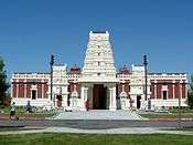
Livermore has five landmarks listed on the National Register of Historic Places: the Bank of Italy Building, the Hagemann Ranch Historic District, the D. J. Murphy House, the Livermore Carnegie Library and Park and Ravenswood Historic Site.
.JPG)
.JPG)
.JPG)
Notable people
- Mikkel Aaland, digital photographer
- Louie Aguiar, football player
- Kristin Allen, gymnast
- Max Baer, heavyweight champion boxer
- Conrad Bain (1923-2013), actor
- Bob Beers, Nevada state senator
- Ben Bodé, actor
- Harold Brown, director of Lawrence Livermore National Laboratory, Secretary of Defense
- Bryn Davies, musician
- Mark Davis, Major League Baseball pitcher, Granada High School (California), (1978)
- Troy Dayak, soccer player, San Jose Earthquakes Hall of Fame inductee
- James DePaiva, actor
- Matt Finders, trombonist
- Duane Glinton, Turks & Caicos Islands football midfielder
- J.R. Graham, Major League Baseball pitcher
- Martin Harrison, football defensive end for San Francisco 49ers, Minnesota Vikings and Seattle Seahawks, active 1990-1999
- Brian Johnson, soccer player
- Randy Johnson, (Livermore High 1982), Major League Baseball pitcher for Montreal Expos, Seattle Mariners, Houston Astros, Arizona Diamondbacks, New York Yankees, and San Francisco Giants, 1988-2009
- Tara Kemp, singer
- Robert Livermore, town namesake (died before the city was named and incorporated)
- Hans Mark, physicist and National Reconnaissance Office director
- Ralph Merkle, pioneer in modern cryptography
- George H. Miller, director of Lawrence Livermore National Laboratory
- Bill Mooneyham, Major League Baseball pitcher for Oakland A's
- Erwin Mueller, basketball player with Chicago Bulls, Los Angeles Lakers, and Seattle SuperSonics in 1960s and Detroit Pistons in the 1970s
- Bill Owens, photographer of Livermore's suburbs, in the book Suburbia
- Danny Payne, soccer player[91]
- Ignatius Piazza, firearms trainer
- Jean Quan, Mayor of Oakland
- James Wesley Rawles, best-selling novelist[92]
- Judith Merkle Riley, author
- Shelby Robertson, artist
- Michael Rodrigues, gymnast
- Syamyon Sharetski, the last acting Chairman of the Supreme Soviet of Belarus, President of Belarus (acting since 1999)
- Bryan Shaw, (Livermore High 2005), Major League Baseball pitcher for Arizona Diamondbacks 2011-2012, and Cleveland Indians 2013-present
- Jon Stebbins, author
- Brad Stisser, soccer player
- Edward Teller, Physicist, Director of Lawrence Livermore National Laboratory
- Steven L. Thompson, author, journalist, historian, former motorcycle racer
- Jack Trudeau, football player
- Brock Van Wey, electronic musician
- Tim Weaver, soccer player
- Jill Whelan, actress
- Herb York, Director of Lawrence Livermore National Laboratory
Sister cities
Livermore has three sister cities, as designated by Sister Cities International:[93]
-
 Quetzaltenango, Guatemala
 -
 Yotsukaido, Japan
 -
 Snezhinsk, Russia
References
- ↑ "California Cities by Incorporation Date" (Word). California Association of Local Agency Formation Commissions. Retrieved March 27, 2013.
- 1 2 "City Manager's Office". City of Livermore. Retrieved 2013-03-18.
- 1 2 "City Council". City of Livermore. Retrieved December 31, 2014.
- 1 2 "California's 15th Congressional District - Representatives & District Map". Civic Impulse, LLC. Retrieved March 14, 2013.
- 1 2 "Senators". State of California. Retrieved March 18, 2013.
- ↑ "2010 Census U.S. Gazetteer Files – Places – California". United States Census Bureau.
- ↑ "City of Livermore". Geographic Names Information System. United States Geological Survey.
- 1 2 "Livermore (city) QuickFacts". United States Census Bureau. Retrieved January 11, 2015.
- 1 2 3 Durham, David L. (1998). California's Geographic Names: A Gazetteer of Historic and Modern Names of the State. Clovis, Calif.: Word Dancer Press. p. 655. ISBN 1-884995-14-4.
- ↑
- ↑ Mont-Rouge Vineyard history
- ↑ Mission Indian life accessed 15 Jul 2013
- ↑ Map of Rancho Los Positas accessed 28 Mar 2013
- ↑ There is conflicting information as to the size of Livermore and Noreiga's grant. The 1884 California surveyors report lists 8,880 acres (3,594 ha) as being approved--this is probably what the Livermore family ended up with of their original grant when it was finally patented 1872. The rancho map (circa 1840?) seems to show a larger grant than 8,880 acres (3,594 ha). accessed 28 Mar 2013
- ↑ Robert Livermore Picture accessed 28 Mar 2013
- ↑ William Mendenhall accessed 28 Mar 2013
- ↑ "Historical Statistics of the United States, 1789–1945". The California U.S. Census of 1850 showed 92,597 residents. To this should be added residents from San Francisco (the largest city in the state), Santa Clara, and Contra Costa counties whose censuses were burned up or lost and not included in the totals. Newspaper accounts in 1850 (Alta Californian) gives the population of San Francisco at 21,000; the special California state census of 1852 finds 6,158 residents of Santa Clara County and 2,786 residents of Contra Costa County. The corrected California U.S. 1850 Census is over 120,000. See: U.S. Seventh Census 1850: California Accessed 14 April 2011
- ↑ CPRR railroad history access 28 Mar 2013
- ↑ Baker, Joseph Eugene; Past and Present of Alameda County, California, Volume 1;p.441;
- ↑ http://www.davidrumsey.com/luna/servlet/detail/RUMSEY~8~1~21426~630040:Livermore,-Mission-San-Jose-?sort=Pub_List_No_InitialSort%2CPub_Date%2CPub_List_No%2CSeries_No&qvq=w4s:/when%2F1878;q:Livermore;sort:Pub_List_No_InitialSort%2CPub_Date%2CPub_List_No%2CSeries_No;lc:RUMSEY~8~1&mi=9&trs=11
- ↑ Baker, Joseph Eugene; Past and Present of Alameda County, California, Volume 1;p.442;
- ↑ http://www.daffodil.org/ncds/dafvistas.htm
- ↑ Livermore Heritage Guild site accessed 28 Mar 2013
- ↑ Livermore Naval Air Station website. Accessed July 2, 2011
- ↑ Livermore Heritage Guild accessed 3 Apr 2013
- ↑ Livermore Heritage Guild photo site accessed 3 Apr 2013
- ↑ Average Livermore weather accessed 20 Apr 2013
- ↑ Livermore rainfall probabilities accessed 20 Apr 2013
- ↑ http://www.wrcc.dri.edu/cgi-bin/cliMAIN.pl?ca8353
- ↑ http://www.wrcc.dri.edu/cgi-bin/cliMAIN.pl?ca4997
- ↑ Livermore Budget 2013-2014 accessed 6 Apr 2013
- ↑ Livermore City Council accessed 6 Apr 2013
- ↑ Livermore Unions accessed 6 Apr 2013
- ↑ Livermore benefits accessed 6 Apr 2013
- ↑ Livermore Police Department accessed 30 Mar 2013
- ↑ Livermore High School accessed 21 Apr 2013
- ↑ Granada High accessed 21 Apr 2013
- ↑ Del Valle and Phoenix accessed 21 Apr 2013
- ↑ Vineyard Alternative High School accessed 21 Apr 2013
- ↑ Livermore Adult School accessed 21 Apr 2013
- ↑ Livermore pre-schools and day care centers accessed 23 Apr 2013
- ↑ Livermore pre-schools and day care centers Yelp accessed 23 Apr 2013
- ↑ Livermore Valley Charter School accessed 23 Apr 2013
- ↑ Our Savior Lutheran School accessed 23 Apr 2013
- ↑ St. Michael's Elementary and Middle Catholic School accessed 23 Apr 2013
- ↑ Valley Montessori accessed 23 Apr 2013
- ↑ Las Positas College accessed 23 Apr 2013
- ↑ University of Phoenix accessed 23 Apr 2013
- ↑ LARPD activities 2013 accessed 6 Apr 2013
- ↑ May Nissen Swim Center accessed 6 Apr 2013
- ↑ Shadow Cliffs Park accessed 23 Apr 2013
- ↑ Shadow Cliffs Park Recreation Area accessed 23 Apr 2013
- ↑ Del Valle Regional Park accessed 24 Apr 2013
- ↑ LARPD Board of Directors Accessed 6 Apr 2013
- ↑ ACER retirement plan accessed 24 Apr 2013
- ↑ LARPD Salary schedule accessed 24 Apr 2013
- ↑ LARPD Employment and benefits accessed 24 Apr 2013
- ↑ LARPD_organization_chart accessed 6 Apr 2013
- ↑ LARPD Municipal Service Review
- ↑ LARPD salary schedules
- ↑ "Annual Estimates of the Resident Population for Incorporated Places: April 1, 2010 to July 1, 2015". Retrieved July 2, 2016.
- ↑ "Census of Population and Housing". Census.gov. Retrieved June 4, 2015.
- ↑ Demographic Profile Bay Area Census http://www.bayareacensus.ca.gov
- ↑ "2010 Census Interactive Population Search: CA - Livermore city". U.S. Census Bureau. Retrieved July 12, 2014.
- ↑ Livermore income rank
- ↑ Political affiliation
- ↑ "Members Assembly". State of California. Retrieved March 18, 2013.
- ↑ Livermore Rodeo
- ↑ suburbia by bill owens
- ↑ Bankhead Theatre accessed 28 Mar 2013
- ↑ accessed 28 Mar 2013
- ↑ Hunt, Tim (August 2, 2010). "Tim Hunt: Forget high-speed rail; government needs to pitch in for BART to Livermore". The Oakland Tribune.
- ↑ Places to Worship accessed 28 Mar 2013
- ↑ Little lightbulb burns 110 years | The Manila Bulletin Newspaper Online
- ↑ "About NIF & Photon Science". lasers.llnl.gov. Retrieved 2016-04-08.
- ↑ "Campus an incubator for innovation", Jeanine Benca, (Hayward) Daily Review, July 8, 2011
- ↑ California selects Livermore Valley’s i-GATE as state innovation hub – Sandia Labs News Releases
- ↑ Robot Garden ← Community Workshop
- ↑ Wente family accessed 25 Mar 2013
- ↑ Concannon family accessed 25 Mar 2013
- ↑ Charles Wetmore accessed 25 Mar 2013
- ↑ Wineries, Wine Tasting, Dining, Tours, Weddings & More! | Livermore Valley Winegrowers Association
- 1 2 3 4 5 6 7 8 9 10 "Comprehensive Annual Financial Report For the Year Ended June 30, 2011". City of Livermore. Retrieved April 11, 2015.
- ↑ City of Livermore accessed 5 Apr 2013
- ↑ Livermore Area Recreation Park District accessed 5 Apr 2013
- ↑ Livermore Municipal Airport accessed 5 Apr 2013
- ↑ Livermore Municipal Airport accessed 6 Apr 2013
- ↑ For details on routes, times, schedules see: WHEELS accessed 5 Apr 2013
- ↑ "LivermoreBART.org". Retrieved 2007-04-20.
- ↑ "About Us - The Independent: Site". www.independentnews.com. Retrieved 2016-02-10.
- ↑ "1999 Hall of Fame Inductees". Chico State Athletics.
- ↑ http://www.goodreads.com/author/show/7855159.James_Wesley_Rawles
- ↑ Livermore sister cities Accessed 6 Apr 2013
Print, photo and film resources on Livermore
- Livermore (2002), a film by Rachel Raney and David Murray
- Suburbia, photoessay by Owens, Bill, (1972), ISBN 1-881270-40-8
External links
| Wikimedia Commons has media related to Livermore, California. |
| Wikivoyage has a travel guide for Livermore. |
- Official website
- Livermore Community Guide
- Livermore Area Recreation and Park District
- Livermore Shakespeare Festival
- Livermore Valley Performing Arts Center
- Livermore Independent, Weekly Newspaper
- Livermore Links
- Livermore Police Department
- i-GATE business hub website
Municipalities and communities of Alameda County, California, United States | ||
|---|---|---|
| Cities |  | |
| CDPs | ||
| Unincorporated communities | ||
| Former settlements | ||
| Bodies of water |
|  |
|---|---|---|
| Counties | ||
| Major cities | ||
| Cities and towns 100k–250k | ||
| Cities and towns 50k–99k | ||
| Cities and towns 25k-50k | ||
| Cities and towns 10k–25k |
| |
| Sub-regions | ||