Vichy Springs, Napa County, California
| Vichy Springs | |
|---|---|
| Unincorporated community | |
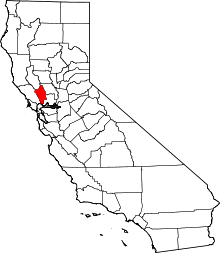
 Vichy Springs Location within the state of California | |
| Coordinates: 38°20′16″N 122°15′36″W / 38.33778°N 122.26000°WCoordinates: 38°20′16″N 122°15′36″W / 38.33778°N 122.26000°W | |
| Country |
|
| State |
|
| County | Napa |
| Elevation[1] | 75 ft (23 m) |
| Time zone | Pacific (PST) (UTC-8) |
| • Summer (DST) | PDT (UTC-7) |
| ZIP codes | 94558 |
| Area code(s) | 707 |
| GNIS feature ID | 1660098 |
Vichy Springs is a small unincorporated community in Napa County, California.[2][3] Vichy Springs is situated south of the Silverado Country Club and Milliken Creek on Montecello Road a few miles northeast of Napa.
Vichy Springs and most of the surrounding lands had once been part of the Mexican land grant Rancho Yajome. Most of this watershed was wilderness area to at least 1869, and thereafter this portion of the Milliken Creek watershed, which historically and to present has a robust steelhead run, was developed as pasture and grazing agricultural uses.[4]
The ZIP Code is 94558. The community is inside area code 707.
Other uses of the name
There is a carbonated hot springs named Vichy Springs in Ukiah, California.
Government
In the California State Legislature, Vichy Springs is in the 3rd Senate District, represented by Democrat Bill Dodd, and in the 4th Assembly District, represented by Democrat Cecilia Aguiar-Curry.[5]
In the United States House of Representatives, Vichy Springs is in California's 5th congressional district, represented by Democrat Mike Thompson.[6]
References
- ↑ U.S. Geological Survey Geographic Names Information System: Vichy Springs, Napa County, California
- ↑ Napa Quadrangle, 7.5 Minute Series, U.S. Geological Survey, Government Printing Office, Washington DC
- ↑ TopoQuest Map displaying Vichy Springs
- ↑ Earth Metrics Incorporated, "Phase I Environmental Site Assessment, Silverado Country Club, Napa County, California", May, 1989
- ↑ "Statewide Database". UC Regents. Retrieved December 6, 2014.
- ↑ "California's 5th Congressional District - Representatives & District Map". Civic Impulse, LLC. Retrieved March 3, 2013.
| Bodies of water |
|  |
|---|---|---|
| Counties | ||
| Major cities | ||
| Cities and towns 100k–250k | ||
| Cities and towns 50k–99k | ||
| Cities and towns 25k-50k | ||
| Cities and towns 10k–25k |
| |
| Sub-regions | ||