Menlo Park, California
| City of Menlo Park | ||
|---|---|---|
| City | ||
|
Downtown Menlo Park | ||
| ||
 Location in San Mateo County and the state of California | ||
 City of Menlo Park Location in the United States | ||
| Coordinates: 37°27′10″N 122°11′00″W / 37.45278°N 122.18333°WCoordinates: 37°27′10″N 122°11′00″W / 37.45278°N 122.18333°W | ||
| Country |
| |
| State |
| |
| County | San Mateo | |
| Incorporated | November 23, 1927[1] | |
| Government | ||
| • Mayor | Rich Cline[2] | |
| Area[3] | ||
| • Total | 17.415 sq mi (45.105 km2) | |
| • Land | 9.790 sq mi (25.355 km2) | |
| • Water | 7.625 sq mi (19.750 km2) 43.79% | |
| Elevation[4] | 72 ft (22 m) | |
| Population (April 1, 2010)[5] | ||
| • Total | 32,026 | |
| • Estimate (2014)[6] | 33,309 | |
| • Density | 3,402/sq mi (1,314/km2) | |
| Time zone | Pacific (UTC−8) | |
| • Summer (DST) | PDT (UTC−7) | |
| ZIP codes | 94025–94029 | |
| Area code | 650 | |
| FIPS code | 06-46870 | |
| GNIS feature IDs | 1659108, 2411079 | |
| Website |
www | |

Menlo Park is a city at the eastern edge of San Mateo County, in the San Francisco Bay Area of California, in the United States. It is bordered by San Francisco Bay on the north and east; East Palo Alto, Palo Alto, and Stanford to the south; Atherton, North Fair Oaks, and Redwood City to the west. Menlo Park is one of the most educated cities in the state of California and the United States, with nearly 70% of its residents having earned a degree.[7] Menlo Park had 32,026 inhabitants according to the 2010 United States Census.[8]
Geography
According to the United States Census Bureau, the city has a total area of 17.4 square miles (45 km2), of which 9.8 square miles (25 km2) is land and 7.6 square miles (20 km2) is water. The total area is 43.79% water. The main street in downtown Menlo Park is Santa Cruz Avenue, with the Menlo Center situated at its intersection with El Camino Real. The Menlo Park Civic Center is bounded by Ravenswood Avenue, Alma Street, Laurel Street and Burgess Drive. It contains the council offices, library, police station and Burgess Park which has various recreational facilities.
History

In the nineteenth century two Irish immigrants, Dennis J. Oliver and his brother-in-law D. C. McGlynn, purchased a 1,700-acre (6.9 km2) tract of land on the former Rancho de las Pulgas.[9] In the 1850s they erected a gate with a wooden arch bearing the inscription "Menlo Park" at the entrance to their property (now the intersection of Middle Ave and El Camino Real).[10][11] The word "Menlo" derived from the owners' former home of Menlo in County Galway, Ireland, and is an Anglicized version of the original Irish name of the place, Mionloch, meaning "middle lake".[9] In 1863, the San Francisco and San Jose Rail Road named a nearby station "Menlo Park" after the sign.[9] The 1867 station building still stands on the platform of the current Caltrain station, used by the local Chamber of Commerce. The town of Menlo Park grew up around this station, becoming a popular home for San Francisco businessmen.[9] A post office arrived in 1870, and the city was incorporated in 1874.[10] The original arch which gave its name to the stations and ultimately the city survived until 1922, when it was destroyed in an automobile accident.[9] The origin of the name of Menlo Park, California (ca 1850)[11] pre-dates any work done by Thomas Edison (ca 1876) in Menlo Park, New Jersey.
Demographics
| Historical population | |||
|---|---|---|---|
| Census | Pop. | %± | |
| 1930 | 2,254 | — | |
| 1940 | 3,258 | 44.5% | |
| 1950 | 13,587 | 317.0% | |
| 1960 | 26,957 | 98.4% | |
| 1970 | 26,826 | −0.5% | |
| 1980 | 26,438 | −1.4% | |
| 1990 | 28,040 | 6.1% | |
| 2000 | 30,785 | 9.8% | |
| 2010 | 32,026 | 4.0% | |
| Est. 2015 | 33,449 | [12] | 4.4% |
2010
The 2010 United States Census[14] reported that Menlo Park had a population of 32,026. The population density was 3,271.3 people per square mile (1,263.1/km²). The racial makeup of Menlo Park was 22,494 (70.2%) White, 1,551 (4.8%) African American, 156 (0.5%) Native American, 3,157 (9.9%) Asian, 454 (1.4%) Pacific Islander, 2,776 (8.7%) from other races, and 1,438 (4.5%) from two or more races. There were 5,902 people (18.4%) of Hispanic or Latino background, of any race. Among the Hispanic population, 4,303 were of Mexican ancestry.
The Census reported that 31,181 people (97.4% of the population) lived in households, 599 (1.9%) lived in non-institutionalized group quarters, and 246 (0.8%) were institutionalized.
There were 12,347 households, out of which 4,112 (33.3%) had children under the age of 18 living in them, 6,163 (49.9%) were opposite-sex married couples living together, 1,039 (8.4%) had a female householder with no husband present, 371 (3.0%) had a male householder with no wife present. There were 642 (5.2%) unmarried opposite-sex partnerships, and 102 (0.8%) same-sex married couples or partnerships. 3,672 households (29.7%) were made up of individuals and 1,371 (11.1%) had someone living alone who was 65 years of age or older. The average household size was 2.53. There were 7,573 families (61.3% of all households); the average family size was 3.20.
In terms of age 7,805 residents (24.4%) were under the age of 18, 1,817 people (5.7%) aged 18 to 24, 9,563 people (29.9%) aged 25 to 44, 8,263 people (25.8%) aged 45 to 64, and 4,578 people (14.3%) who were 65 years of age or older. The median age was 38.7 years. For every 100 females there were 93.7 males. For every 100 females age 18 and over, there were 91.5 males.
There were 13,085 housing units at an average density of 1,336.6 per square mile (516.1/km²), of which 6,927 (56.1%) were owner-occupied, and 5,420 (43.9%) were occupied by renters. The homeowner vacancy rate was 1.1%; the rental vacancy rate was 5.2%. 18,972 people (59.2% of the population) lived in owner-occupied housing units and 12,209 people (38.1%) lived in rental housing units.
|
2000
As of the census[16] of 2009, there were 33,690 people, 12,543 households, and 7,248 families residing in the city. The population density was 3,441.3 inhabitants per square mile (1,328.7/km2). There were 14,026 housing units at an average density of 1,432.7 per square mile (553.2/km²). 64.2% spoke English, 19.5% Spanish, other Indo-European 4.2%, 4.6% Chinese or Mandarin, and other language 0.7%, as their first language from estimate census 2009.
There were 12,543 households out of which 25.8% had children under the age of 18 living with them, 41.5% were married couples living together, 10.8% had a female householder with no husband present, and 45.67% were non-families. 35.1% of all households were made up of individuals and 11.1% had someone living alone who was 65 years of age or older. The average household size was 2.46 and the average family size was 3.15.
In the city the population was spread out with 25.8% under the age of 18, 9.1% from 18 to 24, 31.5% from 25 to 44, 20.4% from 45 to 64, and 14.2% who were 65 years of age or older. The median age was 32 years. For every 100 females there were 94.0 males. For every 100 females age 18 and over, there were 90.6 males.
As of the 2000 estimate census, the median income for a household in the city was $82,609. Males had a median income of $77,766 versus $59,101 for females. The per capita income for the city was $51,341. About 5.9% of families and 7.3% of the population were below the poverty line, including 9.8% of those under age 18 and 8.7% of those over age 64. As of 2009 the median income for a family was $123,251.[17]
Government and politics
City Council members are elected at-large to staggered, 4-year terms, in non-partisan municipal elections held every two years.[18]
County, state, and federal representation
On the San Mateo County Board of Supervisors, Menlo Park is split between Supervisorial District 3 and Supervisorial District 4.[19] represented by Don Horsley and Warren Slocum, respectively.
In the California State Legislature, Menlo Park is in the 13th Senate District, represented by Democrat Jerry Hill, and in the 24th Assembly District, represented by Democrat Marc Berman.[20]
In the United States House of Representatives, Menlo Park is split between California's 14th and 18th congressional districts,[21] represented by Jackie Speier (D–Hillsborough) and Anna Eshoo (D–Atherton), respectively.[22]
Education
For primary schools, the central portions of Menlo Park are served by the Menlo Park City School District, while the Belle Haven neighborhood and VA hospital are served by the Ravenswood City School District, and the Sharon Heights and Stanford Hills neighborhoods served by the Las Lomitas Elementary School District. For high school, Menlo Park is part of the Sequoia Union High School District, with all of Menlo Park falling into the boundaries of Menlo-Atherton High School.
Catholic parochial schools are St. Raymond Catholic Elementary School and Nativity Elementary School.[23] Peninsula School is a private progressive primary school.[24] Trinity School is an Episcopalian elementary school. The German-American International School with about 315 students, K-12, is also in the city.[25]
For higher education, Saint Patrick's Seminary and University is a Catholic seminary in Menlo Park. Fuller Theological Seminary, an evangelical Christian school, has a branch campus in Menlo Park.[26] Menlo College and Menlo School, which is a prep school, despite their names are in neighboring Atherton.
Economy

Much of Menlo Park's economy revolves around the companies on Sand Hill Road, consisting of venture capital, private equity, financial services, law firms, and other professional service companies and investment vehicles focusing on technology. Geron, Robert Half International, Exponent, Sunset and SRI International are among the companies based in Menlo Park. Facebook moved its headquarters to the former campus of Sun Microsystems in Menlo Park in December 2011.
Top employers
As of 2012, Facebook announced it would be the biggest employer in Menlo Park at 6,600 employees.[27] According to the city's 2015 Comprehensive Annual Financial Report,[28] the top employers in the city were:
| # | Employer | # of Employees |
|---|---|---|
| 1 | 6,068 | |
| 2 | SRI International | 1,373 |
| 3 | TE Connectivity | 598 |
| 4 | SHR Hotel, L.L.C. | 457 |
| 5 | E*Trade Financial Corporation | 432 |
| 6 | United Parcel Service | 388 |
| 7 | Pacific Biosciences of California | 293 |
| 8 | Intuit Inc | 275 |
| 9 | Safeway Stores Inc | 245 |
| 10 | City of Menlo Park | 237 |
Notable people
- Joan Baez, folk singer
- Isaac Baron, professional poker player
- Lindsey Buckingham, musician
- Henry Cowell, composer
- Brandon Crawford, San Francisco Giants shortstop
- Marion Dorn, textile designer
- Jeanne DuPrau, author
- Nancy Farmer, author
- Jerry Garcia, founding member of The Grateful Dead
- Chris Gulker, photographer, writer
- Vince Guaraldi, jazz musician
- Jack Herrick, founder of wikiHow
- Jon Huntsman, Jr., former governor of Utah
- Ken Kesey, author
- Milton Latham, railroad baron and politician
- Josie Maran, supermodel
- Abraham Maslow, co-founder of Humanistic Psychology
- Fred Moore, political activist
- Stevie Nicks, musician
- Elizabeth Osborn, equestrian vaulter
- Ariel Rittenhouse, Olympic diver
- Secondhand Serenade, rock band founded in Menlo Park
- Courtney Thorne-Smith, actress
- Thorstein Veblen, sociologist known for "Theory of the Leisure Class"
- John Vesely, musician/songwriter
- Bob Weir, founding member of The Grateful Dead
- Ram Shriram, founding investor of Google
- William R. Larson Sr., founder of Round Table Pizza
See also
Notes
- ↑ "California Cities by Incorporation Date" (Word). California Association of Local Agency Formation Commissions. Retrieved August 25, 2014.
- ↑ "City Council". City of Menlo Park. Retrieved December 16, 2014.
- ↑ "2010 Census U.S. Gazetteer Files – Places – California". United States Census Bureau.
- ↑ "Menlo Park". Geographic Names Information System. United States Geological Survey. Retrieved December 19, 2014.
- ↑ "Menlo Park (city) QuickFacts". United States Census Bureau. Retrieved April 13, 2015.
- ↑ "Annual Estimates of the Resident Population for Incorporated Places: April 1, 2010 to July 1, 2014". Retrieved June 4, 2015.
- ↑ Schwartz, Carly (November 17, 2011). "California's Most Educated Cities: Palo Alto, Los Altos Top the List". The Huffington Post Online. Retrieved September 9, 2012.
- ↑ "Census 2010: Table 3A — Total Population by Race (Hispanic exclusive) and Hispanic or Latino: 2010" (Excel). California Department of Finance. Retrieved March 22, 2010.
- 1 2 3 4 5 Hoover, Mildred Brooke; Douglas E Kyle (2002). Historic Spots in California (4th ed.). Stanford, CA: Stanford University Press. p. 405. ISBN 0-8047-4483-1.
- 1 2 Durham, David L (1998). California's Geographic Names: A Gazetteer of Historic and Modern Names of the State. Clovis, CA: Word Dancer Press. p. 662. ISBN 1-884995-14-4.
- 1 2 Stanger, 1963. pg. 109
- ↑ "Annual Estimates of the Resident Population for Incorporated Places: April 1, 2010 to July 1, 2015". Retrieved July 2, 2016.
- ↑ "Census of Population and Housing". Census.gov. Retrieved June 4, 2015.
- ↑ "2010 Census Interactive Population Search: CA - Menlo Park city". U.S. Census Bureau. Retrieved July 12, 2014.
- ↑ "QuickFacts: Menlo Park city, California". United States Census. Retrieved October 1, 2015.
- ↑ "American FactFinder". United States Census Bureau. Retrieved 2008-01-31.
- ↑ "Best places to live 2008". CNN. Archived from the original on October 23, 2013.
- ↑ "Elections". City of Menlo Park. Retrieved February 2, 2015.
- ↑ "County of San Mateo Board of Supervisors". City of Menlo Park. Retrieved February 2, 2015.
- ↑ "Statewide Database". UC Regents. Retrieved November 20, 2014.
- ↑ "Communities of Interest - City". California Citizens Redistricting Commission. Retrieved September 27, 2014.
- ↑ "California's 14th Congressional District - Representatives & District Map". Civic Impulse, LLC. Retrieved March 13, 2013.
- ↑ "Schools Directory". Archdiocese of San Francisco. Retrieved 2 November 2016.
- ↑ "Quick Facts". Peninsula School. Retrieved 2 November 2016.
- ↑ Mahbubani, Rhea (18 March 2015). "German-American International School will move to old Menlo Oaks campus this fall". San Jose Mercury News. Retrieved 2 November 2016.
- ↑ "Fuller Bay Area". Fuller Theological Seminary. Retrieved 2 November 2016.
- ↑ Guynn, Jessica (May 29, 2012). "Menlo Park set to approve Facebook campus expansion plan". Los Angeles Times.
- ↑ City of Menlo Park, California Comprehensive Annual Financial Report For the Fiscal Year Ended June 30, 2015. Chamber of Commerce, City of Menlo Park, California, January 15, 2016
References
- Stanger, Frank M. South from San Francisco: The Life Story of San Mateo County 1963, publisher: San Mateo County Historical Association
External links
| Wikivoyage has a travel guide for Menlo Park. |
| Wikimedia Commons has media related to Menlo Park, California. |
- Official website
- Menlo Park Chamber of Commerce
- Menlo Park Library
- Menlo Park Library Foundation
- Menlo Park Historical Association
- Walking Tour of Menlo Park
- San Mateo County Visitors Bureau Guide
- GAIS
| Bodies of water |
|  |
|---|---|---|
| Counties | ||
| Major cities | ||
| Cities and towns 100k–250k | ||
| Cities and towns 50k–99k | ||
| Cities and towns 25k-50k | ||
| Cities and towns 10k–25k |
| |
| Sub-regions | ||
Municipalities and communities of San Mateo County, California, United States | ||
|---|---|---|
| Cities and towns | 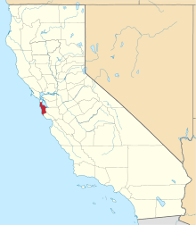 | |
| CDPs | ||
| Unincorporated communities | ||
| Ghost towns | ||