Cherryland, California
| Cherryland | |
|---|---|
| Census designated place | |
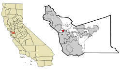 Location in Alameda County and the state of California | |
 Cherryland Location in the United States | |
| Coordinates: 37°40′46″N 122°06′12″W / 37.67944°N 122.10333°WCoordinates: 37°40′46″N 122°06′12″W / 37.67944°N 122.10333°W | |
| Country |
|
| State |
|
| County | Alameda |
| Government | |
| • State senator | Bob Wieckowski (D)[1] |
| • Assemblymember | Bill Quirk (D)[2] |
| • U. S. rep. | Eric Swalwell (D)[3] |
| Area[4] | |
| • Total | 1.197 sq mi (3.101 km2) |
| • Land | 1.197 sq mi (3.101 km2) |
| • Water | 0 sq mi (0 km2) 0% |
| Elevation[5] | 66 ft (20 m) |
| Population (April 1, 2010) | |
| • Total | 14,728 |
| • Density | 12,000/sq mi (4,700/km2) |
| Time zone | Pacific (UTC-8) |
| • Summer (DST) | PDT (UTC-7) |
| ZIP code | 94541 |
| Area code | 510 |
| FIPS code | 06-12902 |
| GNIS feature IDs | 1867005, 2408020 |
Cherryland (formerly, Hayward North) is a census-designated place (CDP) in Alameda County, California, United States. The unincorporated community is located between the cities of San Leandro to the north and Hayward to the south. The population was 14,728 at the 2010 census.
Geography
According to the United States Census Bureau, the CDP has a total area of 1.2 square miles (3.1 km²), all of it land. San Lorenzo Creek runs partly through the town.
Climate
This region experiences warm (but not hot) and dry summers, with no average monthly temperatures above 71.6 °F. According to the Köppen Climate Classification system, Cherryland has a warm-summer Mediterranean climate, abbreviated "Csb" on climate maps.[6]
Demographics
2010
The racial makeup of the CDP in 2010 was 20.9% non-Hispanic White, 10.8% Black or African American, 0.4% Native American, 9.2% Asian, 1.9% Pacific Islander, 0.2% from other races, and 2.7% from two or more races. 54.0% of the population were Hispanic or Latino of any race. The Census reported that 14,272 people (96.9% of the population) lived in households, 277 (1.9%) lived in non-institutionalized group quarters, and 179 (1.2%) were institutionalized.
There were 4,643 households, out of which 1,963 (42.3%) had children under the age of 18 living in them, 1,850 (39.8%) were opposite-sex married couples living together, 844 (18.2%) had a female householder with no husband present, 391 (8.4%) had a male householder with no wife present. There were 447 (9.6%) unmarried opposite-sex partnerships, and 50 (1.1%) same-sex married couples or partnerships. 1,131 households (24.4%) were made up of individuals and 324 (7.0%) had someone living alone who was 65 years of age or older. The average household size was 3.07. There were 3,085 families (66.4% of all households); the average family size was 3.64.
The population was spread out with 3,956 people (26.9%) under the age of 18, 1,457 people (9.9%) aged 18 to 24, 4,728 people (32.1%) aged 25 to 44, 3,339 people (22.7%) aged 45 to 64, and 1,248 people (8.5%) who were 65 years of age or older. The median age was 32.3 years. For every 100 females there were 101.9 males. For every 100 females age 18 and over, there were 101.0 males.
There were 4,975 housing units at an average density of 4,155.5 per square mile (1,604.4/km²), of which 1,458 (31.4%) were owner-occupied, and 3,185 (68.6%) were occupied by renters. The homeowner vacancy rate was 1.5%; the rental vacancy rate was 5.4%. 4,439 people (30.1% of the population) lived in owner-occupied housing units and 9,833 people (66.8%) lived in rental housing units.
2000
As of the census[7] of 2000, there were 13,837 people, 4,658 households, and 3,018 families residing in the CDP. The population density was 11,859.2 people per square mile (4,566.2/km²). There were 4,823 housing units at an average density of 4,133.6 per square mile (1,591.6/km²).
There were 4,658 households out of which 37.2% had children under the age of 18 living with them, 41.0% were married couples living together, 16.0% had a female householder with no husband present, and 35.2% were non-families. 25.9% of all households were made up of individuals and 7.6% had someone living alone who was 65 years of age or older. The average household size was 2.87 and the average family size was 3.46.
In the CDP the population was spread out with 27.0% under the age of 18, 10.4% from 18 to 24, 35.6% from 25 to 44, 17.5% from 45 to 64, and 9.5% who were 65 years of age or older. The median age was 32 years. For every 100 females there were 105.0 males. For every 100 females age 18 and over, there were 101.0 males.
The median income for a household in the CDP was $42,880, and the median income for a family was $44,319. Males had a median income of $34,830 versus $29,724 for females. The per capita income for the CDP was $16,929. About 9.0% of families and 12.3% of the population were below the poverty line, including 13.9% of those under age 18 and 12.1% of those age 65 or over.
Government
Cherryland is in the unincorporated part of Alameda County and thus is overseen by the Cherryland Community Association. The CCA is composed of volunteer Cherryland residents that hold monthly meetings to discuss issues within the community. The CCA reports these issues directly to and works in conjunction with the Alameda County Supervisor that governs the area. As the current supervisor is Nate Miley, District 4 Supervisor (2000 - current)
The area is policed by the Alameda County Sheriff's Office and the California Highway Patrol. Fire & EMT services provided by Alameda County Fire Dept.
History
Cherryland comprises largely the residential subdivision of the vast orchards (2,200 acres (8.9 km2)) of San Lorenzo pioneer William Meek, often called the "first farmer" of Alameda County. Meek Mansion is located on Hampton Road in the Northern part of Cherryland. The mansion is maintained by the Hayward Area Recreation and Park District, in conjunction with the Hayward Area Historical Society.
References
- ↑ "Senators". State of California. Retrieved March 18, 2013.
- ↑ "Members Assembly". State of California. Retrieved March 18, 2013.
- ↑ "California's 15th Congressional District - Representatives & District Map". Civic Impulse, LLC. Retrieved March 9, 2013.
- ↑ "2010 Census U.S. Gazetteer Files – Places – California". United States Census Bureau.
- ↑ "Cherryland". Geographic Names Information System. United States Geological Survey.
- ↑ Climate Summary for Cherryland, California
- ↑ "American FactFinder". United States Census Bureau. Archived from the original on 2013-09-11. Retrieved 2008-01-31.
External links
| Bodies of water |
|  |
|---|---|---|
| Counties | ||
| Major cities | ||
| Cities and towns 100k–250k | ||
| Cities and towns 50k–99k | ||
| Cities and towns 25k-50k | ||
| Cities and towns 10k–25k |
| |
| Sub-regions | ||
Municipalities and communities of Alameda County, California, United States | ||
|---|---|---|
| Cities |  | |
| CDPs | ||
| Unincorporated communities | ||
| Former settlements | ||