Shipyard Acres, California
| Shipyard Acres | |
|---|---|
| unincorporated community | |
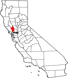
 Shipyard Acres  Shipyard Acres Location in California | |
| Coordinates: 38°15′36″N 122°16′16″W / 38.26000°N 122.27111°WCoordinates: 38°15′36″N 122°16′16″W / 38.26000°N 122.27111°W | |
| Country |
|
| State |
|
| County | Napa County |
| Elevation[1] | 33 ft (10 m) |
Shipyard Acres was an unincorporated community in Napa County, California.[1] It lies at an elevation of 33 feet (10 m).[1] Shipyard Acres is located 2.5 miles (4.0 km) south-southeast of Napa.[2] This was a wartime neighborhood consisting of nearly 400 of plywood houses built to house worker families involved in the World War II effort building ships at Basalt Rock Company.[3] It sprang up early in the war and was dismantled sometime in the mid-1950s. It was on the northwest corner of what is now Kaiser Road and Napa-Vallejo Highway. Some of the structures were moved a few miles west to the Cuttings Wharf area, resurrected, and are still in place near the marina.[4]
References
- 1 2 3 U.S. Geological Survey Geographic Names Information System: Shipyard Acres, California
- ↑ Durham, David L. (1998). California's Geographic Names: A Gazetteer of Historic and Modern Names of the State. Clovis, Calif.: Word Dancer Press. p. 702. ISBN 1-884995-14-4.
- ↑ Courtney, Kevin (November 12, 2002). "Shipyard Acres gone, homefront memories remain". Napa Valley Register. Napa, CA: Lee Enterprises, Inc. Retrieved September 24, 2011.
- ↑ Ford, Jim (September 14, 2009). "Yesterday's landmarks". Napa Valley Register. Napa, CA: Lee Enterprises, Inc. Retrieved August 13, 2011.
This article is issued from Wikipedia - version of the 7/5/2016. The text is available under the Creative Commons Attribution/Share Alike but additional terms may apply for the media files.