Angwin, California
| Angwin, California | |
|---|---|
| census-designated place | |
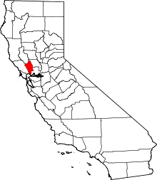
 Location in Napa County and the state of California | |
| Coordinates: 38°34′28″N 122°26′53″W / 38.57444°N 122.44806°WCoordinates: 38°34′28″N 122°26′53″W / 38.57444°N 122.44806°W[1] | |
| Country |
|
| State |
|
| County | Napa |
| Area[2] | |
| • census-designated place | 4.871 sq mi (12.615 km2) |
| • Land | 4.829 sq mi (12.506 km2) |
| • Water | 0.042 sq mi (0.109 km2) 0.86% |
| Elevation | 1,749 ft (533 m) |
| Population (2010) | |
| • census-designated place | 3,051 |
| • Density | 630/sq mi (240/km2) |
| • Metro | 7,468,390 |
| Time zone | Pacific (PST) (UTC-8) |
| • Summer (DST) | PDT (UTC-7) |
| ZIP codes | 94508, 94576 |
| Area code(s) | 707 |
| FIPS code | 06-02168 |
| GNIS feature IDs | 1657934; 2407744 |
Angwin is a census-designated place (CDP)[3] in Napa County, United States. California, best known as the site of Pacific Union College. It is part of the northern San Francisco Bay Area. The population was 3,051 at the 2010 census. Its area code is 707. Its two zip codes are 94508 and 94576. It is in the Pacific time zone.
History
The town was named in 1874 for Edwin Angwin who ran a resort on the land the town now occupies.[4] Edwin Angwin (1841–1919) was a native of St. Agnes, Cornwall. Angwin is a Cornish surname meaning "the white" (an = the; gwynn = white) and is comparable to the English surname "White."
Angwin is home to a large number of Seventh-day Adventists. In 1909, Pacific Union College, an Adventist liberal arts college, moved from Healdsburg to Angwin.
Although many of the residents refrain from drinking alcohol because of religious beliefs, the area is becoming a popular area for winemakers to plant vineyards and build wineries.[5]
Geography
According to the United States Census Bureau, the CDP has a total area of 4.9 square miles (13 km2), 99.14% of it land and 0.86% of it water.
Climate
Angwin's Pacific Union College has maintained a National Weather Service cooperative weather station since 1940. Average January temperatures are a maximum of 52.2 °F (11.2 °C) and a minimum of 37.9 °F (3.3 °C). There are an average of 35.3 days with highs of 90.0 °F (32.2 °C) or higher and 25.1 days with lows of 32.0 °F (0.0 °C) or lower. The record high temperature was 110 °F (43 °C) on July 15, 1972. The record low temperature was 14 °F (−10 °C) on December 9, 1972.
Average annual precipitation is 40.60 inches (103.1 cm). The wettest year was 1983 with 88.89 inches (225.8 cm) and the driest year was 1990 with 19.00 inches (48.3 cm). The most precipitation in one month was 30.44 inches (77.3 cm) in December 1955. The most precipitation in 24 hours was 7.40 inches (18.8 cm) on February 17, 1986.
Average annual snowfall is 2.0 inches (5.1 cm). The most snow in one year was 23.3 inches (59 cm) in 1952, including 12.8 inches (33 cm) in January.
Demographics
2010

The 2010 United States Census[6] reported that Angwin had a population of 3,051. The population density was 626.4 people per square mile (241.9/km²). The racial makeup of Angwin was 2,124 (69.6%) White, 139 (4.6%) African American, 22 (0.7%) Native American, 339 (11.1%) Asian, 5 (0.2%) Pacific Islander, 234 (7.7%) from other races, and 188 (6.2%) from two or more races. Hispanic or Latino of any race were 625 persons (20.5%).
The Census reported that 2,058 people (67.5% of the population) lived in households, 944 (30.9%) lived in non-institutionalized group quarters, and 49 (1.6%) were institutionalized.
There were 824 households, out of which 233 (28.3%) had children under the age of 18 living in them, 461 (55.9%) were opposite-sex married couples living together, 66 (8.0%) had a female householder with no husband present, 33 (4.0%) had a male householder with no wife present. There were 28 (3.4%) unmarried opposite-sex partnerships, and 7 (0.8%) same-sex married couples or partnerships. 209 households (25.4%) were made up of individuals and 38 (4.6%) had someone living alone who was 65 years of age or older. The average household size was 2.50. There were 560 families (68.0% of all households); the average family size was 2.93.
The population was spread out with 413 people (13.5%) under the age of 18, 1,146 people (37.6%) aged 18 to 24, 565 people (18.5%) aged 25 to 44, 672 people (22.0%) aged 45 to 64, and 255 people (8.4%) who were 65 years of age or older. The median age was 24.4 years. For every 100 females there were 102.3 males. For every 100 females age 18 and over, there were 100.8 males.
There were 912 housing units at an average density of 187.2 per square mile (72.3/km²), of which 429 (52.1%) were owner-occupied, and 395 (47.9%) were occupied by renters. The homeowner vacancy rate was 0.2%; the rental vacancy rate was 5.9%. 1,131 people (37.1% of the population) lived in owner-occupied housing units and 927 people (30.4%) lived in rental housing units.
2000
As of the census[7] of 2000, there were 3,148 people, 811 households, and 587 families residing in the CDP. The population density was 643.5 people per square mile (248.6/km²). There were 874 housing units at an average density of 178.7 per square mile (69.0/km²). The racial makeup of the CDP in 2010 was 59.7% non-Hispanic White, 4.2% non-Hispanic Black or African American, 0.3% Native American, 10.7% Asian, 0.2% Pacific Islander, 0.4% from other races, and 4.0% from two or more races. 20.5% of the population were Hispanic or Latino of any race.
There were 811 households out of which 30.0% had children under the age of 18 living with them, 62.6% were married couples living together, 6.7% had a female householder with no husband present, and 27.6% were non-families. 20.8% of all households were made up of individuals and 3.6% had someone living alone who was 65 years of age or older. The average household size was 2.68 and the average family size was 3.06.
In the CDP the population was spread out with 15.4% under the age of 18, 36.8% from 18 to 24, 20.5% from 25 to 44, 18.9% from 45 to 64, and 8.4% who were 65 years of age or older. The median age was 24 years. For every 100 females there were 95.6 males. For every 100 females age 18 and over, there were 91.8 males.
The median income for a household in the CDP was $56,453, and the median income for a family was $63,972. Males had a median income of $46,589 versus $34,917 for females. The per capita income for the CDP was $20,126. About 5.5% of families and 8.4% of the population were below the poverty line, including 14.0% of those under age 18 and 4.9% of those age 65 or over.
Government
In the California State Legislature, Angwin is in the 3rd Senate District, represented by Democrat Bill Dodd, and in the 4th Assembly District, represented by Democrat Cecilia Aguiar-Curry.[8]
In the United States House of Representatives, Angwin is in California's 5th congressional district, represented by Democrat Mike Thompson.[9]
References
- ↑ "US Gazetteer files: 2010, 2000, and 1990". United States Census Bureau. 2011-02-12. Retrieved 2011-04-23.
- ↑ U.S. Census Archived 2012-01-24 at WebCite
- ↑ U.S. Geological Survey Geographic Names Information System: Angwin, California
- ↑ Gudde, Erwin; William Bright (2004). California Place Names (Fourth ed.). University of California Press. ISBN 0-520-24217-3.
- ↑ Noonan, James (August 21, 2011). "Angwin: Where conviction meets cabernet". Napa Valley Register. Napa, CA: Lee Enterprises, Inc. Retrieved August 21, 2011.
- ↑ "2010 Census Interactive Population Search: CA - Angwin CDP". U.S. Census Bureau. Retrieved July 12, 2014.
- ↑ "American FactFinder". United States Census Bureau. Archived from the original on 2013-09-11. Retrieved 2008-01-31.
- ↑ "Statewide Database". UC Regents. Retrieved December 5, 2014.
- ↑ "California's 5th Congressional District - Representatives & District Map". Civic Impulse, LLC. Retrieved March 3, 2013.
| Bodies of water |
|  |
|---|---|---|
| Counties | ||
| Major cities | ||
| Cities and towns 100k–250k | ||
| Cities and towns 50k–99k | ||
| Cities and towns 25k-50k | ||
| Cities and towns 10k–25k |
| |
| Sub-regions | ||
 |
Geyserville | Pope Valley | Woodland | |
| Calistoga | |
Winters | ||
| ||||
| | ||||
| St. Helena | Rutherford | Dixon |