Vacaville, California
| City of Vacaville | |
|---|---|
| City | |
 | |
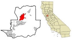 Location in Solano County and the state of California | |
 City of Vacaville Location in the United States | |
| Coordinates: 38°21′14″N 121°58′22″W / 38.35389°N 121.97278°WCoordinates: 38°21′14″N 121°58′22″W / 38.35389°N 121.97278°W | |
| Country | United States |
| State | California |
| County | Solano |
| Incorporated | August 9, 1892[1] |
| Government | |
| • Mayor | Len Augustine[2] |
| • State Senator | Bill Dodd (D)[3] |
| • Assemblymember | Jim Frazier (D)[3] |
| • U. S. Rep. | John Garamendi (D)[4] |
| Area[5] | |
| • Total | 28.585 sq mi (74.034 km2) |
| • Land | 28.373 sq mi (73.485 km2) |
| • Water | 0.212 sq mi (0.550 km2) 0.74% |
| Elevation[6] | 174 ft (53 m) |
| Highest elevation[7] | 300 ft (90 m) |
| Lowest elevation[7] | 90 ft (30 m) |
| Population (April 1, 2010)[8] | |
| • Total | 92,428 |
| • Estimate (2013)[8] | 94,275 |
| • Density | 3,200/sq mi (1,200/km2) |
| Time zone | Pacific (UTC−8) |
| • Summer (DST) | PDT (UTC−7) |
| ZIP codes | 95687, 95688, 95696 |
| Area code | 707 |
| FIPS code | 06-81554 |
| GNIS feature IDs | 277624, 2412139 |
| Website |
www |
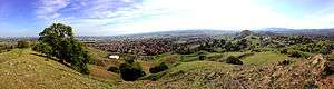
Vacaville is a city located in Solano County in Northern California. The town is nearly halfway between Sacramento and San Francisco on I-80. It sits approximately 35 miles (56 km) from Sacramento, and 55 miles (89 km) from San Francisco. As of the 2010 census, Vacaville had a population of 92,428, making it the third largest city in Solano County.
History
The city was originally laid out on land deeded by Manuel Cabeza Vaca to William McDaniel in August 1850. Its original plot was recorded on December 13, 1851.[9]
The city was a Pony Express stop and was home to many large produce companies and local farms which flourished due to the Vaca Valley's rich soil, including The Nut Tree.
Geography and environment
There are a number of rare and endangered species in the Vacaville area. Endangered plants which have historically occurred in the vernal pool areas in and around Vacaville include Legenre limosa, Plagiobothrys hystriculus, Downingia humilis, Contra Costa Goldfields (Lasthenia conjugens), and Showy Indian clover (Trifolium amoenum).[10] To this day Trifolium amoenum can still be found in Lagoon Valley Regional Park.
According to the United States Census Bureau, the city has a total area of 28.6 square miles (74 km2). 99.26% of the area is land and 0.74% is water. Excluding the Putah South Canal and minor local creeks, the only significant body of water within the city is the 105-acre (0.42 km2) Lagoon Valley Lake.
The unincorporated communities of Allendale and Elmira are generally considered to be part of "greater" Vacaville.
Climate
Vacaville has a typical Mediterranean climate with hot, dry summers and cool, wet winters. Characteristic of inland California, summers can get quite hot. Autumns are warm in the early part but quickly cool down as the wet season approaches. Winters can be cool, and often foggy, but are mild compared to other regions. Spring is a rather pleasant season with fairly mild temperatures and not so much rain. The greater majority of precipitation falls in the autumn, winter, and spring months with little to none in summer.
According to National Weather Service records, average January temperatures in Vacaville are a maximum of 55.4 °F (13.0 °C) and a minimum of 36.7 °F (2.6 °C). Average July temperatures are a maximum of 95.2 °F (35.1 °C) and a minimum of 56.1 °F (13.4 °C). There are an average of 87.7 days with highs of 90 °F (32 °C) or higher. There are an average of 30.7 days with lows of 32 °F (0 °C) or lower. The record high temperature was 116 °F (47 °C) on July 23, 2006. The record low temperature was 14 °F (−10 °C) on December 26, 1924.
Average annual precipitation is 24.55 inches (624 mm). There are an average of 57 days with measurable precipitation. The wettest year was 1983 with 48.90 inches (1,242 mm) and the driest year was 2012 with 5 inches. The most precipitation in one month was 19.83 inches (504 mm) in January 1916. The most precipitation in 24 hours was 6.10 inches (155 mm) on February 27, 1940. Snowfall is rare in Vacaville, but light measurable amounts have occurred, including 2.2 inches (56 mm) in January 1907 and 2.0 inches (51 mm) in December 1988.[11]
| Climate data for Vacaville, California | |||||||||||||
|---|---|---|---|---|---|---|---|---|---|---|---|---|---|
| Month | Jan | Feb | Mar | Apr | May | Jun | Jul | Aug | Sep | Oct | Nov | Dec | Year |
| Record high °F (°C) | 81 (27) |
82 (28) |
91 (33) |
99 (37) |
105 (41) |
115 (46) |
116 (47) |
114 (46) |
112 (44) |
105 (41) |
91 (33) |
78 (26) |
116 (47) |
| Average high °F (°C) | 56 (13) |
62 (17) |
68 (20) |
74 (23) |
82 (28) |
90 (32) |
96 (36) |
95 (35) |
91 (33) |
80 (27) |
66 (19) |
56 (13) |
76.3 (24.7) |
| Average low °F (°C) | 39 (4) |
42 (6) |
45 (7) |
47 (8) |
52 (11) |
57 (14) |
60 (16) |
59 (15) |
57 (14) |
52 (11) |
44 (7) |
39 (4) |
49.4 (9.8) |
| Record low °F (°C) | 18 (−8) |
16 (−9) |
26 (−3) |
29 (−2) |
32 (0) |
36 (2) |
40 (4) |
39 (4) |
39 (4) |
31 (−1) |
22 (−6) |
17 (−8) |
16 (−9) |
| Average precipitation inches (mm) | 5.33 (135.4) |
5.41 (137.4) |
3.53 (89.7) |
1.30 (33) |
0.74 (18.8) |
0.10 (2.5) |
0 (0) |
0.06 (1.5) |
0.27 (6.9) |
1.20 (30.5) |
3.13 (79.5) |
5.23 (132.8) |
26.3 (668) |
| Source: [12] | |||||||||||||
Demographics
| Historical population | |||
|---|---|---|---|
| Census | Pop. | %± | |
| 1870 | 343 | — | |
| 1880 | 361 | 5.2% | |
| 1890 | 725 | 100.8% | |
| 1900 | 1,220 | 68.3% | |
| 1910 | 1,177 | −3.5% | |
| 1920 | 1,254 | 6.5% | |
| 1930 | 1,556 | 24.1% | |
| 1940 | 1,614 | 3.7% | |
| 1950 | 3,169 | 96.3% | |
| 1960 | 10,898 | 243.9% | |
| 1970 | 21,690 | 99.0% | |
| 1980 | 43,367 | 99.9% | |
| 1990 | 71,479 | 64.8% | |
| 2000 | 88,625 | 24.0% | |
| 2010 | 92,428 | 4.3% | |
| Est. 2015 | 96,803 | [13] | 4.7% |
Vacaville has the highest per capita concentration of electric cars in the world[15]
2010
The 2010 United States Census[16] reported that Vacaville had a population of 92,428. The population density was 3,233.5 people per square mile (1,248.5/km²). The racial makeup of Vacaville was 61,301 (66.3%) White, 9,510 (10.3%) African American, 846 (0.9%) Native American, 5,606 (6.1%) Asian (3.3% Filipino, 0.7% Chinese, 0.6% Indian, 0.5% Japanese, 0.3% Vietnamese, 0.3% Korean), 532 (0.6%) Pacific Islander, 8,136 (8.8%) from other races, and 6,497 (7.0%) from two or more races. Hispanic or Latino of any race were 21,121 persons (22.9%); 17.0% of Vacaville is Mexican, 0.9% Puerto Rican, 0.5% Salvadoran, 0.3% Nicaraguan, 0.2% Guatemalan, and 0.2% Peruvian.
The Census reported that 91.3% of the population lived in households and 8.6% were institutionalized.
There were 31,092 households, out of which 11,747 (37.8%) had children under the age of 18 living in them, 16,347 (52.6%) were opposite-sex married couples living together, 4,068 (13.1%) had a female householder with no husband present, 1,686 (5.4%) had a male householder with no wife present. There were 1,892 (6.1%) unmarried opposite-sex partnerships, and 208 (0.7%) same-sex married couples or partnerships. 7,053 households (22.7%) were made up of individuals and 2,689 (8.6%) had someone living alone who was 65 years of age or older. The average household size was 2.71. There were 22,101 families (71.1% of all households); the average family size was 3.19.
The population was spread out with 21,511 people (23.3%) under the age of 18, 8,963 people (9.7%) aged 18 to 24, 26,269 people (28.4%) aged 25 to 44, 26,016 people (28.1%) aged 45 to 64, and 9,669 people (10.5%) who were 65 years of age or older. The median age was 37.2 years. For every 100 females there were 112.5 males. For every 100 females age 18 and over, there were 115.1 males.
There were 32,814 housing units at an average density of 1,148.0 per square mile (443.2/km²), of which 63.4% were owner-occupied and 36.6% were occupied by renters. The homeowner vacancy rate was 2.1%; the rental vacancy rate was 6.8%. 59.0% of the population lived in owner-occupied housing units and 32.3% lived in rental housing units.
2000
As of the 2000 census[17] there were 88,625 people residing in the city. The population density was 1,263.6/km² (3,272.3/mi²). There were 28,696 housing units at an average density of 409.1/km² (1,059.5/mi²). The racial makeup of the city was 72.11% White, 10.02% African American, 0.97% Native American, 4.18% Asian, 0.45% Pacific Islander, 6.74% from other races, and 5.53% from two or more races. 17.88% of the population were Hispanic or Latino of any race.
Of the 28,105 households, 20,966 were families: 41.4% had children under the age of 18 living with them, 57.0% were married couples living together, 12.4% had a female householder with no husband present, and 25.4% were "non-families." 19.2% of all households were made up of individuals and 6.4% had someone living alone who was 65 years of age or older. The average household size was 2.83 and the average family size was 3.24.
The median age was 34 years, and the age distribution of the population was rather spread out: 27.0% under the age of 18, 9.0% from 18 to 24, 35.4% from 25 to 44, 20.3% from 45 to 64, and 8.3% who were 65 years of age or older. However, the sex ratio was higher than the national average. For every 100 females there were 118.4 males. For every 100 females age 18 and over, there were 124.7 males.

Economy
Personal income
The median income for a household in the city is $57,667, and the median income for a family is $63,950. Males have a median income of $43,527 versus $31,748 for females. The per capita income for the city is $21,557. 6.1% of the population and 4.3% of families are below the poverty line. Out of the total population, 7.4% of those under the age of 18 and 4.8% of those 65 and older are living below the poverty line.[18]
Industry
There are biotechnology/pharmaceutical facilities operated by Genentech, ALZA Corporation, Kaiser Permanente, and Novartis International AG.
On May 14, 2014, ICON Aircraft announced they would consolidate all company functions in a new 140,000-square-foot facility in Vacaville.[19]
Tourism
The city holds annual Vacaville Fiesta Days, that happen downtown, which includes a parade that features the public school marching bands, gymnasts, and even an electric car showcase, among other things. Other sites for tourists include the Vacaville Premium Outlets and the Nut Tree, which is home to a train for children, a carousel, and even a life-size checkerboard, as well as numerous stores and dining establishments. Every Friday during the summer the city holds the Creek Walk in Down Town Vacaville. Every December, the city holds a Festival of Trees in the ice skating rink and the Tree Lighting Ceremony, in which residents of Vacaville gather downtown to see a 50-foot (15 m) tree illuminate and enjoy festive music played by the Jepson Band, hot chocolate, and horse-drawn carriage rides. The Jimmy Doolittle Center at the Nut Tree Airport displays aircraft from as early as 1912 and is home to the Jimmy Doolittle Shell Lockheed Vega. Displays also include personal items of General Doolittle and items related to the Doolittle Raid of 1942.
Government
Two state prisons are located in Vacaville: California State Prison, Solano and California Medical Facility. The latter prison houses inmates undergoing medical treatments.
Top employers
According to the City's 2009 Comprehensive Annual Financial Report,[20] the top employers in the city are:
| # | Employer | # of Employees |
|---|---|---|
| 1 | California Department of Corrections and Rehabilitation | 2,915 |
| 2 | Vacaville Unified School District | 1,273 |
| 3 | Genentech | 875 |
| 4 | City of Vacaville | 820 |
| 5 | Alza | 750 |
| 6 | State Compensation Insurance Fund | 670 |
| 7 | Kaiser Permanente | 600 |
| 8 | VacaValley Hospital | 470 |
| 9 | M&G DuraVent | 350 |
| 10 | Travis Credit Union | 311 |
Education

The city has two unified public school districts, a community college district, private schools and colleges.
Public elementary and secondary schools
The Vacaville Unified School District includes the following campuses:
Elementary schools
- Alamo Elementary
- Browns Valley Elementary
- Edwin Markham Elementary
- Eugene Padan Elementary
- Fairmont Elementary
- Cooper Elementary
- Orchard Elementary
- Hemlock Elementary
- Jean Callison Elementary
- Vacaville Christian Elementary
- Sierra Vista Elementary (Reopened)
- Kairos Public Schools Vacaville Academy (K-8)
- Foxboro Elementary
Middle schools
- Vaca Pena Middle School
- Willis Jepson Middle School
- Vacaville Christian Middle School
- Kairos Public Schools Vacaville Academy
High schools
- Buckingham Charter Magnet High School[21]
- Country High School[22]
- Vacaville High School[23]
- Will C. Wood High School[24]
- Vacaville Christian High School
Travis Unified School District
The Travis Unified School District campuses include:
- Cambridge Elementary
- Foxboro Elementary
- Travis Elementary
- Scandia Elementary School
- Center Elementary
Its campuses serving Vacaville secondary students are:
- Golden West Middle School
- Vanden High School
Private schools
Private institutions with campuses in Vacaville are:
- Bethany Lutheran Preschool and Elementary School
- Faith Academy (Independent)
- Notre Dame Parochial School
- Vacaville Adventist (Seventh-day Adventist)
- Vacaville Christian Schools (pre-school through 12th grade)
Colleges and universities
The town has a District supporting the Solano Community College. Among others, it offers an associate degree in biotechnology, which could lead to employment with local industries.
Other colleges and universities include:
- California Maritime Academy
- Touro University College of Osteopathic Medicine
- The University of Phoenix
Notable people
(B) denotes that the person was born in Vacaville.
- Arthur Adams (born 1963), comic book artist known for Longshot and Monkeyman and O'Brien[25][26]
- Dennis Alexio (born 1959) – Kickboxer, eight-time world champion (B)
- Chris Begley – member of the band Fight Fair[27][28]
- Andy Bloom (born 1973), Olympic shot putter
- Frank H. Buck - politician, fruit baron, developer of Beverly Hills, California (B)
- Jarrett Bush – NFL player, Green Bay Packers (B)[29]
- Kyle DeVan – offensive guard for the Indianapolis Colts[30]
- Jermaine Dye – Major League Baseball player; 2005 World Series MVP with the Chicago White Sox (B)[31]
- Xzavie Jackson – defensive end for the Cincinnati Bengals[32][33]
- Stefan Janoski, skateboarder
- Josh Kaddu, Line Backer for the Miami Dolphins.
- Bonnie McKee - pop singer/songwriter (B)
- Vince Newsome - NFL player for LA Rams, Cleveland Browns, Baltimore Ravens. In 1983 became the first Vacaville resident to be drafted into the NFL.[34]
- Frank Parker (actor) Played Grandpa Shawn Brady on Days of Our Lives (currently lives in Vacaville)
- Aaron Pauley - Bassist/Vocalist of rock band Of Mice & Men (band)
- Michael Polenske, vintner[35]
- Jacoby Shaddix – lead singer of rock band Papa Roach[36]
- Casey Sheehan – awarded Bronze Star with Palm Fronds posthumously for actions in Iraq on April 4, 2004[37]
- Cindy Sheehan – political activist[38]
- Jessica Sierra - singer[39]
- Thomas Williams – linebacker for the USC Trojans[40][41]
- Luzena Wilson, California Gold Rush entrepreneur and memoirist.
See also
References
- ↑ "California Cities by Incorporation Date" (Word). California Association of Local Agency Formation Commissions. Retrieved August 25, 2014.
- ↑ "City Council". City of Vacaville, CA. Retrieved December 16, 2014.
- 1 2 "Statewide Database". UC Regents. Retrieved November 23, 2014.
- ↑ "California's 3rd Congressional District - Representatives & District Map". Civic Impulse, LLC.
- ↑ "2010 Census U.S. Gazetteer Files – Places – California". United States Census Bureau.
- ↑ "Vacaville". Geographic Names Information System. United States Geological Survey. Retrieved November 18, 2014.
- 1 2 "About Vacaville". City of Vacaville, CA. Retrieved January 26, 2015.
- 1 2 "Vacaville (city) QuickFacts". United States Census Bureau. Retrieved April 18, 2015.
- ↑ History of Solano County...and histories of its cities, towns...etc. by J. P. Munro-Fraser. Wood, Alley & co., 1879. Page 317.
- ↑ Environmental Assessment for the Green Tree Assessment District, Earth Metrics Inc Report 7690, City of Vacaville, March, 1989
- ↑ "VACAVILLE, CALIFORNIA". Retrieved October 2, 2014.
- ↑ Monthly Averages for Vacaville, CA (95688), Weather.com, retrieved 2012-10-19
- ↑ "Annual Estimates of the Resident Population for Incorporated Places: April 1, 2010 to July 1, 2015". Retrieved July 2, 2016.
- ↑ "Census of Population and Housing". Census.gov. Retrieved June 4, 2015.
- ↑ The Reporter – Rebuilding Voltageville
- ↑ "2010 Census Interactive Population Search: CA - Vacaville city". U.S. Census Bureau. Retrieved July 12, 2014.
- ↑ "American FactFinder". United States Census Bureau. Retrieved 2008-01-31.
- ↑ "Vacaville Information". Archived from the original on October 8, 2007. Retrieved October 2, 2014.
- ↑ "ICON to relocate to Vacaville" General Aviation News, May 14, 2014. Accessed: May 15, 2014.
- ↑ City of Vacaville CAFR
- ↑ buckingham.schoolloop.com
- ↑ countryhs.schoolloop.com
- ↑ http://internal.vusd.solanocoe.k12.ca.us/vhs/index.html
- ↑ willcwood.org
- ↑ Cooke, Jon B. "The Art of Arthur Adams", Reprinted from Comic Book Artist No. 17, November 15, 2001
- ↑ George Khoury and Eric Nolen-Weathington. Modern Masters Volume Six: Arthur Adams, 2006, TwoMorrows Publishing.
- ↑ http://www.myspace.com/chrissbegley
- ↑ "Fight Fair". Myspace. Retrieved October 2, 2014.
- ↑
- Shawn Bolt NBA basketball player, (Los Angeles Lakers, Sacramento Kings)
- ↑ "The Official website of the Indianapolis Colts". Retrieved April 18, 2011.
- ↑ "Jermaine Dye: Stats, Bio, Photos, Highlights". The Official website of the Chicago White Sox. MLB Advanced Media. 2009. Retrieved 2009-05-03.
- ↑ "Player Bio:Xzavie Jackson". The Official Athletic Website of the University of Missouri. CBS Interactive. 2009. Retrieved 2009-05-03.
- ↑ "Player Bio:Xzavie Jackson". The Official website of the Philadelphia Eagles. Philidephia Eagles. 2008. Retrieved 2009-05-03.
- ↑ "Vacaville Football, Bulldogs in the Pros". Retrieved June 16, 2015.
- ↑ Sardar, Zahid (May 2010). "From city to rusticity" (PDF). Rosewood Magazine: 78–80.
- ↑ "Jacoby Shaddix-Biography". Internet Movie Database. IMDB.com. 2009. Retrieved 2009-05-03.
- ↑ Garofoli, Joe (March 18, 2007). "Portraits of Sacrifice – Casey Sheehan: Vacaville". San Francisco Chronicle. Hearst Communications, Inc. p. E4. Retrieved 2009-05-03.
- ↑ "Meet Cindy" Check
|url=value (help). Cindy Sheehan for Congress. 2008. Retrieved 2009-05-03. - ↑ "Season 1 Revisited." Celebrity Rehab with Dr. Drew. Hst. Dr. Drew Pinsky. VH1. 20 Nov. 2011.
- ↑ "Thomas Williams Bio". The Official website of the Jacksonville Jaguars. National Football League. 2008. Retrieved 2009-05-03.
- ↑ "Player Bio:Thomas Williams". Official USC Website. USC. 2008. Retrieved 2009-05-03.
External links
| Wikimedia Commons has media related to Vacaville, California. |
- Official website
- Vacaville Wiki
- The Reporter – Vacaville Newspaper
- Nut Tree
- Historic Downtown Vacaville
- Vacaville Visitor's Bureau
- Vacaville Heritage Council
| Bodies of water |
|  |
|---|---|---|
| Counties | ||
| Major cities | ||
| Cities and towns 100k–250k | ||
| Cities and towns 50k–99k | ||
| Cities and towns 25k-50k | ||
| Cities and towns 10k–25k |
| |
| Sub-regions | ||
Municipalities and communities of Solano County, California, United States | ||
|---|---|---|
| Cities | 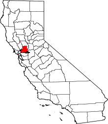 | |
| CDPs | ||
| Unincorporated communities | ||
| Ghost towns |
| |
