Walnut Heights, California
| Walnut Heights Motto: Reaching to greater Heights Nickname: The Heights, WH | |
|---|---|
| Unincorporated community | |
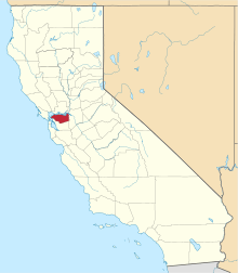
 Walnut Heights Location in California | |
| Coordinates: 37°52′36″N 122°03′04″W / 37.87667°N 122.05111°WCoordinates: 37°52′36″N 122°03′04″W / 37.87667°N 122.05111°W | |
| Country | United States |
| State | California |
| County | Contra Costa County |
| Elevation[1] | 200 ft (61 m) |
| GNIS ID[1][2] | 255921 |
| FIPS code[1][2] | 06-83388 |
Walnut Heights is an affluent unincorporated community in Contra Costa County, California, United States.[1] It is located at an elevation of 200 feet (61 m),[1] in the hills near Walnut Creek. The ZIP Code is 94596. The community is inside area code 925. It it is served by Walnut Heights Elementary School, Walnut Creek Intermediate, and Las Lomas High School.
The area was once a rancho, Rancho del Arroyo de las Bobones, owned by Maria Castro during Mexico's era of rule over California. She had a nephew named Ygnacio, which Ygnacio Valley and Ygnacio Valley Road were named for. Rancho del Arroyo de las Bobones is roughly translated in English 'Walnuts of the Creek Ranch'.
After the Bear Flag Revolt and California's short-lived independence as a sovereign state, the ranchos across the new nation were abandoned including Walnut Heights' rancho. After a month, California got wars and civil unrest between Mexico and the United States. There were many tensions, and thousands got fatalities, prompting California to become once again unorganized and unincorporated.
During the Gold Rush era, the white men from the east coast captured the ranchos and more ranches and farms plus corrals were built. However, the new people did not like California as an unorganized unincorporated land, and that prompted California to join the union as a state.
When Walnut Creek grew into the ranches and farms in the hills because of suburban sprawl, the ranches evolved into houses and trails became roads and driveways. However, some roads still do not have sidewalks even today, merely only curbs. Also, many houses are renovated each year because the large amount of open spaces and large parks which cannot have housing development as there is no more space for it.
Walnut Heights is bordered to the north by Homestead, a low scale neighborhood of Walnut Creek, the northeast by Lakeview, east by Shell Ridge and Mount Diablo, southeast by Walnut Creek Open Space,south by Rudgear, southwest by Rudgear Estates, west by Walnut Knolls, and northwest to Uptown Walnut Creek.
Walnut Heights' span is from the intersection of Walnut Boulevard/Walker Avenue/Eckley Lane (north side), to Shell Ridge and Walnut Creek Open Space (east and south), Mountain View Blvd. (southeast), and Shady Glen Rd (west).
Amenities are the Walnut Heights Otters swim team plus the Rudgear Rats, and more.
Ethnicity is very high in the area, as the half the population is of foreign origin, mostly Asian, Hispanic, and multiracial.
References
- 1 2 3 4 5 "Walnut Heights (Contra Costa County, California)". Geographic Names Information System. United States Geological Survey. Retrieved May 10, 2014.
- 1 2 "FIPS55 Data: California". FIPS55 Data. United States Geological Survey. February 23, 2006. Archived from the original on June 18, 2006. Retrieved May 10, 2014. External link in
|work=(help)
| Bodies of water |
|  |
|---|---|---|
| Counties | ||
| Major cities | ||
| Cities and towns 100k–250k | ||
| Cities and towns 50k–99k | ||
| Cities and towns 25k-50k | ||
| Cities and towns 10k–25k |
| |
| Sub-regions | ||