Oleum, California
| Oleum | |
|---|---|
| Unincorporated community | |
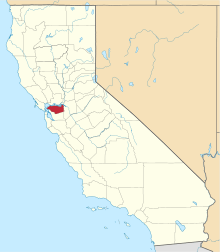
 Oleum Location in California | |
| Coordinates: 38°02′41″N 122°14′54″W / 38.04472°N 122.24833°WCoordinates: 38°02′41″N 122°14′54″W / 38.04472°N 122.24833°W[1] | |
| Country | United States |
| State | California |
| County | Contra Costa County |
| Elevation[1] | 203 ft (62 m) |
| GNIS ID[1][2] | 1659298 |
| FIPS code[1][2] | 06-53658 |
Oleum was an unincorporated community in Contra Costa County, California, United States.,[1] located between the City of Hercules and the unincorporated town of Rodeo. It was a small company town, with housing for Union Oil company workers, hence the name, derived from "petroleum". The refinery still exists.
The site is located on the Mexican land grant Rancho El Pinole made to Ygnacio Martinez. A post office operated at Oleum from 1910 to 1951.
References
- 1 2 3 4 5 "Oleum (Contra Costa County, California)". Geographic Names Information System. United States Geological Survey. Retrieved May 11, 2014.
- 1 2 "FIPS55 Data: California". FIPS55 Data. United States Geological Survey. February 23, 2006. Archived from the original on June 18, 2006. Retrieved May 11, 2014. External link in
|work=(help)
This article is issued from Wikipedia - version of the 3/31/2016. The text is available under the Creative Commons Attribution/Share Alike but additional terms may apply for the media files.