Montalvin Manor, California
| Montalvin Manor Montalvin | |
|---|---|
| Census-designated place | |
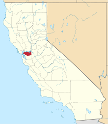
 Montalvin Manor Location in California | |
| Coordinates: 37°59′44″N 122°19′58″W / 37.99556°N 122.33278°WCoordinates: 37°59′44″N 122°19′58″W / 37.99556°N 122.33278°W | |
| Country |
|
| State |
|
| County | Contra Costa County |
| Government | |
| • County Board |
District 1: John Gioia |
| Area[1] | |
| • Total | 0.341 sq mi (0.884 km2) |
| • Land | 0.341 sq mi (0.884 km2) |
| • Water | 0 sq mi (0 km2) 0% |
| Elevation[2] | 69 ft (21 m) |
| Population (2010) | |
| • Total | 2,876 |
| • Density | 8,400/sq mi (3,300/km2) |
| Time zone | Pacific (PST) (UTC-8) |
| • Summer (DST) | PDT (UTC-7) |
| GNIS feature IDs | 1701553; 2583085 |
| U.S. Geological Survey Geographic Names Information System: Montalvin Manor, California; U.S. Geological Survey Geographic Names Information System: Montalvin Manor, California | |
Montalvin Manor (formerly, Montalvin) is a census-designated place[3] (CDP) in Contra Costa County, California.[2] It lies at an elevation of 69 feet (21 m).[2] For census purposes, it formed part of Bayview-Montalvin, California until 2010, when it became a separate CDP with a population of 2,876. The other half of the old CDP became Bayview.
Though this is a census area, outside the City of San Pablo the mailing addresses are San Pablo, California.
Demographics
The 2010 United States Census[4] reported that Montalvin Manor had a population of 2,876. The population density was 8,426.4 people per square mile (3,253.5/km²). The racial makeup of Montalvin Manor was 1,295 (45.0%) White, 222 (7.7%) African American, 36 (1.3%) Native American, 306 (10.6%) Asian, 27 (0.9%) Pacific Islander, 855 (29.7%) from other races, and 135 (4.7%) from two or more races. Hispanic or Latino of any race were 1,800 persons (62.6%).
The Census reported that 2,869 people (99.8% of the population) lived in households, 7 (0.2%) lived in non-institutionalized group quarters, and 0 (0%) were institutionalized.
There were 818 households, out of which 337 (41.2%) had children under the age of 18 living in them, 411 (50.2%) were opposite-sex married couples living together, 122 (14.9%) had a female householder with no husband present, 60 (7.3%) had a male householder with no wife present. There were 50 (6.1%) unmarried opposite-sex partnerships, and 11 (1.3%) same-sex married couples or partnerships. 186 households (22.7%) were made up of individuals and 109 (13.3%) had someone living alone who was 65 years of age or older. The average household size was 3.51. There were 593 families (72.5% of all households); the average family size was 4.11.
The population was spread out with 738 people (25.7%) under the age of 18, 319 people (11.1%) aged 18 to 24, 742 people (25.8%) aged 25 to 44, 712 people (24.8%) aged 45 to 64, and 365 people (12.7%) who were 65 years of age or older. The median age was 35.2 years. For every 100 females there were 93.1 males. For every 100 females age 18 and over, there were 92.3 males.
There were 895 housing units at an average density of 2,622.3 per square mile (1,012.5/km²), of which 621 (75.9%) were owner-occupied, and 197 (24.1%) were occupied by renters. The homeowner vacancy rate was 5.3%; the rental vacancy rate was 8.4%. 2,000 people (69.5% of the population) lived in owner-occupied housing units and 869 people (30.2%) lived in rental housing units.
References
- ↑ "2010 Census U.S. Gazetteer Files – Places – California". United States Census Bureau.
- 1 2 3 U.S. Geological Survey Geographic Names Information System: Montalvin Manor, California
- ↑ U.S. Geological Survey Geographic Names Information System: Montalvin Manor, California
- ↑ "2010 Census Interactive Population Search: CA - Montalvin Manor CDP". U.S. Census Bureau. Retrieved July 12, 2014.
| Bodies of water |
|  |
|---|---|---|
| Counties | ||
| Major cities | ||
| Cities and towns 100k–250k | ||
| Cities and towns 50k–99k | ||
| Cities and towns 25k-50k | ||
| Cities and towns 10k–25k |
| |
| Sub-regions | ||