Valle Vista, Contra Costa County, California
For the Census-designated place in Southern California, see Valle Vista, California.
| Valle Vista | |
|---|---|
| Unincorporated community | |
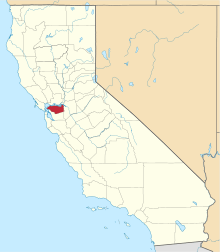
 Valle Vista Location in California | |
| Coordinates: 37°49′22″N 122°08′20″W / 37.82278°N 122.13889°WCoordinates: 37°49′22″N 122°08′20″W / 37.82278°N 122.13889°W[1] | |
| Country | United States |
| State | California |
| County | Contra Costa County |
| Elevation[1] | 577 ft (176 m) |
| GNIS ID[1][2] | 1660086 |
| FIPS code[1][2] | 06-81700 |
Valle Vista is a small unincorporated community in Contra Costa County, California, United States.[1] It lies along Canyon Road between Moraga and Canyon. It is also on the Oakland, Antioch and Eastern Railroad 4.5 miles (7.2 km) south-southeast of Orinda,[3] at an elevation of 577 feet (176 m).[1] The ZIP Code is 94517. The community is inside area code 510.
References
- 1 2 3 4 5 6 "Valle Vista (Contra Costa County, California)". Geographic Names Information System. United States Geological Survey. Retrieved May 11, 2014.
- 1 2 "FIPS55 Data: California". FIPS55 Data. United States Geological Survey. February 23, 2006. Archived from the original on June 18, 2006. Retrieved May 11, 2014. External link in
|work=(help) - ↑ Durham, David L. (1998). California's Geographic Names: A Gazetteer of Historic and Modern Names of the State. Clovis, Calif.: Word Dancer Press. p. 718. ISBN 1-884995-14-4.
| Bodies of water |
|  |
|---|---|---|
| Counties | ||
| Major cities | ||
| Cities and towns 100k–250k | ||
| Cities and towns 50k–99k | ||
| Cities and towns 25k-50k | ||
| Cities and towns 10k–25k |
| |
| Sub-regions | ||
This article is issued from Wikipedia - version of the 3/31/2016. The text is available under the Creative Commons Attribution/Share Alike but additional terms may apply for the media files.