Herpoco, California
| Hercules | |
|---|---|
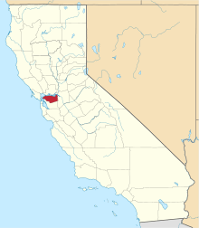
 Hercules Location in California | |
| Coordinates: 38°00′42″N 122°16′16″W / 38.01167°N 122.27111°WCoordinates: 38°00′42″N 122°16′16″W / 38.01167°N 122.27111°W[1] | |
| Country | United States |
| State | California |
| County | Contra Costa County |
| Elevation[1] | 56 ft (17 m) |
| GNIS ID[1][2] | 1658743 |
| FIPS code[1][2] | 06-33405 |
Herpoco was an unincorporated community in Contra Costa County, California, United States.[1] It is located on the Atchison, Topeka and Santa Fe Railroad 5 miles (8 km) east of Point Pinole in Pinole,[3] at an elevation of 56 feet (17 m).[1] The place was started and named by railroad officials for the Hercules Powder Company.[3]
The Hercules Powder Company located here in 1881. The town of Hercules was incorporated in 1900, and included all the surrounding area. The Herpoco reference has fallen into disuse, and is now found almost exclusively on USGS maps, as well as Google.
References
- 1 2 3 4 5 6 "Hercules (Contra Costa County, California)". Geographic Names Information System. United States Geological Survey. Retrieved May 11, 2014.
- 1 2 "FIPS55 Data: California". FIPS55 Data. United States Geological Survey. February 23, 2006. Archived from the original on June 18, 2006. Retrieved May 11, 2014. External link in
|work=(help) - 1 2 Durham, David L. (1998). California's Geographic Names: A Gazetteer of Historic and Modern Names of the State. Clovis, Calif.: Word Dancer Press. p. 642. ISBN 1-884995-14-4.
This article is issued from Wikipedia - version of the 7/3/2016. The text is available under the Creative Commons Attribution/Share Alike but additional terms may apply for the media files.