Bancroft, California
| Bancroft | |
|---|---|
| Unincorporated community | |
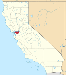
 Bancroft Location in California | |
| Coordinates: 37°56′02″N 122°02′50″W / 37.93389°N 122.04722°WCoordinates: 37°56′02″N 122°02′50″W / 37.93389°N 122.04722°W | |
| Country | United States |
| State | California |
| County | Contra Costa County |
| Elevation[1] | 89 ft (27 m) |
| GNIS ID[1][2] | 1657994 |
| FIPS code[1][2] | 06-03770 |
Bancroft,[1] formerly known as Hookston,[3] is an unincorporated community in Contra Costa County, California, United States.[1] It is located on the Sacramento Northern Railroad 2.25 miles (3.6 km) north-northeast of downtown Walnut Creek,[3] at an elevation of 89 feet (27 m).[1] With the name Hookston, the place was on the Oakland, Antioch and Eastern Railroad.[3]
References
- 1 2 3 4 5 6 "Bancroft (Contra Costa County, California)". Geographic Names Information System. United States Geological Survey. Retrieved May 10, 2014.
- 1 2 "FIPS55 Data: California". FIPS55 Data. United States Geological Survey. February 23, 2006. Archived from the original on June 18, 2006. Retrieved May 10, 2014.
- 1 2 3 Durham, David L. (1998). California's Geographic Names: A Gazetteer of Historic and Modern Names of the State. Clovis, Calif.: Word Dancer Press. p. 598. ISBN 1-884995-14-4.
This article is issued from Wikipedia - version of the 3/28/2016. The text is available under the Creative Commons Attribution/Share Alike but additional terms may apply for the media files.