Meadowsweet, California
| Meadowsweet | |
|---|---|
| Unincorporated community | |
 Meadowsweet  Meadowsweet Location in California | |
| Coordinates: 37°55′23″N 122°30′34″W / 37.92306°N 122.50944°WCoordinates: 37°55′23″N 122°30′34″W / 37.92306°N 122.50944°W | |
| Country | United States |
| State | California |
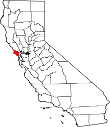
| County | Marin County |
| Elevation[1] | 16 ft (5 m) |
| Area codes | 415/628 |
Meadowsweet is a small unincorporated community in Marin County, California.[1] It is located on the Northwestern Pacific Railroad 3.5 miles (5.6 km) south-southeast of downtown San Rafael,[2] at an elevation of 16 feet (5 m).[1] The community is in ZIP code 94925 and area codes 415 and 628.
References
| Bodies of water |
|  |
|---|---|---|
| Counties | ||
| Major cities | ||
| Cities and towns 100k–250k | ||
| Cities and towns 50k–99k | ||
| Cities and towns 25k-50k | ||
| Cities and towns 10k–25k |
| |
| Sub-regions | ||
This article is issued from Wikipedia - version of the 7/5/2016. The text is available under the Creative Commons Attribution/Share Alike but additional terms may apply for the media files.