Corte Madera, California
| Town of Corte Madera | |
|---|---|
| Town | |
|
Corte Madera Town Center | |
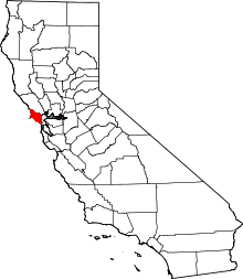
 Location of Corte Madera within Marin County, California. | |
 Town of Corte Madera Location in the United States | |
| Coordinates: 37°55′32″N 122°31′39″W / 37.92556°N 122.52750°WCoordinates: 37°55′32″N 122°31′39″W / 37.92556°N 122.52750°W[1] | |
| Country |
|
| State |
|
| County | Marin |
| Incorporated | June 10, 1916[2] |
| Government | |
| • Mayor | Carla Condon[3] |
| • State Senator | Mike McGuire (D)[4] |
| • Assemblymember | Marc Levine (D)[4] |
| • U. S. Rep. | Jared Huffman (D)[5] |
| • Supervisor | Steve Kinsey (District 4) |
| Area[6] | |
| • Total | 4.406 sq mi (11.410 km2) |
| • Land | 3.164 sq mi (8.193 km2) |
| • Water | 1.242 sq mi (3.216 km2) 28.19% |
| Elevation[1] | 39 ft (12 m) |
| Population (April 1, 2010)[7] | |
| • Total | 9,253 |
| • Estimate (2013)[7] | 9,459 |
| • Density | 2,100/sq mi (810/km2) |
| Time zone | PST (UTC-8) |
| • Summer (DST) | PDT (UTC-7) |
| ZIP codes | 94925, 94976 |
| Area codes | 415/628 |
| FIPS code | 06-16462 |
| GNIS feature IDs | 277492, 2413247 |
| Website |
www |

Corte Madera (/ˈkɔːrtə məˈdɛrə/; formerly, Adams)[8] is an incorporated town in Marin County, California, United States. Corte Madera is located 3.25 miles (5.2 km) south of San Rafael,[8] at an elevation of 39 feet (12 m).[1] The population was 9,253 at the 2010 census.
In Spanish, Corte Madera means the imperative command "Chop wood", as in "To chop the wood". The area was famous for producing lumber out of redwood trees which went into the construction of the city of San Francisco.
Geography

According to the United States Census Bureau, the city has a total area of 4.4 square miles (11 km2), of which, 3.2 square miles (8.3 km2) of it is land and 1.2 square miles (3.1 km2) of it (28.19%) is water. Corte Madera is one of the richest towns in Marin.
History
The first post office in Corte Madera opened in 1878, and closed in 1880.[8] The Adams post office opened in 1902, and changed its name later that year to Corte Madera.[8] The name Adams honored Jerry Adams, its first postmaster.[8] Corte Madera incorporated in 1916.[8]
The town of Corte Madera is on part of Rancho Corte Madera del Presidio granted to John Reed in 1834 by Mexican Governor José Figueroa. Reed quickly took to the lumber industry, logging the area's immense supply of redwoods and shipping the lumber to San Francisco by way of Corte Madera Creek — some of this wood was used to build the Presidio in San Francisco. And the town kept growing.
In 1850, California joined the Union, and the Gold Rush, by then a year old, brought more settlers to the area. By 1875, the North Pacific Coast Railroad set its tracks through Corte Madera, allowing flatcars to haul lumber, and later, passenger trains to service commuters to and from San Francisco, aided in its early stages by the Sausalito ferry. A few of those commuters significantly influenced the formation of Old Town.
In 1885, a New England lawyer, Frank Morrison Pixley, was guaranteed a title for 160 acres (0.65 km2) from Reed's daughter, Hilarita. (Pixley later practiced law in San Francisco, became involved in local politics and founded an esteemed magazine called The Argonaut, whose writers included Mark Twain and Ambrose Bierce.) The Pixley family was credited with creating Corte Madera's first subdivision and with developing downtown. Population continued to grow (eventually exploding after construction of the Golden Gate Bridge was completed in 1937).
The first business structure in Corte Madera was a hotel and tavern just south of the train station, built by Jerry Adams of Switzerland in 1898. The three-story building still exists today on First Street, between Corte Madera Avenue and Montecito Drive, and these days houses a beauty salon, an architectural sheet metal firm and a number of residential apartments. A smaller barn-like building constructed around that time behind the Adams's hotel went through its evolution as a hardware store, a mattress place, an antique shop, a design studio, a gallery and a neighborhood video store. Today it is a textile arts studio and Swedish textile home products store.[9]
Across from the railroad station, a huge barn was built in 1898, and was used as a livery stable, handy for horses to haul goods from nearby mines and for local freight delivery from the trains. In 1906, it then operated as Buckley & Co. general store for the next 50 years. After renovations, the barn exists today at the corner of Tamalpais Drive and Serra Street as a luxurious spa and full-service beauty salon.
In 1905, Del Mahood came to Corte Madera to be the railroad agent and stationmaster. He was also a telegrapher and, along with his brother Foster, Del operated the local telephone agency, the post office and a sweets shop in their building next to the Episcopal Church. The Mahoods' building still stands, over a century later, on Redwood Avenue. Other buildings remain from that era: the dramatic triangular-peaked Holy Innocents church built in 1901 at the northeastern corner of Old Corte Madera Square still stands, as does the Presbyterian Church built on the old road above the square around the same time. Across from the Holy Innocents Episcopal Church, two stucco structures were built in the early 1900s. That property, featuring a creamery and an automobile repair shop, now exists as a yoga studio. Most of the remaining buildings around the historical village square went up in the 1920s and '30s.
The square around the train station was the original center of Corte Madera, around which everything bloomed. Established in 1916 and preserved by the Women's Club, Railroad Park is located in the northwest quadrant of the old train station square. It was renamed Menke Park in the early 1950s after the town leased the property from the railroad and took over maintenance of the land. Several homes constructed during that time pay tribute to the New England-influenced architecture of the late 1880s, and can still be seen in the Old Square's surrounding neighborhoods.
The hill at the base of Corte Madera is called Christmas tree hill; because the lighted homes on the hill leading up to Mt. Tamalpais create the shape of a lighted Christmas tree.
Community festivals
The Fourth of July celebration—joining Corte Madera and its "twin city", Larkspur—draws thousands of spectators and residents from all over the Bay Area. The event includes a parade through Old Town, as well as festivities and a picnic in the nearby Town Park.
From the 1950s until the early 1970s, Holy Innocents Episcopal Parish held an Epiphany pageant with all of the church's younger members costumed and singing, followed by a Christmas tree bonfire in the triangle outside of the church. Residents would drop off their trees after Christmas and the fire department would supervise the burning on the twelfth day of Christmas (Epiphany). In some years, the church handed out candles to attendees. The rector of the church, Reverend Todd Ewald, chose to discontinue the bonfire in the early 1970s, saying he wanted to do it voluntarily before the growing environmental movement forced the change.
Demographics

| Historical population | |||
|---|---|---|---|
| Census | Pop. | %± | |
| 1920 | 607 | — | |
| 1930 | 1,027 | 69.2% | |
| 1940 | 1,098 | 6.9% | |
| 1950 | 1,933 | 76.0% | |
| 1960 | 5,962 | 208.4% | |
| 1970 | 8,464 | 42.0% | |
| 1980 | 8,074 | −4.6% | |
| 1990 | 8,272 | 2.5% | |
| 2000 | 9,100 | 10.0% | |
| 2010 | 9,253 | 1.7% | |
| Est. 2015 | 9,901 | [10] | 7.0% |
2010
The 2010 United States Census[12] reported that Corte Madera had a population of 9,253. The population density was 2,100.4 people per square mile (811.0/km²). The racial makeup of Corte Madera was 7,808 (84.4%) White, 87 (0.9%) African American, 15 (0.2%) Native American, 625 (6.8%) Asian, 29 (0.3%) Pacific Islander, 262 (2.8%) from other races, and 427 (4.6%) from two or more races. Hispanic or Latino of any race were 772 persons (8.3%).
The Census reported that 100% of the population lived in households.
There were 3,793 households, out of which 1,346 (35.5%) had children under the age of 18 living in them, 2,012 (53.0%) were opposite-sex married couples living together, 377 (9.9%) had a female householder with no husband present, 131 (3.5%) had a male householder with no wife present. There were 147 (3.9%) unmarried opposite-sex partnerships, and 31 (0.8%) same-sex married couples or partnerships. 1,027 households (27.1%) were made up of individuals and 461 (12.2%) had someone living alone who was 65 years of age or older. The average household size was 2.44. There were 2,520 families (66.4% of all households); the average family size was 2.99.
The population was spread out with 2,332 people (25.2%) under the age of 18, 390 people (4.2%) aged 18 to 24, 2,039 people (22.0%) aged 25 to 44, 3,009 people (32.5%) aged 45 to 64, and 1,483 people (16.0%) who were 65 years of age or older. The median age was 44.2 years. For every 100 females there were 87.4 males. For every 100 females age 18 and over, there were 83.0 males.
There were 4,026 housing units at an average density of 913.9 per square mile (352.9/km²), of which 2,653 (69.9%) were owner-occupied, and 1,140 (30.1%) were occupied by renters. The homeowner vacancy rate was 0.8%; the rental vacancy rate was 5.8%. 6,668 people (72.1% of the population) lived in owner-occupied housing units and 2,585 people (27.9%) lived in rental housing units.
2000
As of the census[13] of 2000, there were 9,100 people, 3,776 households, and 2,473 families residing in the town. The population density was 2,873.3 people per square mile (1,108.4/km²). There were 3,850 housing units at an average density of 1,215.6 per square mile (468.9/km²). The racial makeup of the town in 2010 was 79.6% non-Hispanic White, 0.9% non-Hispanic Black or African American, 6.7% Asian, 0.3% Pacific Islander, 0.5% from other races, and 3.8% from two or more races. 8.3% of the population were Hispanic or Latino of any race.
There were 3,776 households out of which 32.3% had children under the age of 18 living with them, 52.1% were married couples living together, 10.0% had a female householder with no husband present, and 34.5% were non-families. 24.8% of all households were made up of individuals and 7.8% had someone living alone who was 65 years of age or older. The average household size was 2.41 and the average family size was 2.89.
In the town the population was spread out with 23.4% under the age of 18, 3.5% from 18 to 24, 31.3% from 25 to 44, 28.6% from 45 to 64, and 13.3% who were 65 years of age or older. The median age was 41 years. For every 100 females there were 88.0 males. For every 100 females age 18 and over, there were 85.9 males.
The median income for a household in the town was $79,839, and the median income for a family was $95,471. Males had a median income of $70,968 versus $50,380 for females. The per capita income for the town was $46,326. About 2.7% of families and 4.5% of the population were below the poverty line, including 4.2% of those under age 18 and 6.9% of those age 65 or over.
Government
- In 1980 the town merged its police department with that of its neighbor Larkspur into the Twin Cities Police Authority, which then was merged in 2013 with the police department of San Anselmo as the Central Marin Police Authority.
Federal and state
In the United States House of Representatives, Corte Madera is in California's 2nd congressional district, represented by Democrat Jared Huffman.[14] From 2008 to 2012, Huffman represented Marin County in the California State Assembly.
In the California State Legislature, Corte Madera is in:
- the 10th Assembly District, represented by Democrat Marc Levine[15]
- the 2nd Senate District, represented by Democrat Mike McGuire.
Economy
Restoration Hardware and Il Fornaio are headquartered in Corte Madera.
The Village at Corte Madera and Town Center at Corte Madera are the local serving shopping malls.
The Old Corte Madera Town Square, surrounding Piccolo Pavilion, is home to the historic buildings mentioned in this article as well as local shops including hair salons, consignment stores, arts classrooms, and Swedish textile products.
Education
The Larkspur-Corte Madera School District serves Corte Madera for elementary and middle school. Neil Cummins Elementary School and Hall Middle School serve both Corte Madera and Larkspur. Neil Cummins serves grades K to 5, while Hall serves grades 6 to 8. The former San Clemente Elementary School has been reopened as The Cove School. In lieu of extensive retrofit to the existing structures, new buildings have been built on the same site. This school will serve neighborhoods currently served by Neil Cummins Elementary, mostly to the west of Highway 101, and new developments in the area.
Tamalpais Union High School District serves residents for high school. Redwood High School in Larkspur serves Corte Madera.
Marin Country Day School is an area private school.
A primary campus of the Lycée Français de San Francisco is in Corte Madera.[16]
See also
References
- 1 2 3 "Corte Madera". Geographic Names Information System. United States Geological Survey.
- ↑ "California Cities by Incorporation Date". California Association of Local Agency Formation Commissions. Archived from the original (Word) on November 3, 2014. Retrieved August 25, 2014.
- ↑ "Town Council". Town of Corte Madera. Retrieved December 29, 2014.
- 1 2 "Statewide Database". UC Regents. Retrieved December 29, 2014.
- ↑ "California's 2nd Congressional District - Representatives & District Map". Civic Impulse, LLC. Retrieved March 8, 2013.
- ↑ "2010 Census U.S. Gazetteer Files – Places – California". United States Census Bureau.
- 1 2 "Corte Madera (town) QuickFacts". United States Census Bureau. Retrieved April 9, 2015.
- 1 2 3 4 5 6 Durham, David L. (1998). California's Geographic Names: A Gazetteer of Historic and Modern Names of the State. Clovis, Calif.: Word Dancer Press. p. 619-620. ISBN 1-884995-14-4.
- ↑ http://mimithesardine.com/main/page_store_and_events_visit_us.html
- ↑ "Annual Estimates of the Resident Population for Incorporated Places: April 1, 2010 to July 1, 2015". Retrieved July 2, 2016.
- ↑ "Census of Population and Housing". Census.gov. Archived from the original on May 11, 2015. Retrieved June 4, 2015.
- ↑ "2010 Census Interactive Population Search: CA - Corte Madera town". U.S. Census Bureau. Retrieved July 12, 2014.
- ↑ "American FactFinder". United States Census Bureau. Archived from the original on 2013-09-11. Retrieved 2008-01-31.
- ↑ "California's 2nd Congressional District - Representatives & District Map". Civic Impulse, LLC. Retrieved March 1, 2013.
- ↑ "Members Assembly".
- ↑ "Welcome to the Lycée Français de San Francisco." Lycée Français de San Francisco. Retrieved on March 3, 2013.
External links
| Wikimedia Commons has media related to Corte Madera, California. |
| Bodies of water |
|  |
|---|---|---|
| Counties | ||
| Major cities | ||
| Cities and towns 100k–250k | ||
| Cities and towns 50k–99k | ||
| Cities and towns 25k-50k | ||
| Cities and towns 10k–25k |
| |
| Sub-regions | ||