Las Gallinas, California
Not to be confused with Gallinas, California.
| Las Gallinas | |
|---|---|
| Unincorporated community | |
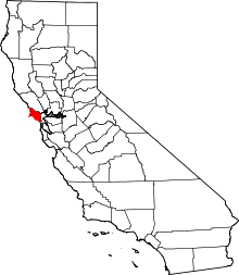
 Las Gallinas  Las Gallinas Location in California | |
| Coordinates: 38°01′14″N 122°32′19″W / 38.02056°N 122.53861°WCoordinates: 38°01′14″N 122°32′19″W / 38.02056°N 122.53861°W | |
| Country | United States |
| State | California |
| County | Marin County |
| Elevation[1] | 26 ft (8 m) |
Las Gallinas is an unincorporated community in Marin County, California, 6.25 miles (10.06 km) south-southeast of Novato. At an elevation of 26 feet (8 m) Las Gallinas is near the interchange of U.S. Route 101 and Lucas Valley Road/Smith Ranch Road in San Rafael.[1][2]
Although consisting mainly of residential households, the immediate vicinity also includes a county park with golf course, wild life ponds, a private airport, shops, restaurants and movie theaters. A small industrial park houses low impact companies, storage units, and several non profit organizations.
The area is named for the Rancho San Pedro, Santa Margarita y Las Gallinas Mexican land grant.[2]
References
This article is issued from Wikipedia - version of the 7/5/2016. The text is available under the Creative Commons Attribution/Share Alike but additional terms may apply for the media files.