Point Reyes (former settlement), California
| Point Reyes | |
|---|---|
| Former settlement | |
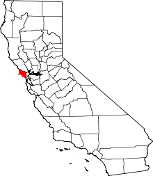
 Point Reyes Location in California | |
| Coordinates: 38°05′11″N 122°57′14″W / 38.08639°N 122.95389°WCoordinates: 38°05′11″N 122°57′14″W / 38.08639°N 122.95389°W | |
| Country | United States |
| State | California |
| County | Marin County |
| Elevation[1] | 79 ft (24 m) |
Point Reyes is a former settlement in Marin County, California.[1] It was located 7.25 miles (12 km) north-northeast of Point Reyes Lighthouse,[2] (9 miles (14 km) along Sir Francis Drake Boulevard, 6.5 miles (10 km) from Inverness, California) at an elevation of 79 feet (24 m).[1] Point Reyes still appeared on maps as of 1947.[1]
A post office operated at Point Reyes from 1891 to 1942, moving in 1919.[2]
References
This article is issued from Wikipedia - version of the 1/14/2011. The text is available under the Creative Commons Attribution/Share Alike but additional terms may apply for the media files.