San Geronimo, California
| San Geronimo | |
|---|---|
| Census designated place | |
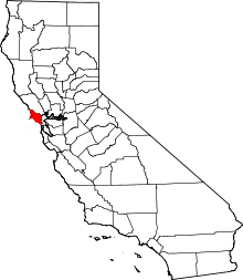
 Location in Marin County and the state of California | |
 San Geronimo Location in the United States | |
| Coordinates: 38°00′48″N 122°39′50″W / 38.01333°N 122.66389°WCoordinates: 38°00′48″N 122°39′50″W / 38.01333°N 122.66389°W | |
| Country |
|
| State |
|
| County | Marin |
| Government | |
| • Supervisor |
District 2 Harold Brown |
| • State senator | Mark Leno (D) |
| • Assemblymember | Marc Levine (D) |
| • U. S. rep. | Jared Huffman (D)[1] |
| Area[2] | |
| • Total | 1.508 sq mi (3.905 km2) |
| • Land | 1.508 sq mi (3.905 km2) |
| • Water | 0 sq mi (0 km2) 0% |
| Elevation[3] | 292 ft (89 m) |
| Population (April 1, 2010) | |
| • Total | 446 |
| • Density | 300/sq mi (110/km2) |
| Time zone | Pacific (UTC-8) |
| • Summer (DST) | PDT (UTC-7) |
| ZIP code | 94963 |
| Area codes | 415/628 |
| FIPS code | 06-67070 |
| GNIS feature ID | 232399 |
San Geronimo (formerly Nicasio Station)[4] is a census-designated place (CDP) located in the San Geronimo Valley in Marin County, California in the United States. San Geronimo is located 8 miles (13 km) southwest of downtown Novato,[4] at an elevation of 292 feet (89 m).[3] The population was 446 at the 2010 census.
San Geronimo is the home of the San Geronimo Golf Course.[5]
Geography
San Geronimo is located at 38°00′48″N 122°39′50″W / 38.01333°N 122.66389°W.[3]
According to the United States Census Bureau, the CDP has a total area of 1.5 square miles (3.9 km2), all of it land.
History
Prior to 1877, the place was called Nicasio.[4] The San Geronimo post office opened in 1895, closed in 1910, and re-opened in 1911.[4]
Demographics
2010
The 2010 United States Census[6] reported that San Geronimo had a population of 446. The population density was 295.8 people per square mile (114.2/km²). The racial makeup of San Geronimo was 421 (94.4%) White, 3 (0.7%) African American, 2 (0.4%) Native American, 3 (0.7%) Asian, 3 (0.7%) from other races, and 14 (3.1%) from two or more races. Hispanic or Latino of any race were 21 persons (4.7%).
The Census reported that 100% of the population lived in households.
There were 199 households, out of which 49 (24.6%) had children under the age of 18 living in them, 108 (54.3%) were opposite-sex married couples living together, 19 (9.5%) had a female householder with no husband present, 7 (3.5%) had a male householder with no wife present. There were 13 (6.5%) unmarried opposite-sex partnerships, and 2 (1.0%) same-sex married couples or partnerships. 43 households (21.6%) were made up of individuals and 9 (4.5%) had someone living alone who was 65 years of age or older. The average household size was 2.24. There were 134 families (67.3% of all households); the average family size was 2.60.
The population was spread out with 72 people (16.1%) under the age of 18, 20 people (4.5%) aged 18 to 24, 89 people (20.0%) aged 25 to 44, 189 people (42.4%) aged 45 to 64, and 76 people (17.0%) who were 65 years of age or older. The median age was 50.0 years. For every 100 females there were 97.3 males. For every 100 females age 18 and over, there were 94.8 males.
There were 208 housing units at an average density of 137.9 per square mile (53.3/km²), of which 73.4% were owner-occupied and 26.6% were occupied by renters. The homeowner vacancy rate was 0%; the rental vacancy rate was 0%. 76.5% of the population lived in owner-occupied housing units and 23.5% lived in rental housing units.
2000
As of the census[7] of 2000, there were 436 people, 174 households, and 120 families residing in the CDP. The population density was 287.4 people per square mile (110.8/km²). There were 176 housing units at an average density of 116.0 per square mile (44.7/km²). The racial makeup of the CDP in 2010 was 90.6% non-Hispanic White, 0.7% non-Hispanic African American, 0.4% Native American, 0.7% Asian, 0.4% from other races, and 2.5% from two or more races. Hispanic or Latino of any race were 4.7% of the population.
There were 174 households out of which 28.7% had children under the age of 18 living with them, 51.1% were married couples living together, 14.9% had a female householder with no husband present, and 31.0% were non-families. 18.4% of all households were made up of individuals and 2.9% had someone living alone who was 65 years of age or older. The average household size was 2.47 and the average family size was 2.70.
In the CDP the population was spread out with 17.9% under the age of 18, 6.9% from 18 to 24, 26.8% from 25 to 44, 39.4% from 45 to 64, and 8.9% who were 65 years of age or older. The median age was 44 years. For every 100 females there were 92.9 males. For every 100 females age 18 and over, there were 96.7 males.
The median income for a household in the CDP was $58,542, and the median income for a family was $60,875. Males had a median income of $70,536 versus $32,292 for females. The per capita income for the CDP was $31,960. About 9.9% of families and 10.4% of the population were below the poverty line, including 18.4% of those under age 18 and none of those age 65 or over.
References
- ↑ "California's 2nd Congressional District - Representatives & District Map". Civic Impulse, LLC. Retrieved March 8, 2013.
- ↑ U.S. Census
- 1 2 3 U.S. Geological Survey Geographic Names Information System: San Geronimo, California
- 1 2 3 4 Durham, David L. (1998). California's Geographic Names: A Gazetteer of Historic and Modern Names of the State. Clovis, Calif.: Word Dancer Press. p. 695. ISBN 1-884995-14-4.
- ↑ "Golf course review: San Geronimo GC". ABC7 San Francisco. Retrieved 2016-02-01.
- ↑ "2010 Census Interactive Population Search: CA - San Geronimo CDP". U.S. Census Bureau. Retrieved July 12, 2014.
- ↑ "American FactFinder". United States Census Bureau. Retrieved 2008-01-31.
| Bodies of water |
|  |
|---|---|---|
| Counties | ||
| Major cities | ||
| Cities and towns 100k–250k | ||
| Cities and towns 50k–99k | ||
| Cities and towns 25k-50k | ||
| Cities and towns 10k–25k |
| |
| Sub-regions | ||