List of State Routes in Nevada
| Nevada State Routes | |
|---|---|
|
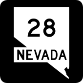
Standard route markers for State Route 28 and State Route 318 | |
| System information | |
| Formed: | 1917 (current numbering in 1976) |
| Highway names | |
| State: | State Route X (SR X) |
| System links | |
| |

The following is a list of all State Routes that have existed in the U.S. state of Nevada since July 1, 1976. All active state-numbered highways in this list are maintained by the Nevada Department of Transportation.
Primary routes (0–499)
Primary state routes are assigned numbers based upon the county in which the majority of the route resides (or, in some instances, the county of the major town on the route). State routes in a county are grouped together with similar numbers, which are assigned in order based upon alphabetical order of county names. SR 28, SR 88 and SR 140 are the three exceptions to this numbering scheme exist; all three are highway numbers that continue into an adjoining state.
| Number | Length (mi) | Length (km) | Southern or western terminus | Northern or eastern terminus | Formed | Removed | Notes | |
|---|---|---|---|---|---|---|---|---|
| 16.174 | 26.030 | US 50 near Glenbrook | California state line on CA 28 towards Kings Beach, Calif. | 1948 | current | |||
| 7.868 | 12.662 | California state line on CA 88 towards Woodfords, Calif. | US 395 in Minden | 1957 | current | |||
| 4.821 | 7.759 | SR 119 in southern Fallon | Stillwater Avenue in Fallon | 1976 | current | |||
| 10.491 | 16.884 | US 50 east of Fallon | Stillwater | 1976 | current | |||
| 6.914 | 11.127 | US 50 in western Fallon | US 95 in Fallon | 1976 | current | |||
| 3.480 | 5.601 | SR 115 in Fallon | Wildes Road near NAS Fallon in Fallon | 1976 | current | |||
| 4.137 | 6.658 | US 95 in southern Fallon | Beach Road at NAS Fallon gate in southeastern Fallon | 1976 | current | |||
| 6.260 | 10.074 | US 95 in southern Fallon | SR 119 in southeastern Fallon | 1976 | current | |||
| 26.951 | 43.373 | US 50 southeast of Fallon | Settlement Road in Dixie Valley | 1976 | current | |||
| 110.113 | 177.210 | Oregon state line on OR 140 towards Adel, Ore. | US 95 south of Orovada | c. 1968 | current | |||
| 3.132 | 5.040 | I-15 in Mesquite (at exit 120) | I-15 in Mesquite (at exit 122) | 1976 | c. 2005 | |||
| 6.673 | 10.739 | I-15 south of Las Vegas | I-215 in Henderson | 1976 | current | |||
| 14.986 | 24.118 | I-15 in North Las Vegas | Lake Mead Nat'l Rec Area boundary east of North Las Vegas | 1976 | current | |||
| 17.592 | 28.312 | Lee Canyon | US 95 northwest of Las Vegas | 1976 | current | |||
| 21.428 | 34.485 | Kyle Canyon near Mt. Charleston | US 95 in northwest Las Vegas | 1976 | current | |||
| 8.882 | 14.294 | SR 157 in Mount Charleston | SR 156 in Lee Canyon | 1976 | current | |||
| 31.007 | 49.901 | SR 160 south of Blue Diamond | SR 612 in Las Vegas | 1976 | current | |||
| 80.393 | 129.380 | US 95 north of Pahrump | Las Vegas Blvd in southern Las Vegas | 1976 | current | |||
| 7.290 | 11.732 | Esmeralda Street in Goodsprings | I-15 in Jean | 1976 | current | |||
| — | — | — | — | 1976 | c. 1982 | Needles Highway | ||
| 19.256 | 30.990 | US 95 south of Calnevari | AZ 95 toward Bullhead City, Ariz. | 1976 | current | |||
| 18.600 | 29.934 | Calif. state line on Nipton Road towards Nipton, Calif. | US 95 in Searchlight | 1976 | current | |||
| 11.002 | 17.706 | Nelson | US 95 south of Boulder City | 1976 | current | |||
| — | — | US 93 northeast of Boulder City | SR 147 / SR 564 east of Henderson | 1976 | c. 2000 | |||
| — | — | SR 147 east of Las Vegas | SR 169 south of Overton | 1976 | c. 2000 | |||
| 24.778 | 39.876 | US 93 northwest of Moapa | I-15 in Glendale | 1976 | current | |||
| 18.486 | 29.750 | Lake Mead Nat'l Rec. Area boundary south of Overton | I-15 north of Logandale | 1976 | current | |||
| 12.272 | 19.750 | I-15 north of Riverside | Mesquite Blvd. in Mesquite | 1976 | current | |||
| 0.64 | 1.03 | I-215 in Las Vegas | Sunset Road/McCarran Airport tunnel in Las Vegas | 1994 | current | |||
| 1.612 | 2.594 | US 93 northeast of Boulder City | Hoover Dam access road west of Hoover Dam | 2010 | current | |||
| 15.435 | 24.840 | SR 88 south of Gardnerville | US 395 north of Minden | 1976 | current | |||
| 11.092 | 17.851 | US 50 in Stateline | SR 206 west of Gardnerville | 1976 | current | |||
| 37.892 | 60.981 | US 395 north of Topaz Lake | US 95 Alt. in Yerington | 1976 | current | |||
| 2.995 | 4.820 | SR 278 in Carlin | I-80 in Carlin | 1976 | current | |||
| 2.010 | 3.235 | SR 231 in Wells | US 93 in Wells | 1976 | current | |||
| 0.6 | 1.0 | US 93 Alt. in West Wendover | Utah state line on UT 58 in Wendover, Utah | 1976 | 1993 | |||
| 100.301 | 161.419 | SR 535 in Elko | Idaho state line on ID 51 in Owyhee | 1976 | current | |||
| 39.017 | 62.792 | Deep Creek | SR 225 north of Elko | 1976 | current | |||
| 20.134 | 32.403 | SR 535 in Elko | Crossroads Lane in Lamoille | 1976 | current | |||
| 26.814 | 43.153 | Jiggs | SR 227 southeast of Elko | 1976 | current | |||
| 50.360 | 81.047 | I-80 at Halleck | US 93 south of Wells | 1976 | current | |||
| 13.049 | 21.000 | I-80 in Deeth | I-80 at Welcome | 1976 | current | |||
| 11.600 | 18.668 | Angel Lake | SR 223 in Wells | 1976 | current | |||
| 14.531 | 23.385 | south of Steele Creek | US 93 south of Wells | 1976 | current | |||
| 34.234 | 55.094 | I-80 at Oasis | Utah state line on UT 30 towards Rosette, Utah | 1976 | current | |||
| 33.667 | 54.182 | California state line on CA 266 towards Oasis, CA | US 6 east of Basalt | 1976 | current | |||
| 20.500 | 32.992 | Silver Peak Road in Silver Peak | US 6 / US 95 east of Coaldale | 1976 | current | |||
| 40.338 | 64.918 | California state line on CA 266 towards Oasis, CA | US 95 south of Goldfield | 1976 | current | |||
| 21.425 | 34.480 | California state line towards Scotty's Castle | US 95 northwest of Beatty | 1976 | current | |||
| 87.571 | 140.932 | US 50 north of Eureka | I-80 in Carlin | 1976 | current | |||
| 1.637 | 2.634 | US 95 in Winnemucca | SR 795 in northern Winnemucca | 1976 | current | |||
| 18.012 | 28.988 | US 95 north of Winnemucca | Bridge Street in Paradise Valley | 1976 | current | |||
| 2.935 | 4.723 | SR 140 at Denio Junction | Oregon state line in Denio | 1976 | current | |||
| 23.989 | 38.607 | Kings River Valley | US 95 in Orovada | 1976 | current | |||
| 8.845 | 14.235 | Pershing County county line on Grass Valley Road | SR 794 in Winnemucca | 1981 | current | |||
| 3.788 | 6.096 | I-80 in Battle Mountain | I-80 in Battle Mountain | 1976 | current | |||
| 87.717 | 141.167 | US 50 in Austin | SR 304 in Battle Mountain | 1976 | current | |||
| 30.645 | 49.318 | Barrack Gold Mine east of Gold Acres | I-80 north of Beowawe | 1976 | current | |||
| 21.490 | 34.585 | Elgin | US 93 in Caliente | 1976 | current | |||
| 110.775 | 178.275 | US 93 at Crystal Springs | US 6 northwest of Preston | 1976 | current | |||
| 20.914 | 33.658 | US 93 west of Panaca | Utah state line on UT 56 towards Modena, Utah | 1976 | current | |||
| 10.674 | 17.178 | US 93 south of Pioche | US 93 north of Pioche | 1976 | current | |||
| 5.113 | 8.229 | US 93 south of Pioche | US 93 north of Pioche | 1976 | current | |||
| 18.572 | 29.889 | SR 321 in Pioche | Spring Valley State Park | 1976 | current | |||
| 30.896 | 49.722 | California state line on CA 182 towards Bridgeport, Calif. | SR 208 in Smith Valley | 1976 | current | |||
| 11.523 | 18.544 | SR 208 near Wilson Canyon | US 95 Alt. in Yerington | 1976 | current | |||
| 1.080 | 1.738 | SR 339 in western Yerington | SR 208 in Yerington | 1976 | current | |||
| 22.389 | 36.032 | US 50 west of Dayton | US 395 Alt. / SR 431 in Reno | 1976 | current | |||
| 3.780 | 6.083 | SR 341 near Silver City | SR 341 in Virginia City | 1976 | current | |||
| 33.350 | 53.672 | California state line on CA 167 towards Lee Vining, Calif. | US 95 in Hawthorne | 1976 | current | |||
| 23.245 | 37.409 | US 6 at Basalt | US 95 south of Mina | 1976 | current | |||
| 62.853 | 101.152 | US 95 in Luning | US 50 at Middlegate | 1976 | current | |||
| 1.297 | 2.087 | US 95 in eastern Hawthorne | US 95 in Hawthorne | 1976 | current | Signed as US 95 Truck | ||
| 7.770 | 12.505 | California state line on CA 178 towards Shoshone, Calif. | SR 160 in Pahrump | 1976 | current | |||
| 16.304 | 26.239 | California state line on CA 127 towards Death Valley Junction, Calif. | US 95 in Amargosa Valley | 1976 | current | |||
| 8.840 | 14.227 | Death Valley Nat'l Park boundary southwest of Beatty | US 95 in Beatty | 1976 | current | |||
| 98.414 | 158.382 | SR 318 at Crystal Springs | US 6 at Warm Springs | 1976 | current | |||
| 99.810 | 160.629 | US 6 east of Tonopah | US 50 southeast of Austin | 1976 | current | |||
| 6.597 | 10.617 | SR 376 west of Manhattan | Main Street in Manhattan | 1976 | current | |||
| 2.7 | 4.3 | SR 376 west of Round Mountain | Main Street in Round Mountain | 1976 | c. 1999 | |||
| 19.532 | 31.434 | US 6 in Currant | Duckwater | 1976 | current | |||
| 7.701 | 12.394 | I-80 in Lovelock | I-80 northeast of Lovelock | 1976 | current | |||
| 11.840 | 19.055 | SR 860 southwest of Lovelock | SR 398 in Lovelock | 1976 | current | |||
| 4.755 | 7.652 | I-80 / US 95 in Lovelock | SR 396 northeast of Lovelock | 1976 | current | |||
| 18.184 | 29.264 | Eagle Picher Mine northwest of Lovelock | SR 398 in Lovelock | 1976 | current | |||
| 16.582 | 26.686 | Kyle Hot Springs Road east of Unionville | I-80 / US 95 at Mill City | 1976 | current | |||
| 2.333 | 3.755 | Rye Patch State Rec. Area | I-80 / US 95 northeast of Lovelock | 1976 | current | |||
| 3.437 | 5.531 | Gold Ranch Road in Verdi | I-80 in Verdi | 1976 | current | |||
| 0.370 | 0.595 | US 395 Alt. in Reno | I-580 / US 395 in Reno | 1976 | current | |||
| 4.700 | 7.564 | I-80 southwest of Wadsworth | US 50 Alt. / US 95 Alt. in Fernley | 1976 | current | |||
| 11 | 18 | US 395 north of Carson City | US 395 north of Washoe City | 1976 | c. 1983 | |||
| 7.824 | 12.592 | Hobart Road north of Carson City | US 395 in Washoe City | 1976 | 2012 | |||
| 3.161 | 5.087 | SR 659 in Reno, Nevada | US 395 in Reno | 1976 | current | |||
| 24.413 | 39.289 | SR 28 in Incline Village | US 395 Alt. & SR 341 in Reno | 1976 | current | |||
| 6.255 | 10.066 | End of pavement in Tahoe Reno Industrial Center | I-80 east of Sparks | 2015 | current | Future southern terminus will be at US 50 in Silver Springs | ||
| 3.197 | 5.145 | SR 659 in Reno | 7th Avenue in Sun Valley | 1976 | current | |||
| 41.708 | 67.123 | Nugget Avenue in Sparks | Warrior Point Park Road north of Sutcliffe | 1976 | current | |||
| 13.156 | 21.173 | SR 445 southeast of Sutcliffe | SR 447 in Nixon | 1976 | current | |||
| 74.645 | 120.129 | SR 427 in Wadsworth | Washoe County Route 447 in Gerlach | 1976 | current | |||
| 2 | 3 | Ruth | US 50 west of Ely | 1976 | c. 1983 | |||
| 33 | 53 | US 6 / US 50 / US 93 southeast of Ely | US 93 north of Ely | 1976 | c. 1983 | |||
| 11.025 | 17.743 | Utah state line on UT 21 towards Milford, Utah | US 6 / US 50 northwest of Baker | 1976 | current | |||
| 4.786 | 7.702 | Great Basin Nat'l Park | SR 487 in Baker | 1976 | current | |||
| 8.2 | 13.2 | Cherry Creek | US 93 north of Ely | 1976 | c. 1978 | |||
| 8.931 | 14.373 | Ely State Prison | US 93 northeast of Ely | 1976 | current | |||
| ||||||||
Urban routes (500–699)
Urban state routes, numbered in the 500s and 600s, typically lie on arterial roadways in larger metropolitan areas. Urban state routes are grouped together sequentially, assigned by alphabetical order of the name of the city in which they primarily reside.
Nevada DOT has been attempting to remove some urban routes from the state highway system since the 1990s, preferring to transfer control of these roadways to local municipalities. This is especially apparent in Carson City, where most of the city's state routes have been removed since 2011.
| Number | Length (mi) | Length (km) | Southern or western terminus | Northern or eastern terminus | Formed | Removed | Notes | |
|---|---|---|---|---|---|---|---|---|
| 2.25 | 3.62 | US 93 in Boulder City | US 93 northeast of Boulder City | 1976 | c. 1982 | |||
| 0 | 0 | — | — | 1976 | c. 1982 | |||
| 0.808 | 1.300 | Ormsby Blvd in Carson City | N. Carson Street in Carson City | c. 1983 | c. 2009 | |||
| 2.282 | 3.673 | Kings Creek in Carson City | S. Carson Street in Carson City | c. 1983 | c. 2009 | |||
| 2.185 | 3.516 | S. Carson Street in Carson City | Fairview Drive in Carson City | 1976 | 2011 | |||
| 2.452 | 3.946 | W. King Street in Carson City | N. Carson Street in Carson City | 1983 | c. 2009 | |||
| 1.017 | 1.637 | US 50 / US 395 in Carson City | Jacobsen Way in Carson City | 1976 | current | |||
| 1.227 | 1.975 | S. Carson Street in Carson City | E. William Street in Carson City | 1976 | 2010 | |||
| 1.323 | 2.129 | Lompa Lane in Carson City | US 50 in Carson City | 1976 | 2011 | |||
| 1.987 | 3.198 | US 50 / US 395 south of Carson City | Fairview Drive in Carson City | 1994 | current | |||
| 0 | 0 | Carson Street in Carson City | Lompa Lane in Carson City | 1994 | 2010 | |||
| 1.645 | 2.647 | N. Carson Street in Carson City | Lompa Lane in Carson City | 1995 | 2011 | |||
| 3.196 | 5.143 | I-80 west of Elko | SR 227 in Elko | 1976 | current | |||
| 5.962 | 9.595 | Las Vegas Blvd in Las Vegas | SR 582 in Henderson | 1976 | current | |||
| 8.224 | 13.235 | I‑515 / US 93 / US 95 in Henderson | Lake Mead Nat'l Rec Area boundary east of Henderson | 2002 | current | |||
| 5.330 | 8.578 | US 95 in Las Vegas | SR 604 in Las Vegas | 1976 | current | Route has two sections | ||
| 10.668 | 17.168 | US 95 in Las Vegas | SR 612 in Las Vegas | 1976 | current | |||
| 0.661 | 1.064 | I-15 in Las Vegas | Las Vegas Blvd in Las Vegas | 1976 | current | |||
| 2.206 | 3.550 | SR 599 in Las Vegas | Las Vegas Blvd in Las Vegas | 1976 | current | |||
| 16.688 | 26.857 | I‑515 / US 93 / US 95 in Henderson | 8th Street in Las Vegas | 1991 | current | |||
| 10.023 | 16.130 | SR 595 in Las Vegas | SR 612 in Las Vegas | 1976 | current | |||
| 0.242 | 0.389 | Aldebaran Drive in Las Vegas | Highland Drive in Las Vegas | 1976 | c. 2008 | |||
| 8.451 | 13.601 | SR 595 in Las Vegas | SR 582 in Las Vegas | 1997 | current | |||
| 7.346 | 11.822 | Dean Martin Drive in Las Vegas | SR 582 in Las Vegas | 1976 | current | |||
| 0.723 | 1.164 | Polaris Ave in Las Vegas | Las Vegas Blvd in Las Vegas | 1976 | current | |||
| 5.495 | 8.843 | Tropicana Avenue in Las Vegas | US 95 in Las Vegas | 1976 | current | |||
| 7.158 | 11.520 | Tropicana Avenue in Las Vegas | Smoke Ranch Road in Las Vegas | 1976 | current | |||
| 7.049 | 11.344 | Mesquite Avenue in Las Vegas | US 95 in Las Vegas | 1976 | current | |||
| 0 | 0 | Las Vegas Blvd S. in Las Vegas | Las Vegas Blvd N. in North Las Vegas | 1976 | c. 2005 | |||
| 0.253 | 0.407 | Stewart Avenue in Las Vegas | Bonanza Road in Las Vegas | 1976 | current | |||
| 13.407 | 21.576 | Tonopah Avenue in North Las Vegas | I-15 / US 93 at Apex | 1976 | current | |||
| 2.977 | 4.791 | Tropicana Avenue in Las Vegas | Sahara Avenue in Las Vegas | 1976 | c. 2001 | |||
| 5.237 | 8.428 | Sahara Avenue in Las Vegas | Cheyenne Avenue in North Las Vegas | 1976 | c. 2006 | |||
| 2.028 | 3.264 | SR 604 in Las Vegas | I-15 / US 93 in North Las Vegas | 1976 | current | |||
| 9.427 | 15.171 | SR 593 in Las Vegas | SR 573 in Las Vegas | 1976 | current | |||
| 0.090 | 0.145 | 0.090 miles west of McCarran Blvd in Sparks | McCarran Blvd in Sparks | 1976 | 2010 | |||
| 0 | 0 | I-80 west of Reno | I-80 in Sparks | 1976 | current | Route has two sections | ||
| 2.657 | 4.276 | SR 667 in Reno | SR 659 in Sparks | 1976 | current | |||
| 6.365 | 10.243 | Equity Avenue in Reno | US 395 in northern Reno | 1976 | 2009 | Absorbed into SR 659 in 2009 | ||
| 6.630 | 10.670 | West 4th St in Reno | US 395 in northern Reno | 1976 | 2009 | Absorbed into SR 659 in 2009 | ||
| 0.589 | 0.948 | SR 667 in Reno | Terminal Way in Reno | 1976 | current | |||
| — | — | — | — | 1976 | 1982 | Peckham Lane in Reno | ||
| 1.142 | 1.838 | — | — | 1986 | current | |||
| 0.180 | 0.290 | 0.18 mi south of McCarran Blvd in Reno | McCarran Blvd in Reno | 1976 | c. 2008 | |||
| 22.978 | 36.980 | Belt route through Reno–Sparks | 2009 | current | ||||
| 0.055 | 0.089 | Maple Street in Reno | 8th Street in Reno | 1976 | 2011 | |||
| 2.491 | 4.009 | Sutro Street in Reno | SR 445 in Sparks | 1976 | 2010 | |||
| 4.468 | 7.191 | S. Virginia St in Reno | Victorian Ave in Sparks | 1976 | current | |||
| 0.314 | 0.505 | Hymer Ave in Sparks | Victorian Ave in Sparks | 1976 | current | |||
| 3.426 | 5.514 | US 395 Alt. in Reno | Del Monte Lane in Reno | 1983 | current | |||
| 0.397 | 0.639 | N. Virginia St north of Reno | US 395 north of Reno | 1983 | current | |||
| 0.105 | 0.169 | Enterprise Road in Reno | McCarran Blvd in Reno | 1976 | c. 2006 | |||
| ||||||||
Secondary routes (700–895)
Minor state routes, numbered in the 700s and 800s, chiefly exist to connect smaller rural communities to other state highways. In some small urban areas, these routes can also serve as minor collector or arterial roadways.
Like primary state routes, minor state routes are grouped sequentially in alphabetical order by county name.
| Number | Length (mi) | Length (km) | Southern or western terminus | Northern or eastern terminus | Formed | Removed | Notes | |
|---|---|---|---|---|---|---|---|---|
| 0.928 | 1.493 | Clear Creek Road south of Carson City | Clear Creek Road south of Carson City | 1976 | current | |||
| 2.135 | 3.436 | SR 117 southwest of Fallon | US 50 west of Fallon | 1976 | current | |||
| 2.903 | 4.672 | Curry Road south of Fallon | US 95 south of Fallon | 1976 | current | |||
| 3.016 | 4.854 | US 95 south of Fallon | Pasture Road south of Fallon | 1976 | current | |||
| 58.139 | 93.566 | US 50 near Middlegate | US 50 near Austin | 1976 | current | |||
| 2.008 | 3.232 | US 50 west of Fallon | Cox Road northwest of Fallon | 1976 | current | |||
| 1.866 | 3.003 | US 95 north of Fallon | Old River Road north of Fallon | 1976 | current | |||
| 0.218 | 0.351 | I-15 south of Las Vegas | Las Vegas Blvd south of Las Vegas | 1976 | 2010 | |||
| 3.974 | 6.396 | SR 88 near Centerville | US 395 in Gardnerville | 1976 | current | |||
| 3.190 | 5.134 | SR 206 south of Genoa | US 395 north of Minden | 1976 | current | |||
| 0 | 0 | SR 206 near Genoa | US 395 north of Minden | 1976 | 1995 | Absorbed into SR 206 by 1995 | ||
| 1.004 | 1.616 | US 395 north of Minden | Heybourne Road north of Minden | 1976 | current | |||
| 0.475 | 0.764 | Nevada Beach on Lake Tahoe | US 50 near Zephyr Cove | 1976 | current | |||
| 0 | 0 | — | — | 1976 | 1995 | |||
| 11.507 | 18.519 | SR 221 in Carlin | Newmont Mine Road northwest of Carlin | 1976 | current | |||
| 1.924 | 3.096 | Ruby Valley Road north of Ruby Valley | SR 229 southeast of Halleck | 1976 | current | |||
| 10.496 | 16.892 | SR 264 in Fish Lake Valley | US 6 west of Coaldale | 1976 | current | |||
| 7.445 | 11.982 | 3rd Street in Silver Peak | SR 266 east of Lida | 1976 | current | |||
| 2.270 | 3.653 | Richmond-Eureka Mine | US 50 in Eureka | 1976 | 2012 | |||
| 0.039 | 0.063 | Palisade bridge southwest of Carlin | Palisade bridge southwest of Carlin | 1976 | current | |||
| 0 | 0 | — | — | 1976 | c. 2002 | Absorbed by SR 294 on May 1, 1997 | ||
| 0.497 | 0.800 | US 95 in Winnemucca | SR 294 in Winnemucca | 1997 | current | |||
| 16.249 | 26.150 | I-80 in Golconda | Midas Road north of Golconda | 1976 | current | |||
| 0 | 0 | — | — | 1976 | 1997 | |||
| 2.438 | 3.924 | SR 294 in Winnemucca | I-80 east of Winnemucca | 1981 | current | |||
| 1.245 | 2.004 | US 95 north of Winnemucca | SR 289 north of Winnemucca | 1999 | current | |||
| 1.364 | 2.195 | Winnemucca Airport southwest of Winnemucca | I-80 Frontage Road west of Winnemucca | 1997 | current | |||
| 5.812 | 9.354 | SR 304 in Battle Mountain | Reese Road north of Battle Mountain | 1976 | current | |||
| 0.610 | 0.982 | County Airport Road west of Panaca | US 93 west of Panaca | 1976 | current | |||
| 0.146 | 0.235 | US 50 in Dayton | Ricci Road in Dayton | 1976 | current | |||
| 7.614 | 12.254 | SR 208 near Wellington | Upper Colony Road at Simpson | 1976 | current | |||
| 5.573 | 8.969 | SR 208 at Smith | SR 823 near Simpson | 1976 | current | |||
| 0.415 | 0.668 | West of Day Lane near Smith | SR 824 at Smith | 1976 | current | |||
| 5.796 | 9.328 | SR 339 at Mason | East Purcell Lane southeast of Yerington | 1976 | current | |||
| 7.736 | 12.450 | US 50 Alt. / US 95 Alt. / I‑80 Bus. in Fernley | US 50 Alt. east of Fernley | 1976 | current | |||
| 3.167 | 5.097 | SR 338 southeast of Wellington | SR 208 in Wellington | 1976 | current | |||
| 18.073 | 29.086 | Rawhide Road | US 50 southeast of Fallon | 1976 | current | |||
| 12.319 | 19.826 | SR 361 north of Gabbs | Humboldt-Toiyabe National Forest east of Gabbs | 1976 | current | |||
| 4.120 | 6.630 | SR 399 northwest of Lovelock | SR 398 in Lovelock | 1976 | current | |||
| 1.398 | 2.250 | SR 396 in Lovelock | Reservoir Road east of Lovelock | 1976 | current | |||
| 0.546 | 0.879 | I‑80 / US 95 northeast of Oreana | I-80 frontage road | 1976 | 2013 | |||
| 0.331 | 0.533 | I-80 at Imlay | Imlay | 1976 | c. 2001 | |||
| 1.888 | 3.038 | Derby Field southwest of Lovelock | Old US 40 (I-80 frontage road) southwest of Lovelock | 1976 | current | |||
| 4.296 | 6.914 | US 395 Alt. in Washoe Valley | US 395 Alt. south of Washoe City | 1976 | current | |||
| 1.022 | 1.645 | Mount Rose | SR 431 near Incline Village | 1976 | current | |||
| 0.621 | 0.999 | Malapai Way in Sparks | SR 445 in Sparks | 1976 | current | |||
| 35.919 | 57.806 | US 50 southeast of Eureka | Strawberry Road north of Strawberry | 1976 | current | |||
| 39.753 | 63.976 | US 6 / US 50 east of Lages Station | Spring Valley Road at Muncy Creek | 1976 | current | |||
| 16.617 | 26.742 | Shoshone Road in Shoshone | US 93 south of Lages Station | 1976 | current | |||
| 1.481 | 2.383 | Preston | SR 318 north of Preston | 1976 | current | |||
| ||||||||
See also
- List of State Routes in Nevada prior to 1976
- List of Interstate Highways in Nevada
- List of U.S. Routes in Nevada
- Nevada Scenic Byways
References
- Nevada Department of Transportation, State Maintained Highways of Nevada: Descriptions & Maps
- Nevada Department of Transportation, Historical Maps
- University of Nevada, Reno, Nevada in Maps: Nevada Highway Maps - 1917-2005
External links
| Wikimedia Commons has media related to State highways in Nevada. |