Silver City, Nevada
| Silver City | |
|---|---|
| Unincorporated community | |
 | |
 Silver City Location within the state of Nevada | |
| Coordinates: 39°15′49″N 119°38′26″W / 39.26361°N 119.64056°WCoordinates: 39°15′49″N 119°38′26″W / 39.26361°N 119.64056°W | |
| Country | United States |
| State | Nevada |
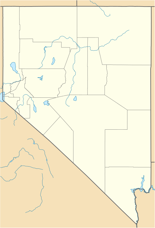
| County | Lyon |
| Population (2000) | |
| • Total | 170 |
| Time zone | Pacific (PST) (UTC-8) |
| • Summer (DST) | PDT (UTC-7) |
Silver City is a near ghost town and a small residential community in Lyon County, Nevada, USA, near the Lyon/Carson border. The population as of the 2000 census was 170. Settled in 1859, the population in 1861 was about 1,200, but began declining after the Virginia and Truckee Railroad was completed in 1869. Construction workers left the area, taking their business with them.[1]
Devil's Gate, just north of Silver City, marks the boundary line between Storey and Lyon counties, and was a notable natural landmark of the Nevada Territory. Through this narrow gorge, thousands of people passed on their way to the silver mines of the Comstock Lode. Nevada State Route 342 was constructed through here.[2]
Films shot in Silver City, Nevada
- 1948 : Chicken Every Sunday, directed by George Seaton
References
- ↑ Silver City, Nevada, Western Mining History
- ↑ Devil's Gate, Nevada Historical Marker 223

Devils Gate and Silver City. Left photo is circa 1866; right photo is 2010.
Municipalities and communities of Lyon County, Nevada, United States | ||
|---|---|---|
| Cities | 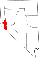 | |
| CDPs | ||
| Other unincorporated communities | ||
| Ghost towns | ||
| Indian reservation | ||
This article is issued from Wikipedia - version of the 12/20/2015. The text is available under the Creative Commons Attribution/Share Alike but additional terms may apply for the media files.