Reno, Nevada
| Reno, Nevada | ||
|---|---|---|
| City | ||
| City of Reno | ||
|
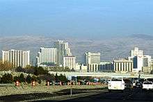
Reno in September 2014 | ||
| ||
| Nickname(s): "The Biggest Little City in the World" | ||
 Location of Reno in Washoe County, Nevada | ||
 Reno Location in the United States | ||
| Coordinates: 39°31′38″N 119°49′19″W / 39.52722°N 119.82194°WCoordinates: 39°31′38″N 119°49′19″W / 39.52722°N 119.82194°W | ||
| Country |
| |
| State |
| |
| County |
| |
| Founded | May 9, 1868 | |
| Incorporated | March 16, 1903 | |
| Named for | Jesse L. Reno | |
| Government | ||
| • Type | Council-manager | |
| • Mayor | Hillary Schieve (D) | |
| Area | ||
| • City | 105.9 sq mi (274.2 km2) | |
| • Land | 103.0 sq mi (266.8 km2) | |
| • Water | 2.9 sq mi (7.4 km2) | |
| Elevation | 4,505.6 ft (1,373 m) | |
| Population (2010) | ||
| • City | 225,221 | |
| • Estimate (2015)[1] | 241,445 | |
| • Density | 2,186/sq mi (844.1/km2) | |
| • Metro | 425,417 | |
| Demonym(s) | Renoites | |
| Time zone | Pacific (PST) (UTC−8) | |
| • Summer (DST) | PDT (UTC−7) | |
| ZIP codes | 89500-89599 | |
| Area code(s) | 775 | |
| FIPS code | 32-60600 | |
| GNIS feature ID | 0861100 | |
| Website |
reno | |
Nevada Historical Marker | ||
| Reference no. | 30 | |

Reno is a city in the U.S. state of Nevada. It is located in Northern Nevada, approximately 22 miles (35 km) from Lake Tahoe. Known as "The Biggest Little City in the World",[2] Reno is famous for its casinos and as the birthplace of Caesars Entertainment Corporation. It is the county seat of Washoe County, located in the northwestern part of the state. The city sits in a high desert at the foot of the Sierra Nevada and its downtown area (along with Sparks) occupies a valley informally known as the Truckee Meadows.
Reno is the most populous Nevada city outside of the Las Vegas–Paradise, NV MSA, with an estimated population of 233,294 in 2013,[1] and is the third most populous city in the state after Las Vegas and Henderson.[3]
Reno is part of the Reno–Sparks metropolitan area, which consists of all of both Washoe and Storey counties, and has a 2013 estimated population of 420,000,[4] making it the second largest metropolitan area in Nevada.
History
Archaeological finds place the eastern border for the prehistoric Martis people in the Reno area.[5]
As early as the mid 1850s a few pioneers settled in the Truckee Meadows, a relatively fertile valley through which the Truckee River made its way from Lake Tahoe to Pyramid Lake. In addition to subsistence farming, these early residents could pick up business from travelers along the California Trail, which followed the Truckee westward, before branching off towards Donner Lake, where the formidable obstacle of the Sierra Nevada began.
Gold was discovered in the vicinity of Virginia City in 1850, and a modest mining community developed, but the discovery of silver in 1859 at the Comstock Lode led to a mining rush.

To provide the necessary connection between Virginia City and the California Trail, Charles W. Fuller built a log toll bridge across the Truckee River in 1859. A small community that would service travelers soon grew up near the bridge. After two years, Fuller sold the bridge to Myron C. Lake, who continued to develop the community with the addition of a grist mill, kiln, and livery stable to the hotel and eating house. He renamed it "Lake's Crossing". In 1864, Washoe County was consolidated with Roop County, and Lake's Crossing became the largest town in the county. Lake had earned himself the title "founder of Reno".[6]
By January 1863, the Central Pacific Railroad (CPRR) had begun laying tracks east from Sacramento, California, eventually connecting with the Union Pacific Railroad at Promontory, Utah, to form the First Transcontinental Railroad. Lake deeded land to the CPRR in exchange for its promise to build a depot at Lake's Crossing. Once the railroad station was established, the town of Reno officially came into being on May 9, 1868.[7] CPRR construction superintendent Charles Crocker named the community after Major General Jesse Lee Reno, a Union officer killed in the American Civil War at the Battle of South Mountain.
In 1871, Reno became the county seat of the newly expanded Washoe County, replacing the previous county seat, located in Washoe City. However, political power in Nevada remained with the mining communities, first Virginia City and later Tonopah and Goldfield.
The extension of the Virginia and Truckee Railroad to Reno in 1872 provided a boost to the new city's economy. In the following decades, Reno continued to grow and prosper as a business and agricultural center and became the principal settlement on the transcontinental railroad between Sacramento and Salt Lake City.

As the mining boom waned early in the 20th century, Nevada's centers of political and business activity shifted to the non-mining communities, especially Reno and Las Vegas, and today the former mining metropolises stand as little more than ghost towns. Despite this, Nevada is still the third-largest gold producer in the world, after South Africa and Australia; the state yielded 6.9 percent of the world's supply in 2005 world gold production.[8]
The "Reno Arch" was erected on Virginia Street in 1926 to promote the upcoming Transcontinental Highways Exposition of 1927. The arch included the words "Nevada's Transcontinental Highways Exposition" and the dates of the exposition. After the exposition, the Reno City Council decided to keep the arch as a permanent downtown gateway, and Mayor E.E. Roberts asked the citizens of Reno to suggest a slogan for the arch. No acceptable slogan was received until a $100 prize was offered, and G.A. Burns of Sacramento was declared the winner on March 14, 1929, with "Reno, The Biggest Little City in the World".[9][10]
Reno took a leap when the state of Nevada legalized open-gambling on March 19, 1931, along with the passage of even more liberal divorce laws than places like Hot Springs, Arkansas, offered. No other state offered what Nevada did in the 1930s, and casinos like the Bank Club and Palace were popular.
Within a few years, the Bank Club, owned by George Wingfield, Bill Graham, and Jim McKay, was the state's largest employer and the largest casino in the world. Wingfield owned most of the buildings in town that housed gaming and took a percentage of the profits, along with his rent.[11]
Ernie Pyle once wrote in one of his columns, "All the people you saw on the streets in Reno were obviously there to get divorces." In Ayn Rand's novel The Fountainhead, published in 1943, the New York-based female protagonist tells a friend, "I am going to Reno," which is taken as a different way of saying "I am going to divorce my husband." Among others, the Belgian-French writer Georges Simenon, at the time living in the U.S., came to Reno in 1950 in order to divorce his first wife.[12]

The divorce business eventually died as the other states fell in line by passing their own laws easing the requirements for divorce, but gambling continued as a major Reno industry. While gaming pioneers like "Pappy" and Harold Smith of Harold's Club and Bill Harrah of the soon-to-dominate Harrah's casino set up shop in the 1930s, the war years of the 1940s cemented Reno as the place to play for two decades.[13] Beginning in the 1950s, the need for economic diversification beyond gaming fueled a movement for more lenient business taxation.[12]
A disaster occurred on the afternoon of February 5, 1957, when an explosion ripped through the heart of downtown. At 1:03 pm, two explosions, caused by natural gas leaking into the maze of pipes and ditches under the city, and an ensuing fire destroyed five buildings in the vicinity of Sierra and First streets along the Truckee River. Forty-nine people were injured in the disaster, and two were killed. The first explosion hit under the block of shops on the west side of Sierra Street (now the site of the Century Riverside), the second, across Sierra Street, now the site of the Palladio.
The presence of a main east-west rail line, the emerging interstate highway system, favorable state tax climate, and relatively inexpensive land created good conditions for warehousing and distribution of goods.
In the 1980s, Indian gaming rules were relaxed, and starting in 2000, Californian Native casinos began to cut into casino revenues.[14] Major new construction projects have been completed in the Reno and Sparks areas. A few new luxury communities were recently built in Truckee, California, approximately 28 miles (45 km) west of Reno on Interstate 80. Reno also is an outdoor recreation destination, due to its close proximity to the Sierra Nevada, Lake Tahoe, and numerous ski resorts in the region.
In more recent years, the city has gained some notoriety as the subject of the comedy series Reno 911! (the main scenes of which, however, are filmed in the city of Carson, California).[15]
On May 9, 2014, the Reno Historical App[16] was released in conjunction with the city's celebration of its 111th birthday as an incorporated city. The free app puts Reno's history at users' fingertips, allowing them to explore the people, places and moments that have shaped both the city's and the university's history.
Geography
Environmental factors
Wetlands are an important part of the Reno/Tahoe area. They act as a natural filter for the solids that come out of the water treatment plant. Plant roots absorb nutrients from the water and naturally filter it. Wetlands are home to over 75% of the species in the Great Basin. However, the area's wetlands are at risk of being destroyed due to development around the city. While developers build on top of the wetlands they fill them with dirt, destroying the habitat they create for the plants and animals. Washoe County has devised a plan that will help protect these ecosystems: mitigation. In the future, when developers try to build over a wetland, they will be responsible for creating another wetland near Washoe Lake.
The Truckee River serves as Reno's primary source of drinking water. It supplies Reno with 80 million U.S. gallons (300 Ml) of water a day during the summer, and 40 million U.S. gallons (150 Ml) of water per day in the winter. Before the water goes to the homes around the Reno area, it must go to one of two water treatment plants, Chalk Bluff or Glendale Water Treatment Plant. As an attempt to save water, golf courses in Reno have been using treated effluent water instead of treated water from one of Reno's water plants.
The Reno-Sparks wastewater treatment plant discharges tertiary treated effluent to the Truckee River. In the 1990s this capacity was increased from 20 to 30 million U.S. gallons (70 to 110 million liters) per day. While treated, the effluent contains suspended solids, nitrogen, and phosphorus, aggravating water quality concerns of the river and its receiving waters of Pyramid Lake. Local agencies working with the Environmental Protection Agency have developed a number of watershed management strategies to accommodate this expanded effluent discharge; to accomplish this successful outcome, the DSSAM Model was developed and calibrated for the Truckee River in order to analyze the most cost-effective available management strategy set.[17] The resulting management strategies included a package of measures such as land use controls in the Lake Tahoe basin, urban runoff controls in Reno and Sparks, and best management practices for wastewater discharge.

The Reno area is frequently subject to wildfires, causing property damage and sometimes loss of life. In August 1960, the Donner Ridge fire resulted in a loss of electricity to the city for four days.[18] In November 2011, arcing from powerlines caused a fire in Caughlin in southwest Reno that destroyed 26 homes and killed one older man, and only two months later in January 2012 another fire in Washoe Drive sparked by fireplace ashes destroyed 29 homes and killed one older woman. Around 10,000 residents were evacuated, and a state of emergency was declared. The fires came at the end of Reno's longest recorded dry spell.[19]
Geology

Reno is situated just east of the Sierra Nevada on the western edge of the Great Basin at an elevation of about 4,400 feet (1,300 m) above sea level. Numerous faults exist throughout the region. Most of these are normal (vertical motion) faults associated with the uplift of the various mountain ranges, including the Sierra Nevada.
In February 2008, an earthquake swarm began to occur, lasting for several months, and with the largest quake registering at 4.9 on the Richter scale, although some geologic estimates put it at 5.0. The earthquakes were centered on the Somersett community in western Reno near the areas of Mogul and Verdi. Many homes in these areas were damaged.[20]
Climate
Reno sits in the rain shadow of the Sierra Nevada mountain range. Annual rainfall averages 7.48 inches (190 mm). Despite this low amount of rainfall per year, Reno features a steppe climate (Köppen: BSk) due to its low evapotranspiration. Annual precipitation has ranged from 1.55 inches (39.4 mm) in 1947 to 13.23 inches (336.0 mm) in 1983. The most precipitation in one month was 5.25 inches (133.4 mm) in December 1955 and the most precipitation in 24 hours was 2.29 inches (58.2 mm) on January 21, 1943. Winter has snowfall which is usually light to moderate but can be heavy some days, averaging 21.5 inches (55 cm) annually. Snowfall varies with the lowest amounts (roughly 19–23 inches annually) at the lowest part of the valley at and east of the Reno–Tahoe International Airport at 4,404 feet (1,342 m), while the foothills of the Carson Range to the west ranging from 4,700 to 5,600 feet (1,400 to 1,700 m) in elevation just a few miles west of downtown can receive up to two to three times as much annual snowfall. The mountains of the Virginia Range to the east can receive more summer thunderstorms and precipitation, and around twice as much annual snowfall above 5,500 feet (1,700 m). However, snowfall increases in the Virginia Range are less dramatic as elevation climbs than in the Carson Range to the west, because the Virginia Range is well within the rain shadow of the Sierra Nevada and Carson Range. The most snowfall in the city in one year was 63.8 inches (162 cm) in 1971, and the most snowfall in one month was 29.0 inches (74 cm) in March 1952.
Most rainfall occurs in winter and spring. The city has 300 days of sunshine per year. Summer thunderstorms can occur between April and October. The eastern side of town and the mountains east of Reno tend to be prone to thunderstorms more often, and these storms may be severe because an afternoon downslope west wind, called a "Washoe Zephyr", can develop in the Sierra Nevada, causing air to be pulled down in the Sierra Nevada and Reno, destroying or preventing thunderstorms, but the same wind can push air upwards against the Virginia Range and other mountain ranges east of Reno, creating powerful thunderstorms.[21][22]
The monthly daily average temperature ranges from 35.3 °F (1.8 °C) in December to 74.9 °F (23.8 °C) in July, with the diurnal temperature variation reaching 35 °F (19 °C) in summer, still lower than much of the high desert to the east. There are 3.9 days of 100 °F (38 °C)+ highs, 58 days of 90 °F (32 °C)+ highs, and 2.5 nights with sub-10 °F (−12 °C) lows annually;[23] the temperature does not rise above freezing on only 5.1 days.[24] The all-time record high temperature is 108 °F (42 °C), which occurred on July 10 and 11, 2002, and again on July 5, 2007. The all-time record low temperature is −17 °F (−27 °C), which occurred on January 21, 1916.[24] In addition, the region is windy throughout the year; observers such as Mark Twain have commented about the "Washoe Zephyr", northwestern Nevada's distinctive wind.
| Climate data for Reno, Nevada (Reno-Tahoe Int'l), 1981–2010 normal, extremes 1893–present | |||||||||||||
|---|---|---|---|---|---|---|---|---|---|---|---|---|---|
| Month | Jan | Feb | Mar | Apr | May | Jun | Jul | Aug | Sep | Oct | Nov | Dec | Year |
| Record high °F (°C) | 71 (22) |
75 (24) |
83 (28) |
90 (32) |
98 (37) |
104 (40) |
108 (42) |
105 (41) |
101 (38) |
93 (34) |
77 (25) |
71 (22) |
108 (42) |
| Average high °F (°C) | 45.7 (7.6) |
51.0 (10.6) |
57.9 (14.4) |
63.9 (17.7) |
73.5 (23.1) |
83.3 (28.5) |
92.2 (33.4) |
90.6 (32.6) |
82.0 (27.8) |
69.2 (20.7) |
55.0 (12.8) |
45.6 (7.6) |
67.6 (19.8) |
| Average low °F (°C) | 25.4 (−3.7) |
28.9 (−1.7) |
33.5 (0.8) |
37.8 (3.2) |
45.5 (7.5) |
52.0 (11.1) |
57.7 (14.3) |
55.8 (13.2) |
48.5 (9.2) |
38.8 (3.8) |
30.5 (−0.8) |
25.0 (−3.9) |
40.0 (4.4) |
| Record low °F (°C) | −17 (−27) |
−16 (−27) |
−3 (−19) |
13 (−11) |
16 (−9) |
25 (−4) |
33 (1) |
24 (−4) |
20 (−7) |
8 (−13) |
1 (−17) |
−16 (−27) |
−17 (−27) |
| Average precipitation inches (mm) | 1.03 (26.2) |
1.02 (25.9) |
0.76 (19.3) |
0.47 (11.9) |
0.49 (12.4) |
0.51 (13) |
0.18 (4.6) |
0.23 (5.8) |
0.35 (8.9) |
0.51 (13) |
0.82 (20.8) |
1.03 (26.2) |
7.40 (188) |
| Average snowfall inches (cm) | 5.6 (14.2) |
5.0 (12.7) |
2.0 (5.1) |
0.5 (1.3) |
0.3 (0.8) |
trace | 0.0 (0) |
0.0 (0) |
0.1 (0.3) |
0.3 (0.8) |
3.1 (7.9) |
4.9 (12.4) |
21.8 (55.4) |
| Average precipitation days (≥ 0.01 in) | 6.9 | 7.0 | 5.8 | 4.2 | 3.7 | 3.7 | 1.6 | 1.8 | 2.9 | 3.3 | 5.0 | 6.4 | 52.3 |
| Average snowy days (≥ 0.1 in) | 4.0 | 3.0 | 2.6 | 1.0 | 0.2 | 0.0 | 0.0 | 0.0 | 0.1 | 0.3 | 1.9 | 3.2 | 16.3 |
| Average relative humidity (%) | 68.0 | 60.2 | 52.7 | 45.9 | 43.2 | 39.9 | 36.2 | 39.3 | 44.0 | 50.7 | 61.2 | 67.6 | 50.7 |
| Mean monthly sunshine hours | 195.6 | 204.2 | 291.0 | 332.1 | 375.8 | 393.8 | 424.0 | 390.8 | 343.9 | 295.2 | 212.0 | 187.5 | 3,645.9 |
| Percent possible sunshine | 65 | 68 | 78 | 83 | 84 | 88 | 93 | 92 | 92 | 85 | 70 | 64 | 82 |
| Source: NOAA (relative humidity and sun 1961–1990)[24][25][26] | |||||||||||||
Demographics
| Historical population | |||
|---|---|---|---|
| Census | Pop. | %± | |
| 1860 | 1,035 | — | |
| 1870 | 1,035 | 0.0% | |
| 1880 | 1,362 | 31.6% | |
| 1890 | 3,563 | 161.6% | |
| 1900 | 4,500 | 26.3% | |
| 1910 | 10,867 | 141.5% | |
| 1920 | 12,016 | 10.6% | |
| 1930 | 18,529 | 54.2% | |
| 1940 | 21,317 | 15.0% | |
| 1950 | 32,497 | 52.4% | |
| 1960 | 51,470 | 58.4% | |
| 1970 | 72,863 | 41.6% | |
| 1980 | 100,756 | 38.3% | |
| 1990 | 133,850 | 32.8% | |
| 2000 | 180,480 | 34.8% | |
| 2010 | 225,221 | 24.8% | |
| Est. 2015 | 241,445 | [27] | 7.2% |
| source:[28] | |||
As of the census of 2010, there were 225,221 people, 90,924 households, and 51,112 families residing in the city. The population density was 2,186.6 per square mile (844.2/km²). There were 102,582 housing units at an average density of 995.9 per square mile (384.5/km²). The racial makeup of the city was 74.2% White, 2.9% African American, 1.3% Native American, 6.3% Asian, 0.7% Pacific Islander, 10.5% some other race, and 4.2% from two or more races. Hispanic or Latino of any race were 24.3% of the population.[29] Non-Hispanic Whites were 62.5% of the population in 2010,[29] down from 88.5% in 1980.[30]
At the 2010 census, there were 90,924 households, out of which 29.8% had children under the age of 18 living with them, 38.4% were headed by married couples living together, 11.8% had a female householder with no husband present, and 43.8% were non-families. 32.1% of all households were made up of individuals, and 9.7% were someone living alone who was 65 years of age or older. The average household size was 2.43, and the average family size was 3.10.[29]
In the city the 2010 population was spread out with 22.8% under the age of 18, 12.5% from 18 to 24, 28.2% from 25 to 44, 24.9% from 45 to 64, and 11.7% who were 65 years of age or older. The median age was 34.6 years. For every 100 females there were 103.4 males. For every 100 females age 18 and over, there were 102.7 males.[29]
In 2011 the estimated median income for a household in the city was $44,846, and the median income for a family was $53,896. Males had a median income of $42,120 versus $31,362 for females. The per capita income for the city was $25,041. About 9.6% of families and 14.4% of the population were below the poverty line, including 15.1% of those under age 18 and 12.8% of those age 65 or over.[31][32] The population was 180,480 at the 2000 census; in 2010, its population had risen to 225,221, making it the third-largest city in the state after Las Vegas and Henderson, and the largest outside of Clark County. Reno lies 26 miles (42 km) north of the Nevada state capital, Carson City, and 22 miles (35 km) northeast of Lake Tahoe in a shrub-steppe environment. Reno shares its eastern border with the city of Sparks and is the larger of the principal cities of the Reno–Sparks, Nevada Metropolitan Statistical Area (MSA), a metropolitan area that covers Storey and Washoe counties.[33] The MSA had a combined population of 425,417 at the 2010 census.[34] The MSA is combined with the Fernley Micropolitan Statistical Area to form the Reno-Sparks-Fernley Combined Statistical Area, which had a total population of 477,397 at the 2010 census.[4]
Economy


Before the late 1950s, Reno was the gambling capital of the United States, but in the last twenty years Las Vegas' rapid growth, American Airlines' 2000 buyout of Reno Air, and the growth of Native American gaming in California have reduced its business. Older casinos were torn down (Mapes Hotel, Fitzgerald's Nevada Club, Primadonna, Horseshoe Club, Harold's Club, Palace Club), or smaller casinos like the Comstock, Sundowner, Golden Phoenix, Kings Inn, Money Tree, Virginian, and Riverboat were either closed or were converted into condos.
Because of its location, Reno has traditionally drawn the majority of its California tourists and gamblers from the San Francisco Bay Area and Sacramento, while Las Vegas has historically served more tourists from Southern California and the Phoenix area.
Several local large hotel casinos have shown significant growth and have moved gaming further away from the Virginia Street core. These larger hotel casinos are the Atlantis, the Peppermill and the Grand Sierra Resort. The Peppermill was chosen as the most outstanding Reno gaming/hotel property by Casino Player and Nevada magazines. In 2005, the Peppermill Reno began a $300 million Tuscan-themed expansion.
In an effort to bring more tourism to the area, Reno holds several events throughout the year, most of which have been extremely successful. They include Hot August Nights[35] (a classic car convention), Street Vibrations (a motorcycle fan gathering and rally), The Great Reno Balloon Race, a Cinco de Mayo celebration, bowling tournaments (held in the National Bowling Stadium), and the Reno Air Races.
Several large commercial developments were constructed during the mid-2000s boom, such as The Summit in 2007 and Legends at Sparks Marina in 2008.
Reno is the location of the corporate headquarters for numerous companies, including Braeburn Capital, Hamilton, EE Technologies, and Port of Subs. International Game Technology, Bally Technologies and GameTech have development and manufacturing presence in Reno.
Top employers
According to Reno's 2013 Comprehensive Annual Financial Report,[36] the top employers in the city are:
| # | Employer | # of Employees |
|---|---|---|
| 1 | Washoe County School District | 8,250 |
| 2 | University of Nevada, Reno | 4,250 |
| 3 | Washoe County | 2,750 |
| 4 | Renown Regional Medical Center | 2,750 |
| 5 | Peppermill Reno | 2,250 |
| 6 | International Game Technology | 2,250 |
| 7 | Integrity Staffing Solutions | 2,250 |
| 8 | Silver Legacy Reno | 2,250 |
| 9 | Saint Mary's Regional Medical Center | 1,750 |
| 10 | Atlantis Casino Resort | 1,750 |
Culture


- Artown
- National Automobile Museum
- Nevada Museum of Art,the only American Alliance of Museums (AAM) accredited art museum in the state of Nevada.
- Nevada Opera
- Pioneer Center for the Performing Arts
- Reno Philharmonic Orchestra
- Reno Pops Orchestra
- University of Nevada, Reno Arboretum
- Wilbur D. May Center, an arboretum and botanical garden
- Hot August Nights
- Burning Man
Libraries
Washoe County Library System has locations throughout Reno and its surrounding communities.
Reno in media
Movies filmed in Reno include:
- The Cooler[37]
- Magnolia[38]
- Hard Eight[39]
- Charley Varrick[40]
- Into the Wild
- Desert Hearts[41]
- The Wizard[42]
- Jinxed![10]
- The Misfits[10]
- Kingpin[43]
- ...All the Marbles[44]
- Pink Cadillac[10]
- Diamonds[45]
- Sister Act[46]
- Father's Day[47]
- Waking Up in Reno[48]
- Austin Powers in Goldmember[49]
- Jane Austen's Mafia!
- 40 Pounds of Trouble
- California Split[50]
- Up Close & Personal[51]
- The Pledge[52]
- Kill Me Again[51]
- The Last Don[53]
- Ocean's Eleven (1960 film)[12]
- Andy Hardy's Blonde Trouble[54]
- Blind Fury[55]
- Melvin and Howard
- Mr. Belvedere Goes to College[56]
- Scarecrow[57]
- Wild Is the Wind
- Born to Kill (1947 film)[58]
- The Muppets
- Promised Land (1987 film)
- The Motel Life (film)
- 5 Against the House
Music videos filmed in Reno include:
- "Drive Slow" – Kanye West
- "Little Motel" – Modest Mouse
- "Take Me Home Tonight" – Eddie Money
- "Send The Pain Below" - Chevelle
The young adult author Ellen Hopkins has written a series of novels called Crank set in Reno. Also, many of the short stories included in Claire Vaye Watkins' collection Battleborn are set in the city.
American songwriter Richard Fariña composed a song named Reno Nevada; it was first released on Richard & Mimi Fariña's debut album Celebrations For A Grey Day in 1965. The song was famously covered by Fairport Convention in 1968 and by Iain Matthews in 1971.
Thomas Dolby composed a song named "Road to Reno" as part of his A Map of the Floating City album, released in 2011.
Sports
| Club | League | Sport | Venue | Established | Championships |
|---|---|---|---|---|---|
| Reno Aces | PCL | Baseball | Greater Nevada Field | 1998 | 2 (2006, 2012) |
| Reno Bighorns | NBA D-League | Basketball | Reno Events Center | 2008 | 0 |
| Reno 1868 FC | USL | Soccer | Greater Nevada Field | 2015 | 0 |

Reno is home to the Reno Aces, the minor league baseball Triple-A affiliate of the Arizona Diamondbacks, playing in Greater Nevada Field, a downtown ballpark opened in 2009. Reno has hosted multiple professional baseball teams in the past, most under the Reno Silver Sox name. The Reno Astros, a former professional, unaffiliated baseball team, played at Moana Stadium until 2009.
In basketball, the Reno Bighorns, who joined the NBA Development League in 2008, play at the Reno Events Center.[59] They are an affiliate of the Sacramento Kings.
Reno is host to both amateur and professional combat sporting events such as mixed martial arts and boxing. The "Fight of the Century" between Jack Johnson and James J. Jeffries was held in Reno in 1910.[60] Boxer Ray Mancini fought four of his last five fights in Reno against Bobby Chacon, Livingstone Bramble, Hector Camacho, and Greg Haugen.[61]
The Reno Barons, an independent professional indoor football team, played at the Reno Events Center in 2011.
Reno expected to be the future home of an ECHL ice hockey team, named the Reno Raiders, but construction on a suitable arena never began. The franchise was dormant since 1998, when it was named the Reno Rage, and earlier the Reno Renegades, and played in the now-defunct West Coast Hockey League (WCHL). In 2016, Reno was removed from the ECHL's Future Markets page.
The Reno–Tahoe Open is northern Nevada's only PGA Tour event, held at Montrêux Golf & Country Club in Reno. As part of the FedEx Cup, the tournament follows 132 PGA Tour professionals competing for a share of the event's $3 million purse. The Reno-Tahoe Open Foundation has donated more than $1.8 million to local charities.
Reno has a college sports scene, with the Nevada Wolf Pack appearing in football bowl games and an Associated Press Top Ten ranking in basketball in 2007.

In 2004, the city completed a $1.5 million whitewater park on the Truckee River in downtown Reno which hosts whitewater events throughout the year. The course runs Class 2 and 3 rapids with year-round public access. The 1,400-foot (430 m) north channel features more aggressive rapids, drop pools and "holes" for rodeo kayak-type maneuvers. The milder 1,200 ft (370 m) south channel is set up as a kayak slalom course and a beginner area.
Reno is home to two roller derby teams, the Battle Born Derby Demons and the Reno Roller Girls.[62] The Battle Born Derby Demons compete on flat tracks locally and nationally. They are the only derby team locally to compete in a national Derby league.
Reno is the home of the National Bowling Stadium, which hosts the United States Bowling Congress (USBC) Open Championships every three years.
Recreation
Reno is home to a variety of recreation activities including both seasonal and year-round. In the summer, Reno locals can be found near three major bodies of water: Lake Tahoe, the Truckee River, and Pyramid Lake. The Truckee River originates at Lake Tahoe and flows west to east through the center of downtown Reno before terminating at Pyramid Lake to the north. The river is a major part of Artown, held in the summer at Wingfield Park. Washoe Lake is a popular kite and windsurfing location because of its high wind speeds during the summer.
Skiing and snowboarding are among the most popular winter sports and draw in many tourists. There are 18 ski resorts[63] (8 major resorts) located as close as 11 miles (18 km) and as far as 98 miles (158 km) from the Reno–Tahoe International Airport, including Northstar California, Sierra-at-Tahoe, Alpine Meadows, Squaw Valley, Sugar Bowl, Diamond Peak, Heavenly Mountain, and Mount Rose. Other popular Reno winter activities include snowshoeing, ice skating, and snowmobiling. There are many bike paths to ride in the summer time. International bike competitions are held in Lake Tahoe over the summer time.
Air races

The Reno Air Races, also known as the National Championship Air Races, are held each September at the Reno Stead Airport.[64][65]
Government
Reno has a democratic municipal government. The city council is the core of the government, with seven members. Five of these council people represent districts of Reno, and are vetted in the primary by the citizens of each district. In general, the top two vote earners in each ward make the ballot for the citywide election. The other two council members are the at-large member, who represents the entire city, and the mayor, who is elected by the people of the city. The council has several duties, including setting priorities for the city, promoting communication with the public, planning development, and redevelopment.
There is an elected city attorney who is responsible for civil and criminal cases. The City Attorney represents the city government in court, and prosecutes misdemeanors.
The city's charter calls for a council-manager form of government, meaning that the council appoints only two positions, the city manager, who implements and enforces the policies and programs the council approves, and the city clerk. The city manager is in charge of the budget and workforce for all city programs. The city clerk, who records the proceedings of the council, makes appointments for the council, and makes sure efficient copying and printing services are available.
In 2010, there was a ballot question asking whether the Reno city government and the Washoe County government should explore the idea of becoming one combined governmental body.[66] Fifty-four percent of voters approved of the ballot measure to make an inquiry into consolidating the governments.[67]
Fire department
The city of Reno is protected by the Truckee Meadows Fire Protection District (TMFPD) manning 14 fire stations.[68][69] The TMFPD operates a fire apparatus fleet of 20 engines, 5 trucks, 2 rescue units, 2 hazardous material units, various support units, 2 technical rescue support units, 15 brush units, 3 water tenders, and 3 water rescue entry vehicles.[70]
Education
Universities and colleges

- The University of Nevada, Reno is the oldest university in the state of Nevada and Nevada System of Higher Education. In 1886, the state university, previously only a college preparatory school, moved from Elko in remote northeastern Nevada to a site north of downtown Reno, where it became a full-fledged state college. The university grew slowly over the decades, but has begun to expand rapidly along with the rest of the state and currently has an enrollment of 16,867,[71] with most students hailing from within Nevada. Among its specialties are mining engineering, agriculture, journalism, business, and one of only two Basque Studies programs in the nation. It houses the National Judicial College. The university was named one of the top 200 colleges in the nation in the most recent U.S. News & World Report National Universities category index.[72]
- Truckee Meadows Community College (TMCC) is a regionally accredited, two-year institution which is part of the Nevada System of Higher Education. The college has an enrollment of approximately 13,000 students attending classes at a primary campus and four satellite centers. The college offers a wide range of academic and university transfer programs, occupational training, career enhancement workshops, and classes just for fun. TMCC offers associate of arts, associate of science, associate of applied science or associate of general studies degrees, one-year certificates, or certificates of completion in more than 50 career fields, including architecture, auto/diesel mechanics, criminal justice, dental hygiene, graphic design, musical theatre, nursing, and welding.
- Career College of Northern Nevada (CCNN) is a nationally accredited trade school that trains students in technical fields that support fast growing industries. The college is locally owned and operated. Employer advisory boards direct the college in order to provide skill training that is relevant to industry needs.
- University of Phoenix – Northern Nevada Campus is located in south Reno. The university faculty is a collection business and academic professionals from the local Reno area.
- The Nevada School of Law at Old College in Reno was the first law school established in the state of Nevada. Its doors were open from 1981–1988.
Public schools
Public education is provided by the Washoe County School District.
- Reno has twelve public high schools: Damonte Ranch, Galena, Hug, North Valleys High School, McQueen, Academy of Arts, Careers, and Technology (AACT), Reno, Truckee Meadows Community College High School,[73] Washoe, and Wooster.
- There are three public high schools in neighboring Sparks, attended by many students who live in Reno: Reed, Spanish Springs, and Sparks High School.
- Reno-Sparks has 13 middle schools: Billinghurst, Clayton, Cold Springs, Depoali, Dilworth, Mendive, O'Brien, Pine, Shaw,Sparks, Swope, Traner, and Vaughn.
- Reno-Sparks has 64 elementary schools: Allen, Anderson, Beasley, Jesse Beck, Bennett, Booth, Brown, Cannan, Caughlin Ranch, Corbett, Desert Heights, Diedrichsen, Dodson, Donner Springs, Double Diamond, Drake, Duncan, Dunn, Elmcrest, Gomes, Grace Warner, Greenbrae, Hidden Valley, Huffaker, Hunsberger, Hunter Lake, Jesse Beck, Johnson, Juniper, Lemmon Valley, Elizabeth Lenz, Lincoln Park, Echo Loder, Mathews, Maxwell, Melton, Mitchell, Moss, Mount Rose, Natchez, Palmer, Peavine, Picollo Special Education School, Pleasant Valley, Risley, Roy Gomm, Sepulveda, Sierra Vista, Silver Lake, Alice Smith, Kate Smith, Smithridge, Spanish Springs, Stead, Sun Valley, Taylor, Towles, Van Gorder, Verdi [pronounced VUR-die], Veterans Memorial, Warner, Westergard, Whitehead and Sarah Winnemucca. (some schools included on this list are in Sparks)
Public charter schools
Reno has many charter schools, which include Academy for Career Education, serving grades 10–12, opened 2002;[74] Alpine Academy Charter High School, serving grades 9–12, opened 2009;[75] Bailey Charter Elementary School, serving grades K-6, opened 2001;[76][77] Davidson Academy, serving grades 6–12, opened 2006;[78] High Desert Montessori School, serving grades PreK-7, opened 2002; I Can Do Anything Charter School, serving grades 9–12, opened 2000; Rainshadow Community Charter High School, serving grades 9–12, opened 2003;[79] Sierra Nevada Academy Charter School, serving grades PreK-8, opened 1999; and TEAM A (Together Everyone Achieves More Academy), serving grades 9–12, opened 2004.[80]
Private schools
Reno has a few private elementary schools such as Legacy Christian School, Excel Christian School, Lamplight Christian School, Coral Academy of Science,[81] and Nevada Sage Waldorf School[82] as well as private high schools, the largest of which are Bishop Manogue High School[83] and Sage Ridge School.[84]
Infrastructure
Transportation
Roads
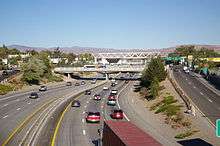
Reno was historically served by the Victory Highway and a branch of the Lincoln Highway. After the formation of the U.S. Numbered Highways system, U.S. Route 40 was routed along 4th Street through downtown Reno, before being replaced by Interstate 80. The primary north-south highway through Reno is U.S. Route 395/Interstate 580.
Bus
The Regional Transportation Commission of Washoe County (RTC) has a bus system that provides intracity buses, intercity buses to Carson City, and an on-demand shuttle service for disabled persons.[85] The bus system has its main terminal on 4th Street in downtown Reno and secondary terminals in Sparks and at Meadowood Mall in south Reno.
Numerous shuttle and excursion services are offered connecting the Reno–Tahoe International Airport to various destinations:
- South Tahoe Express provides connecting shuttle service to South Lake Tahoe resorts.
- Eastern Sierra Transit Authority provides shuttles to destinations south along the US-395 corridor in California, such as Mammoth Mountain and Lancaster
- Modoc Sage Stage provides shuttles to Alturas and Susanville, California, along the northern US-395 corridor.
Greyhound and Silver State Trailways stop at a downtown terminal. Megabus stops at the Silver Legacy Reno.[86]
Rail
Reno was historically a stopover along the First Transcontinental Railroad; the modern Overland Route continues to run through Reno. Reno was historically the southern terminus of the Nevada–California–Oregon Railway (NCO) and the northern terminus of the Virginia and Truckee Railroad. Using the NCO depot and right of way, the Western Pacific Railroad historically provided rail service to Reno. In the early 20th century, Reno also had a modest streetcar system. Downtown Reno has two historic train depots, the inactive Nevada-California-Oregon Railroad Depot and the still active Amtrak depot, originally built by the Southern Pacific Railroad.
Amtrak provides daily passenger service to Reno via the California Zephyr and multiple Amtrak Thruway Motorcoaches connecting to trains departing from Sacramento.
Air
The city is served by Reno–Tahoe International Airport, with general aviation traffic handled by Reno Stead Airport. Reno–Tahoe International Airport is the second busiest commercial airport in the state of Nevada after McCarran International Airport in Las Vegas. Reno was the hub and headquarters of the defunct airline Reno Air.
Utilities
Potable water for the city of Reno is provided by the Truckee Meadows Water Authority. The Truckee River is the primary water source, with purification being done at two plants, Chalk Bluff and Glendale. The Chalk Bluff plant's main intakes are west of Reno in Verdi, with the water flowing through a series of flumes and ditches to the plant itself. Alternative intakes are located below the plant along the banks of the Truckee River itself. The Glendale plant is sited alongside the river, and is fed by a rock and concrete rubble diversion dam a short distance upstream.[87]
Sewage treatment for the majority of the Truckee Meadows region takes place at the Truckee Meadows Water Reclamation Facility at the eastern edge of the valley. Treated effluent returns to the Truckee River by way of Steamboat Creek.[88]
Electrical power and natural gas are provided by NV Energy, formerly Sierra Pacific. Power comes from multiple sources, including Tracy-Clark Station to the east, and the Steamboat Springs binary cycle power plants at the southern end of town.
Notable residents
- Mädchen Amick, actress, Twin Peaks, Dream Lover
- Chris Ault, Hall of Fame NCAA football coach, retired head coach of University of Nevada, Reno Wolf Pack
- David Coverdale, singer-songwriter, former frontsinger of Deep Purple and Whitesnake
- Luke Babbitt, basketball player for Nizhny Novgorod, previously Portland Trail Blazers 2010-2013
- Shannon Bahrke, skier, silver medalist 2002 Winter Olympics, bronze medalist 2010 Winter Olympics, and 2003 World Cup champion
- Brent Boyd, pro football player
- T. Brian Callister, physician and health care quality expert
- Chris Carr, pro football player
- Chino XL, rapper; owns a residence in Reno
- Walter Van Tilburg Clark, author of The Ox-Bow Incident
- Doug Clifford, Creedence Clearwater Revival drummer
- Kimberley Conrad, Playboy Playmate of the Year (1989), Hugh Hefner's ex-wife
- Heidi Cortez, Sunset Tan, The Howard Stern Show
- Joe Flanigan, actor
- Rudy Galindo, figure skater
- Matt Gallagher, author and Iraq War veteran
- Bud Gaugh, drummer of the band Sublime
- Jim Gibbons, former governor and member of United States House of Representatives
- Mark Gilmartin, golfer, entrepreneur
- Curtis Hanson, producer-director of films 8 Mile, L.A. Confidential, The Hand That Rocks the Cradle, more
- Jennifer Harman, professional poker player
- Wilder W. Hartley (1901–70), Los Angeles City Council member, 1939–41, born in Reno
- Martin Heinrich, U.S. Senator from New Mexico since 2013; was considered for nominee Hillary Clinton's Vice President for the 2016 election
- Procter Ralph Hug, Jr., federal judge
- Terri Ivens, actress on All My Children
- C.L.R. James, playwright, historian (lived in Reno while getting divorce)
- Kevin Jepsen, professional baseball player, attended Bishop Manogue High School
- Colin Kaepernick, football quarterback, University of Nevada, Reno and San Francisco 49ers
- Mark Kotsay, professional baseball player
- Mike Krukow, MLB pitcher and broadcaster, Reno resident
- Mills Lane, boxing referee, district judge, television personality on Judge Mills Lane
- Paul Laxalt, governor and U.S. senator from Nevada
- Greg London, entertainer
- Dana MacDuff, film producer, Oakdale Pictures
- Julia Mancuso, skier, Olympic gold medalist 2006
- Rich Marotta, boxing commentator, Los Angeles radio personality
- Anne Henrietta Martin, first woman to run for U.S. Senate
- April Meservy, singer-songwriter
- Jessica Nigri, cosplay celebrity, promotional model, YouTuber, voice actress and fan convention interview correspondent
- Roger Norman, off-road racer and owner of Norman Motorsports
- Carl Ravazza, bandleader and talent agent
- Charles Rolley, inventor of Sea & Ski sunscreen[89][90][91]
- Chuck Ruff, drummer, Edgar Winter Group
- Brian Sandoval, Governor of Nevada
- Gene Savoy, Peru explorer, discoverer of Vilcabamba, Gran Pajaten, Gran Vilaya, Gran Saposoa
- Nate Schierholtz, professional baseball player, born in Reno
- Jason-Shane Scott, soap opera actor
- Ken Shamrock, mixed martial artist, UFC Hall of Famer, professional wrestler
- Shannyn Sossamon, actress of A Knight's Tale, 40 Days and 40 Nights and The Rules of Attraction
- Kevin Stadler, pro golfer, born in Reno
- Willy Vlautin, novelist, lead vocalist and songwriter for Alt-Country band Richmond Fontaine[92]
- J. Buzz Von Ornsteiner, forensic psychologist, television personality
- Michael Weiss, 2016 Olympic swimmer
- Dawn Wells, Miss Nevada 1959, actress on TV series Gilligan's Island
- Joe Wieland, professional baseball player
- Taylor Wilson, nuclear scientist; previously held record for being youngest person to achieve nuclear fusion
- Friedwardt Winterberg, German-American theoretical physicist, and professor at University of Nevada Reno
- David Wise, five-time World Cup medalist and Olympic gold medalist in half pipe skiing
- Dolora Zajick, renowned dramatic mezzo-soprano
Twin towns – Sister cities
Reno has eight sister cities:[93]
 Yellowknife, Northwest Territories, Canada
 Hatzor, Israel
 Donostia-San Sebastian, Spain
 Udonthani, Thailand
 Taichung, Taiwan
 Shenzhen, Guangdong, China[94][95][96]
 Nalchik, Russia
- Nanhai District, Foshan, Guangdong, China
References
- 1 2 http://quickfacts.census.gov/qfd/states/32/3260600.html
- ↑ "City of Reno : Home". Reno.gov. Retrieved 2013-01-16.
- ↑ http://quickfacts.census.gov/qfd/states/32000.html
- 1 2 "United States Census Bureau: 2013accessdate=September 14, 2014".
- ↑ Brauman, Sharon K. (October 6, 2004). "North Fork petroglyphs". ucnrs.org. Retrieved August 15, 2008.
- ↑ Guy Louis Rocha, "Reno's First Robber Baron," Nevada Magazine 40,2(March–April 1980), p. 28.
- ↑ "History of Reno". City of Reno. Retrieved 2014-07-13.
- ↑ John_O'Neill_100001295309124 (January 9, 2008). "ReviewJournal.com – News – Gold hits record high". Lvrj.com.
- ↑ http://isgreaterthan.net/2010/07/sign-of-the-times-the-history-of-the-reno-arch/
- 1 2 3 4 Land, Barbara; Myrick Land (1995). A short history of Reno. Reno, Nevada: University of Nevada Press. p. 67. ISBN 978-0-87417-262-1.
- ↑ Moe, Al W. The Roots of Reno, , 2008, p.153
- 1 2 3 Barber, Alicia (2008). Reno's big gamble: image and reputation in the biggest little city. University Press of Kansas. ISBN 978-0-7006-1594-0.
- ↑ Moe, Al W. Nevada's Golden Age of Gambling, Puget Sound Books, 2002, p.68
- ↑ Onishi, Norimitsu (July 14, 2012). "With Gambling in Decline, Reno Struggles to Reinvent Itself". The New York Times.
- ↑ "Hollywood on Location - TV LOCATIONS". SeeingStars.com. Retrieved October 19, 2016.
- ↑ "Reno Historical App : Home". Nevada Humanities, et al. Retrieved 2014-05-22.
- ↑ C. Michael Hogan, Marc Papineau et al. 1987. Development of a dynamic water quality simulation model for the Truckee River, Earth Metrics Inc., Environmental Protection Agency Technology Series, Washington D.C.
- ↑ Weather and Climate of the Reno-Carson City-Lake Tahoe Region: Nevada Bureau of Mines and Geology Special Publication 34. NV Bureau of Mines & Geology. 2007. p. 53. ISBN 1-888035-11-0. Retrieved 2013-01-16.
- ↑ Magerum, Liz (January 20, 2012). "'Remorseful' man admits he caused Reno blaze". USA Today. Associated Press. Retrieved February 2, 2012.
- ↑ Ashley Powers; Thomas H. Maugh II (April 30, 2008). "Swarm of earthquakes shakes Reno area". Los Angeles Times. Retrieved August 27, 2008.
- ↑ %7CReno Tahoe Visitors website "Reno, NV" Check
|url=value (help). Retrieved June 1, 2010. - ↑ Google Books. Google Books. June 2007. ISBN 9781888035117.
- ↑ ftp://ftp.ncdc.noaa.gov/pub/data/normals/1981-2010/products/station/USW00023185.normals.txt. Retrieved 2013-12-28. Missing or empty
|title=(help) - 1 2 3 "NowData – NOAA Online Weather Data". National Oceanic and Atmospheric Administration. Retrieved June 6, 2015.
- ↑ "NV Reno Tahoe INTL AP". National Oceanic and Atmospheric Administration. Retrieved June 6, 2015.
- ↑ "WMO Climate Normals for Reno/INTL, NV 1961–1990". National Oceanic and Atmospheric Administration. Retrieved June 6, 2015.
- ↑ "Annual Estimates of the Resident Population for Incorporated Places: April 1, 2010 to July 1, 2015". Retrieved July 2, 2016.
- ↑ Moffatt, Riley. Population History of Western U.S. Cities & Towns, 1850–1990. Lanham: Scarecrow, 1996, 158.
- 1 2 3 4 "Profile of General Population and Housing Characteristics: 2010 Demographic Profile Data (DP-1): Reno city, Nevada". U.S. Census Bureau, American Factfinder. Retrieved January 15, 2013.
- ↑ "Nevada – Race and Hispanic Origin for Selected Cities and Other Places: Earliest Census to 1990". U.S. Census Bureau. Retrieved April 21, 2012.
- ↑ "Selected Economic Characteristics: 2011 American Community Survey 1-Year Estimates (DP03): Reno city, Nevada". U.S. Census Bureau, American Factfinder. Retrieved January 15, 2013.
- ↑ "Find a County". National Association of Counties. Retrieved 2011-06-07.
- ↑ Metropolitan statistical areas and components, Office of Management and Budget, May 11, 2007. Retrieved July 30, 2008.
- ↑ "Profile of General Population and Housing Characteristics: 2010 Demographic Profile Data (DP-1): Reno-Sparks, NV Metro Area". U.S. Census Bureau, American Factfinder. Retrieved January 15, 2013.
- ↑ "Hot August Nights". Hot August Nights. Retrieved August 12, 2010.
- ↑ "City of Reno CAFR".
- ↑ Benson, Sara (2008). Lonely Planet Las Vegas City Guide. Lonely Planet. p. 24. ISBN 978-1-74104-677-9.
- ↑ DuVal.(2002) p.117
- ↑ DuVal.(2002) p.79
- ↑ DuVal, Gary (2002). The Nevada filmography: nearly 600 works made in the state, 1897 through 2000. McFarland. p. 38. ISBN 978-0-7864-1271-6.
- ↑ DuVal.(2002) p.51
- ↑ Catalano, Grace (1991). Fred Savage: Totally Awesome. Bantam Books. p. 71. ISBN 978-0-553-28858-2.
- ↑ Didinger, Ray; Glen Macnow (2009). The Ultimate Book of Sports Movies: Featuring the 100 Greatest Sports Films of All Time. Running Press. p. 216. ISBN 978-0-7624-3548-7.
- ↑ DuVal.(2002) p.11
- ↑ Maltin, Leonard (2008). Leonard Maltin's 2009 Movie Guide. Penguin. p. 351. ISBN 978-0-452-28978-9.
- ↑ Turan, Kenneth (2006). Now in theaters everywhere: a celebration of a certain kind of blockbuster. PublicAffairs. p. 149. ISBN 978-1-58648-395-1.
- ↑ DuVal.(2002) p.19
- ↑ Bleiler, David (2003). Tla Video & Dvd Guide 2004: The Discerning Film Lover's Guide. Macmillan. p. 655. ISBN 978-0-312-31686-0.
- ↑ D'Arc, James V. (2010). When Hollywood Came to Town. Gibbs Smith. p. 302. ISBN 978-1-4236-0587-4.
- ↑ DuVal.(2002) p.13
- 1 2 DuVal.(2002) p.177
- ↑ McDougal, Dennis (2008). Five easy decades: how Jack Nicholson became the biggest movie star in modern times. John Wiley and Son. p. 371. ISBN 978-0-471-72246-5.
- ↑ DuVal.(2002) p.107
- ↑ DuVal.(2002) p.5
- ↑ Emery, Robert J. (2003). The directors: take four. Allworth Communications, Inc. p. 73. ISBN 978-1-58115-279-1.
- ↑ DuVal.(2002) p.125
- ↑ DuVal.(2002) p.220
- ↑ DuVal.(2002) p.25
- ↑ "NBA Development League: The D-League Expands to Reno". Nbareno.com. Retrieved 2013-01-16.
- ↑ Borrowman, Shane (May–June 2010). "Celebrating Jack Johnson". Nevada Magazine. Retrieved 2011-04-11.
- ↑ "Ray Mancini-Boxer". Retrieved 2011-04-11.
- ↑ Daniel Riggs (2008). "There are two roller derby organizations in Reno—and don't ever make the mistake of confusing one for the other". newsreview.com. Retrieved August 14, 2010.
- ↑ "About Reno-Sparks". Reno Sparks Chamber of Commerce. Archived from the original on July 27, 2011. Retrieved September 3, 2011.
- ↑ "Celebrating 50 years of the Reno Air Races". Reno Gazette-Journal. September 16, 2013. Retrieved October 18, 2014.
- ↑ "FAQs". The Reno Air Racing Association. Retrieved October 18, 2014.
- ↑ Voyles, Susan (October 24, 2010). "Combining local governments is questioned on ballot issue". Reno Gazette-Journal.
- ↑ "Election Results: Nevada". The New York Times. Retrieved November 3, 2010.
- ↑ "City of Reno : Fire Department". Reno.gov. 2013-03-20. Archived from the original on January 18, 2013. Retrieved 2013-05-04.
- ↑ "City of Reno : Administration". Reno.gov. 2013-03-20. Archived from the original on January 19, 2013. Retrieved 2013-05-04.
- ↑ UnionCentrics.com. "Reno Fire Fighters Association, IAFF Local 731 - Our Department". Iaff731.org. Retrieved 2013-05-04.
- ↑ "University of Nevada, Reno General Information". U.S. University Directory. Retrieved September 6, 2011.
- ↑ College Name. "Best College | Search | US News". Colleges.usnews.rankingsandreviews.com. Retrieved 2013-01-16.
- ↑ "TMCC High School". Tmcc.edu. Archived from the original on May 18, 2015.
- ↑ "ACE High School". ACE High School. Retrieved 2013-01-16.
- ↑ "Alpine Academy Charter High School – Sparks, Nevada". Alpineacademy.net. Retrieved 2013-01-16.
- ↑ "School Brief". Baileycharter.org. Retrieved 2013-01-16.
- ↑ "Home page". Coral Academy of Science. March 10, 2012.
- ↑ Sandra Chereb (August 4, 2009). "No genius left behind? Reno academy caters to smart students". USA Today. Associated Press. Retrieved 2011-11-15.
- ↑ "Rainshadow Community Charter High School". Rainshadowcchs.org. Retrieved 2013-01-16.
- ↑ "TEAM A Official site". Teammartialartsacademy. Archived from the original on July 16, 2011. Retrieved August 12, 2010.
- ↑ "Lamplight Christian School". Lcsreno.com. Retrieved 2013-01-16.
- ↑ "Nevada sage waldorf school". nevadasagewaldorf.org. Retrieved 2014-09-24.
- ↑ "Bishop Manogue Catholic High School – Home". Bishopmanogue.org. February 29, 2012.
- ↑ "Sage Ridge School". Sageridge.org.
- ↑ "RTC Washoe". RTC Washoe. Retrieved August 12, 2010.
- ↑ "AIBRA - Find a Station". Retrieved 2015-05-02.
- ↑ "Truckee Meadows Water Authority".
- ↑ "Truckee Meadows Water Reclamation Facility".
- ↑ Thursday 13: Summer Dreams - MissMeliss.com
- ↑ Well, Tan My Hide! - I Tried Being Tasteful...
- ↑ History of Sea & Ski Suntan and Sunscreen - BrandlandUSA
- ↑ "Bio". Willy Vlautin. Retrieved August 12, 2010.
- ↑ Sister Cities International, Inc. (SCI) Archived October 15, 2008, at the Wayback Machine.
- ↑ 友好城市 (Friendly cities), 市外办 (Foreign Affairs Office), 2008-03-22. (Translation by Google Translate.)
- ↑ 国际友好城市一览表 (International Friendship Cities List), 2011-01-20. (Translation by Google Translate.)
- ↑ 友好交流 (Friendly exchanges), 2011-09-13. (Translation by Google Translate.)
- ↑ Wood, Simon (February 26, 2009). "Laws questions value of sister city relationship". Wanganui Chronicle. Archived from the original on March 13, 2009.
External links
| ||
| ||
Municipalities and communities of Washoe County, Nevada, United States | ||
|---|---|---|
| Cities | 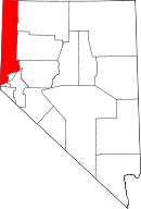 | |
| CDPs | ||
| Unincorporated communities | ||
| Indian reservation | ||
| Indian colony | ||
| Ghost towns | ||