California State Route 178
| ||||
|---|---|---|---|---|
|
Map of eastern California with SR 178 highlighted in red | ||||
| Route information | ||||
| Defined by Streets and Highways Code § 478 | ||||
| Maintained by Caltrans | ||||
| Length: | 167 mi[1] (268 km) | |||
| Section 1 | ||||
| West end: |
| |||
| Major junctions: |
| |||
| East end: | Trona Rd. near Trona | |||
| Section 2 | ||||
| West end: | Death Valley | |||
| Major junctions: |
| |||
| East end: |
| |||
| Highway system | ||||
| ||||


State Route 178 (SR 178) is a route that exists in two constructed segments. The gap in between segments is connected by various local roads and State Route 190 through Death Valley National Park.
SR 178 serves many different purposes. It connects SR 99 and Downtown Bakersfield with East Bakersfield and Lake Isabella. It is one of two crossings over the Sierra Nevada south of Yosemite (SR 120, Tioga Pass Road), connecting the southern San Joaquin Valley with the upper Mojave Desert and the Owens Valley. This also provides access to Death Valley National Park. If the unconstructed portion were built, it would also provide an easy route between Ridgecrest, California and Las Vegas, via Pahrump, Nevada.
This route is part of the California Freeway and Expressway System[2] and is eligible for the State Scenic Highway System.[3]
Route description
Western segment

The first segment starts at State Route 99 just west of Downtown Bakersfield. The road continues as 24th street, but then splits at B St. utilizing 24th street as its westbound usage, and 23rd St. as its eastbound through the eastern part of Downtown Bakersfield. SR 178 becomes a freeway as it leaves Downtown, and winds through East Bakersfield. The freeway then travels east as it enters Northeast Bakersfield. Just east of the Fairfax Interchange, the road narrows to a 2-lane conventional highway. The highway continues through the rural, but growing Rio Bravo section of Bakersfield. It then crosses SR 184. Turning northeast, the route continues to the mouth of Kern Canyon (which is also the city limits of Bakersfield). For the next approximately 8 miles, the route is a narrow 2-lane road (average width of 18 ft. to 24 ft.), as it ascends the lower Sierra Nevada. Average speed is 35 mph, with sharp turns and steep dropoffs. After approximately 8 miles, the road becomes a much gentler 4-lane, 60 ft. expressway. The route continues east, and reaches the town of Lake Isabella, which is just south of the Lake Isabella Reservoir. The road briefly expands to a divided freeway through Lake Isabella, before narrowing to a 2-lane conventional highway at the intersection with Lake Isabella Blvd. The road winds a little bit until it ascends to Walker Pass, an elevation of over 5,000 feet (1,500 m). The highway then descends from the mountains to its junction with State Route 14. It then proceeds eastward across US 395 into the town of Ridgecrest, CA. The constructed highway ends at the turnoff for the Trona Pinnacles National Natural Landmark.
Eastern segment

The second segment resumes four miles (6 km) west of Salisberry Pass in the southeasterly part of Death Valley National Park in Inyo County at what had been the former boundary of Death Valley National Monument until 1994. It then meets up with State Route 127. 178 then branches northward from 127 to the California-Nevada State Line. In Nevada, the roadway continues as State Route 372 ending at State Route 160 near the center of Pahrump in Nye County. Plans to connect the two constructed segments in California are unlikely due to the would-be link's passage through Death Valley National Park.
The segment of State Route 178 from State Route 127 to the California-Nevada State Line as well as all of Nevada State Route 372 are both known as the Charles Brown Highway. Charles Brown, a former California State Legislator, was a major proponent for the incorporation of the segment of State Route 178 between State Route 14 and the California-Nevada state line into the California Highway System.
History
SR 178 was one of the routes created with the third bond act of 1919. It defined a route 202 miles long between Santa Maria and Freeman Junction through Bakersfield. Freeman does not exist today; it was originally located near (and later at) the junction of SR 178 and SR 14. The route was defined as Legislative Route 57. The 1919 bond act also created the first segment of LRN 58. The route was extended several times since 1919.[4] In 1933, the final segment was added to LRN 58, which created a route from US 101 near Santa Margarita to the Nevada state line via Bakersfield.[5] Construction on the route between Bakersfield and Isabella through Kern Canyon started in 1922. Progress moved slowly, as sheer rock walls had to be blasted with dynamite. In 1931, 9 years after construction started, the 26-mile highway segment was completed.[6]
In 1933, with the creation of signed routes, portions of LRN 57 and LRN 58 would be signed as Route 178. LRN 58 would be signed between Route 33 and US 99, and LRN 57 would be signed between US 99 and US 6.[7] Later, in 1947, LRN 212 was created, and defined to run from LRN 23 (signed as US 6) near Inyokern, east to the Nevada state line. It was an unsigned route.[8]
In the period 1950-53 a portion of SR178 in Lake Isabella was rerouted around the Isabella Auxiliary Dam. The dam was built over the old route and parts of it are inundated by Isabella Lake. The new route goes over the dam's southern abutment and along the shoreline of Isabella Lake toward Onyx.
In 1964 all of the California routes were renumbered. LRN 58 was dropped from Route 178 and combined with the eastern portion of the decommissioned US 466 (also defined as part of LRN 58) to create SR 58. The remaining Route 178 was combined with LRN 212 to create SR 178. It was originally defined to start at SR 99 in Bakersfield, but later that year it was changed to simply start in Bakersfield.[7] This change was probably done to avoid a cosign with SR 58 along 23rd/24th St. After SR 58 was moved to the freeway south of Brundage Lane. in 1976, SR 178 was extended west to SR 99.
Construction on the initial freeway in Bakersfield was completed in 1968. It ran from M St, on the eastern edge of Downtown, through East Bakersfield to Haley St. Eastern extensions have been constructed since 1968, one interchange at a time as the need arises. In the Kern Canyon section, which is between Bakersfield and the Kern River Valley, a bypass route was identified in 1964. By 1968, a deed from the US forestry service issued an easement to the State for the construction of the highway through National Forest lands. The first phase of construction was completed in 1974, which created a short freeway near Lake Isabella and a 60’ wide expressway extending west to China Garden. Subsequent phases were not funded.[9]
Future
Western freeway extension
The freeway portion of Route 178 ends as it approaches downtown Bakersfield from the east, causing a large volume of traffic congestion foreseen since the freeway's inception in the late 1950s. Weak public support and subsequent lack of funds hindered efforts to complete the freeway through downtown and Westchester to its purposed terminus at the beginning of the recently completed Westside Parkway. Although freeway alternatives through various neighborhoods have been studied several times following the existing portion's completion in 1968, the city of Bakersfield has never formally endorsed a route. Although Caltrans formally announced preference for an alignment through downtown and Westchester in 1973, fierce public opposition coupled with the historic integrity of the neighborhoods slated to be demolished greatly hindered momentum of the project. By the time then-Governor Jerry Brown issued a moratorium on all new freeway construction in 1977, any realistic hope for a completion date for a downtown freeway had since completely evaporated. Formal studies on possible routes continue to be studied, however, resulting in recommendations of a more southern alignment near Truxtun Ave. executed by the Kern Council of Governors (KernCOG) in 1986, and most recently in 2001 as a part of the so-called Bakersfield System Study.
A Westchester alignment would have extended the freeway west from its current terminus at M St and through Downtown Bakersfield in the vicinity of 23rd street. As it continued through Westchester the freeway would turn southwest, cross under SR 99 and terminate at the newly completed Westside Parkway.[10]
A southern alignment would start at SR 178 at Baker St., about 0.7 miles east of its current terminus. From there, it would turn southwest, and run parallel to Baker St, through East Bakersfield, to the BNSF railroad yard. From there, it would turn west and run south of the railroad tracks through the southern end of Downtown Bakersfield. At Bakersfield High School, it would run north of the tracks (avoiding the high school). It would continue, under SR 99 and terminate at the proposed Westside Parkway.[11]
Still needing to address the increasing crosstown congestion and with a freeway through downtown effectively out of the question, the City of Bakersfield in the late 2000s finally approved construction to increase capacity on 23rd and 24th streets through Downtown using TRIP funds. 23rd and 24th streets will be widened to four lanes each through downtown, and through Westchester streets will be widened to three in each direction, accompanied by the closure of access to B Street through Elm Street from the north. This solution required the acquisition of the row of properties north of 24th street, which was completed in early 2015. As a result, SR 178 as a limited-access highway through downtown is unlikely to come to pass anytime in the near future.
Eastern freeway extension
There are plans to extend SR 178 as a divided highway east of Fairfax Road. When all of the projects are completed, the highway will be a four-lane divided freeway to future Vineland Road (near the old Mesa Marin Raceway) and a four-lane arterial to Miramonte Drive.[12][13] These improvements are expected to be completed by 2014.[14]
Kern Canyon bypass
There is a plan to realign SR 178 from its current route through Kern Canyon to a route parallel to Rancheria Road, north of the canyon. The new alignment would run from future Vineland Road, 15 miles to China Garden, where it will meet with the existing four-lane expressway (which was completed in 1974). The goal will be to have a four lane expressway from Bakersfield to Lake Isabella.[15] This would eliminate the sharp curves and steep drop-offs that exist with the current route. No final construction date has been released, nor has much of the right-of-way been acquired.
Major intersections
Except where prefixed with a letter, postmiles were measured on the road as it was in 1964, based on the alignment that existed at the time, and do not necessarily reflect current mileage. R reflects a realignment in the route since then, M indicates a second realignment, L refers an overlap due to a correction or change, and T indicates postmiles classified as temporary (for a full list of prefixes, see the list of postmile definitions).[16] Segments that remain unconstructed or have been relinquished to local control may be omitted. The numbers reset at county lines; the start and end postmiles in each county are given in the county column.
| County | Location | Postmile [16][17][18] | Exit [19] | Destinations | Notes | ||
|---|---|---|---|---|---|---|---|
| Kern KER 0.00-104.62 | Bakersfield | 0.00 | Interchange; west end of SR 178; SR 99 north exit 26A, south exit 26 | ||||
| 0.36 | Oak Street south | Former Legislative Route 141 south | |||||
| 1.48– 1.50 | Chester Avenue – Central District | ||||||
| | West end of freeway | ||||||
| R2.01 | 2A | Q Street, Golden State Avenue (SR 204, SR 99 Bus.) | Eastbound exit and westbound entrance; former US 99 south | ||||
| R2.01 | 2A | Westbound exit and eastbound entrance | |||||
| R2.41 | 2B | Union Avenue (SR 204 south, SR 99 Bus. south) | Former US 99 south | ||||
| R3.40 | 3 | Beale Avenue | |||||
| R4.10 | 4 | Haley Street | Eastbound exit and westbound entrance | ||||
| R4.63 | 5 | Mount Vernon Avenue | |||||
| R5.64 | 6 | Oswell Street | |||||
| R6.77 | 7 | Fairfax Road | |||||
| | 8 | Morning Drive | Opened August 18, 2015 | ||||
| | East end of freeway | ||||||
| T9.61 | |||||||
| Lake Isabella | | West end of freeway | |||||
| R41.65 | 42 | Bodfish, Lake Isabella | |||||
| R42.94 | 43 | ||||||
| | East end of freeway | ||||||
| | 55.68 | Sierra Way – Kernville | Serves Kern Valley Airport | ||||
| Freeman Junction | 88.26 57.77[N 1] | West end of SR 14 overlap; former US 6 south | |||||
| | 60.57[N 1] 88.38 | East end of SR 14 overlap; former US 6 north | |||||
| | R93.24 | Interchange; west end of US 395 Bus. overlap | |||||
| Ridgecrest | 100.60 | Inyokern Road, Sandquist Road | |||||
| 102.61 | East end of US 395 Bus. overlap; China Lake Boulevard serves Cerro Coso Community College | ||||||
| San Bernardino SBD 0.00-14.78 | | 7.35 | Trona Road – Red Mountain | ||||
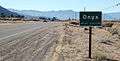
| | 14.78 | Trona Road – Trona, Furnace Creek | |||||
| Gap in route | |||||||
| Inyo INY 28.00-62.19 | | 28.00 | Jubilee Pass Road | Former Death Valley National Monument boundary | |||
| | 42.92 16.25[N 2] | West end of SR 127 overlap | |||||
| Shoshone | 14.75[N 2] 42.93 | East end of SR 127 overlap | |||||
| | 62.19 | Continuation into Nevada; east end of SR 178 | |||||
1.000 mi = 1.609 km; 1.000 km = 0.621 mi
| |||||||
Images along SR178
 CalTrans guide sign along State Route 178 in Onyx.
 CalTrans G9-2 guide sign looking westbound on SR178 at the eastern extent of Mountain Mesa.
 SR178 is the road left of center in this view of Bodfish and Lake Isabella.
 Guide sign at the east extent of South Lake in eastern Kern County.
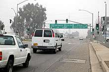 SR178 upgrades to freeway eastbound from M Street in Bakersfield.
References
- ↑ "California Log of Bridges on State Highways" (PDF). California Department of Transportation. January 1, 2006. Retrieved 2007-06-18.
- ↑ CA Codes (shc:250-257)
- ↑ CA Codes (shc:260-284)
- ↑ Chronology of California Highways - Phase II: Early Growth. CAHighway.org. Accessed: 01-14-2010.
- ↑ Chronology of California Highways - Phase III: A Significant System is Created. CAHighway.org. Accessed: 01-14-2010.
- ↑ Draft Report of Kern Canyon Highway Corridor Study Archived January 5, 2009, at the Wayback Machine.. KernCOG. September 1984. Page 5.
- 1 2 Route 177-184. CAHighway.org. Accessed: 01-14-2010.
- ↑ Route 209-216. CAHighway.org. Accessed: 01-14-2010.
- ↑ Draft Report of Kern Canyon Highway Corridor Study Archived January 5, 2009, at the Wayback Machine.. KernCOG. September 1984. Page 4-5.
- ↑ Route 178 Corridor Study. Kern Council of Governments. December 1986. Pages 39-41. Retrieved on April 5, 2015.
- ↑ Route 178 Corridor Study. Kern Council of Governments. December 1986. Pages 42-43. Retrieved on April 5, 2015.
- ↑ "Morning Dr. Archived September 12, 2009, at the Wayback Machine." Thomas Roads Improvement Program (TRIP). Retrieved on July 3, 2009.
- ↑ "SR 178 Widening Archived September 12, 2009, at the Wayback Machine.." Thomas Roads Improvement Program (TRIP). Retrieved on July 3, 2009.
- ↑ TRIP 2008/2009 Progress Report Archived July 20, 2011, at the Wayback Machine.. Thomas Roads Improvement Program (TRIP). Page 8. Retrieved on July 3, 2009.
- ↑ Draft Report of Kern Canyon Highway Corridor Study. Kern Council of Governments. Retrieved on August 29, 2013.
- 1 2 California Department of Transportation. "State Truck Route List". Sacramento: California Department of Transportation. Archived from the original (XLS file) on June 30, 2015. Retrieved June 30, 2015.
- ↑ California Department of Transportation, Log of Bridges on State Highways, July 2007
- ↑ California Department of Transportation, All Traffic Volumes on CSHS, 2005 and 2006
- ↑ California Department of Transportation, California Numbered Exit Uniform System, SR-178 Eastbound and SR-178 Westbound, accessed February 2008
External links
| Wikimedia Commons has media related to California State Route 178. |
- Caltrans: Route 178 highway conditions
- West Coast Roads: State Route 178
- California Highways: State Route 178