Spring Valley State Park
| Spring Valley State Park | |
| Nevada State Park | |
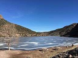 Eagle Valley Reservoir in Spring Valley State Park | |
| Country | |
|---|---|
| State | |
| County | Lincoln |
| Location | Ursine |
| - elevation | 5,869 ft (1,789 m) [1] |
| - coordinates | 38°3′14″N 114°10′14″W / 38.05389°N 114.17056°WCoordinates: 38°3′14″N 114°10′14″W / 38.05389°N 114.17056°W |
| Founded | 1969 |
| Management | Nevada Division of State Parks |
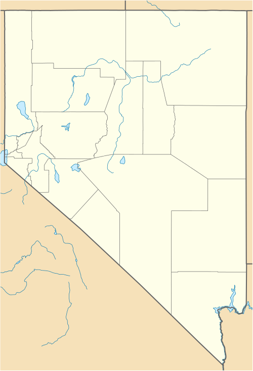 Location of Spring Valley State Park in Nevada | |
Spring Valley State Park is a state park of Nevada, USA, adjoining the 65-acre (26 ha) Eagle Valley Reservoir. It is located at the east end of Nevada State Route 322 near the eastern border with the state of Utah, 20 miles (32 km) east of the town of Pioche and near the village of Ursine.[2]
History
The Eagle Valley Dam was built in 1965, creating the Eagle Valley Reservoir for agricultural usage. The area around the reservoir was designated a state park in 1969.[2]
Activities
The park offers camping, fishing, a boat launch, picnicking, hiking trails, historic ranch buildings, and a group-use area.
Climate
| Climate data for Spring Valley SP, NV, 1981-2010 normals, extremes 1974-present | |||||||||||||
|---|---|---|---|---|---|---|---|---|---|---|---|---|---|
| Month | Jan | Feb | Mar | Apr | May | Jun | Jul | Aug | Sep | Oct | Nov | Dec | Year |
| Record high °F (°C) | 64 (18) |
72 (22) |
80 (27) |
84 (29) |
94 (34) |
97 (36) |
103 (39) |
98 (37) |
98 (37) |
89 (32) |
77 (25) |
63 (17) |
103 (39) |
| Average high °F (°C) | 43.1 (6.2) |
46.3 (7.9) |
53.7 (12.1) |
61.3 (16.3) |
70.7 (21.5) |
81.9 (27.7) |
88.7 (31.5) |
85.8 (29.9) |
78.6 (25.9) |
66.0 (18.9) |
52.9 (11.6) |
43.6 (6.4) |
64.38 (17.99) |
| Average low °F (°C) | 8.6 (−13) |
14.3 (−9.8) |
20.1 (−6.6) |
23.7 (−4.6) |
29.8 (−1.2) |
34.8 (1.6) |
42.2 (5.7) |
40.7 (4.8) |
32.0 (0) |
22.3 (−5.4) |
14.8 (−9.6) |
7.6 (−13.6) |
24.24 (−4.31) |
| Record low °F (°C) | −29 (−34) |
−33 (−36) |
−10 (−23) |
−3 (−19) |
9 (−13) |
16 (−9) |
24 (−4) |
21 (−6) |
14 (−10) |
2 (−17) |
−20 (−29) |
−45 (−43) |
−45 (−43) |
| Average precipitation inches (mm) | 1.16 (29.5) |
1.28 (32.5) |
1.26 (32) |
0.94 (23.9) |
0.82 (20.8) |
0.55 (14) |
0.84 (21.3) |
1.41 (35.8) |
0.92 (23.4) |
1.10 (27.9) |
0.71 (18) |
0.93 (23.6) |
11.92 (302.7) |
| Average snowfall inches (cm) | 4.8 (12.2) |
5.9 (15) |
5.0 (12.7) |
1.6 (4.1) |
0.2 (0.5) |
0 (0) |
0 (0) |
0 (0) |
0 (0) |
0.4 (1) |
2.6 (6.6) |
6.1 (15.5) |
26.6 (67.6) |
| Average precipitation days | 4 | 6 | 6 | 4 | 4 | 2 | 4 | 4 | 3 | 3 | 3 | 3 | 46 |
| Source: http://www.nws.noaa.gov/climate/xmacis.php?wfo=akq | |||||||||||||
References
- ↑ "Spring Valley State Park". Geographic Names Information System. United States Geological Survey. 1990-05-01. Retrieved 2011-04-02.
- 1 2 "Spring Valley State Park". Nevada Division of State Parks. Retrieved November 9, 2010.
External links
| Wikimedia Commons has media related to Spring Valley State Park. |
This article is issued from Wikipedia - version of the 1/30/2015. The text is available under the Creative Commons Attribution/Share Alike but additional terms may apply for the media files.