Blue Diamond, Nevada
| Blue Diamond, Nevada | |
|---|---|
| Census-designated place | |
 | |
 Location of Blue Diamond in Clark County, Nevada | |
 Blue Diamond, Nevada Location in the United States | |
| Coordinates: 36°2′50″N 115°24′11″W / 36.04722°N 115.40306°WCoordinates: 36°2′50″N 115°24′11″W / 36.04722°N 115.40306°W | |
| Country | United States |
| State | Nevada |
| County | Clark |
| Area | |
| • Total | 7.2 sq mi (18.7 km2) |
| • Land | 7.2 sq mi (18.7 km2) |
| • Water | 0.0 sq mi (0.0 km2) |
| Elevation | 3,383 ft (1,031 m) |
| Population (2010) | |
| • Total | 290 |
| • Density | 40/sq mi (15.5/km2) |
| Time zone | PST (UTC-8) |
| • Summer (DST) | PDT (UTC-7) |
| ZIP code | 89004 |
| Area code(s) | 702 |
| FIPS code | 32-05700 |
| GNIS feature ID | 0847248 |
Blue Diamond is a census-designated place (CDP) in Clark County, Nevada, United States. The population was 290 at the 2010 census.[1]
The town includes a park, city pool, library, elementary school, event hall, church, and mercantile / gas station. The mercantile (general store) was built in 1942 and originally sold household staples and sundries to residents who were mostly miners at the Blue Diamond Mine. The store has maintained its original external look. Walls inside the store showcase many of the town's historical photos, courtesy of the Blue Diamond Historical Society, a 501c3 all-volunteer organization.
History
Blue Diamond is the site of Cottonwood Spring (formerly known as Ojo de Cayetana, or Pearl Spring), a watering place and camp site on the Old Spanish Trail and the later Mormon Road between Mountain Springs and Las Vegas Springs. The springs are located on a mountainside south of the town at 36°02′44″N 115°24′22″W / 36.04556°N 115.40611°W at an elevation of 3409 feet.[2]
Geography
Blue Diamond is located at 36°2′50″N 115°24′11″W / 36.04722°N 115.40306°W (36.047090, -115.403166).[3]
Demographics
As of the census[4] of 2000, there were 282 people, 118 households, and 77 families residing in the CDP. The population density was 38.3 people per square mile (14.8/km²). There were 125 housing units at an average density of 17.0 per square mile (6.6/km²). The racial makeup of the CDP was 94.33% White, 0.35% Native American, 1.42% Asian, 0.35% Pacific Islander, 0.35% from other races, and 3.19% from two or more races. Hispanic or Latino of any race were 1.42% of the population.
There were 118 households out of which 28.0% had children under the age of 18 living with them, 48.3% were married couples living together, 13.6% had a female householder with no husband present, and 33.9% were non-families. Of all households 25.4% were made up of individuals and 5.9% had someone living alone who was 65 years of age or older. The average household size was 2.39 and the average family size was 2.85.
In the CDP the population was spread out with 19.9% under the age of 18, 6.4% from 18 to 24, 26.6% from 25 to 44, 36.2% from 45 to 64, and 11.0% who were 65 years of age or older. The median age was 43 years. For every 100 females there were 104.3 males. For every 100 females age 18 and over, there were 101.8 males.
The median income for a household in the CDP was $54,091, and the median income for a family was $54,432. Males had a median income of $47,604 versus $47,692 for females. The per capita income for the CDP was $30,479. About 15.9% of families and 7.2% of the population were below the poverty line, including 21.2% of those under the age of eighteen and none of those sixty five or over.
References
- ↑ "Profile of General Population and Housing Characteristics: 2010 Demographic Profile Data (DP-1): Blue Diamond CDP, Nevada". U.S. Census Bureau, American Factfinder. Archived from the original on September 11, 2013. Retrieved March 9, 2012.
- ↑ U.S. Geological Survey Geographic Names Information System: Cottonwood Spring
- ↑ "US Gazetteer files: 2010, 2000, and 1990". United States Census Bureau. 2011-02-12. Retrieved 2011-04-23.
- ↑ "American FactFinder". United States Census Bureau. Archived from the original on 2013-09-11. Retrieved 2008-01-31.
External links
| Wikimedia Commons has media related to Blue Diamond, Nevada. |
Municipalities and communities of Clark County, Nevada, United States | ||
|---|---|---|
| Cities | 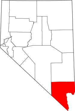 | |
| CDPs | ||
| Unincorporated communities | ||
| Townships |
| |
| Ghost towns | ||
| Indian reservations | ||
| Footnotes | ‡This populated place also has portions in an adjacent county or counties | |