Dawson County, Georgia
| Dawson County, Georgia | |
|---|---|
 Dawson County Courthouse in Dawsonville | |
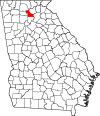 Location in the U.S. state of Georgia | |
 Georgia's location in the U.S. | |
| Founded | 1857 |
| Named for | William Crosby Dawson |
| Seat | Dawsonville |
| Largest city | Dawsonville |
| Area | |
| • Total | 214 sq mi (554 km2) |
| • Land | 211 sq mi (546 km2) |
| • Water | 3.6 sq mi (9 km2), 1.7% |
| Population | |
| • (2010) | 22,330 |
| • Density | 106/sq mi (41/km²) |
| Congressional district | 9th |
| Time zone | Eastern: UTC-5/-4 |
| Website |
www |
Dawson County is a county located in the north central portion of the U.S. state of Georgia. As of the 2010 census, the population was 22,330.[1] The county seat is Dawsonville.[2]
Dawson County is included in the Atlanta-Sandy Springs-Roswell, GA Metropolitan Statistical Area.
History
Dawson County was created on December 3, 1857 from Gilmer and Lumpkin counties. It is named for William Crosby Dawson, a U.S. Senator from Georgia.[3]
Civil War
The 1860s brought war and hardships to the people of Dawson County. The men of Dawson County answered the call and went to defend their homes from the invading Federal Army. The following Confederate units were raised in Dawson County.
21st Regiment, Georgia Infantry, Company E Concord Rangers
22nd Regiment, Georgia Infantry, Company I, Dawson County Independents
38th Regiment, Georgia Infantry, Company I (Wright's Legion), Dawson Farmers
38th Regiment, Georgia Infantry, Company L (Wright's Legion)
52nd Regiment, Georgia Volunteer Infantry, Company I
Post Civil War
The county is known in auto racing circles for its long tradition of involvement in the sport as many of the original NASCAR racers were from this area. Many racing skills originally developed as a consequence of running moonshine down highway 9 to Atlanta, also known as Thunder Road. Celebrations of Dawson County's history and of its involvement occur every October with the Moonshine Festival.
Locals have referred to Dawson County as the Moonshine Capital of the World. This title is claimed by many other areas but is fiercely defended by residents of the area. This is due to the secluded area and the ability to move so much moonshine to the larger cities, especially Atlanta.
Education
Dawson County currently serves grades K-12. It has a total of 7 schools, 1 solely for Pre-K, 3 being for grades K-5, 2 being for grades 6-8, and 1 being for grades 9-12.
Dawson Head Start Pre-K
Blacks Mill Elementary School (K-5)
Kilough Elementary School (K-5)
Riverview Elementary School (K-5)
Riverview Middle School (6-8)
Dawson County Middle School (6-8)
Dawson County High School (9-12)
Soon, in the 2016-2017 year, Riverview Middle School will serve grades 6-7, and Dawson County Middle School will serve Grade 8. In the 2017-2018 year, Grade 9 will be moved to Dawson County Middle School, with Dawson County High School serving grades 10-12
Geography

According to the U.S. Census Bureau, the county has a total area of 214 square miles (550 km2), of which 211 square miles (550 km2) is land and 3.6 square miles (9.3 km2) (1.7%) is water.[4]
Part of Lake Lanier is in the southeastern part of the county and the boundary line with neighboring counties pass through the lake. The 729-foot (222 m) Amicalola Falls, are located in the county. The Amicalola Falls are the highest in Georgia, the tallest cascading waterfall east of the Mississippi River and are one of the Seven Natural Wonders of Georgia. The highest point in the county is Black Mountain, with an elevation of 3,600 feet (1,100 m). 6,760 acres (27.4 km2), which is located in the Chattahoochee National Forest. The Chestatee and Etowah rivers flow through Dawson County.
The vast majority of Dawson County is located in the Etowah River sub-basin of the ACT River Basin (Coosa-Tallapoosa River Basin). The southeastern tip of the county is located in the Upper Chattahoochee River sub-basin of the ACF River Basin (Apalachicola-Chattahoochee-Flint River Basin), and a very small northern section of Dawson County is located in the Coosawattee River sub-basin of the larger ACT River Basin.[5]
Major highways
 U.S. Route 19
 State Route 9
 State Route 52
 State Route 53
 State Route 136
 State Route 183
 State Route 400
Secondary Highways
- Cowart Road
- Steve Tate Highway
- Burnt Mountain Road (Old SR 108)
- Dawson Forest Road (Old SR 318)
- Lumpkin Campground Road (Old SR 9E)
- Harmony Church Road (Old SR 9E)
- Auraria Road (Old SR 9E)
- Keith Evans Road (Old SR 342)
- Bailey Waters Road (Old SR 342)
- Shoal Creek Road (Old SR 136 Spur)
- Nix Bridge Road (Old SR 226)
Adjacent counties
- Fannin County - north
- Lumpkin County - northeast
- Hall County - east
- Forsyth County - south
- Cherokee County - southwest
- Pickens County - west
- Gilmer County - northwest
National protected area
Demographics
| Historical population | |||
|---|---|---|---|
| Census | Pop. | %± | |
| 1860 | 3,856 | — | |
| 1870 | 4,369 | 13.3% | |
| 1880 | 5,837 | 33.6% | |
| 1890 | 5,612 | −3.9% | |
| 1900 | 5,442 | −3.0% | |
| 1910 | 4,686 | −13.9% | |
| 1920 | 4,204 | −10.3% | |
| 1930 | 3,502 | −16.7% | |
| 1940 | 4,479 | 27.9% | |
| 1950 | 3,712 | −17.1% | |
| 1960 | 3,590 | −3.3% | |
| 1970 | 3,639 | 1.4% | |
| 1980 | 4,774 | 31.2% | |
| 1990 | 9,429 | 97.5% | |
| 2000 | 15,999 | 69.7% | |
| 2010 | 22,330 | 39.6% | |
| Est. 2015 | 23,312 | [6] | 4.4% |
| U.S. Decennial Census[7] 1790-1960[8] 1900-1990[9] 1990-2000[10] 2010-2013[1] | |||
2000 census
As of the census[11] of 2010, there were 22,330 people, and 10,425 households, and 6,390 families residing in the county. The racial makeup of the county was 95.62% White, 0.5% Black or African American, 0.4% Native American, 0.6% Asian, <0.01% Pacific Islander, 1.6% from other races, and 1.4% from two or more races. 4.1% of the population were Hispanic or Latino of any race.
There were 8,433 households out of which 21.9% had children under the age of 18 living with them, 61.7% were married couples living together, 9.5% had a female householder with no husband present, 4.6% had a male householder with no wife present, and 24.2% were non-families. 19.7% of all households were made up of individuals living alone and 6.5% had someone living alone who was 65 years of age or older. The average household size was 2.61 and the average family size was 2.97.
In the county the population was spread out with 5.7% under the age of 5, 6.5% between 5–9 years, 6.8% between 10–14 years, 6.0% between 15–19 years, 6.1% between 20–24 years, 5.7% between 25–29 years, 5.8% between 30–34 years, 6.6% between 35–39 years, 6.9% between 40–44 years, 8.1% between 45–49 years, 7.2% between 50–54 years, 7.0% between 55–59 years, 7.6% between 60–64 years, 6.0% between 65–69 years, 3.6% between 70–74 years, 2.4% between 75–79 years, 1.3% between 80–84 years, and 0.8 over age 85. The median age was 40.6 years. 50% (11,164) were male, and 50% (11,166) were female.
The median income for a household in the county was estimated $51,989, and the median income for a family was estimated $60,455. About 8.9% of families and 13.5% of the population were below the poverty line, including 16.0% of those under age 18 and 6.3% of those age 65 or over.[12]
2010 census
As of the 2010 United States Census, there were 22,330 people, 8,433 households, and 6,390 families residing in the county.[13] The population density was 105.9 inhabitants per square mile (40.9/km2). There were 10,425 housing units at an average density of 49.4 per square mile (19.1/km2).[14] The racial makeup of the county was 95.6% white, 0.6% Asian, 0.5% black or African American, 0.4% American Indian, 1.6% from other races, and 1.4% from two or more races. Those of Hispanic or Latino origin made up 4.1% of the population.[13] In terms of ancestry, 18.9% were American, 18.8% were Irish, 14.7% were English, and 13.6% were German.[15]
Of the 8,433 households, 33.0% had children under the age of 18 living with them, 61.7% were married couples living together, 9.5% had a female householder with no husband present, 24.2% were non-families, and 19.7% of all households were made up of individuals. The average household size was 2.61 and the average family size was 2.97. The median age was 40.6 years.[13]
The median income for a household in the county was $51,128 and the median income for a family was $60,236. Males had a median income of $41,726 versus $31,978 for females. The per capita income for the county was $25,557. About 7.8% of families and 12.0% of the population were below the poverty line, including 16.0% of those under age 18 and 5.3% of those age 65 or over.[16]
Cities and Communities
Incorporated Cities
Unincorporated Communities
- Juno
- Afton
Private Communities
There are large, gated private communities that function similar to a municipality providing many municipal-type services that operate independent of county government.
- Paradise Valley Resort (a private residential/recreational community)
Famous residents
- Bill Elliott - NASCAR Racer & Champion
- Chase Elliott - NASCAR Racer & 2014 NASCAR Xfinity Series Champion
- Gober Sosebee - Stock Car Racer (3 time Daytona Champion)
- Jerry Glanville - National Football League head coach, NASCAR driver
- Bill Goldberg - professional wrestler and actor (once resided in Dawson County)
See also
References
- 1 2 "State & County QuickFacts". United States Census Bureau. Retrieved February 15, 2014.
- ↑ "Find a County". National Association of Counties. Retrieved 2011-06-07.
- ↑ Gannett, Henry (1905). The Origin of Certain Place Names in the United States. Govt. Print. Off. p. 101.
- ↑ "US Gazetteer files: 2010, 2000, and 1990". United States Census Bureau. 2011-02-12. Retrieved 2011-04-23.
- ↑ "Georgia Soil and Water Conservation Commission Interactive Mapping Experience". Georgia Soil and Water Conservation Commission. Retrieved 2015-11-19.
- ↑ "County Totals Dataset: Population, Population Change and Estimated Components of Population Change: April 1, 2010 to July 1, 2015". Retrieved July 2, 2016.
- ↑ "U.S. Decennial Census". United States Census Bureau. Retrieved June 21, 2014.
- ↑ "Historical Census Browser". University of Virginia Library. Retrieved June 21, 2014.
- ↑ "Population of Counties by Decennial Census: 1900 to 1990". United States Census Bureau. Retrieved June 21, 2014.
- ↑ "Census 2000 PHC-T-4. Ranking Tables for Counties: 1990 and 2000" (PDF). United States Census Bureau. Retrieved June 21, 2014.
- ↑ http://factfinder2.census.gov/faces/tableservices/jsf/pages/productview.xhtml?pid=DEC_10_DP_DPDP1
- ↑ http://factfinder2.census.gov/faces/tableservices/jsf/pages/productview.xhtml?pid=ACS_11_5YR_DP03
- 1 2 3 "DP-1 Profile of General Population and Housing Characteristics: 2010 Demographic Profile Data". United States Census Bureau. Retrieved 2015-12-29.
- ↑ "Population, Housing Units, Area, and Density: 2010 - County". United States Census Bureau. Retrieved 2015-12-29.
- ↑ "DP02 SELECTED SOCIAL CHARACTERISTICS IN THE UNITED STATES – 2006-2010 American Community Survey 5-Year Estimates". United States Census Bureau. Retrieved 2015-12-29.
- ↑ "DP03 SELECTED ECONOMIC CHARACTERISTICS – 2006-2010 American Community Survey 5-Year Estimates". United States Census Bureau. Retrieved 2015-12-29.
External links
- Archives of Dawson County, Roadside Georgia
- Dawson County historical marker
 |
Gilmer County | Fannin County | Lumpkin County | |
| Pickens County | |
Hall County | ||
| ||||
| | ||||
| Cherokee County | Forsyth County |
Municipalities and communities of Dawson County, Georgia, United States | ||
|---|---|---|
| City | | |
| Unincorporated communities | ||
| Footnotes | ‡This populated place also has portions in an adjacent county or counties | |
|  | |||||||
|
| ||||||||
| ||||||||
Coordinates: 34°26′N 84°10′W / 34.44°N 84.17°W