Douglasville, Georgia
| Douglasville, Georgia | |
|---|---|
| City | |
| Motto: "New Growth, Old Charm, Always Home"[1] | |
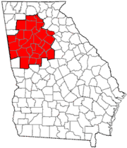
 Location in Douglas County and the state of Georgia | |
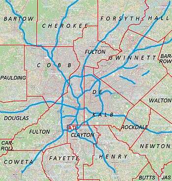 Douglasville Location of Douglasville in Metro Atlanta | |
| Coordinates: 33°44′59″N 84°43′23″W / 33.74972°N 84.72306°W | |
| Country | United States |
| State | Georgia |
| County | Douglas |
| Government | |
| • Mayor | Rochelle Robinson |
| • City Manager | Marcia Hampton |
| Area | |
| • Total | 22.6 sq mi (58.5 km2) |
| • Land | 22.5 sq mi (58.2 km2) |
| • Water | 0.1 sq mi (0.3 km2) |
| Elevation | 1,201 ft (366 m) |
| Population (2010)[2] | |
| • Total | 30,961 |
| • Estimate (2014)[3] | 32,523 |
| • Density | 1,448/sq mi (559.0/km2) |
| Time zone | EST (UTC-5) |
| • Summer (DST) | EDT (UTC-4) |
| ZIP codes | 30134, 30135 |
| Area code(s) | 770/678/470 |
| FIPS code | 13-23900[4] |
| GNIS feature ID | 0355535[5] |
| Website |
www |
The city of Douglasville is the county seat of Douglas County, Georgia, United States. As of the 2010 census, the city had a population of 30,961,[2] up from 20,065 at the 2000 census. Douglasville is located approximately 20 miles (32 km) west of Atlanta and is part of the Atlanta Metro Area.
Highway access can be obtained via three interchanges along Interstate 20.
History
Located along a natural rise in the topography, Douglasville was originally known as "Skint Chestnut". The name derived from a large tree used by Native Americans as a landmark, which was stripped of its bark so as to be more conspicuous.
Douglasville was founded in 1874 as the railroad arrived into the area. That same year, Douglasville was designated county seat of the recently formed Douglas County. The community was named for Senator Stephen A. Douglas.[6]
An election was held on the first Saturday in March 1875, and a mayor, treasurer, records (secretary), and marshal were chosen.
In 1916, the Reverend Atkinson of Douglasville was a key figure in the Arc Light Controversy in Atlanta.
Natural disasters
On September 21, 2009, Douglas County was devastated by the worst flood in Georgia history. Over 18 inches (457 mm) of rain fell in one night, destroying many roads and homes. The county was later declared a disaster area, and the governor of Georgia declared a state of emergency. The flooding most affected the areas of Douglasville, Villa Rica, Austell, Lithia Springs, and Chapel Hill. The disaster killed more than eight people in the county, most of them in the Douglasville area.
Geography
Douglasville is located in north-central Douglas County at 33°44′59″N 84°43′23″W / 33.74972°N 84.72306°WCoordinates: 33°44′59″N 84°43′23″W / 33.74972°N 84.72306°W (33.749824, −84.723190). Lithia Springs is 6 miles (10 km) to the northeast along U.S. Route 78, and Villa Rica is 10 miles (16 km) to the west. Hiram is 9 miles (14 km) to the north via SR 92. Downtown Atlanta is 22 miles (35 km) to the east via Interstate 20.
According to the United States Census Bureau, Douglasville has a total area of 22.6 square miles (58.5 km2), of which 22.5 square miles (58.2 km2) is land and 0.1 square miles (0.3 km2), or 0.58%, is water.[2]
Douglasville has an elevation of 1,209 ft (369 m) above sea level.
Demographics
| Historical population | |||
|---|---|---|---|
| Census | Pop. | %± | |
| 1880 | 286 | — | |
| 1890 | 863 | 201.7% | |
| 1900 | 1,140 | 32.1% | |
| 1910 | 1,462 | 28.2% | |
| 1920 | 2,159 | 47.7% | |
| 1930 | 2,316 | 7.3% | |
| 1940 | 2,555 | 10.3% | |
| 1950 | 3,400 | 33.1% | |
| 1960 | 4,462 | 31.2% | |
| 1970 | 5,472 | 22.6% | |
| 1980 | 7,641 | 39.6% | |
| 1990 | 11,635 | 52.3% | |
| 2000 | 20,065 | 72.5% | |
| 2010 | 30,961 | 54.3% | |
| Est. 2015 | 32,897 | [7] | 6.3% |
2010 Census
As of the census of 2010, there were 30,961 people, 11,627 households, and 7,692 families residing in the city. The population density was 1,376 people per square mile (532.0/km²). There were 13,163 housing units at an average density of 585.0 per square mile (226.2/km²). The racial makeup of the city was 36.0% White (33.4% Non-Hispanic White), 55.9% African American, 0.2% Native American, 1.8% Asian, 0.1% Pacific Islander, 3.3% from other races, and 2.8% from two or more races. 7.2% of the population were Hispanic or Latino of any race.
There were 11,627 households out of which 36.9% had children under the age of 18 living with them, 39.3% were married couples living together, 21.7% had a female householder with no husband present, and 33.8% were non-families. 28.3% of all households were made up of individuals and 5.4% had someone living alone who was 65 years of age or older. The average household size was 2.58 and the average family size was 3.18.
In the city the population was spread out with 28.3% under the age of 18, 9.5% from 18 to 24, 33.2% from 25 to 44, 22.2% from 45 to 64, and 6.8% who were 65 years of age or older. The median age was 32.7 years. For every 100 females there were 87.8 males. For every 100 females age 18 and over, there were 83.3 males.
The median income for a household in the city is $47,596, and the median income for a family was $54,375. Males had a median income of $45,933 versus $39,675 for females. The per capita income for the city was $26,002. 15.9% of the population and 14.1% of families were below the poverty line. Out of the total population, 22.2% of those under the age of 18 and 15.1% of those 65 and older are living below the poverty line.[8]
2000 Census
As of the census of 2000, there were 20,065 people, 7,286 households, and 5,078 families residing in the city. The population density was 938.5 people per square mile (362.4/km²). There were 7,903 housing units at an average density of 369.6 per square mile (142.7/km²). The racial makeup of the city was 63.84% White, 30.29% African American, 0.31% Native American, 1.73% Asian, 0.01% Pacific Islander, 1.69% from other races, and 2.13% from two or more races. 3.99% of the population were Hispanic or Latino of any race.
There were 7,286 households out of which 38.3% had children under the age of 18 living with them, 48.2% were married couples living together, 16.9% had a female householder with no husband present, and 30.3% were non-families. 22.8% of all households were made up of individuals and 5.6% had someone living alone who was 65 years of age or older. The average household size was 2.68 and the average family size was 3.16.
In the city the population was spread out with 28.3% under the age of 18, 11.1% from 18 to 24, 34.4% from 25 to 44, 19.6% from 45 to 64, and 6.6% who were 65 years of age or older. The median age was 31 years. For every 100 females there were 94.8 males. For every 100 females age 18 and over, there were 91.0 males.
The median income for a household in the city is $45,289, and the median income for a family was $52,340. Males had a median income of $37,464 versus $27,038 for females. The per capita income for the city was $22,283. 12.2% of the population and 10.1% of families were below the poverty line. Out of the total population, 17.3% of those under the age of 18 and 8.1% of those 65 and older are living below the poverty line.[8]
Economy
While Downtown hosts many shops and eateries, the main business area in Douglasville is located south of the city between Chapel Hill Road and Georgia State Route 5, around the Douglas Boulevard Corridor. Arbor Place Mall is located in this area, as well as many major retail stores and fast food chains.
The Fairburn Road area also hosts many shops, food stores and fast food, but some were in the process of vacating for an expansion of the highway set to begin in early 2008.
Expansion is aided by the Douglasville Development Authority (described below).
Top employers
According to Douglasville's 2011 Comprehensive Annual Financial Report,[9] the top employers in the city are:
| # | Employer | # of Employees |
|---|---|---|
| 1 | Walmart | 750 |
| 2 | Kroger | 487 |
| 3 | American Red Cross | 450 |
| 4 | Benton-Georgia | 300 |
| 5 | Sam's Club | 180 |
| 6 | The Home Depot | 155 |
| 7 | A.L.P. Lighting Components | 120 |
| 8 | Medline | 111 |
| 9 | G & L Marble | 96 |
| 10 | Reflek Manufacturing | 75 |
The Douglasville CAFR table of principal employers (p. 77) does not show public employees. The Douglas County School System currently employs over 3,550 employees, including teachers, administrators, and support staff.[10]
Arts & culture
Points of interest

The Central Business District (CBD) of downtown Douglasville is listed on the National Register of Historic Places as a historic district; it is an outstanding example of a turn-of-the-century southern railroad town. The majority of the buildings are one- and two-story brick structures dating from the mid-19th century into the mid-20th century. Most are of Victorian era commercial design set flush with the sidewalk. Styles of the buildings include Romanesque, Italianate, and Queen Anne. Many of the doorways and windows have Gothic arched openings and hooded windows. The dominant landscape feature is the railroad right-of-way running east-to-west through downtown.
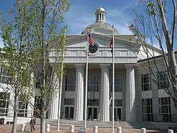
In the center of town is a small plaza, which was converted from a street block, known as O'Neal Plaza (named after the former O'Neal's department store, now the Douglasville City Hall). The plaza features a brick pyramid fountain and a small performance venue. It is home to many festivals year round. The Douglasville School of Art makes its home on the plaza, and the annual Christmas Tree Lighting Festival also makes its home here.
- The Douglasville Convention & Visitors Bureau is located in the heart of downtown and serves as the city's welcome center.
- The Douglas County Cultural Arts Center is located at Campbellton Street south of Downtown. The center holds art shows and special events throughout the year, and hosts events for schools across the county.
- The new courthouse on Hospital Drive hosts the Douglasville Farmer's and Artisan's Market every Wednesday from 4 pm until 7 pm from April until November. Shoppers can find local and organic produce and products, including raw honey, free range eggs, meat, jams and jellies.
- The Douglasville Downtown Conference Center is located at 6701 Church Street. The conference center hosts corporate meetings, community events, and social gatherings. Summit Church of West Georgia meets in the conference center on Sunday mornings. A new 37,000-square-foot (3,400 m2) conference center with a two-level, 300-space parking deck, opened in early 2013. The new conference center has a 7,600-foot (2,300 m) ballroom space that can be divided into five rooms. It includes a 150-seat auditorium, a 15-person boardroom, a business center, three meeting rooms, two pre-function spaces, bride and groom dressing rooms, and a terrace in the back.
- Arbor Place Mall is home to over 100 shops and restaurants. The anchor stores are Dillard's, Sears, Macy's, Belk, J.C. Penney, Old Navy and Bed Bath & Beyond. The mall sponsors many festivals, as well as Douglasville's July 4 celebrations.
- The 7 Venue is a music venue consisting of two stages. Mainly local Christian metal and metalcore bands play here. Well-known bands that have played here include Underoath, Maylene and the Sons of Disaster, Sky Eats Airplane, Drop Dead, Gorgeous, The Chariot, and The Glass Ocean.
- The Boundary Waters Aquatic Center, located on GA Highway 92 North/Highway 166 East, has several pools which are open to the public. These pools include an indoor heated pool, an outdoor saltwater pool, an unheated chlorinated pool, a shallower children's pool, a paddling pool for toddlers and infants, and a sauna.
- Champ's Clock Shop and Museum: The World's Largest and Finest Selection of clocks. Attractions Include the World's Largest Real Cuckoo Clock, The Operating 1865 John Moore & Son's English Tower Clock, Over A thousand clocks on display all in a Museum quality environment.
Parks & recreation
- Hunter Park is Douglasville's largest park and home to the Douglas County Boys & Girls Club. Many festivals, sports activities and recreation in the city are at Hunter Park. The park features a playground, wildlife pond and trail, 7 tennis courts, 11 baseball/softball fields, including one designed for the handicapped, and an 18-hole disc golf course that opened in 2015. The small train for children that operated during the summer no longer exists. The park is named after the late 1st Lt. "Jerry" Hunter (USAF), Douglas County's first casualty of the Vietnam War.
- Deer Lick Park is located approximately 3 miles (5 km) south of Interstate 20 east of the city limits on Mack Road.
- The West Pines Golf Club was purchased by the city in 2003 and is now operated as a public course.
- The Fowler Field Soccer Complex is located in the southwest part of the city on Chapel Hill Road.
- The Chestnut Log Soccer Complex is located on Pope Road beside Chestnut Log Middle School, about ½ mile west of SR 92 (Fairburn Road).
- Jesse Davis Park is located north of downtown Douglasville and serves as a neighborhood park for residents of North Douglasville. The park was recently renovated, and has a playground as well as a community swimming pool.
- Sweetwater Creek State Park is a 2,549-acre (10.32 km2) park 7 miles (11 km) east of Douglasville. The park has 9 miles (14 km) of wooded trails that follow the stream to the ruins of the New Manchester Manufacturing Company, a textile mill burned during the Civil War. The park has a 215-acre (0.87 km2) lake with two fishing docks, canoe and fishing boat rentals, 11 picnic shelters, playground, visitors center and museum.
- Clinton Nature Preserve is 7 miles (11 km) west of Douglasville, near Villa Rica.
Government
Law enforcement
The Douglasville police chief is Gary Sparks.[11] The Douglasville Police Department is located at 2083 Fairburn Road.[12] The sheriff is Tim Pounds, and the Douglas County Sheriff's Office is located at 8470 Earl D Lee Boulevard in Douglasville.[13]
Education
Education in Douglasville is varied with a large public school system,[14] many private schools,[15][16][17][18][19][20] and several nearby universities and colleges.[21][22][23]
The Douglas County School District operates 21 elementary schools, eight middle schools, and five high schools covering grades pre-K to 12th grade.[24]
Douglasville is home to many secular and religious private schools including:
- Heirway Christian Academy[15]
- Harvester Christian Academy[25]
- St. Rose Academy[17]
- Primrose School at Brookmont[26]
- The International Montessori Academy[27]
- The Kings Way Christian School[28]
- Sunbrook Academy at Chapel Hill[29]
Douglasville is served by such institutes of higher learning as Strayer University,[21] Mercer University[23] and West Georgia Technical College,[22] all of which have campuses in or near the city.
Media
Douglasville is served by the Douglas County Sentinel, a three-day-a-week publication that covers local and state news.
Infrastructure
Transportation
- U.S. Highway 78 (State Route 8, Veterans' Memorial Highway) runs directly east to west through downtown Douglasville.
- State Route 92 runs north to southeast just ¼ of a mile to the east of downtown as a truck route designed to keep large trucks from crossing an elevated railroad crossing at Campbellton Street. The city and the Georgia DOT are working on plans to reroute Highway 92 farther east of downtown on a four-lane bridge serving as a bypass.
- State Route 5 is colocated with US 78 through downtown east to the Cobb County line and west just past Hunter Park. Highway 5 continues in a southwesterly direction through the village of Bill Arp and crosses into Carroll County near Whitesburg.
- Interstate 20 (Ga Hwy 402) extends roughly east to west about 1.5 miles (2.4 km) south of downtown, with access from Exits 34, 36, and 37.
Douglasville is home to single-runway Pinewood Airport, located 5.7 miles (9.2 km) northwest of downtown.[30]
Healthcare
Residents of Douglasville are served by the WellStar Douglas Hospital located at 8954 Hospital Drive; it has 98 licensed beds.[31]
Douglasville Development Authority
The primary goals of the City of Douglasville Development Authority (CDDA) are to promote the economic prosperity of that city while simultaneously increasing the existing industry and business sectors in order to raise the quality of life for the city's residents. The City Development Authority also focuses on education in order successfully promote the labor force.
In fall 2009, an area of interest for the CDDA was the reconstruction and widening of Highway 92, which runs through the heart of the city.[32] This major roadway reconstruction was expected to have a significant impact on the city and its ability to promote economic development.
See also
References
- ↑ "City of Douglasville Georgia". City of Douglasville. Retrieved September 6, 2012.
- 1 2 3 "Geographic Identifiers: 2010 Demographic Profile Data (G001): Douglasville city, Georgia". U.S. Census Bureau, American Factfinder. Retrieved October 23, 2015.
- ↑ "Annual Estimates of the Resident Population for Incorporated Places: April 1, 2010 to July 1, 2014". Retrieved June 4, 2015.
- ↑ "American FactFinder". United States Census Bureau. Retrieved 2008-01-31.
- ↑ "US Board on Geographic Names". United States Geological Survey. 2007-10-25. Retrieved 2008-01-31.
- ↑ Hellmann, Paul T. (May 13, 2013). Historical Gazetteer of the United States. Routledge. p. 228. Retrieved 30 November 2013.
- ↑ "Annual Estimates of the Resident Population for Incorporated Places: April 1, 2010 to July 1, 2015". Retrieved July 2, 2016.
- 1 2 3 "Census of Population and Housing". Census.gov. Retrieved June 4, 2015.
- ↑ City of Douglasville CAFR
- ↑ douglas.k12.ga.us
- ↑ "Douglasville Police Department | Douglasville, GA - Official Website". www.ci.douglasville.ga.us. Retrieved 2016-12-02.
- ↑ Douglasville official website
- ↑ http://www.sheriff.douglas.ga.us/
- ↑ "Douglas County School District". Douglas.k12.ga.us. November 7, 2011. Retrieved November 13, 2011.
- 1 2 "Heirway Christian Academy". Heirway Christian Academy. Retrieved November 13, 2011.
- ↑ "Harvester Academy". Harvester Academy. Retrieved November 13, 2011.
- 1 2 "St. Rose Academy". Saintroseacademy.net. September 29, 2004. Retrieved November 13, 2011.
- ↑ "Primrose School". Primroseschools.com. November 1, 2011. Retrieved November 13, 2011.
- ↑ "Kings Way Christian School". Kwcsinfo.com. Retrieved November 13, 2011.
- ↑ "Welcome theinternationalmontessoriacademy.com". Theinternationalmontessoriacademy.com. Retrieved November 13, 2011.
- 1 2 "Strayer University". Strayer.edu. July 22, 2011. Retrieved November 13, 2011.
- 1 2 "West Georgia Technical College". Westgatech.edu. September 20, 2010. Retrieved November 13, 2011.
- 1 2 "Mercer University". Mercer.edu. Retrieved November 13, 2011.
- ↑ Georgia Board of Education. Retrieved July 30, 2010.
- ↑ "Harvester Christian Academy". Harvesteracademy.com. Retrieved November 13, 2011.
- ↑ "Primrose School at Brookmont". Primroseschools.com. November 1, 2011. Retrieved November 13, 2011.
- ↑ "The International Montessori Academy". The International Montessori Academy. Retrieved November 13, 2011.
- ↑ "The Kings Way Christian School". Kwcsinfo.com. Retrieved November 13, 2011.
- ↑ Sunbrook Academy at Chapel Hill
- ↑ "Pinewood Airport". Airnav.com. Retrieved November 13, 2011.
- ↑ Wellstar Douglas Hospital
- ↑ "Douglasville Highway 92 Project". Gagwy92.com. 2009.
External links
| Wikimedia Commons has media related to Douglasville, Georgia. |
- City of Douglasville official website
- City of Douglasville Development Authority
- Douglas County Sheriff's Office
- Douglasville Convention & Visitors Bureau
|  | |||||||
|
| ||||||||
| ||||||||
Municipalities and communities of Douglas County, Georgia, United States | ||
|---|---|---|
| Cities | 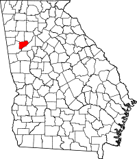 | |
| CDP | ||
| Unincorporated communities | ||
| Footnotes | ‡This populated place also has portions in an adjacent county or counties | |
