Baldwin County, Georgia
| Baldwin County, Georgia | |
|---|---|
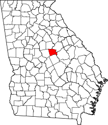 Location in the U.S. state of Georgia | |
 Georgia's location in the U.S. | |
| Founded | 1803 |
| Named for | Abraham Baldwin |
| Seat | Milledgeville |
| Largest city | Milledgeville |
| Area | |
| • Total | 267 sq mi (692 km2) |
| • Land | 258 sq mi (668 km2) |
| • Water | 9.6 sq mi (25 km2), 3.6% |
| Population | |
| • (2010) | 45,720 |
| • Density | 177/sq mi (68/km²) |
| Congressional district | 10th |
| Time zone | Eastern: UTC-5/-4 |
| Website |
www |
Baldwin County is a county located in the U.S. state of Georgia. As of the 2010 census, the population was 46,337.[1] The county seat is Milledgeville.[2]
Baldwin County is part of the Milledgeville, GA Micropolitan Statistical Area.
History
For centuries the land was occupied by the Creek Nation, and for thousands of years before them, varying cultures of indigenous peoples.
Part of the land ceded by the Creek Nation in the Treaty of Fort Wilkinson in 1802 was used to create Baldwin County on May 11, 1803, by the Georgia General Assembly, the state's legislative body.
The land west of the Oconee River was organized as Baldwin and Wilkinson counties. The Treaty of Washington with the Creek in 1805 extended the state's western boundary to the Ocmulgee River. A legislative act on June 26, 1806, added some of this additional land to both counties.
The state legislature subsequently passed an act on December 10, 1807 that created four new counties from Baldwin County's 1806 borders. It expanded Baldwin to the east with land from Hancock and Washington counties. The new counties were Morgan, Jones, Putnam, and present-day Jasper (originally named Randolph County at the time of the act).
The county is named for Abraham Baldwin, a signer of the United States Constitution, U.S. congressman representing Georgia, and the founder of the University of Georgia. Euroepan-American settlers moved rapidly into the area and developed large cotton plantations, made possible by the labor of slaves. Since the invention of the cotton gin, short-staple cotton could be profitably processed, and it was well-suited to the uplands of Georgia. What became known as the Black Belt of Georgia, an arc of fertile soil, was one of the destinations for slaves being sold from the Upper South, as well as from the Low Country.
The county seat of Milledgeville is the former state capital of Georgia (1804–1868). Other than Washington, DC, it is the only planned capital city in the United States.
Because of its central location within the state and its abundant supply of water from the Oconee River, Milledgeville grew rapidly into a bustling frontier settlement. On November 2, 1807, the state legislature held its first session in the newly completed statehouse in Milledgeville. Georgia's first state penitentiary was also built within the historic city limits of Milledgeville in 1817. This site is now used as part of the campus of Georgia College and State University. In 1837 the General Assembly provided for the establishment of the state's first mental asylum, today known as Central State Hospital.
When the state of Georgia seceded from the Union in January 1861 during a legislative session held in Milledgeville, Baldwin County became a target for Union forces. When Union general William T. Sherman's made his devastating March to the Sea through Georgia, his troops occupied the capital city in November 1864. Sherman and his Union armies burned the state penitentiary, vandalized the city, and held a mock session of the legislature in the statehouse to repeal the state's ordinance of secession.
In 1868, after the Civil War (1861–65), Georgia's capital was moved from Milledgeville to its present location in Atlanta. Today Milledgeville is home to two institutions of higher education: Georgia College and State University and Georgia Military College. Founded in 1889 as the Georgia Normal and Industrial College for Women, Georgia College and State University has since grown to become the state's premier public liberal arts university. Georgia Military College, founded in 1879, now occupies the Old Capitol Building.
In addition to the Old Capitol and Governor's Mansion, visitors to Baldwin County can explore Andalusia, writer Flannery O'Connor's family farm; Milledgeville's historic district; and the Lockerly Arboretum, a botanical garden and nature education center that hosts the Lockerly Heritage Festival each September.
Notable residents
- Carl Vinson, who served for fifty years in the U.S. Congress, was born in Baldwin County.
- Oliver Hardy, comedian and film director, began his career in the Milledgeville Opera House.
- Flannery O'Connor, novelist and short-story writer, lived in Milledgeville. She is buried in her family plot in the city's historic Memory Hill Cemetery.
Geography
According to the U.S. Census Bureau, the county has a total area of 267 square miles (690 km2), of which 258 square miles (670 km2) is land and 9.6 square miles (25 km2) (3.6%) is water.[3]
The majority of Baldwin County, south of Lake Sinclair, is located in the Lower Oconee River sub-basin of the Altamaha River basin. The northern portion of the county is located in the Upper Oconee River sub-basin of the same Altamaha River basin.[4]
Major highways
-
 U.S. Route 441
- U.S. Route 441 Business
-
 State Route 22
 -
 State Route 24
 -
 State Route 29
 -
 State Route 49
 -
 State Route 112
 -
 State Route 212
 -
 State Route 243
 -
 State Route 540 (Fall Line Freeway) (coming soon)
Adjacent Counties
- Putnam County, Georgia - north
- Hancock County, Georgia - northeast
- Washington County, Georgia - east
- Wilkinson County, Georgia - south
- Jones County, Georgia - west
Demographics
| Historical population | |||
|---|---|---|---|
| Census | Pop. | %± | |
| 1810 | 6,356 | — | |
| 1820 | 7,734 | 21.7% | |
| 1830 | 7,295 | −5.7% | |
| 1840 | 7,250 | −0.6% | |
| 1850 | 8,148 | 12.4% | |
| 1860 | 9,078 | 11.4% | |
| 1870 | 10,618 | 17.0% | |
| 1880 | 13,806 | 30.0% | |
| 1890 | 14,608 | 5.8% | |
| 1900 | 17,768 | 21.6% | |
| 1910 | 18,354 | 3.3% | |
| 1920 | 19,791 | 7.8% | |
| 1930 | 22,878 | 15.6% | |
| 1940 | 24,190 | 5.7% | |
| 1950 | 29,706 | 22.8% | |
| 1960 | 34,064 | 14.7% | |
| 1970 | 34,240 | 0.5% | |
| 1980 | 34,686 | 1.3% | |
| 1990 | 39,530 | 14.0% | |
| 2000 | 44,700 | 13.1% | |
| 2010 | 45,720 | 2.3% | |
| Est. 2015 | 45,459 | [5] | −0.6% |
| U.S. Decennial Census[6] 1790-1960[7] 1900-1990[8] 1990-2000[9] 2010-2013[1] | |||
2000 census
As of the census[10] of 2010, there were 46,337 people, 14,758 households, and 9,843 families residing in the county. The population density was 173 people per square mile (67/km²). There were 17,173 housing units at an average density of 66 per square mile (26/km²). The racial makeup of the county was 54.17% White, 43.38% Black or African American, 0.21% Native American, 1.01% Asian, 0.01% Pacific Islander, 0.48% from other races, and 0.74% from two or more races. 1.36% of the population were Hispanic or Latino of any race.
There were 14,758 households out of which 31.00% had children under the age of 18 living with them, 43.90% were married couples living together, 18.20% had a female householder with no husband present, and 33.30% were non-families. 25.60% of all households were made up of individuals and 7.80% had someone living alone who was 65 years of age or older. The average household size was 2.50 and the average family size was 3.02.
In the county the population was spread out with 21.70% under the age of 18, 14.50% from 18 to 24, 31.20% from 25 to 44, 21.90% from 45 to 64, and 10.60% who were 65 years of age or older. The median age was 34 years. For every 100 females there were 117.30 males. For every 100 females age 18 and over, there were 119.70 males.
The median income for a household in the county was $35,159, and the median income for a family was $42,736. Males had a median income of $31,227 versus $22,718 for females. The per capita income for the county was $16,271. About 11.80% of families and 16.80% of the population were below the poverty line, including 22.80% of those under age 18 and 13.00% of those age 65 or over.
2010 census
As of the 2010 United States Census, there were 45,720 people, 16,788 households, and 10,373 families residing in the county.[11] The population density was 177.3 inhabitants per square mile (68.5/km2). There were 20,159 housing units at an average density of 78.2 per square mile (30.2/km2).[12] The racial makeup of the county was 54.9% white, 41.5% black or African American, 1.3% Asian, 0.2% American Indian, 0.8% from other races, and 1.2% from two or more races. Those of Hispanic or Latino origin made up 2.0% of the population.[11] In terms of ancestry, 24.0% were American, 7.9% were English, and 6.8% were Irish.[13]
Of the 16,788 households, 30.5% had children under the age of 18 living with them, 38.0% were married couples living together, 19.2% had a female householder with no husband present, 38.2% were non-families, and 26.9% of all households were made up of individuals. The average household size was 2.45 and the average family size was 2.97. The median age was 34.1 years.[11]
The median income for a household in the county was $37,237 and the median income for a family was $47,714. Males had a median income of $36,158 versus $26,576 for females. The per capita income for the county was $17,488. About 16.8% of families and 25.2% of the population were below the poverty line, including 31.6% of those under age 18 and 10.8% of those age 65 or over.[14]
Government
Baldwin State Prison (previously Georgia Women's Correctional Institution) of the Georgia Department of Corrections is located in Milledgeville.[15][16][17]
Education
Communities
See also
References
- 1 2 "State & County QuickFacts". United States Census Bureau. Retrieved June 17, 2014.
- ↑ "Find a County". National Association of Counties. Archived from the original on 2011-05-31. Retrieved 2011-06-07.
- ↑ "US Gazetteer files: 2010, 2000, and 1990". United States Census Bureau. 2011-02-12. Retrieved 2011-04-23.
- ↑ "Georgia Soil and Water Conservation Commission Interactive Mapping Experience". Georgia Soil and Water Conservation Commission. Retrieved 2015-11-21.
- ↑ "County Totals Dataset: Population, Population Change and Estimated Components of Population Change: April 1, 2010 to July 1, 2015". Retrieved July 2, 2016.
- ↑ "U.S. Decennial Census". United States Census Bureau. Archived from the original on May 11, 2015. Retrieved June 17, 2014.
- ↑ "Historical Census Browser". University of Virginia Library. Retrieved June 17, 2014.
- ↑ "Population of Counties by Decennial Census: 1900 to 1990". United States Census Bureau. Retrieved June 17, 2014.
- ↑ "Census 2000 PHC-T-4. Ranking Tables for Counties: 1990 and 2000" (PDF). United States Census Bureau. Retrieved June 17, 2014.
- ↑ "American FactFinder". United States Census Bureau. Archived from the original on 2013-09-11. Retrieved 2011-05-14.
- 1 2 3 "DP-1 Profile of General Population and Housing Characteristics: 2010 Demographic Profile Data". United States Census Bureau. Retrieved 2015-12-27.
- ↑ "Population, Housing Units, Area, and Density: 2010 - County". United States Census Bureau. Retrieved 2015-12-27.
- ↑ "DP02 SELECTED SOCIAL CHARACTERISTICS IN THE UNITED STATES – 2006-2010 American Community Survey 5-Year Estimates". United States Census Bureau. Retrieved 2015-12-27.
- ↑ "DP03 SELECTED ECONOMIC CHARACTERISTICS – 2006-2010 American Community Survey 5-Year Estimates". United States Census Bureau. Retrieved 2015-12-27.
- ↑ "2010 Census - Census Block Map Milledgeville, GA." U.S. Census Bureau. Retrieved on November 18, 2012.
- ↑ "2010 Census - Census Block Map Milledgeville, GA Block 5." U.S. Census Bureau. Retrieved on November 18, 2012.
- ↑ "Baldwin State Prison." Georgia Department of Corrections. Retrieved on November 18, 2012. "ADDRESS: LAYING FARM ROAD / POST OFFICE BOX 218 HARDWICK, GA 31034"
Further reading
- Anna Maria Green Cook, The History of Baldwin County, Georgia. (1925) Spartanburg, SC: Reprint Co., 1978.
External links
 |
Putnam County | Hancock County | | |
| Jones County | |
Washington County | ||
| ||||
| | ||||
| Wilkinson County |
Municipalities and communities of Baldwin County, Georgia, United States | ||
|---|---|---|
| City | | |
| CDP | ||
Coordinates: 33°04′N 83°15′W / 33.07°N 83.25°W