Candler County, Georgia
| Candler County, Georgia | |
|---|---|
 Candler County courthouse in Metter | |
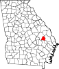 Location in the U.S. state of Georgia | |
 Georgia's location in the U.S. | |
| Founded | 1914 |
| Named for | Allen D. Candler |
| Seat | Metter |
| Largest city | Metter |
| Area | |
| • Total | 249 sq mi (645 km2) |
| • Land | 243 sq mi (629 km2) |
| • Water | 5.8 sq mi (15 km2), 2.3% |
| Population | |
| • (2010) | 10,998 |
| • Density | 45/sq mi (17/km²) |
| Congressional district | 12th |
| Time zone | Eastern: UTC-5/-4 |
| Website |
metter-candler |
Candler County is a county located in the U.S. state of Georgia. As of the 2010 census, the population was 10,998.[1] The county seat is Metter.[2] The county was founded in 1914 and named for Allen D. Candler, the 56th governor of Georgia.[3]
Geography
According to the U.S. Census Bureau, the county has a total area of 249 square miles (640 km2), of which 243 square miles (630 km2) is land and 5.8 square miles (15 km2) (2.3%) is water.[4]
The majority of Candler County is located in the Canoochee River sub-basin of the Ogeechee River basin. The very western edge of the county, west of State Route 57, is located in the Ohoopee River sub-basin of the Altamaha River basin.[5]
Major highways
-
 Interstate 16
 -
 State Route 23
 -
 State Route 46
 -
 State Route 57
 -
 State Route 121
 -
 State Route 129
 -
 State Route 404
Adjacent counties
- Bulloch County (east)
- Evans County (southeast)
- Tattnall County (south)
- Emanuel County (northwest)
Demographics
| Historical population | |||
|---|---|---|---|
| Census | Pop. | %± | |
| 1920 | 9,228 | — | |
| 1930 | 8,991 | −2.6% | |
| 1940 | 9,103 | 1.2% | |
| 1950 | 8,063 | −11.4% | |
| 1960 | 6,672 | −17.3% | |
| 1970 | 6,412 | −3.9% | |
| 1980 | 7,518 | 17.2% | |
| 1990 | 7,744 | 3.0% | |
| 2000 | 9,577 | 23.7% | |
| 2010 | 10,998 | 14.8% | |
| Est. 2015 | 10,886 | [6] | −1.0% |
| U.S. Decennial Census[7] 1790-1960[8] 1900-1990[9] 1990-2000[10] 2010-2013[1] | |||
2000 census
As of the census[11] of 2000, there were 9,577 people, 3,375 households, and 2,426 families residing in the county. The population density was 39 people per square mile (15/km²). There were 3,893 housing units at an average density of 16 per square mile (6/km²). The racial makeup of the county was 65.45% White, 27.08% Black or African American, 0.19% Native American, 0.28% Asian, 0.03% Pacific Islander, 6.16% from other races, and 0.81% from two or more races. 9.21% of the population were Hispanic or Latino of any race.
There were 3,375 households out of which 33.70% had children under the age of 18 living with them, 52.80% were married couples living together, 14.30% had a female householder with no husband present, and 28.10% were non-families. 23.90% of all households were made up of individuals and 11.40% had someone living alone who was 65 years of age or older. The average household size was 2.72 and the average family size was 3.17.
In the county the population was spread out with 26.80% under the age of 18, 9.40% from 18 to 24, 26.10% from 25 to 44, 22.50% from 45 to 64, and 15.20% who were 65 years of age or older. The median age was 36 years. For every 100 females there were 100.60 males. For every 100 females age 18 and over, there were 96.40 males.
The median income for a household in the county was $25,022, and the median income for a family was $30,705. Males had a median income of $24,482 versus $18,750 for females. The per capita income for the county was $12,958. About 21.40% of families and 26.10% of the population were below the poverty line, including 36.90% of those under age 18 and 22.00% of those age 65 or over.
2010 census
As of the 2010 United States Census, there were 10,998 people, 4,041 households, and 2,793 families residing in the county.[12] The population density was 45.3 inhabitants per square mile (17.5/km2). There were 4,761 housing units at an average density of 19.6 per square mile (7.6/km2).[13] The racial makeup of the county was 65.9% white, 24.4% black or African American, 0.5% Asian, 0.1% American Indian, 8.0% from other races, and 1.0% from two or more races. Those of Hispanic or Latino origin made up 11.2% of the population.[12] In terms of ancestry, 10.6% were Irish, 9.4% were English, 8.2% were German, and 4.6% were American.[14]
Of the 4,041 households, 35.2% had children under the age of 18 living with them, 48.1% were married couples living together, 15.7% had a female householder with no husband present, 30.9% were non-families, and 25.5% of all households were made up of individuals. The average household size was 2.65 and the average family size was 3.15. The median age was 37.6 years.[12]
The median income for a household in the county was $35,828 and the median income for a family was $39,105. Males had a median income of $31,348 versus $23,044 for females. The per capita income for the county was $16,068. About 18.5% of families and 22.3% of the population were below the poverty line, including 24.7% of those under age 18 and 16.7% of those age 65 or over.[15]
Education
Communities
- Metter (county seat)
- Pulaski
See also
References
- 1 2 "State & County QuickFacts". United States Census Bureau. Retrieved February 15, 2014.
- ↑ "Find a County". National Association of Counties. Archived from the original on 2011-05-31. Retrieved 2011-06-07.
- ↑ appreciation
- ↑ "US Gazetteer files: 2010, 2000, and 1990". United States Census Bureau. 2011-02-12. Retrieved 2011-04-23.
- ↑ "Georgia Soil and Water Conservation Commission Interactive Mapping Experience". Georgia Soil and Water Conservation Commission. Retrieved 2015-11-22.
- ↑ "County Totals Dataset: Population, Population Change and Estimated Components of Population Change: April 1, 2010 to July 1, 2015". Retrieved July 2, 2016.
- ↑ "U.S. Decennial Census". United States Census Bureau. Archived from the original on May 11, 2015. Retrieved June 17, 2014.
- ↑ "Historical Census Browser". University of Virginia Library. Retrieved June 19, 2014.
- ↑ "Population of Counties by Decennial Census: 1900 to 1990". United States Census Bureau. Retrieved June 19, 2014.
- ↑ "Census 2000 PHC-T-4. Ranking Tables for Counties: 1990 and 2000" (PDF). United States Census Bureau. Retrieved June 19, 2014.
- ↑ "American FactFinder". United States Census Bureau. Archived from the original on 2013-09-11. Retrieved 2011-05-14.
- 1 2 3 "DP-1 Profile of General Population and Housing Characteristics: 2010 Demographic Profile Data". United States Census Bureau. Retrieved 2015-12-27.
- ↑ "Population, Housing Units, Area, and Density: 2010 - County". United States Census Bureau. Retrieved 2015-12-27.
- ↑ "DP02 SELECTED SOCIAL CHARACTERISTICS IN THE UNITED STATES – 2006-2010 American Community Survey 5-Year Estimates". United States Census Bureau. Retrieved 2015-12-27.
- ↑ "DP03 SELECTED ECONOMIC CHARACTERISTICS – 2006-2010 American Community Survey 5-Year Estimates". United States Census Bureau. Retrieved 2015-12-27.
External links
- Candler County
- Candler County historical marker
 |
Emanuel County | | ||
| |
Bulloch County | |||
| ||||
| | ||||
| Tattnall County | Evans County |
Municipalities and communities of Candler County, Georgia, United States | ||
|---|---|---|
| City | | |
| Town | ||

Coordinates: 32°24′N 82°04′W / 32.40°N 82.07°W