Monroe, Georgia
| Monroe, Georgia | |
|---|---|
| City | |
|
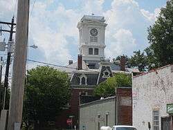
Walton County, Georgia courthouse | |
| Motto: Do Right | |
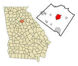 Location in Walton County and the state of Georgia | |
 Monroe Location of Monroe in Georgia | |
| Coordinates: 33°47′36″N 83°42′39″W / 33.79333°N 83.71083°WCoordinates: 33°47′36″N 83°42′39″W / 33.79333°N 83.71083°W | |
| Country | United States |
| State | Georgia |
| County | Walton |
| Government | |
| • Mayor | Greg Thompson[1] |
| Area | |
| • Total | 10.5 sq mi (27.1 km2) |
| • Land | 10.4 sq mi (26.8 km2) |
| • Water | 0.1 sq mi (0.3 km2) |
| Elevation | 909 ft (277 m) |
| Population (2010) | |
| • Total | 13,234 |
| • Density | 1,086.4/sq mi (420.9/km2) |
| Time zone | Eastern (EST) (UTC-5) |
| • Summer (DST) | EDT (UTC-4) |
| ZIP codes | 30655-30656 |
| Area code(s) | 470/678/770 |
| FIPS code | 13-52192[2] |
| GNIS feature ID | 0356398[3] |
| Website | http://www.monroega.com/ |
Monroe is a city in and the county seat of Walton County, Georgia.[4] It is located east of Atlanta and is part of the Atlanta metropolitan area. The population was 13,234 at the 2010 census.
History
Monroe was founded in 1818 as seat of the newly formed Walton County. It was incorporated as a town in 1821 and as a city in 1896.[5]
Monroe was the premier cotton producer in the state of Georgia during the 1900s. The two main cotton mills in Monroe used to be the driving economic force in the region. Now the mills no longer produce for the cotton industry, but rather serve as economic engines for the region by showcasing premiere antique markets, event space, and other unique retail.
Geography
Monroe is located at 33°47′36″N 83°42′39″W / 33.79333°N 83.71083°W (33.793295, -83.710790).[6]
According to the United States Census Bureau, the city has a total area of 10.5 square miles (27 km2), of which 10.4 square miles (27 km2) is land and 0.1 square miles (0.26 km2) (1.05%) is water.
Demographics
| Historical population | |||
|---|---|---|---|
| Census | Pop. | %± | |
| 1870 | 438 | — | |
| 1880 | 530 | 21.0% | |
| 1890 | 983 | 85.5% | |
| 1900 | 1,846 | 87.8% | |
| 1910 | 3,029 | 64.1% | |
| 1920 | 3,211 | 6.0% | |
| 1930 | 3,706 | 15.4% | |
| 1940 | 4,168 | 12.5% | |
| 1950 | 4,542 | 9.0% | |
| 1960 | 6,826 | 50.3% | |
| 1970 | 8,071 | 18.2% | |
| 1980 | 8,854 | 9.7% | |
| 1990 | 9,759 | 10.2% | |
| 2000 | 11,407 | 16.9% | |
| 2010 | 13,234 | 16.0% | |
| Est. 2015 | 13,641 | [7] | 3.1% |
As of the 2010 United States Census, there were 13,234 people residing in the city. The racial makeup of the city was 51.8% White, 42.2% Black, 0.1% Native American, 0.8% Asian, 0.0% Pacific Islander, 0.2% from some other race and 1.6% from two or more races. 3.4% were Hispanic or Latino of any race.
As of the census[2] of 2000, there were 11,407 people, 4,287 households, 2,983 families residing in the city. The population density was 1,101.3 people per square mile (425.1/km²). There were 4,637 housing units at an average density of 447.7 per square mile (172.8/km²). There were 4,287 households out of which 33.9% had children under the age of 18 living with them, 39.2% were married couples living together, 25.7% had a female householder with no husband present, and 30.4% were non-families. 25.7% of all households were made up of individuals and 10.4% had someone living alone who was 65 years of age or older. The average household size was 2.59 and the average family size was 3.07.
In the city the population was spread out with 28.7% under the age of 18, 10.7% from 18 to 24, 28.6% from 25 to 44, 19.2% from 45 to 64, and 12.8% who were 65 years of age or older. The median age was 32 years. For every 100 females there were 83.8 males. For every 100 females age 18 and over, there were 80.1 males. Current mayor is Abby Herman.
The median income for a household in the city was $27,500, and the median income for a family was $31,568. Males had a median income of $30,717 versus $23,028 for females. The per capita income for the city was $16,636 (2008). About 19.8% of families and 22.9% of the population were below the poverty line, including 34.2% of those under age 18 and 17.1% of those age 65 or over.
The racial makeup of the city is 54.69% White, 42.24% African American, 0.21% Native American, 0.36% Asian, 0.04% Pacific Islander, 1.26% from other races, and 1.20% from two or more races. 2.52% of the population are Hispanic or Latino of any race.
Education
Walton County School District
The Walton County School District holds pre-school to grade twelve, and consists of nine elementary schools, three middle schools, and four high schools.[9] The district has 675 full-time teachers and over 10,368 students.[10]
Schools
Public
Elementary
- Atha Road Elementary School
- Bay Creek Elementary School
- Harmony Elementary School
- Monroe Elementary School
- Walker Park Elementary School
- Walnut Grove Elementary School
- Sharon Elementary School
- Loganville Elementary School
- Youth Elementary School
Middle
- Carver Middle School
- Loganville Middle School
- Youth Middle School
High
- Monroe Area High School
- Loganville High School
- Walnut Grove High School
- Social Circle High School
Private
Loganville Christian Academy
Notable natives
- Alfred H. Colquitt - Georgia governor and senator who served as a Confederate officer
- Frances Conroy - Golden Globe- and SAG Award-winning actress
- Besse Cooper - world's oldest living person between June 2011 and December 2012[11]
- Marquis Floyd - NFL player
- Lonnie Hillyer - jazz trumpeter
- Tyler Hubbard - country music singer/songwriter, member of the band Florida Georgia Line
- Martha Wilson Lumpkin - daughter of Georgia Governor and US Senator Wilson Lumpkin, and for whom Atlanta was originally named "Marthasville"[12]
- Henry Dickerson McDaniel - governor of Georgia from 1883 to 1886
- Moina Michael - American professor and humanitarian known as the "Poppy Lady"
- Prince Hulon Preston, Jr. - member of the US House of Representatives
- Patricia Roberts - US Olympic Silver Medalist and Women's Basketball Hall of Fame inductee
- Stephon Tuitt - defensive end for the NFL's Pittsburgh Steelers and former All-American at the University of Notre Dame
- Clifford Walker - governor of Georgia from 1923 to 1927.
Economy
The east end of the City of Monroe on Unisa Drive contains multiple industries.
- Unisia of Georgia Corporation
- Tucker Door and Trim[13]
- Arkansas-headquartered Wal-Mart Stores, Inc.'s southeast Walmart Distribution Center[14]
- Leggett & Platt Corporation[15]
References
- ↑ "Mayor's Office". City of Monroe, GA. Retrieved 23 June 2016.
- 1 2 "American FactFinder". United States Census Bureau. Retrieved 2008-01-31.
- ↑ "US Board on Geographic Names". United States Geological Survey. 2007-10-25. Retrieved 2008-01-31.
- ↑ "Find a County". National Association of Counties. Retrieved 2011-06-07.
- ↑ Hellmann, Paul T. (May 13, 2013). Historical Gazetteer of the United States. Routledge. p. 240. Retrieved 30 November 2013.
- ↑ "US Gazetteer files: 2010, 2000, and 1990". United States Census Bureau. 2011-02-12. Retrieved 2011-04-23.
- ↑ "Annual Estimates of the Resident Population for Incorporated Places: April 1, 2010 to July 1, 2015". Retrieved July 2, 2016.
- ↑ "Census of Population and Housing". Census.gov. Retrieved June 4, 2015.
- ↑ Georgia Board of Education, Retrieved June 26, 2010.
- ↑ School Stats, Retrieved June 26, 2010.
- ↑ Stevens, Alexis (4 December 2012). "World's oldest person, Besse Cooper, dies at 116". The Atlanta Journal-Constitution. Retrieved 5 December 2012.
- ↑ http://www.georgiaencyclopedia.org/articles/counties-cities-neighborhoods/walton-county
- ↑ http://www.manta.com/c/mm7k0xy/unisia-of-georgia-corp
- ↑ http://www.georgiatrend.com/our-state/08_07_walton.shtml
- ↑ http://www.manta.com/c/mms1yt3/leggett-platt-incorporated
|  | |||||||
|
| ||||||||
| ||||||||
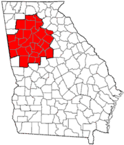
Municipalities and communities of Walton County, Georgia, United States | ||
|---|---|---|
| Cities | 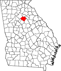 | |
| Towns | ||
| Unincorporated communities | ||
| Footnotes | ‡This populated place also has portions in an adjacent county or counties | |