Houston County, Georgia
| Houston County, Georgia | |
|---|---|
.JPG) Houston County courthouse in Perry | |
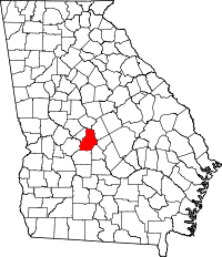 Location in the U.S. state of Georgia | |
 Georgia's location in the U.S. | |
| Founded | May 15, 1821 |
| Named for | John Houstoun |
| Seat | Perry |
| Largest city | Warner Robins |
| Area | |
| • Total | 380 sq mi (984 km2) |
| • Land | 376 sq mi (974 km2) |
| • Water | 4.4 sq mi (11 km2), 1.2% |
| Population (est.) | |
| • (2015) | 150,033 |
| • Density | 373/sq mi (144/km²) |
| Congressional district | 8th |
| Time zone | Eastern: UTC-5/-4 |
| Website |
www |
Houston County /ˈhaʊstən/ is a county located in the central portion of the U.S. state of Georgia. As of the 2010 census, the population was 139,900.[1] Its county seat is Perry.[2] The county was created on May 15, 1821, as one of five counties in the state, and later reduced in size with the formation of Bibb, Crawford, Pike, Macon, and Peach counties.[3] It was named after Georgia governor John Houstoun, with the spelling being a common 19th-century variation that later evolved to "Houston". [4] The pronunciation, however, remains to this day "howston." [5] The geographic center of the county was given the name Wattsville, which was later changed to Perry. [6]
Houston County is included in the Warner Robins, GA Metropolitan Statistical Area, which is also included in the Macon-Warner Robins, GA Combined Statistical Area.
Geography
According to the U.S. Census Bureau, the county has a total area of 380 square miles (980 km2), of which 376 square miles (970 km2) is land and 4.4 square miles (11 km2) (1.2%) is water.[7]
The vast majority of Houston County is located in the Lower Ocmulgee River sub-basin of the Altamaha River basin. The very northern edge of the county, north of Centerville and Warner Robins, is located in the Upper Ocmulgee River sub-basin of the same Altamaha River basin. The very southwestern corner of Houston County, well west of Interstate 75, is located in the Middle Flint River sub-basin of the ACF River Basin (Apalachicola-Chattahoochee-Flint River Basin).[8]
Major highways
-
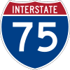 Interstate 75
 -
 U.S. Route 41
 -
 U.S. Route 129
 -
 U.S. Route 341
 -
 State Route 7
 -
 State Route 7 Spur
 -
 State Route 11
 -
 State Route 11 Business
 -
 State Route 11 Connector
 -
 State Route 26
 -
 State Route 49
 -
 State Route 96
 -
 State Route 127
 -
 State Route 224
 -
 State Route 247
 -
 State Route 247 Connector
 -
 State Route 247 Spur
 -
 State Route 329
 -
 State Route 401 (unsigned designation for I-75)
Adjacent counties
- Bibb County - north
- Peach County - west
- Twiggs County - east
- Bleckley County - southeast
- Pulaski County - south-southeast
- Dooly County - south
- Macon County - southwest
Demographics
| Historical population | |||
|---|---|---|---|
| Census | Pop. | %± | |
| 1830 | 7,369 | — | |
| 1840 | 9,711 | 31.8% | |
| 1850 | 16,450 | 69.4% | |
| 1860 | 15,611 | −5.1% | |
| 1870 | 20,406 | 30.7% | |
| 1880 | 22,414 | 9.8% | |
| 1890 | 21,613 | −3.6% | |
| 1900 | 22,641 | 4.8% | |
| 1910 | 23,609 | 4.3% | |
| 1920 | 21,964 | −7.0% | |
| 1930 | 11,280 | −48.6% | |
| 1940 | 11,303 | 0.2% | |
| 1950 | 20,964 | 85.5% | |
| 1960 | 39,154 | 86.8% | |
| 1970 | 62,924 | 60.7% | |
| 1980 | 77,605 | 23.3% | |
| 1990 | 89,208 | 15.0% | |
| 2000 | 110,765 | 24.2% | |
| 2010 | 139,900 | 26.3% | |
| Est. 2015 | 150,033 | [9] | 7.2% |
| U.S. Decennial Census[10] 1790-1960[11] 1900-1990[12] 1990-2000[13] 2010-2013[1] | |||
As of the 2010 United States Census, there were 139,900 people, 53,051 households, and 37,874 families residing in the county.[14] The population density was 372.5 inhabitants per square mile (143.8/km2). There were 58,325 housing units at an average density of 155.3 per square mile (60.0/km2).[15] The racial makeup of the county was 63.3% white, 28.6% black or African American, 2.4% Asian, 0.3% American Indian, 0.1% Pacific islander, 2.4% from other races, and 2.8% from two or more races. Those of Hispanic or Latino origin made up 6.1% of the population.[14] In terms of ancestry, 12.9% were American, 10.3% were German, 10.0% were English, and 9.1% were Irish.[16]
Of the 53,051 households, 38.7% had children under the age of 18 living with them, 50.3% were married couples living together, 16.2% had a female householder with no husband present, 28.6% were non-families, and 24.0% of all households were made up of individuals. The average household size was 2.61 and the average family size was 3.09. The median age was 34.5 years.[14]
The median income for a household in the county was $55,098 and the median income for a family was $67,227. Males had a median income of $47,557 versus $34,239 for females. The per capita income for the county was $25,206. About 10.3% of families and 12.8% of the population were below the poverty line, including 18.7% of those under age 18 and 9.5% of those age 65 or over.[17]
Education
Communities
Cities
Unincorporated communities
- Bonaire
- Byron (part)
- Clinchfield
- Dunbar
- Elberta
- Elko
- Grovania
- Henderson
- Haynesville
- Houston Lake
- Kathleen
- Klondike
- Pabst
- Sand Bed
Census-designated place
See also
References
- 1 2 "State & County QuickFacts". United States Census Bureau. Retrieved June 23, 2014.
- ↑ "Find a County". National Association of Counties. Retrieved 2011-06-07.
- ↑ "Houston County". The New Georgia Encyclopedia. Georgia Humanities Council, in partnership with the University of Georgia Press, the University System of Georgia/GALILEO, and the Office of the Governor. Retrieved 2008-09-24.
- ↑ Houston County, Georgia - Centerville, Perry, Warner Robins - Georgia's Most Progressive County!
- ↑ "Houston County". The New Georgia Encyclopedia. Georgia Humanities Council, in partnership with the University of Georgia Press, the University System of Georgia/GALILEO, and the Office of the Governor. Retrieved 2016-09-01.
- ↑ "Houston County". The New Georgia Encyclopedia. Georgia Humanities Council, in partnership with the University of Georgia Press, the University System of Georgia/GALILEO, and the Office of the Governor. Retrieved 2016-09-01.
- ↑ "US Gazetteer files: 2010, 2000, and 1990". United States Census Bureau. 2011-02-12. Retrieved 2011-04-23.
- ↑ "Georgia Soil and Water Conservation Commission Interactive Mapping Experience". Georgia Soil and Water Conservation Commission. Retrieved 2015-11-24.
- ↑ "County Totals Dataset: Population, Population Change and Estimated Components of Population Change: April 1, 2010 to July 1, 2015". Retrieved July 2, 2016.
- ↑ "U.S. Decennial Census". United States Census Bureau. Retrieved June 23, 2014.
- ↑ "Historical Census Browser". University of Virginia Library. Retrieved June 23, 2014.
- ↑ "Population of Counties by Decennial Census: 1900 to 1990". United States Census Bureau. Retrieved June 23, 2014.
- ↑ "Census 2000 PHC-T-4. Ranking Tables for Counties: 1990 and 2000" (PDF). United States Census Bureau. Retrieved June 23, 2014.
- 1 2 3 "DP-1 Profile of General Population and Housing Characteristics: 2010 Demographic Profile Data". United States Census Bureau. Retrieved 2015-12-30.
- ↑ "Population, Housing Units, Area, and Density: 2010 - County". United States Census Bureau. Retrieved 2015-12-30.
- ↑ "DP02 SELECTED SOCIAL CHARACTERISTICS IN THE UNITED STATES – 2006-2010 American Community Survey 5-Year Estimates". United States Census Bureau. Retrieved 2015-12-30.
- ↑ "DP03 SELECTED ECONOMIC CHARACTERISTICS – 2006-2010 American Community Survey 5-Year Estimates". United States Census Bureau. Retrieved 2015-12-30.
External links
 Ripley, George; Dana, Charles A., eds. (1879). "Houston. I. A central county of Georgia". The American Cyclopædia.
- Flint Electric Membership Corporation historical marker
- Houston County historical marker
 |
Bibb County | | ||
| Peach County | |
Twiggs County | ||
| ||||
| | ||||
| Macon County | Dooly County | Bleckley County and Pulaski County |
Municipalities and communities of Houston County, Georgia, United States | ||
|---|---|---|
| Cities | | |
| CDP | ||
| Unincorporated communities | ||
| Footnotes | ‡This populated place also has portions in an adjacent county or counties | |
| Principal cities |  | |
|---|---|---|
| Municipalities | ||
| Other communities | ||
| Counties | ||
| CSA components |
| |
Template:Georgia
Coordinates: 32°28′N 83°40′W / 32.46°N 83.67°W