Cherokee County, Georgia
| Cherokee County, Georgia | |
|---|---|
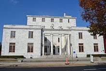 The Old Cherokee County Court House in Canton, built in 1929 | |
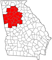
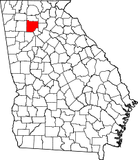 Location in the U.S. state of Georgia | |
 Georgia's location in the U.S. | |
| Founded | December 6, 1831 |
| Named for | Cherokee people |
| Seat | Canton |
| Largest city | Woodstock |
| Area | |
| • Total | 434 sq mi (1,124 km2) |
| • Land | 422 sq mi (1,093 km2) |
| • Water | 13 sq mi (34 km2), 2.9% |
| Population (est.) | |
| • (2015) | 235,900 |
| • Density | 508/sq mi (196/km²) |
| Congressional district | 11th |
| Time zone | Eastern: UTC-5/-4 |
| Website |
www |
Cherokee County is a county located in the US state of Georgia. As of the 2010 census, the population was 214,346.[1] The county seat is Canton.[2] The county is under the jurisdiction of the Cherokee County Sheriff's Office which is headed by Sheriff Roger Garrison. The Cherokee County Sheriff's office is accredited by CALEA. The major cities within the county are under the jurisdiction of police departments such as Woodstock Police, Canton Police, Holly Springs Police, and Ball Ground Police departments.
Cherokee County is included in the Atlanta-Sandy Springs-Roswell, GA Metropolitan Statistical Area.
History
Original territory
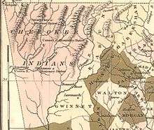
Originally, Cherokee County was more like a territory than a county, covering everything northwest of the Chattahoochee River and Chestatee River except for Carroll County. This county was created December 26, 1831 by the state legislature. It was named after the Cherokee Indians who lived in the area at that time. Several other counties were carved out of these Cherokee lands as part of the Cherokee Land Lottery of 1832.[3]
An act of the Georgia General Assembly passed on December 3 of that year created the counties of Forsyth, Lumpkin, Union, Cobb, Gilmer, Murray, Cass (now Bartow), Floyd, and Paulding.[4] The forcible (sometimes at gunpoint) removal of the Cherokee people, leading up to the notorious Trail of Tears, began in this area the year before, later accelerated by the discovery of gold in local streams.
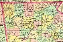
County courts were authorized to first met at the home of Ambrose Harnage that soon became known as Harnageville, later called Marble Works, and even later Tate, Georgia when Cherokee County was first established. Since 1880 that town has been called Tate, and it is now (since 1853) in Pickens County. Part of that county was taken directly from Cherokee, the other via Gilmer (itself earlier taken from Cherokee). Etowah was named the first county seat in 1833.
Remaining county
In 1857, part of the southeastern corner of the county was ceded by the General Assembly to form Milton County (now the city of Milton in the county of Fulton). In the 1890s, The Atlanta & Knoxville Railroad (later renamed the Marietta & North Georgia Railroad when it could not be completed to Knoxville) built a branch line up through the middle of the county. When this line was bought by the Louisville & Nashville Railroad the following decade, the L&N built railroad stations at Woodstock and other towns.
Development
Cherokee County is a part of the Atlanta metro area. It is bisected by Interstate 575, which runs from Marietta north through Woodstock, Lebanon, Holly Springs, Canton, the county seat, and Ball Ground, ending at the Pickens County line into Georgia 515, the Appalachian Parkway developmental highway. Interstate 575 is undergoing significant widening to accommodate growth in Cherokee County population.
The Georgia Northeastern Railroad also operates freight service on the former L&N tracks, roughly parallel to this route. Population growth follows the same general pattern as well, with new suburbs in the south following the highway toward exurbs further north.
Geography
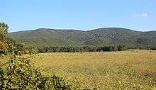
According to the U.S. Census Bureau, the county has a total area of 434 square miles (1,120 km2), of which 422 square miles (1,090 km2) is land and 13 square miles (34 km2) (2.9%) is water.[5] Much of the water is in Lake Allatoona in the southwest. The lake is fed by the Etowah and Little rivers (the county's primary waterways), and other large streams such as Noonday Creek. Much of the northern part of the county begins to rise toward the foothills.
The vast majority of Cherokee County is located in the Etowah River sub-basin of the ACT River Basin (Coosa-Tallapoosa River Basin), with only a small northwesterly corner of the county located in the Coosawattee River sub-basin of the same ACT River Basin.[6]
Mountains
There are nine summits listed by the USGS GNIS as being in the county. From tallest to lowest, they are:
- Bear Mountain – 2,297 feet (700 m)
- Pine Log Mountain – 2,260 feet (689 m)
- Oakey Mountain – 1,686 feet (514 m)
- Dry Pond Mountain – 1,644 feet (501 m)
- Hickory Log Mountain – 1,545 feet (471 m)
- Polecat Mountain – 1,503 feet (458 m)
- Byrd Mountain – 1,358 feet (414 m)
- Garland Mountain – 1,348 feet (411 m)
- Posey Mountain – 1,306 feet (398 m)
These mountains are in the still-rural northern and western parts of the county. However, if considered part of metro Atlanta, Bear Mountain is the tallest in the metro area.
Adjacent counties
- Pickens – north
- Dawson – northeast
- Forsyth – east
- Fulton – southeast
- Cobb – south
- Bartow – west
- Gordon – northwest
Demographics
| Historical population | |||
|---|---|---|---|
| Census | Pop. | %± | |
| 1840 | 5,895 | — | |
| 1850 | 12,800 | 117.1% | |
| 1860 | 11,291 | −11.8% | |
| 1870 | 10,399 | −7.9% | |
| 1880 | 14,325 | 37.8% | |
| 1890 | 15,412 | 7.6% | |
| 1900 | 15,243 | −1.1% | |
| 1910 | 16,661 | 9.3% | |
| 1920 | 18,569 | 11.5% | |
| 1930 | 20,003 | 7.7% | |
| 1940 | 20,126 | 0.6% | |
| 1950 | 20,750 | 3.1% | |
| 1960 | 23,001 | 10.8% | |
| 1970 | 31,059 | 35.0% | |
| 1980 | 51,699 | 66.5% | |
| 1990 | 90,204 | 74.5% | |
| 2000 | 141,903 | 57.3% | |
| 2010 | 214,346 | 51.1% | |
| Est. 2015 | 235,900 | [7] | 10.1% |
| U.S. Decennial Census[8] 1790-1960[9] 1900-1990[10] 1990-2000[11] 2010-2013[1] | |||
2000 census
As of the census[12] of 2000, there were 141,903 people, 49,495 households, and 39,200 families residing in the county. The population density was 335 people per square mile (129/km²). There were 51,937 housing units at an average density of 123 per square mile (47/km²). The racial makeup of the county was 81.29% White, 5.44% Black or African American, 0.38% Native American, 2.06% Asian, 0.03% Pacific Islander, 2.61% from other races, and 1.29% from two or more races. 9.60% of the population were Hispanic or Latino of any race.
There were 49,495 households out of which 41.40% had children under the age of 18 living with them, 67.20% were married couples living together, 8.30% had a female householder with no husband present, and 20.80% were non-families. 16.00% of all households were made up of individuals and 4.10% had someone living alone who was 65 years of age or older. The average household size was 2.85 and the average family size was 3.18.
In the county the population was spread out with 28.30% under the age of 18, 7.70% from 18 to 24, 35.80% from 25 to 44, 21.70% from 45 to 64, and 6.60% who were 65 years of age or older. The median age was 34 years. For every 100 females there were 100.70 males. For every 100 females age 18 and over, there were 98.90 males.
The median income for a household in the county was $60,896, and the median income for a family was $66,419. Males had a median income of $44,374 versus $31,036 for females. The per capita income for the county was $24,871. About 3.50% of families and 5.30% of the population were below the poverty line, including 5.50% of those under age 18 and 9.80% of those age 65 or over.
Cherokee County was named one of the fastest-growing counties in the state of Georgia in 2014.
2010 census
As of the 2010 United States Census, there were 214,346 people, 75,936 households, and 57,876 families residing in the county.[13] The population density was 508.3 inhabitants per square mile (196.3/km2). There were 82,360 housing units at an average density of 195.3 per square mile (75.4/km2).[14] The racial makeup of the county was 86.6% white, 5.7% black or African American, 1.7% Asian, 0.4% American Indian, 0.1% Pacific islander, 3.6% from other races, and 2.1% from two or more races. Those of Hispanic or Latino origin made up 9.6% of the population.[13] In terms of ancestry, 16.2% were Irish, 16.1% were German, 14.1% were English, 10.7% were American, and 5.7% were Italian.[15]
Of the 75,936 households, 41.4% had children under the age of 18 living with them, 61.9% were married couples living together, 10.1% had a female householder with no husband present, 23.8% were non-families, and 18.8% of all households were made up of individuals. The average household size was 2.80 and the average family size was 3.20. The median age was 36.3 years.[13]
The median income for a household in the county was $66,320 and the median income for a family was $77,190. Males had a median income of $53,773 versus $40,153 for females. The per capita income for the county was $30,217. About 5.5% of families and 7.4% of the population were below the poverty line, including 8.4% of those under age 18 and 7.7% of those age 65 or over.[16]
Education
Public Schools
- Cherokee County School District (44 Schools)
- Cherokee Charter Academy (CSUSA)
Private schools
Private schools in Cherokee County include:
- Lyndon Academy (Woodstock)
- Cherokee Christian Schools (Woodstock)
- Cherokee Christian Academy (Woodstock)
- Community Christian School (Canton)
- Crossroads Christian School (Canton)
- Omega Learning Academy (Woodstock)
- King's Academy (Woodstock)
Higher education
- Reinhardt University is a private, co-educational liberal arts college located in Waleska, Georgia.
Transportation
Major highways
-
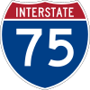 Interstate 75
 -
 Interstate 575
 -
 State Route 5
 -
 State Route 5 Business (Canton)
 - State Route 5 Business (Ball Ground)
-
 State Route 20
 -
 State Route 92
 -
 State Route 108
 -
 State Route 140
 -
 State Route 369
 -
 State Route 372
 -
 State Route 401 (unsigned designation for I-75)
 -
 State Route 417 (unsigned designation for I-575)
Other Major Roads
- Bells Ferry Road (Old SR 205)
- East Cherokee Drive
- Towne Lake Parkway
- Woodstock Road
- Victory Drive
- Arnold Mill Road
- Yellow Creek Road
- Upper Burris Road
- Lower Burris Road
- Wade Green Road
- Kellogg Creek Road (Old SR 92)
- Canton Highway (Old SR 5)
- Marietta Highway (Old SR 5)
- Ball Ground Highway (Old SR 5)
- Old Marietta Road (Old SR 20)
Airport
The Cherokee County Airport (FAA LOC ID: CNI) is located adjacent to I-575 about six miles (10 km) northeast of downtown Canton, GA.
A redevelopment project recently completed a 10,000-square-foot (930 m2) terminal, the lengthening of the runway from 3,414 feet (1,041 m) to 5,000 feet (1,500 m), a new parallel taxiway, instrument landing equipment, and new hangars. The new facilities will accommodate 200 hangared corporate aircraft and provide 100 tie-downs for smaller aircraft.
Public transportation
The Cherokee Area Transit Service (CATS) serves all of the Cherokee County area rural and suburban.
Communities
Unincorporated communities
- Avery
- Batesville
- Buffington
- Clayton / Burris Crossroads
- Creighton
- Free Home
- Gober
- Gold Ridge
- Greeley
- Hickory Flat
- Holbrook
- Keithsburg
- Lake Arrowhead
- Lathemtown
- Lebanon / Toonigh
- Macedonia
- Mica
- Oak Grove
- Ophir
- Orange
- Salacoa
- Sharp Top
- Sixes
- Sutallee
- Towne Lake
- Union Hill
- Univeter
- Victoria
Notable residents
- Joseph E. Brown, who was elected governor of Georgia in 1857 and later served as U.S. Senator from Georgia. Brown's primary residence and law practice were in Canton, and he owned a farm believed to be near the Sutallee community.
- Ira Roe Foster, Quartermaster General of Georgia, Brigadier General in the Georgia Militia (1845), attorney, medical doctor, Cherokee County State Representative, first mayor of Eastman, Georgia, Alabama State Senator
- Josh Holloway, actor and model, most famous for his role as James "Sawyer" Ford on Lost. He attended Free Home Elementary in Free Home and Cherokee High School in Canton
- Johnny Hunt, President of the Southern Baptist Convention in 2008–2010.
- Robert Rechsteiner, also known as Rick Steiner, ex-professional wrestler who is now a part of the school board for the county. He also sells homes in the county as a real estate agent.
- Blair Redford, is an actor known for his acting on soap operas such as Days Of Our Lives.
- Dean Rusk, U.S. Secretary of State was born in Cherokee County.
- Bruce Miller, NFL fullback for the San Francisco 49ers, attended Woodstock High School.
- Nick Markakis, MLB outfielder for the Atlanta Braves, attended Woodstock High School.
See also
References
- 1 2 "State & County QuickFacts". United States Census Bureau. Retrieved June 19, 2014.
- ↑ "Find a County". National Association of Counties. Archived from the original on May 10, 2015. Retrieved 2011-06-07.
- ↑ "GeorgiaInfo has moved :: Carl Vinson Institute of Government". Cviog.uga.edu. Archived from the original on May 11, 2008. Retrieved July 22, 2010.
- ↑ "GeorgiaInfo has moved :: Carl Vinson Institute of Government". Cviog.uga.edu. Archived from the original on February 18, 2008. Retrieved July 22, 2010.
- ↑ "US Gazetteer files: 2010, 2000, and 1990". United States Census Bureau. 2011-02-12. Retrieved 2011-04-23.
- ↑ "Georgia Soil and Water Conservation Commission Interactive Mapping Experience". Georgia Soil and Water Conservation Commission. Retrieved 2015-11-19.
- ↑ "County Totals Dataset: Population, Population Change and Estimated Components of Population Change: April 1, 2010 to July 1, 2015". Retrieved July 2, 2016.
- ↑ "U.S. Decennial Census". United States Census Bureau. Archived from the original on May 11, 2015. Retrieved June 17, 2014.
- ↑ "Historical Census Browser". University of Virginia Library. Retrieved June 19, 2014.
- ↑ "Population of Counties by Decennial Census: 1900 to 1990". United States Census Bureau. Retrieved June 19, 2014.
- ↑ "Census 2000 PHC-T-4. Ranking Tables for Counties: 1990 and 2000" (PDF). United States Census Bureau. Retrieved June 19, 2014.
- ↑ "American FactFinder". United States Census Bureau. Retrieved 2011-05-14.
- 1 2 3 "DP-1 Profile of General Population and Housing Characteristics: 2010 Demographic Profile Data". United States Census Bureau. Retrieved 2015-12-27.
- ↑ "Population, Housing Units, Area, and Density: 2010 - County". United States Census Bureau. Retrieved 2015-12-27.
- ↑ "DP02 SELECTED SOCIAL CHARACTERISTICS IN THE UNITED STATES – 2006-2010 American Community Survey 5-Year Estimates". United States Census Bureau. Retrieved 2015-12-27.
- ↑ "DP03 SELECTED ECONOMIC CHARACTERISTICS – 2006-2010 American Community Survey 5-Year Estimates". United States Census Bureau. Retrieved 2015-12-27.
External links
- Cherokee TV
- Cherokee County government
- Cherokee County School District
- Cherokee County Airport – FAA Airport Master Record
- Cherokee County historical marker
Local Newspapers
- TheCherokeeConnection.com – Cherokee County Ga News, Events, & Community Publication
- The Cherokee Ledger-News
- HomeTownCherokee.com – Cherokee's Online News & Community Publication
- Cherokee Tribune
- Cherokee Today
 |
Gordon County | Pickens County | Dawson County | |
| Bartow County | |
Forsyth County | ||
| ||||
| | ||||
| Cobb County | Fulton County |
Municipalities and communities of Cherokee County, Georgia, United States | ||
|---|---|---|
| Cities | | |
| Unincorporated communities | ||
| Footnotes | ‡This populated place also has portions in an adjacent county or counties | |
|  | |||||||
|
| ||||||||
| ||||||||
Coordinates: 34°14′N 84°28′W / 34.24°N 84.47°W