Douglas County, Georgia
| Douglas County, Georgia | ||
|---|---|---|
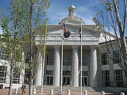 Douglas County courthouse in Douglasville | ||
| ||
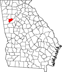 Location in the U.S. state of Georgia | ||
 Georgia's location in the U.S. | ||
| Founded | 1870 | |
| Named for | Stephen A. Douglas | |
| Seat | Douglasville | |
| Largest city | Douglasville | |
| Area | ||
| • Total | 201 sq mi (521 km2) | |
| • Land | 200 sq mi (518 km2) | |
| • Water | 1.0 sq mi (3 km2), 0.5% | |
| Population (est.) | ||
| • (2015) | 140,733 | |
| • Density | 662/sq mi (256/km²) | |
| Congressional district | 13th | |
| Time zone | Eastern: UTC-5/-4 | |
| Website |
www.douglascountygeorgia.com www www | |

Douglas County is a county located in the north central portion of the U.S. state of Georgia. As of the 2010 census, the population was 132,403.[1] The county seat is Douglasville.[2]
Douglas County is included in the Atlanta-Sandy Springs-Roswell, GA Metropolitan Statistical Area.
History
Formed in 1870 during Reconstruction after the US Civil War, Douglas County was originally named by the reconstruction legislature after Frederick Douglass, the Civil War-era abolitionist. However, at the end of Reconstruction, the second "s" was quietly dropped and the designated honoree was changed to Stephen A. Douglas,[3] an Illinois senator and the Democratic opponent of Abraham Lincoln in the presidential election of 1860 as evidenced by a historical marker about the creation of Douglas County:
"This county, created by Act of the Legislature October 1, 1870, was named for Stephen A. Douglas, the "Little Giant," a Vermonter who was Congressman from Illinois 1843 to '47, Senator from '47 to '61, and Democratic candidate for President in 1860 on the ticket with gov. Herschel V. Johnson, of Georgia, for Vice President. Among the first County Officers were: sheriff T.H. Sellman, Clerk of Superior Court A.L. Gorman, Ordinary Wm. Hindman, Tax Receiver Jno. M. James, Tax Collector M.D. Watkins, Treasurer C.P. Bower, Surveyor John M. Hughey. The county was created from the part of Campbell county which was northwest of the Chattahoochee River. The remainder of Campbell became southwest Fulton at the beginning of 1932."
The Oct. 17, 1870 act creating Douglas County provided that on the first Monday in November 1870, voters of the new county would elect county officers, and also by ballot would select the site of the county seat. In the election, some voters chose a site near the center of the county, but a larger number voted for several different named sites (which may have been different names for the settlement known as "Skinned Chestnut" or "Skin(t) Chestnut"—the early name of Douglasville). Thinking that the majority of voters had intended Skinned Chestnut, the courthouse commissioners chose this site as county seat and proceeded to sell lots and build a courthouse.
However, a group of citizens filed suit against the commissioners. The case ultimately went to the Supreme Court of Georgia, which ruled against the commissioners. However, both sides agreed to postpone further action until the route of the Georgia Western Railroad through Douglas County was determined. To clear up the matter, the General Assembly enacted legislation on Feb. 28, 1874, directing that an election be held on Apr. 7, 1874, to determine the location of the county seat—but with the provision that the site be located on the Georgia Western Railroad. In the election, voters confirmed Douglasville as the county seat. On Feb. 25, 1875, the General Assembly incorporated Douglasville.
Geography
According to the U.S. Census Bureau, the county has a total area of 201 square miles (520 km2), of which 200 square miles (520 km2) is land and 1.0 square mile (2.6 km2) (0.5%) is water.[4]
Douglas County's elevation above sea level ranges as low as 740 feet (230 m) at the Chattahoochee River to as high as 1,340 feet (410 m); one of the county's highest elevation points lies inside the city of Douglasville. Andy Mountain, between Villa Rica and Winston – west of Douglasville along Bankhead Highway, has the highest elevation in Douglas County. Two other elevated summits are located in the county, known as Cedar Mountain at 1,257 feet (383 m)), and Pine Mountain at 1,180 feet (360 m).
Douglas County sits in Georgia's Piedmont region, which makes its elevation vary due to many rolling hills that Douglas County sits on near the tail end of the Appalachian Mountains. There are no high mountain peaks in Douglas County, just a range of ridges, hills and valleys.
The entirety of Douglas County is located in the Middle Chattahoochee River-Lake Harding sub-basin of the ACF River Basin (Apalachicola-Chattahoochee-Flint River Basin).[5]
| Location | Height | |
|---|---|---|
| Andy Mountain | 1,340 feet (408 m) | |
| Cedar Mountain | 1,257 feet (383 m) | |
| Winston | 1,221 feet (372 m) | |
| Downtown Douglasville | 1,209 feet (369 m) | |
| Beulah | 1,184 feet (361 m) | |
| Pine Mountain | 1,180 feet (360 m) | |
| White City | 1,177 feet (359 m) | |
| Fairplay | 1,170 feet (357 m) | |
| Wellstar Douglas Hospital | 1,120 feet (341 m) | |
| Midway | 1,080 feet (329 m) | |
| Hannah | 1,077 feet (328 m) | |
| McWhorter | 1,067 feet (325 m) | |
| Lithia Springs | 1,043 feet (318 m) | |
| Villa Rica | 1,040 feet (317 m) | |
| Groovers Lake | 905 feet (276 m) | |
Bodies of water
- The Chattahoochee River borders the county to the east and southeast.
- Sweetwater Creek runs in the eastern side of the county in the Lithia Springs area. The USGS stream gauge (NWS identifier AUSG1) at Lithia Springs is considered to be "near Austell" by the National Weather Service, however, even though that city is further away and in Cobb and not Douglas.
- George Sparks Reservoir makes its home at Sweetwater Creek State Park.
- The Dog River is a small, almost creek like river in the western side of Douglas county and travels south and eastward until it ends at the Dog River Reservoir in the southern part of the county.
- The Dog River Reservoir is Douglas County's main source of drinking water, and also serves as a recreational lake for residents of the county.
All of these had massive flooding during the 2009 Atlanta floods.
Climate
Douglas County has been experiencing numerous natural disasters over the most recent decades. Being located in the South Eastern United States the county experiences strong storms and tornadoes often because of its location in Dixie Alley.
A tornado touched down in the city of Douglasville on March 7, 2008 damaging many homes and ripping one home in half in the Brookmont subdivision on Chapel Hill Road. Arbor Place Mall also reported broken windows from the storm. The tornado also damaged the Chapel Hill Kroger grocery store and threw a heavy air conditioning unit onto cars below. There was only one injury reported from the storm.
Another tornado touched down in Douglas County on May 11, 2008, known as the "Mother's Day Tornado". The EF2 tornado caused damage all over the county. The tornado touched down in the Fairplay area and moved through the rest of the county. The tornado packing wind speeds up to 110 mph (180 km/h) downed many trees and damaged many homes in the county. A gas station in Douglasville was destroyed by the storm, with the large roof being thrown onto the street. No injuries or deaths were reported. The governor of Georgia declared a state of emergency for Douglas County and many other counties in the state on May 12, 2008. This is the first time in history that two tornados have touched down in Douglas County in the same year.
The county has suffered through numerous ice storms throughout the years. The ice storms bring everything to a stand still in the area due to the lack of equipment to deal with the problem and drastic amounts of power outages. Some of the worst ice storms were in 1938, 1994, 1998, 2000, 2005, and 2010.
In 2007 the county suffered one of the worst droughts in the areas history, causing a complete watering ban and resulting in the largest wildfire in Georgia history. The fire was located in south east Georgia, but it still affected the county with smoke often through the life of the fire.
In 2005 Hurricane Katrina's remnants tore through the area spawning tornadoes, causing wind damage, and flooding rains. Katrina killed 2 people in Georgia
Sunday night on January 9, 2011, Right after Douglasville's first white Christmas in decades, a snowstorm developed over Douglas County and caused as much as 8 inches of snow in the area. The storm closed grocery stores, the courthouse, and arbor place mall until that Wednesday January 12. Schools were closed the entire second week of January.
The "Storm of the Century" (1993) in March 1993 brought 17 inches (43 cm) to Douglasville, with drifts measuring several feet.
On September 21, 2009 Douglas County was devastated by the worst flood in Georgia history. Over 18 inches (460 mm) of rain fell in one night causing many roads to be destroyed and many homes a total loss. The county was later declared a disaster area, and the governor of Georgia declared a state of emergency. The floodings worst affected areas were in the areas of Douglasville, Villa Rica, Austell, Lithia Springs, and Chapel Hill. The disaster killed more than eight people in the county, most of them in the Douglasville area. The Austell death toll was also high but it was reported in the Cobb County losses.
Adjacent counties
- Cobb County– northeast
- Fulton County – southeast
- Carroll County – west
- Paulding County – northwest
Demographics
| Historical population | |||
|---|---|---|---|
| Census | Pop. | %± | |
| 1880 | 6,934 | — | |
| 1890 | 7,794 | 12.4% | |
| 1900 | 8,745 | 12.2% | |
| 1910 | 8,953 | 2.4% | |
| 1920 | 10,477 | 17.0% | |
| 1930 | 9,461 | −9.7% | |
| 1940 | 10,053 | 6.3% | |
| 1950 | 12,173 | 21.1% | |
| 1960 | 16,741 | 37.5% | |
| 1970 | 28,659 | 71.2% | |
| 1980 | 54,573 | 90.4% | |
| 1990 | 71,120 | 30.3% | |
| 2000 | 92,174 | 29.6% | |
| 2010 | 132,403 | 43.6% | |
| Est. 2015 | 140,733 | [6] | 6.3% |
| U.S. Decennial Census[7] 1790-1960[8] 1900-1990[9] 1990-2000[10] 2010-2013[1] | |||
2000 census
As of the census[11] of 2010, there were 132,403 people, 42,423 households, and 24,911 families residing in the county. The population density was 662 people per square mile. There were 51,672 housing units. The racial makeup of the county was 52.5% White, 39.5% Black or African American, 0.3% Native American, 1.4% Asian and 2.4% from two or more races. 8.4% of the population were Hispanic or Latino of any race.
There were 32,822 households out of which 38.60% had children under the age of 18 living with them, 58.90% were married couples living together, 12.70% had a female householder with no husband present, and 24.10% were non-families. 18.40% of all households were made up of individuals and 4.40% had someone living alone who was 65 years of age or older. The average household size was 2.78 and the average family size was 3.17.
In the county the population was spread out with 27.60% under the age of 18, 8.90% from 18 to 24, 33.50% from 25 to 44, 22.40% from 45 to 64, and 7.50% who were 65 years of age or older. The median age was 34 years. For every 100 females there were 96.50 males. For every 100 females age 18 and over, there were 93.80 males.
The median income for a household in the county was $50,798, and the median income for a family was $54,082. Males had a median income of $38,204 versus $28,475 for females. The per capita income for the county was $21,172. About 5.70% of families and 7.80% of the population were below the poverty line, including 9.90% of those under age 18 and 7.50% of those age 65 or over.
2010 census
As of the 2010 United States Census, there were 132,403 people, 46,624 households, and 34,429 families residing in the county.[12] The population density was 661.8 inhabitants per square mile (255.5/km2). There were 51,672 housing units at an average density of 258.3 per square mile (99.7/km2).[13] The racial makeup of the county was 52.5% white, 39.5% black or African American, 1.4% Asian, 0.3% American Indian, 0.1% Pacific islander, 3.8% from other races, and 2.4% from two or more races. Those of Hispanic or Latino origin made up 8.4% of the population.[12] In terms of ancestry, 13.1% were Subsaharan African, 9.1% were American, 8.6% were Irish, 7.8% were German, and 7.6% were English.[14]
Of the 46,624 households, 42.6% had children under the age of 18 living with them, 50.9% were married couples living together, 17.3% had a female householder with no husband present, 26.2% were non-families, and 21.5% of all households were made up of individuals. The average household size was 2.81 and the average family size was 3.27. The median age was 35.0 years.[12]
The median income for a household in the county was $55,852 and the median income for a family was $62,977. Males had a median income of $45,424 versus $37,120 for females. The per capita income for the county was $24,515. About 8.8% of families and 11.3% of the population were below the poverty line, including 15.5% of those under age 18 and 10.3% of those age 65 or over.[15]
Economy
Per Capita Income Growth for Douglas County[16]
| Year | Income | Increase |
|---|---|---|
| 1994 | $19,189 | — |
| 1995 | $20,320 | 5.894% |
| 1997 | $22,386 | 10.17% |
| 1998 | $23,201 | 3.641% |
| 1999 | $24,457 | 5.414% |
| 2000 | $26,272 | 7.421% |
| 2001 | $26,455 | 0.6966% |
| 2002 | $26,191 | -0.9979% |
| 2003 | $26,048 | -0.546% |
| 2004 | $26,687 | 2.453% |
Parks and recreation
- Sweetwater Creek State Park is host to the ruins of a Civil War-era mill destroyed in General Sherman's campaign through Georgia.
- Hunter Park is located within the city limits of Douglasville, and it is home to the majority of the sports events held in Douglas County. It is home to the Douglas County Boys and Girls Club.
- Deer Lick Park is located in the northeast corner of the county and is the third-largest park in the county. It is also home to sporting events.
- Woodrow Wilson Park and Lithia Springs Girls Ball Field are located in Lithia Springs next to Sweetwater Creek. The ballfield has flooded during heavy rain storms.
- Boundary Waters Aquatic Center opened in July 2005 in the southeastern section of the County, and it is home to the Douglas County swim team, the Stingrays. The Center also provides aquatic therapy and swim lessons to the county's citizens for a low fee. Residents outside the county can use the center as well for a slightly higher fee.
Other parks in the county include:
- Post Road Park
- Clinton Nature Preserve
- Bill Arp Park
- Fairplay Park
- Winston Park
- Mount Carmel Ball Field
- Dog River Park/Reservoir
Government
| Year | Democratic | Republican | |||
|---|---|---|---|---|---|
| 2016 | 54.00% | 31,005 | 43.22% | 24,817 | |
| 2012 | 51.36% | 28,441 | 47.38% | 26,241 | |
| 2008 | 50.41% | 27,825 | 48.58% | 26,812 | |
| 2004 | 37.99% | 15,997 | 61.39% | 25,846 | |
| 2000 | 36.05% | 11,162 | 61.02% | 18,893 | |
| 1996 | 36.37% | 9,631 | 54.75% | 14,495 | |
| 1992 | 33.27% | 8,869 | 50.08% | 13,349 | |
Most government offices in the county are located at the Douglas County Courthouse complex, about 1-mile (1.6 km) south of the downtown area of Douglasville. The exception is the Douglas County Board of Education, located adjacent to Hunter Park. The Douglas County Chamber of Commerce is located in downtown Douglasville.
The county courthouse was constructed in 1997–98 and opened in 1998 after the county services needed a new courthouse for the ever-growing and changing county. The services prior to the opening were scattered all over downtown Douglasville in seven or eight office buildings. The old Douglas County courthouse, built in 1956, remains in downtown and is now used as a museum and a satellite school for the University of West Georgia.
Douglas County is governed by the Douglas County Board of Commissioners and its Chairman, Tom Worthan (R), elected in 2004. The remaining commissioners are representatives from Douglas County's four districts.
In presidential elections, Douglas County had been a reliably Republican county between 1980 and 2004, voting Republican by a double-digit margin even in 1992, when Democrat Bill Clinton carried the state of Georgia. The county gave over 60% of the vote to Republican George W. Bush in both of his elections. However a surge in the black population and turnout flipped the county to Democrat Barack Obama in both 2008 and 2012 and Hillary Clinton in 2016.
Law enforcement
Douglas County law enforcement is handled by the Douglas County Sheriffs Department, run by Sheriff Phil Miller elected in 2000. Inside Douglasville city limits, law enforcement is handled by the Douglasville Police Department under Chief Gary Sparks.
Education

Douglas County is served by the Douglas County School System, the seventeenth largest public school district in Georgia. Based in Douglasville, it operates 19 Elementary Schools, 7 Middle Schools, 5 High Schools, Crossroads Night school, A Performance Learning Center and numerous private academies.
Douglas County (Lithia Springs) is home to a regional academic center of Mercer University, which provides educational programs and extended learning opportunities for working adults. In addition, the county has a campus of West Georgia Technical College, formerly West Central Technical College (main campus in Waco, Georgia); the college provides programs for those seeking higher education in technical fields, as well as adult education and GED classes. The county also is home to Tanner Technical Institute, Strayer University, and Georgia Highlands College.
Media
The newspaper that serves the Douglas County area is the Douglas County Sentinel, a paper that circulates three days a week: Wednesday, Friday and Sunday. The paper has been in circulation since 1902. It now relies on its web site for breaking news.
The county also has a secondary paper that circulates on Wednesday, the Douglas Neighbor, a paper that is run by the publisher of the Marietta Daily Journal. This paper is delivered free of charge, supported by advertising.
The county also has a monthly magazine called Chapel Hill News & Views that delivers to 39,000 homes and businesses ranging from Villa Rica to Lithia Springs and everywhere in between. It also includes a local yellow pages. The company's website covers a wide range of local information as well.
The county is also well-served by online media. Home Rule News launched in 2009 and covers Douglas County as part of its Greater West Metro Atlanta territory. Douglasville Patch launched in 2010 and focuses on countywide news and extensive crime coverage. The Douglasville Menu launched in 2015 and focuses on the retail, economic and development news of the city and county with some community and events news as well. The Douglasville Menu is part of The City Menus which began solely as The Carrollton Menu.
The Atlanta Journal-Constitution also serves readers of Douglas County, seven days a week, with its largest paper on Sunday.
Douglas County is served by the Atlanta television market, but has a small information TV channel on cable, DCTV 23. The station broadcasts board meetings and special events, classified job listings, and original shows: Gesundheit, Douglas County Living, Insights, District Dialogue, Legally Speaking, dctv23 Presents, Storytime at the Library, Pet Pause, and the "Friday Night Drive-in Movie".
Transportation
Major highways
Other roads
- Lee Road: Runs through the eastern portion of the county in the Lithia Springs area. The road intersects I-20, begins at Fairburn Road (State Highway 92) in the south and terminates at S. Sweetwater Rd north of I-20.
- Post Road: Runs through the western portion of Douglas County through the Winston area. The road begins at the southern border with Carroll County, and runs north, intersects I-20 and ends at Bankhead Highway (US Route 78).
- Chapel Hill Road: begins at I-20 (road continues north as Campbellton St.) and runs south to Dorsett Shoals Road, ending at SR 166.
- Douglas Boulevard runs from Chapel Hill Rd. at I-20 to SR 5 (Bill Arp Rd.), and from there to Bright Star Road. This road passes Douglasville's Arbor Place Mall.
- Kings Highway runs south from SR 5 to Big A Road, and is host to many residential developments.
- Pope Road runs south, southeast looping from the Midway area of Fairburn Rd.(SR 92) and ends at Annewakee Rd.
- Annewakee Road runs south from Chapel Hill Rd. at Dorsett Shoals Rd. and ending at Fairburn Rd.(SR 92) and Pope Rd.
- Dorsett Shoals Road runs west from Chapel Hill Rd. at Annewakee Rd. to SR 5.
- Capps Ferry Road (a future state route) runs from the end of South Fulton Parkway to S.R. 166 connecting southern Douglas County to Atlanta.
Healthcare
Douglas County is served by Wellstar Douglas Hospital
Communities
Cities
- Austell (part)
- Douglasville
- Villa Rica (part)
Census-designated place
Unincorporated communities
- Beulah
- Bill Arp
- Chapel Hill
- Cracker
- Fairplay
- Fouts Mill
- Hannah
- McWhorter
- Midway
- Phillips Mill
- Tributary
- White City
- Winston
See also
- National Register of Historic Places listings in Douglas County, Georgia
- New Manchester in east Douglas County, Georgia
References
- Specific
- 1 2 "State & County QuickFacts". United States Census Bureau. Retrieved June 22, 2014.
- ↑ "Find a County". National Association of Counties. Retrieved 2011-06-07.
- ↑ Gannett, Henry (1905). The Origin of Certain Place Names in the United States. Govt. Print. Off. p. 108.
- ↑ "US Gazetteer files: 2010, 2000, and 1990". United States Census Bureau. 2011-02-12. Retrieved 2011-04-23.
- ↑ "Georgia Soil and Water Conservation Commission Interactive Mapping Experience". Georgia Soil and Water Conservation Commission. Retrieved 2015-11-18.
- ↑ "County Totals Dataset: Population, Population Change and Estimated Components of Population Change: April 1, 2010 to July 1, 2015". Retrieved July 2, 2016.
- ↑ "U.S. Decennial Census". United States Census Bureau. Retrieved June 22, 2014.
- ↑ "Historical Census Browser". University of Virginia Library. Retrieved June 22, 2014.
- ↑ "Population of Counties by Decennial Census: 1900 to 1990". United States Census Bureau. Retrieved June 22, 2014.
- ↑ "Census 2000 PHC-T-4. Ranking Tables for Counties: 1990 and 2000" (PDF). United States Census Bureau. Retrieved June 22, 2014.
- ↑ "American FactFinder". United States Census Bureau. Retrieved 2011-05-14.
- 1 2 3 "DP-1 Profile of General Population and Housing Characteristics: 2010 Demographic Profile Data". United States Census Bureau. Retrieved 2015-12-29.
- ↑ "Population, Housing Units, Area, and Density: 2010 - County". United States Census Bureau. Retrieved 2015-12-29.
- ↑ "DP02 SELECTED SOCIAL CHARACTERISTICS IN THE UNITED STATES – 2006-2010 American Community Survey 5-Year Estimates". United States Census Bureau. Retrieved 2015-12-29.
- ↑ "DP03 SELECTED ECONOMIC CHARACTERISTICS – 2006-2010 American Community Survey 5-Year Estimates". United States Census Bureau. Retrieved 2015-12-29.
- ↑ Metro Atlanta Chamber Growth Stat Report 2006
- ↑ http://uselectionatlas.org/RESULTS/state.php?fips=13&f=0&off=99
- General
- (1994–2002). Roadside Georgia: Archives of Douglas County. Retrieved December 23, 2004.
- Carl Vinson Institute of Government, UGA Retrieved March 2006.
External links
- CelebrateDouglasCounty.com
- Douglas County Website
- Douglas County School System
- douglascountygeorgia.com
- southeastroads.com/georgia
- Losing Georgia: The Douglas Story
- All About Douglas County Taxes
- Douglas County historical marker
 |
Paulding County | Cobb County | | |
| Carroll County | |
|||
| ||||
| | ||||
| Fulton County |
Municipalities and communities of Douglas County, Georgia, United States | ||
|---|---|---|
| Cities | | |
| CDP | ||
| Unincorporated communities | ||
| Footnotes | ‡This populated place also has portions in an adjacent county or counties | |
|  | |||||||
|
| ||||||||
| ||||||||
Coordinates: 33°42′N 84°46′W / 33.70°N 84.77°W