Jasper County, Georgia
| Jasper County, Georgia | |
|---|---|
 Jasper County Courthouse | |
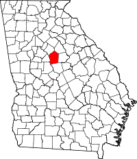 Location in the U.S. state of Georgia | |
 Georgia's location in the U.S. | |
| Founded | December 10, 1807 |
| Named for | William Jasper |
| Seat | Monticello |
| Largest city | Monticello |
| Area | |
| • Total | 373 sq mi (966 km2) |
| • Land | 368 sq mi (953 km2) |
| • Water | 5.3 sq mi (14 km2), 1.4% |
| Population | |
| • (2010) | 13,900 |
| • Density | 38/sq mi (15/km²) |
| Congressional district | 10th |
| Time zone | Eastern: UTC-5/-4 |
Jasper County is a county located in the U.S. state of Georgia. As of the 2010 census, the population was 13,900.[1] The county seat is Monticello.[2]
Jasper County is part of the very large Atlanta-Sandy Springs-Roswell, GA Metropolitan Statistical Area.
History
This area was inhabited by indigenous peoples for thousands of years before the European encounter. At the time of European-Americans settlement, it was inhabited by the Cherokee and Muscogee Creek peoples, who became known as among the Five Civilized Tribes of the Southeast.
The County was created on December 10, 1807, by an act of the Georgia General Assembly with land that was originally part of Baldwin County, Georgia.[3] It became part of the new area of upland settlement through the South eventually known as the Black Belt, and a center of large plantations for short-staple cotton. Invention of the cotton gin in the late 18th century had made processing of this type of cotton profitable, and it was cultivated throughout the inland areas. As migration continued to the west, the county population rapidly rose and fell through the nineteenth century. Georgia settlers pushed Congress for the Indian Removal Act of 1830, which eventually forced most of the Native Americans west of the Mississippi River.
Jasper County was originally named Randolph County (after the Virginian John Randolph). Because of Randolph's opposition to U.S. entry into the War of 1812, the General Assembly changed the name of Randolph County to Jasper County on December 10, 1812, to honor Sergeant William Jasper, an American Revolutionary War hero from South Carolina. However, Randolph's reputation eventually was restored, and in 1828, the General Assembly created a new Randolph County.[4]
Newton County was created from a part of the original Jasper County in 1821.
The Jasper County, Georgia courthouse, was shown and used for filming the courthouse scenes in the motion picture comedy "My Cousin Vinny", starting Joe Pesci. Although the setting of the movie is in Beechum County, Alabama (a fictitious place), near the end of the movie, Sheriff Farley (played by veteran actor Bruce McGill), actually mentions Jasper County, Georgia by name
Government
The county has a five-member county commission, elected from single-member districts. The commission elects a chairman and vice-chairman to aid in conducting business.
Geography
According to the U.S. Census Bureau, the county has a total area of 373 square miles (970 km2), of which 368 square miles (950 km2) is land and 5.3 square miles (14 km2) (1.4%) is water.[5]
The western portion of Jasper County, west of a line formed by State Route 11 to northwest of Monticello, then along the eastern border of the Piedmont National Wildlife Refuge, is located in the Upper Ocmulgee River sub-basin of the Altamaha River basin. The eastern portion of the county is located in the Upper Oconee River sub-basin of the same Altamaha River basin.[6]
Major highways
Adjacent counties
- Morgan County - northeast
- Putnam County - east
- Jones County - south
- Monroe County - southwest
- Butts County - west
- Newton County - northwest
National protected areas
- Oconee National Forest (part)
- Piedmont National Wildlife Refuge (part)
Demographics
| Historical population | |||
|---|---|---|---|
| Census | Pop. | %± | |
| 1810 | 7,573 | — | |
| 1820 | 14,614 | 93.0% | |
| 1830 | 13,131 | −10.1% | |
| 1840 | 11,111 | −15.4% | |
| 1850 | 11,486 | 3.4% | |
| 1860 | 10,743 | −6.5% | |
| 1870 | 10,439 | −2.8% | |
| 1880 | 11,851 | 13.5% | |
| 1890 | 13,879 | 17.1% | |
| 1900 | 15,033 | 8.3% | |
| 1910 | 16,552 | 10.1% | |
| 1920 | 16,362 | −1.1% | |
| 1930 | 8,594 | −47.5% | |
| 1940 | 8,772 | 2.1% | |
| 1950 | 7,473 | −14.8% | |
| 1960 | 6,135 | −17.9% | |
| 1970 | 5,760 | −6.1% | |
| 1980 | 7,553 | 31.1% | |
| 1990 | 8,453 | 11.9% | |
| 2000 | 11,426 | 35.2% | |
| 2010 | 13,900 | 21.7% | |
| Est. 2015 | 13,635 | [7] | −1.9% |
| U.S. Decennial Census[8] 1790-1960[9] 1900-1990[10] 1990-2000[11] 2010-2013[1] | |||
2000 census
As of the census[12] of 2000, there were 11,426 people, 4,175 households, and 3,122 families residing in the county. The population density was 31 people per square mile (12/km²). There were 4,806 housing units at an average density of 13 per square mile (5/km²). The racial makeup of the county was 70.95% White, 27.26% Black or African American, 0.21% Native American, 0.16% Asian, 0.02% Pacific Islander, 0.61% from other races, and 0.79% from two or more races. 2.07% of the population were Hispanic or Latino of any race.
There were 4,175 households out of which 34.60% had children under the age of 18 living with them, 56.80% were married couples living together, 13.30% had a female householder with no husband present, and 25.20% were non-families. 21.40% of all households were made up of individuals and 7.70% had someone living alone who was 65 years of age or older. The average household size was 2.72 and the average family size was 3.14.
In the county the population was spread out with 27.20% under the age of 18, 7.90% from 18 to 24, 28.60% from 25 to 44, 24.50% from 45 to 64, and 11.80% who were 65 years of age or older. The median age was 36 years. For every 100 females there were 96.20 males. For every 100 females age 18 and over, there were 93.00 males.
The median income for a household in the county was $39,890, and the median income for a family was $43,271. Males had a median income of $32,351 versus $21,785 for females. The per capita income for the county was $19,249. About 10.90% of families and 14.20% of the population were below the poverty line, including 19.20% of those under age 18 and 13.50% of those age 65 or over.
2010 census
As of the 2010 United States Census, there were 13,900 people, 5,044 households, and 3,778 families residing in the county.[13] The population density was 37.8 inhabitants per square mile (14.6/km2). There were 6,153 housing units at an average density of 16.7 per square mile (6.4/km2).[14] The racial makeup of the county was 73.9% white, 21.8% black or African American, 0.4% American Indian, 0.2% Asian, 2.0% from other races, and 1.7% from two or more races. Those of Hispanic or Latino origin made up 3.7% of the population.[13] In terms of ancestry, 14.2% were English, 12.2% were Irish, 11.9% were American, and 6.6% were German.[15]
Of the 5,044 households, 36.2% had children under the age of 18 living with them, 55.7% were married couples living together, 13.8% had a female householder with no husband present, 25.1% were non-families, and 20.8% of all households were made up of individuals. The average household size was 2.74 and the average family size was 3.15. The median age was 39.0 years.[13]
The median income for a household in the county was $42,081 and the median income for a family was $52,177. Males had a median income of $40,323 versus $27,491 for females. The per capita income for the county was $20,263. About 13.2% of families and 19.1% of the population were below the poverty line, including 28.7% of those under age 18 and 18.0% of those age 65 or over.[16]
Communities
Notable natives
- Country music artist Trisha Yearwood. In 2005, she released a studio album titled Jasper County.
- NFL player Odell Thurman.
See also
References
- 1 2 "State & County QuickFacts". United States Census Bureau. Retrieved February 16, 2014.
- ↑ "Find a County". National Association of Counties. Retrieved 2011-06-07.
- ↑ - GeorgiaInfo Jasper County Courthouse history
- ↑ GeorgiaInfo.com - Georgia Counties in Order of Creation, University of Georgia
- ↑ "US Gazetteer files: 2010, 2000, and 1990". United States Census Bureau. 2011-02-12. Retrieved 2011-04-23.
- ↑ "Georgia Soil and Water Conservation Commission Interactive Mapping Experience". Georgia Soil and Water Conservation Commission. Retrieved 2015-11-20.
- ↑ "County Totals Dataset: Population, Population Change and Estimated Components of Population Change: April 1, 2010 to July 1, 2015". Retrieved July 2, 2016.
- ↑ "U.S. Decennial Census". United States Census Bureau. Retrieved June 23, 2014.
- ↑ "Historical Census Browser". University of Virginia Library. Retrieved June 23, 2014.
- ↑ "Population of Counties by Decennial Census: 1900 to 1990". United States Census Bureau. Retrieved June 23, 2014.
- ↑ "Census 2000 PHC-T-4. Ranking Tables for Counties: 1990 and 2000" (PDF). United States Census Bureau. Retrieved June 23, 2014.
- ↑ "American FactFinder". United States Census Bureau. Retrieved 2011-05-14.
- 1 2 3 "DP-1 Profile of General Population and Housing Characteristics: 2010 Demographic Profile Data". United States Census Bureau. Retrieved 2015-12-30.
- ↑ "Population, Housing Units, Area, and Density: 2010 - County". United States Census Bureau. Retrieved 2015-12-30.
- ↑ "DP02 SELECTED SOCIAL CHARACTERISTICS IN THE UNITED STATES – 2006-2010 American Community Survey 5-Year Estimates". United States Census Bureau. Retrieved 2015-12-30.
- ↑ "DP03 SELECTED ECONOMIC CHARACTERISTICS – 2006-2010 American Community Survey 5-Year Estimates". United States Census Bureau. Retrieved 2015-12-30.
External links
- Jasper County Sheriff's Office
- Jasper County historical marker
- The Old Loyd Place historical marker
 |
Newton County | Morgan County | | |
| Butts County | |
Putnam County | ||
| ||||
| | ||||
| Monroe County | Jones County |
Municipalities and communities of Jasper County, Georgia, United States | ||
|---|---|---|
| City | | |
| Town | ||
| Unincorporated community | ||
|  | |||||||
|
| ||||||||
| ||||||||
Template:Georgia
Coordinates: 33°19′N 83°41′W / 33.32°N 83.69°W