Walton County, Georgia
| Walton County, Georgia | |
|---|---|
 Walton County courthouse in Monroe | |
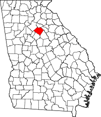 Location in the U.S. state of Georgia | |
 Georgia's location in the U.S. | |
| Founded | December 22, 1818 |
| Named for | George Walton |
| Seat | Monroe |
| Largest city | Monroe |
| Area | |
| • Total | 330 sq mi (855 km2) |
| • Land | 326 sq mi (844 km2) |
| • Water | 4.3 sq mi (11 km2), 1.3% |
| Population (est.) | |
| • (2015) | 88,399 |
| • Density | 257/sq mi (99/km²) |
| Congressional district | 10th |
| Time zone | Eastern: UTC-5/-4 |
| Website |
www |
Walton County is a county located in the U.S. state of Georgia. As of the 2010 census, the population was 83,768.[1] The county seat is Monroe.[2]
Walton County is part of the Atlanta-Sandy Springs-Roswell, GA Metropolitan Statistical Area.
History
Walton County was created on December 15, 1818. It is named for George Walton, one of the three men from Georgia who signed the United States Declaration of Independence. The other two were Button Gwinnett and Lyman Hall.
In July 1946, the county was the site of a lynching of two young black couples, including a veteran of World War II, four persons in total. The mob of 40 men tied them up and shot the two couples so many times that the bodies were difficult to identify. Nobody was ever prosecuted for the murders.[3] In 2013 a new person talked to authorities, claiming his late uncle and at least 12 other members of the Ku Klux Klan had been among the killers, but it was not clear if the investigation could use his testimony.[4]
Walton County is located about 30 miles east of the city of Atlanta. Monroe is the county seat, with other major towns being Loganville and other communities.
Walton County has been home to,the birthplace of, or claim to seven Georgia governors (in chronological order): Wilson Lumpkin, Howell Cobb, Alfred Colquitt, James Boynton, Henry McDaniel, Clifford Walker, and Richard Russell, Jr..
Geography
According to the U.S. Census Bureau, the county has a total area of 330 square miles (850 km2), of which 326 square miles (840 km2) is land and 4.3 square miles (11 km2) (1.3%) is water.[5]
The western half of Walton County, in a half circle from Social Circle through Monroe to northeast of Loganville, is located in the Upper Ocmulgee River sub-basin of the Altamaha River basin. The eastern part of the county, east of that curve, is located in the Upper Oconee River sub-basin of the same Altamaha River basin.[6]
Major highways
Adjacent counties
- Barrow County – north
- Oconee County – northeast
- Morgan County – southeast
- Newton County – south
- Rockdale County – southwest
- Gwinnett County – northwest
Demographics
| Historical population | |||
|---|---|---|---|
| Census | Pop. | %± | |
| 1810 | 1,026 | — | |
| 1820 | 4,192 | 308.6% | |
| 1830 | 10,929 | 160.7% | |
| 1840 | 10,209 | −6.6% | |
| 1850 | 10,821 | 6.0% | |
| 1860 | 11,074 | 2.3% | |
| 1870 | 11,038 | −0.3% | |
| 1880 | 15,622 | 41.5% | |
| 1890 | 17,467 | 11.8% | |
| 1900 | 20,942 | 19.9% | |
| 1910 | 25,393 | 21.3% | |
| 1920 | 24,216 | −4.6% | |
| 1930 | 21,118 | −12.8% | |
| 1940 | 20,777 | −1.6% | |
| 1950 | 20,230 | −2.6% | |
| 1960 | 20,481 | 1.2% | |
| 1970 | 23,404 | 14.3% | |
| 1980 | 31,211 | 33.4% | |
| 1990 | 38,586 | 23.6% | |
| 2000 | 60,687 | 57.3% | |
| 2010 | 83,768 | 38.0% | |
| Est. 2015 | 88,399 | [7] | 5.5% |
| U.S. Decennial Census[8] 1790-1960[9] 1900-1990[10] 1990-2000[11] 2010-2013[1] | |||
2000 census
As of the census[12] of 2000, there were 60,687 people, 21,307 households, and 17,002 families residing in the county. The population density was 184 people per square mile (71/km²). There were 22,500 housing units at an average density of 68 per square mile (26/km²). The racial makeup of the county was 83.03% White, 14.42% Black or African American, 0.25% Native American, 0.70% Asian, 0.02% Pacific Islander, 0.64% from other races, and 0.95% from two or more races. 1.92% of the population were Hispanic or Latino of any race.
There were 21,307 households out of which 39.20% had children under the age of 18 living with them, 62.70% were married couples living together, 12.80% had a female householder with no husband present, and 20.20% were non-families. 16.60% of all households were made up of individuals and 6.20% had someone living alone who was 65 years of age or older. The average household size was 2.82 and the average family size was 3.16.
In the county the population was spread out with 28.40% under the age of 18, 8.10% from 18 to 24, 32.20% from 25 to 44, 21.70% from 45 to 64, and 9.60% who were 65 years of age or older. The median age was 34 years. For every 100 females there were 94.90 males. For every 100 females age 18 and over, there were 93.00 males.
The median income for a household in the county was $46,479 and the median income for a family was $52,386. Males had a median income of $37,482 versus $25,840 for females. The per capita income for the county was $19,470. About 8.00% of families and 9.70% of the population were below the poverty line, including 12.30% of those under age 18 and 10.60% of those age 65 or over.
2010 census
As of the 2010 United States Census, there were 83,768 people, 29,583 households, and 22,921 families residing in the county.[13] The population density was 257.2 inhabitants per square mile (99.3/km2). There were 32,435 housing units at an average density of 99.6 per square mile (38.5/km2).[14] The racial makeup of the county was 80.1% white, 15.6% black or African American, 1.1% Asian, 0.3% American Indian, 0.1% Pacific islander, 1.4% from other races, and 1.5% from two or more races. Those of Hispanic or Latino origin made up 3.2% of the population.[13] In terms of ancestry, 20.2% were American, 12.2% were Irish, 10.9% were English, and 8.9% were German.[15]
Of the 29,583 households, 40.7% had children under the age of 18 living with them, 58.5% were married couples living together, 13.9% had a female householder with no husband present, 22.5% were non-families, and 18.7% of all households were made up of individuals. The average household size was 2.81 and the average family size was 3.19. The median age was 37.4 years.[13]
The median income for a household in the county was $51,721 and the median income for a family was $58,750. Males had a median income of $45,669 versus $32,064 for females. The per capita income for the county was $22,521. About 10.5% of families and 12.5% of the population were below the poverty line, including 17.6% of those under age 18 and 9.1% of those age 65 or over.[16]
Government
Walton County has a 6-member commission elected from single-member districts. This legislative body can pass laws for the county and tax bills. The county chairman is elected at-large to serve as the leader. If a seat becomes vacant during the term, the governor can appoint someone to fill the seat, based on recommendations. In 2015, two of the six positions were filled by appointees.
Communities
Cities
Towns
Unincorporated communities
- Bold Springs
- Campton
- Gratis
- Mt. Vernon
- Pannell
- Windsor
- Youth
See also
References
- Camp, Lynn Robinson, and Jennifer E. Cheek-Collins. Walton County, Georgia (Black America Series; Charleston, S.C., 2003) (ISBN 0-7385-1528-0).
- Sams, Anita B. Wayfarers in Walton: A History of Walton County, Georgia, 1818–1967 (Monroe, Ga., 1967).
- 1 2 "State & County QuickFacts". United States Census Bureau. Retrieved June 27, 2014.
- ↑ "Find a County". National Association of Counties. Retrieved 2011-06-07.
- ↑ "Lynching in the South; Marking Murder". The Economist. 21 February 2015.
- ↑ Joeff Davis, "New information to be presented in unsolved Georgia lynching case", Creative Loafing (Atlanta), 1 March 2014
- ↑ "US Gazetteer files: 2010, 2000, and 1990". United States Census Bureau. 2011-02-12. Retrieved 2011-04-23.
- ↑ "Georgia Soil and Water Conservation Commission Interactive Mapping Experience". Georgia Soil and Water Conservation Commission. Retrieved 2015-11-18.
- ↑ "County Totals Dataset: Population, Population Change and Estimated Components of Population Change: April 1, 2010 to July 1, 2015". Retrieved July 2, 2016.
- ↑ "U.S. Decennial Census". United States Census Bureau. Retrieved June 27, 2014.
- ↑ "Historical Census Browser". University of Virginia Library. Retrieved June 27, 2014.
- ↑ "Population of Counties by Decennial Census: 1900 to 1990". United States Census Bureau. Retrieved June 27, 2014.
- ↑ "Census 2000 PHC-T-4. Ranking Tables for Counties: 1990 and 2000" (PDF). United States Census Bureau. Retrieved June 27, 2014.
- ↑ "American FactFinder". United States Census Bureau. Retrieved 2008-01-31.
- 1 2 3 "DP-1 Profile of General Population and Housing Characteristics: 2010 Demographic Profile Data". United States Census Bureau. Retrieved 2015-12-30.
- ↑ "Population, Housing Units, Area, and Density: 2010 - County". United States Census Bureau. Retrieved 2015-12-30.
- ↑ "DP02 SELECTED SOCIAL CHARACTERISTICS IN THE UNITED STATES – 2006-2010 American Community Survey 5-Year Estimates". United States Census Bureau. Retrieved 2015-12-30.
- ↑ "DP03 SELECTED ECONOMIC CHARACTERISTICS – 2006-2010 American Community Survey 5-Year Estimates". United States Census Bureau. Retrieved 2015-12-30.
External links
- Georgia.gov on Walton County
- http://www.negrdc.org/counties/walton/default.asp
- "Holding on to Those Who Can't be Held": Reenacting a Lynching at Moore's Ford, Georgia" Southern Spaces, November 8, 2010.
 |
Gwinnett County | Barrow County | Oconee County | |
| |
||||
| ||||
| | ||||
| Rockdale County | Newton County | Morgan County |
Municipalities and communities of Walton County, Georgia, United States | ||
|---|---|---|
| Cities | | |
| Towns | ||
| Unincorporated communities | ||
| Footnotes | ‡This populated place also has portions in an adjacent county or counties | |
|  | |||||||
|
| ||||||||
| ||||||||
Template:Georgia
Coordinates: 33°47′N 83°44′W / 33.78°N 83.74°W