Polk County, Georgia
| Polk County, Georgia | |
|---|---|
 Polk County Courthouse in Cedartown | |
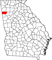 Location in the U.S. state of Georgia | |
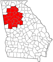
 Georgia's location in the U.S. | |
| Founded | December 20, 1851 |
| Named for | James K. Polk |
| Seat | Cedartown |
| Largest city | Cedartown |
| Area | |
| • Total | 312 sq mi (808 km2) |
| • Land | 310 sq mi (803 km2) |
| • Water | 1.8 sq mi (5 km2), 0.6% |
| Population | |
| • (2010) | 41,475 |
| • Density | 134/sq mi (52/km²) |
| Congressional district | 14th |
| Time zone | Eastern: UTC-5/-4 |
| Website |
www |

Polk County is a county located in the northwestern part of the U.S. state of Georgia. As of the 2010 census, the population was 41,475.[1] The county seat is Cedartown.[2] The county was created on December 20, 1851 by an act of the Georgia General Assembly and named after James K. Polk, the eleventh President of the United States.[3]
Polk County comprises the Cedartown, GA Metropolitan Statistical Area, which is also included in the Atlanta-Athens-Clarke County-Sandy Springs, GA Combined Statistical Area
Geography
According to the U.S. Census Bureau, the county has a total area of 312 square miles (810 km2), of which 310 square miles (800 km2) is land and 1.8 square miles (4.7 km2) (0.6%) is water.[4]
Most of eastern Polk County, centered on Rockmart, is located in the Etowah River sub-basin of the ACT River Basin (Alabama-Coosa-Tallapoosa River Basin), while most of western Polk County, centered on Cedartown, is located in the Upper Coosa River sub-basin of the same ACT River Basin. Small slivers of the southern edges of the county are located in the Upper Tallapoosa River sub-basin of the same larger ACT River Basin.[5]
Major highways
Adjacent counties
- Floyd County – north
- Bartow County – northeast
- Paulding County – east
- Haralson County – south
- Cleburne County, Alabama – southwest
- Cherokee County, Alabama – west
Demographics
| Historical population | |||
|---|---|---|---|
| Census | Pop. | %± | |
| 1860 | 6,295 | — | |
| 1870 | 7,822 | 24.3% | |
| 1880 | 11,952 | 52.8% | |
| 1890 | 14,945 | 25.0% | |
| 1900 | 17,856 | 19.5% | |
| 1910 | 20,203 | 13.1% | |
| 1920 | 20,357 | 0.8% | |
| 1930 | 25,141 | 23.5% | |
| 1940 | 28,467 | 13.2% | |
| 1950 | 30,976 | 8.8% | |
| 1960 | 28,015 | −9.6% | |
| 1970 | 29,656 | 5.9% | |
| 1980 | 32,386 | 9.2% | |
| 1990 | 33,815 | 4.4% | |
| 2000 | 38,127 | 12.8% | |
| 2010 | 41,475 | 8.8% | |
| Est. 2015 | 41,524 | [6] | 0.1% |
| U.S. Decennial Census[7] 1790-1960[8] 1900-1990[9] 1990-2000[10] 2010-2013[1] | |||
2000 census
As of the census[11] of 2000, there were 38,127 people, 14,012 households, and 10,340 families residing in the county. The population density was 122 people per square mile (47/km²). There were 15,059 housing units at an average density of 48 per square mile (19/km²). The racial makeup of the county was 80.52% White, 13.34% Black or African American, 0.22% Native American, 0.31% Asian, 0.04% Pacific Islander, 4.62% from other races, and 0.95% from two or more races. 7.66% of the population were Hispanic or Latino of any race.
There were 14,012 households out of which 32.90% had children under the age of 18 living with them, 55.90% were married couples living together, 13.10% had a female householder with no husband present, and 26.20% were non-families. 22.70% of all households were made up of individuals and 10.50% had someone living alone who was 65 years of age or older. The average household size was 2.66 and the average family size was 3.09.
In the county the population was spread out with 26.10% under the age of 18, 9.70% from 18 to 24, 28.80% from 25 to 44, 22.30% from 45 to 64, and 13.20% who were 65 years of age or older. The median age was 35 years. For every 100 females there were 99.20 males. For every 100 females age 18 and over, there were 95.70 males.
The median income for a household in the county was $32,328, and the median income for a family was $37,847. Males had a median income of $29,985 versus $21,452 for females. The per capita income for the county was $15,617. About 11.20% of families and 15.50% of the population were below the poverty line, including 18.70% of those under age 18 and 12.60% of those age 65 or over.
2010 census
As of the 2010 United States Census, there were 41,475 people, 15,092 households, and 10,908 families residing in the county.[12] The population density was 133.6 inhabitants per square mile (51.6/km2). There were 16,908 housing units at an average density of 54.5 per square mile (21.0/km2).[13] The racial makeup of the county was 77.1% white, 12.5% black or African American, 0.7% Asian, 0.3% American Indian, 0.1% Pacific islander, 7.5% from other races, and 1.8% from two or more races. Those of Hispanic or Latino origin made up 11.8% of the population.[12] In terms of ancestry, 17.2% were English, 15.2% were American, 13.0% were Irish, and 5.3% were German.[14]
Of the 15,092 households, 38.2% had children under the age of 18 living with them, 51.5% were married couples living together, 14.8% had a female householder with no husband present, 27.7% were non-families, and 23.6% of all households were made up of individuals. The average household size was 2.72 and the average family size was 3.20. The median age was 36.2 years.[12]
The median income for a household in the county was $38,646 and the median income for a family was $43,172. Males had a median income of $37,070 versus $27,758 for females. The per capita income for the county was $18,214. About 15.6% of families and 19.3% of the population were below the poverty line, including 25.4% of those under age 18 and 10.5% of those age 65 or over.[15]
Recreation
- Silver Comet Trail[16]
- Nathan Dean Complex and Park
Communities
See also
References
- 1 2 "State & County QuickFacts". United States Census Bureau. Retrieved February 18, 2014.
- ↑ "Find a County". National Association of Counties. Retrieved 2011-06-07.
- ↑ "Polk County". Calhoun Times. 1 September 2004. p. 97. Retrieved 26 April 2015.
- ↑ "US Gazetteer files: 2010, 2000, and 1990". United States Census Bureau. 2011-02-12. Retrieved 2011-04-23.
- ↑ "Georgia Soil and Water Conservation Commission Interactive Mapping Experience". Georgia Soil and Water Conservation Commission. Retrieved 2015-11-18.
- ↑ "County Totals Dataset: Population, Population Change and Estimated Components of Population Change: April 1, 2010 to July 1, 2015". Retrieved July 2, 2016.
- ↑ "U.S. Decennial Census". United States Census Bureau. Retrieved June 25, 2014.
- ↑ "Historical Census Browser". University of Virginia Library. Retrieved June 25, 2014.
- ↑ "Population of Counties by Decennial Census: 1900 to 1990". United States Census Bureau. Retrieved June 25, 2014.
- ↑ "Census 2000 PHC-T-4. Ranking Tables for Counties: 1990 and 2000" (PDF). United States Census Bureau. Retrieved June 25, 2014.
- ↑ "American FactFinder". United States Census Bureau. Retrieved 2008-01-31.
- 1 2 3 "DP-1 Profile of General Population and Housing Characteristics: 2010 Demographic Profile Data". United States Census Bureau. Retrieved 2015-12-30.
- ↑ "Population, Housing Units, Area, and Density: 2010 - County". United States Census Bureau. Retrieved 2015-12-30.
- ↑ "DP02 SELECTED SOCIAL CHARACTERISTICS IN THE UNITED STATES – 2006-2010 American Community Survey 5-Year Estimates". United States Census Bureau. Retrieved 2015-12-30.
- ↑ "DP03 SELECTED ECONOMIC CHARACTERISTICS – 2006-2010 American Community Survey 5-Year Estimates". United States Census Bureau. Retrieved 2015-12-30.
- ↑ Silver Comet Trail, Polk County Information – Georgia
External links
- Polk County Historical Society
- Polk County Genealogy
- Polk County Courthouse – Carl Vinson Institute of Government, University of Georgia
- Polk County Tourism website – Polk on Purpose!
 |
Floyd County | Bartow County | | |
| Cherokee County, Alabama | |
Paulding County | ||
| ||||
| | ||||
| Cleburne County, Alabama | Haralson County |
Municipalities and communities of Polk County, Georgia, United States | ||
|---|---|---|
| Cities | | |
| Town | ||
| Unincorporated communities | ||
| Footnotes | ‡This populated place also has portions in an adjacent county or counties | |
|  | |||||||
|
| ||||||||
| ||||||||
Template:Georgia
Coordinates: 34°00′N 85°11′W / 34.00°N 85.18°W