Dawson, Georgia
| Dawson, Georgia | |
|---|---|
| City | |
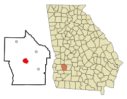 Location in Terrell County and the state of Georgia | |
| Coordinates: 31°46′26″N 84°26′27″W / 31.77389°N 84.44083°WCoordinates: 31°46′26″N 84°26′27″W / 31.77389°N 84.44083°W | |
| Country | United States |
| State | Georgia |
| County | Terrell |
| Area | |
| • Total | 3.7 sq mi (9.5 km2) |
| • Land | 3.7 sq mi (9.5 km2) |
| • Water | 0 sq mi (0 km2) |
| Elevation | 351 ft (107 m) |
| Population (2010) | |
| • Total | 4,557 |
| • Density | 1,367/sq mi (532.4/km2) |
| Time zone | Eastern (EST) (UTC-5) |
| • Summer (DST) | EDT (UTC-4) |
| ZIP codes | 31742, 39842 |
| Area code(s) | 229 |
| FIPS code | 13-21912[1] |
| GNIS feature ID | 0313367[2] |
Dawson is a city in and the county seat of Terrell County, Georgia. The population was 4,557 at the 2010 census.[1] Incorporated on December 22, 1857, the city is named for Senator William Crosby Dawson.
Dawson is part of the Albany, Georgia Metropolitan Statistical Area.
History
Dawson was founded in 1856 as seat of the newly formed Terrell County. It was incorporated as a town in 1857 and as a city in 1872.[3] It was an important site in the 1960s, when the county in which it is located was labeled "Terrible Terrell" by the Student Nonviolent Coordinating Committee (SNCC). Jackie Robinson helped raise money to rebuild three Black churches that were burned in the area.
Geography
Dawson is located in Southwest Georgia along U.S. Route 82 and Georgia State Route 520 (Columbus Highway), which leads southeast 8 mi (13 km) to Sasser and northwest 9 mi (14 km) to Parrott. U.S. 82 leads west 21 mi (34 km) to Cuthbert and 47 mi (76 km) to Eufaula, Alabama. Albany is 24 mi (39 km) southeast and Columbus is 63 mi (101 km) northwest.
The city is located at 31°46′26″N 84°26′27″W / 31.77389°N 84.44083°W (31.773969, -84.440870).[4]
According to the United States Census Bureau, the city has a total area of 3.7 square miles (9.6 km2), all land.
Demographics
| Historical population | |||
|---|---|---|---|
| Census | Pop. | %± | |
| 1860 | 521 | — | |
| 1870 | 1,099 | 110.9% | |
| 1880 | 1,576 | 43.4% | |
| 1890 | 2,284 | 44.9% | |
| 1900 | 2,926 | 28.1% | |
| 1910 | 3,827 | 30.8% | |
| 1920 | 3,504 | −8.4% | |
| 1930 | 3,827 | 9.2% | |
| 1940 | 3,681 | −3.8% | |
| 1950 | 4,411 | 19.8% | |
| 1960 | 5,062 | 14.8% | |
| 1970 | 5,383 | 6.3% | |
| 1980 | 5,699 | 5.9% | |
| 1990 | 5,295 | −7.1% | |
| 2000 | 5,058 | −4.5% | |
| 2010 | 4,540 | −10.2% | |
| Est. 2015 | 4,353 | [5] | −4.1% |
As of the census[1] of 2000, there were 5,058 people, 1,791 households, and 1,276 families residing in the city. The population density was 1,373.5 people per square mile (530.7/km²). There were 1,967 housing units at an average density of 534.1 per square mile (206.4/km²). The racial makeup of the city was 21.49% White, 77.26% African American, 0.06% Native American, 0.40% Asian, 0.10% from other races, and 0.69% from two or more races. Hispanic or Latino of any race were 0.93% of the population.
There were 1,791 households out of which 34.1% had children under the age of 18 living with them, 33.9% were married couples living together, 32.4% had a female householder with no husband present, and 28.7% were non-families. 25.6% of all households were made up of individuals and 10.8% had someone living alone who was 65 years of age or older. The average household size was 2.76 and the average family size was 3.29.
In the city the population was spread out with 30.3% under the age of 18, 11.1% from 18 to 24, 24.7% from 25 to 44, 19.9% from 45 to 64, and 14.0% who were 65 years of age or older. The median age was 33 years. For every 100 females there were 83.3 males. For every 100 females age 18 and over, there were 74.6 males.
The median income for a household in the city was $24,140, and the median income for a family was $25,511. Males had a median income of $26,006 versus $18,629 for females. The per capita income for the city was $10,752. About 31.6% of families and 36.3% of the population were below the poverty line, including 49.8% of those under age 18 and 26.0% of those age 65 or over.
Climate
This area climate is characterized by Wamer humid summers and generally mild to cold in the winters. According to the Köppen Climate Classification system, England has a humid subtropical climate, abbreviated "Cfa" on climate maps.[7]
| Climate data for Dawson, Georgia | |||||||||||||
|---|---|---|---|---|---|---|---|---|---|---|---|---|---|
| Month | Jan | Feb | Mar | Apr | May | Jun | Jul | Aug | Sep | Oct | Nov | Dec | Year |
| Average high °C (°F) | 26 (78) |
14 (58) |
17 (63) |
24 (75) |
26 (79) |
30 (86) |
33 (92) |
34 (93) |
33 (91) |
26 (79) |
21 (69) |
16 (60) |
26 (79) |
| Average low °C (°F) | 2 (36) |
4 (40) |
11 (51) |
12 (53) |
18 (64) |
20 (68) |
21 (70) |
22 (71) |
21 (69) |
12 (53) |
7 (44) |
2 (36) |
13 (55) |
| Average precipitation mm (inches) | 117 (4.6) |
114 (4.5) |
140 (5.5) |
104 (4.1) |
91 (3.6) |
130 (5.1) |
150 (5.9) |
122 (4.8) |
99 (3.9) |
56 (2.2) |
80 (3) |
112 (4.4) |
1,250 (49.2) |
| Source: Weatherbase [8] | |||||||||||||
Education
Terrell County School District
The Terrell County School District holds pre-school to grade twelve, and consists of two elementary schools, a middle school and a high school.[9] The district has 98 full-time teachers and over 1,764 students.[10]
- Cooper-Carver Elementary School
- Terrell County Middle High School
Private education
- Terrell Academy
Higher education
Nearby Albany has three colleges to which students may easily commute: Darton State College,[11] Albany State University,[12] and Albany Technical College.[13] To the west, in Cuthbert, is historic Andrew College.[14] Also nearby is Georgia Southwestern State University[15] in Americus.
Notable people
- Lucius D. Battle - ambassador to Egypt
- Erle Cocke, Jr. - U.S. National Guard general
- Benjamin J. Davis - attorney who defended man trying to organize a union from insurrection charges; elected as New York City Councilman after move to New York; Communist Party leader in 1930s
- Wayland Flowers - puppeteer best known for his puppet known as "Madame"
- Robert J. Jones, PhD - 19th president of State University of New York at Albany
- Otis Redding - American soul singer, crossover artist who appealed to both young whites and blacks
- Walter Washington - elected as first black mayor of Washington, D.C. after the city was granted home rule by Congress
- Bessie Jones - gospel/folk singer
References
- 1 2 3 "American FactFinder". United States Census Bureau. Retrieved 2008-01-31.
- ↑ "US Board on Geographic Names". United States Geological Survey. 2007-10-25. Retrieved 2008-01-31.
- ↑ Hellmann, Paul T. (May 13, 2013). Historical Gazetteer of the United States. Routledge. p. 227. Retrieved 30 November 2013.
- ↑ "US Gazetteer files: 2010, 2000, and 1990". United States Census Bureau. 2011-02-12. Retrieved 2011-04-23.
- ↑ "Annual Estimates of the Resident Population for Incorporated Places: April 1, 2010 to July 1, 2015". Retrieved July 2, 2016.
- ↑ "Census of Population and Housing". Census.gov. Retrieved June 4, 2015.
- ↑ Climate Summary for Dawson, Georgia
- ↑ "Weatherbase.com". Weatherbase. 2013. Retrieved on October 15, 2013.
- ↑ Georgia Board of Education, Retrieved June 27, 2010.
- ↑ School Stats, Retrieved June 27, 2010.
- ↑ Darton College, Retrieved June 27, 2010.
- ↑ Albany State University, Retrieved June 27, 2010.
- ↑ Albany Technical College, Retrieved June 27, 2010.
- ↑ Andrew College, Retrieved June 27, 2010.
- ↑ Georgia Southwestern State University, Retrieved June 27, 2010.
Municipalities and communities of Terrell County, Georgia, United States | ||
|---|---|---|
| City | 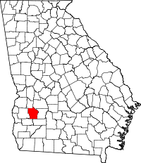 | |
| Towns | ||