Yermo, California
| Yermo | |
|---|---|
| Town | |
|
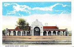
The former Union Pacific depot in the 1920s | |
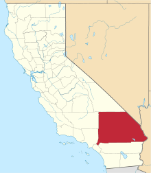
 Yermo Location within the state of California | |
| Coordinates: 34°54′18″N 116°49′13″W / 34.90500°N 116.82028°WCoordinates: 34°54′18″N 116°49′13″W / 34.90500°N 116.82028°W | |
| Country | United States |
| State | California |
| County | San Bernardino |
| Elevation[1] | 1,929 ft (588 m) |
| Time zone | Pacific (PST) (UTC-8) |
| • Summer (DST) | PDT (UTC-7) |
| ZIP codes | 92398 |
| Area codes | 442/760 |
| FIPS code | 06-86720 |
| GNIS feature ID | 251862 |
| Website |
www |
Yermo is a town in the Mojave Desert in San Bernardino County, California. Its name is derived from one of the Spanish words for "desert". [2][3] It is 13 miles east of Barstow on Interstate 15, just south of the Calico Mountains. In 2009, the town's population was an estimated 1,750.
Founded in 1902 and originally named Otis, the town is situated at a division point of the Union Pacific Railroad line. [3] A post office was established three years later with William J. Flavin serving as Yermo's first postmaster. [3] The town later developed around serving motorists traveling on the Arrowhead Trail (later U.S. Route 91), which ran through the community. Today, Yermo is governed by an elected five-member board of directors comprising the Community Services District authorized by the County of San Bernardino. The board, which meets monthly, oversees the town's volunteer fire department, the Yermo/Calico VFD, as well as its street lighting, parks and water system. Yermo's ZIP Code is 92398, and the community is in telephone area codes 442 and 760. Its USPS branch provides post office boxes to local residents and businesses; there is no letter-carrier service.
Yermo hosts the 1,859-acre (7.5 km2) storage and industrial annex of the Marine Corps Logistics Base Barstow.
Economy
Businesses
When the Interstate 15 highway opened in 1968, Yermo was immediately bypassed by traffic traveling to and from Las Vegas, Nevada. As a result, 90 percent of its local businesses were required to close. During its heyday, Yermo had 27 gas stations with mechanics, seven bars, two grocery stores, a hardware store, a pizza shop, four real estate offices, three motels, a thrift store, several restaurants, roadside camping sites and two parks. In 2009, it had one grocery/general store, one bar, one thrift store, three restaurants, four gas stations, one park, and one motel three miles south of town. The fast-food restaurant chain Del Taco was founded in Yermo in 1964;[4] the original structure remains active as a local fast food restaurant, The Burger Den.
Yermo has a California agriculture inspection station[5] for traffic heading south on Interstate 15. Caltrans has begun construction on a new port of entry[6] on Interstate 15 just south of the Nevada border, between Yates Well Road and Nipton Road, a joint venture of Caltrans, the California Department of Food and Agriculture, the California Department of General Services and the California Highway Patrol. The new facility will replace the inspection station in Yermo, which will be demolished.
Tourism
In the mid-20th century, the Yermo chamber of commerce styled the town the "Gateway to the Calicos", referring to the Calico Mountains and the historic Calico Ghost Town located 3 miles north of town. At the time, Yermo and Barstow were campaigning to establish a state park at Calico,[7] which was an active silver mining town from the early 1880s until the turn of the 20th century. In 1952, entrepreneur Walter Knott, whose uncle John King was once Calico's sheriff, and who worked at the town as a carpenter in 1915,[8] purchased Calico and restored it. He later deeded it to the San Bernardino County,[9] which operates the site as a historical county park and a popular tourist attraction of the U.S. Southwest.
Other establishments
Schools
The Silver Valley Unified School District (SVUSD) is the education authority in the Yermo area. It operates K-12 schools in the communities of Yermo, Daggett and Newberry Springs, and at the U.S. Army National Training Center at Ft. Irwin.
Churches
In 2009 Yermo had three active churches, one Baptist and two non-denominational/fundamentalist.
Climate
According to the Köppen Climate Classification system, Yermo has a semi-arid climate, abbreviated "BSk" on climate maps.[10]
References
- ↑ "Yermo". Geographic Names Information System. United States Geological Survey. Retrieved April 9, 2015.
- ↑ T&E Brochure - Bureau of Land Management
- 1 2 3 Salley, Harold E.; Patera, Edward L. (1991). History of California Post Offices, 1849-1990. The Depot.
- ↑ Gant, Tina (2003). International Directory of Company Histories. Gale. pp. 89–91.
- ↑ "CDFA Field/District Offices". California Department of Food and Agriculture. Retrieved 2013-09-05.
- ↑ "Environmental Assessment for Interstate 15 Joint Port of Entry" (PDF). Bureau of Land Management-Needles Field Office. Retrieved 2014-06-24.
- ↑ "Urge Calico State Park" (PDF). Desert: 32. May 1953. Retrieved 2013-09-06. Excerpted from the Barstow Printer-Review
- ↑ Douglas W. Steeples (1999). Treasure from the Painted Desert. p. 16. Retrieved 15 October 2014.Steeples, Douglas W., "Treasure from the Painted Desert: A History of Calico, California, 1882-1907", 1999
- ↑ Kyle, Douglas E. (1990). Historic Spots in California. Stanford University Press. p. 314.
- ↑ Climate Summary for Yermo, California