Kramer Hills, California
For the range of hills nearby, see Kramer Hills.
| Kramer Hills | |
|---|---|
| Unincorporated community | |
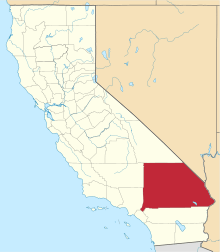
 Kramer Hills Location in California | |
| Coordinates: 34°55′15″N 117°28′07″W / 34.92083°N 117.46861°WCoordinates: 34°55′15″N 117°28′07″W / 34.92083°N 117.46861°W[1] | |
| Country | United States |
| State | California |
| County | San Bernardino |
| Elevation[1] | 2,739 ft (835 m) |
| Time zone | Pacific Time Zone (UTC−8) |
| • Summer (DST) | PDT (UTC−7) |
| Area codes | 442/760 |
| FIPS code | 06-38905 |
| GNIS feature ID | 252916 |
Kramer Hills is an unincorporated community in San Bernardino County, California, United States. Kramer Hills is 6.4 miles (10.3 km) southeast of Kramer Junction and 26 miles (42 km) west of Barstow.
The small mining camp of Kramer Hill was founded around 1885 after a nearby copper discovery, but was short-lived. Later discoveries of gold and copper revived interest, but the only substantial development was at the Herkelrath gold mine around 1926. Actual production (if any) is unknown, but many claims were staked and much prospecting done.[2][3]
References
- 1 2 "Kramer Hills". Geographic Names Information System. United States Geological Survey. Retrieved May 11, 2015.
- ↑ Kramer Hills at Mining History of the California Desert Conservation Area
- ↑ Kramer Hills and Herkelrath at Mindat
This article is issued from Wikipedia - version of the 5/11/2015. The text is available under the Creative Commons Attribution/Share Alike but additional terms may apply for the media files.