Lucerne Valley, California
| Lucerne Valley | ||
|---|---|---|
| census-designated place | ||
|
Aerial view of the Lucerne Valley in the Mojave Desert | ||
| ||
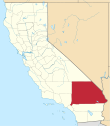
 Lucerne Valley Location within the state of California | ||
| Coordinates: 34°26′38″N 116°58′1″W / 34.44389°N 116.96694°WCoordinates: 34°26′38″N 116°58′1″W / 34.44389°N 116.96694°W | ||
| Country |
| |
| State |
| |
| County | San Bernardino | |
| Government | ||
| • Managed by | County of San Bernardino, 5th District | |
| Area[1] | ||
| • Total | 105.590 sq mi (273.477 km2) | |
| • Land | 105.590 sq mi (273.477 km2) | |
| • Water | 0 sq mi (0 km2) 0% | |
| Elevation[2] | 2,953 ft (900 m) | |
| Population (2010) | ||
| • Total | 5,811 | |
| • Density | 55/sq mi (21/km2) | |
| Time zone | Pacific (PST) (UTC-8) | |
| • Summer (DST) | PDT (UTC-7) | |
| ZIP code | 92356 | |
| Area codes | 442/760 | |
| GNIS Feature IDs | 272271; 2627937 | |
| Website |
lucernevalley | |
| U.S. Geological Survey Geographic Names Information System: Lucerne Valley, California; U.S. Geological Survey Geographic Names Information System: Lucerne Valley, California | ||
.jpg)
Lucerne Valley is a census-designated place[3] and valley landform located in the southern Mojave Desert, within western San Bernardino County, California. On September 24–25, 2016, The Grand Tour on Amazon Prime shot an episode at Rabbit Dry Lake outside of Lucerne Valley town limits.[4]
Geography
.jpg)
The geographic valley is defined by the surrounding Granite Mountains, Ord Mountains, and San Bernardino Mountains.
Lucerne Valley lies east of the Victor Valley, whose population nexus includes Victorville, Apple Valley, Adelanto and Hesperia. It is located 19 miles (31 km) east of Apple Valley, and 20 miles (32 km) north of Big Bear Lake. Distant surrounding communities include Yucca Valley which lies 45 miles (72 km) east via State Route 247/Old Woman Springs Road, and Barstow, which is 26 miles (42 km) north via State Route 247/Barstow Road.
The transportation nexus of Lucerne Valley is located where State Route 247 and State Route 18 are connected by Old Woman Springs and Barstow Roads, the two highways do not have a direct junction.
In San Bernardino County, Lucerne Valley's area is also identified as County Service Area 29. While Lucerne Valley's "town limit" signs are within 2 miles of each other, the County Service Area Limits are much larger: in the west to Joshua Road (unpaved road east of Milpas Rd. on Hwy. 18), to the north at the 4,000 feet (1,200 m) height of Ord Mountain on Highway 247, to the south at the entrance to Cushenbury Canyon on Highway 18, and at Old Woman Springs Ranch as the eastern boundary.[5] On June 11, 2013, Lucerne Valley and Johnson Valley were merged under the same Municipal Advisory Council, which serves as an advisory reporting agency to the County of San Bernardino District Supervisor concerning the region.[6] On August 14, 2013, Johnson Valley was sworn in to the same Municipal Advisory Council as Lucerne Valley.[7] CSA 29's borders, however, remain unchanged from the move.
According to the United States Census Bureau, the CDP covers an area of 105.6 square miles (273.5 km²), all of it land.
Climate
According to the Köppen Climate Classification system, Lucerne Valley has a semi-arid climate, abbreviated "BSk" on climate maps.[8]
Demographics
The 2010 United States Census[9] reported that Lucerne Valley had a population of 5,811. The population density was 55.0 people per square mile (21.2/km²). The racial makeup of Lucerne Valley was 4,507 (77.6%) White (66.8% Non-Hispanic White),[10] 170 (2.9%) African American, 106 (1.8%) Native American, 90 (1.5%) Asian, 0 (0.0%) Pacific Islander, 676 (11.6%) from other races, and 262 (4.5%) from two or more races. Hispanic or Latino of any race were 1,447 persons (24.9%).
The Census reported that 5,780 people (99.5% of the population) lived in households, 31 (0.5%) lived in non-institutionalized group quarters, and 0 (0%) were institutionalized.
There were 2,176 households, out of which 685 (31.5%) had children under the age of 18 living in them, 954 (43.8%) were opposite-sex married couples living together, 280 (12.9%) had a female householder with no husband present, 157 (7.2%) had a male householder with no wife present. There were 146 (6.7%) unmarried opposite-sex partnerships, and 14 (0.6%) same-sex married couples or partnerships. 632 households (29.0%) were made up of individuals and 255 (11.7%) had someone living alone who was 65 years of age or older. The average household size was 2.66. There were 1,391 families (63.9% of all households); the average family size was 3.28.
The population was spread out with 1,424 people (24.5%) under the age of 18, 452 people (7.8%) aged 18 to 24, 1,214 people (20.9%) aged 25 to 44, 1,780 people (30.6%) aged 45 to 64, and 941 people (16.2%) who were 65 years of age or older. The median age was 42.7 years. For every 100 females there were 106.1 males. For every 100 females age 18 and over, there were 105.4 males.
There were 2,949 housing units at an average density of 27.9 per square mile (10.8/km²), of which 1,454 (66.8%) were owner-occupied, and 722 (33.2%) were occupied by renters. The homeowner vacancy rate was 4.3%; the rental vacancy rate was 9.0%. 3,800 people (65.4% of the population) lived in owner-occupied housing units and 1,980 people (34.1%) lived in rental housing units.
According to the 2010 United States Census, Lucerne Valley had a median household income of $30,142, with 18.4% of the population living below the federal poverty line.[10]
Development
Zoning
The majority of Lucerne Valley's zoning consists of Rural Residential, Resource Conservation and Agricultural zones.
Industrial zoning is predominantly in the southern border of the community on the north-facing slopes of the San Bernardino Mountains.[11]
The commercial zoning corridor is primarily on State Route 18, with outlying businesses within a mile of the eastern half of the Old Woman Springs/Barstow Road junction. Commercial development is focused on mixed-use development, with storefronts facing the highway and a private residence on the same property behind the business on the same lot. Traditional retail construction has been restrained in the latter half of the 20th Century to keep the rural character of the town intact,[11] but in September 2015 a Dollar General store[12] opened as the first franchise grocery retail to enter town limits.
All residential zones are classified as Rural, Single or Medium density. Most housing developments are tract-based and were completed prior to the 1990s. No further tract-based construction projects have occurred in 20 years, with most new construction done individually on privately owned lots.[11] An attempt to construct a golf course and install utilities for residential/commercial zones called "Rancho Lucerne"[13] began grading north of the High School site before embezzlement charges filed against the financier caused the project to shut down in 2001, leaving the site abandoned and desert habitat destroyed.[14][15]
Utilities
Utilities development projects have met with mixed reactions from residents and state/county officials, including solar power plants and wind turbine plants,[16] and water well drilling and export proposals. They all would transport local resources for statewide use: such as power added to state grid through CalISO; or as water rights for power projects cooling purposes or for direct use by the Los Angeles Department of Water and Power (LADWP) to the Los Angeles metropolitan area. In 2012, LADWP cancelled an attempt to install a 2 mile wide water and power corridor in the southern half of the town.[17]
Education
Lucerne Valley Unified School District operates three school campuses. [18] Lucerne Valley Elementary School, built in 1952, is a 1/4 mile north of Old Woman Springs and Barstow Road and serves grades K-5. Lucerne Valley Middle School was built in 1986 on State Route 18, and formerly serviced grades 6-8 there. Lucerne Valley Middle School later merged with Lucerne Valley High School. Lucerne Valley High School was built in 1992, on Rabbit Springs Road east of State Route 247 and services grades 9-12, and the middle school's 6-8. Lucerne Valley High School offers athletics, FFA, and other activities for students.[19] The high school's first graduating class was in 1995. The School District Office, Community Day School, and Mountain View High School have moved into the former Lucerne Valley Middle School site.
The Lucerne Valley Unified School District has had difficulty in recent years with financial issues, [20][21] and lower than average test scores compared to San Bernardino County schools, [22][23] which has contributed to the low student population. The School District reported a student population of less than 800 pupils as of September 2015.[24]
Public safety & amenities
San Bernardino County requires cities and towns to be incorporated. Since Lucerne Valley is an unincorporated community in the county, services and local government responsibilities within Lucerne Valley are operated by the County itself.[5]
San Bernardino County operates a Sheriff Substation and a full-time staffed fire station within town limits. The same Fire Station serves as the CSA 29 Field Office, which operates a Parks and Recreation Department to maintain the town parks, county facilities including two community centers and the county library, an ATSC TV Translator tower, and a public cemetery. Cal Fire also has a fire station east of the Town between Lucerne Valley and Johnson Valley. California Highway Patrol provides traffic enforcement and investigation.
CSA 29 has started Digital TV service on August 2012 to replace existing analog channels on or around September 2013 by FCC Mandate. The licenses are to repeat Los Angeles Metro Area TV signals and utilize subchannels to deliver various broadcast stations.[25]
Features
- Lucerne Dry Lake and Rabbit Springs Dry Lake — two dry lakes within the Lucerne Valley. A variety of small meteorites have been found and documented from these two dry lakes.[26] The Critically endangered wildflower Parish's popcornflower (Plagiobothrys parishii) is native to the springs of Rabbit Springs Dry Lake. The dry lakes have been used for filming projects. Selena Gomez shot her music video for "A Year Without Rain" on Rabbit Springs Dry Lake. [27]

- Blackhawk Landslide — a prehistoric landslide that is one of the largest known in North America is in the southeast corner of the Lucerne Valley.[28]
- Chimney Rock — a registered California Historical Landmark, located in the mountains north of the Rabbit Springs Dry Lake and of Highway 18 near the Rabbit Springs Road junction. [29] It is the site of the last battle between immigrant settlers and a Native American tribe in the Mojave Desert. [29][30] Conflicts between Indians and white settlers over the rich lands of the San Bernardino Mountains culminated in the battle at Chimney Rock on February 16, 1867. Although the Indians defended themselves fiercely, they were forced to retreat into the desert. In the years following, the Indians' traditional mountain food gathering areas were lost to white encroachment. [30] A historical marker is beside Highway 18, next to the welcome sign on the town's western border.[31]
Parks
Parks in the Lucerne Valley include:[32]
- Pioneer Park, next to the County Fire Station, is the main park for San Bernardino County's CSA 29 and used for most public community events. The Lucerne Valley Museum is located in the park, and has self-guided tours.
- Midway Park, at Midway and Rabbit Springs Roads, is the location of the Midway Schoolhouse and Equestrian Arena.
- Visalia Park broke ground in October 2015, and has a planned opening in latter 2016.[33]
- The Johnson Valley OHV Area is mostly within Johnson Valley, and bordered on the west by Lucerne Valley. 2012 expansion plans for the Marine Corps Air Ground Combat Center Twentynine Palms may close the majority of the OHV area for 25 years or longer, and would end the "The Hammers" seasonal off-road vehicle race that brings annual business to Lucerne Valley.[34]
- Mojave Trails National Monument is located to the east and north of the Lucerne Valley.
See also
- Populated places in the Mojave Desert
- Solar power plants in the Mojave Desert
References
- ↑ U.S. Census
- ↑ U.S. Geological Survey Geographic Names Information System: Lucerne Valley, California
- ↑ U.S. Geological Survey Geographic Names Information System: Lucerne Valley, California
- ↑ Hoscik, Martin. "Photos: Jeremy Clarkson, Richard Hammond and James May on the set of The Grand Tour". StreamedTV.uk. StreamedTV. Retrieved 28 September 2016.
- 1 2 Reilly, Kris. "Answering basic questions". Lucerne Valley Leader. Retrieved 19 June 2014.
- ↑ Day, Peter. "County approves new MAC format". LucerneValleyLeader.com. Lucerne Valley Leader. Retrieved 19 June 2014.
- ↑ Day, Peter. "Ramos swears in seven to new regional MAC". Lucerne Valley Leader. Local Media Group. Retrieved 22 December 2014.
- ↑ Climate Summary for Lucerne Valley, California
- ↑ "2010 Census Interactive Population Search: CA - Lucerne Valley CDP". U.S. Census Bureau. Retrieved July 12, 2014.
- 1 2 "quickfacts.census.gov".
- 1 2 3 County of San Bernardino. "Lucerne Valley Community Plan" (PDF). County of San Bernardino. Retrieved 22 December 2014.
- ↑ Day, Peter. "Dollar General store under construction". lucernevalleyleader.com. Lucerne Valley Leader. Retrieved 16 September 2015.
- ↑ http://www.golfcalifornia.com/holland51.htm
- ↑ Day, Peter. "Promising Rancho Lucerne project fades into Lucerne Valley's history". Lucerne Valley Leader. Local Media Group. Retrieved 29 December 2015.
- ↑ Bloomberg Newswire. "Developer Ordered To Pay Penalty". Los Angeles Times. Tribune Communications. Retrieved 29 December 2015.
- ↑ http://lucernevalleyleader.com/node/511
- ↑ http://lucernevalleyleader.com/node/237
- ↑ Lucerne Valley Unified School District
- ↑ "Student Life". lucernevalleyusd.org. LVUSD. Retrieved 12 June 2016.
- ↑ Reilly, Kris. "Grand jury critical of LVUSD strategy". lucernevalleyleader.com. Lucerne Valley Leader. Retrieved 16 September 2015.
- ↑ Reilly, Kris. "Schools looking at $800k in cuts". lucernevalleyleader.com. Lucerne Valley Leader. Retrieved 16 September 2015.
- ↑ Day, Peter. "School district STAR scores drop". lucernevalleyleader.com. Lucerne Valley Leader. Retrieved 16 September 2015.
- ↑ Day, Peter. "Statewide test scores released". lucernevalleyleader.com. Lucerne Valley Leader. Retrieved 16 September 2015.
- ↑ "District Office". Lucerne Valley Unified School District. Retrieved 16 September 2015.
- ↑ Millington, Tim. "TV Districts Will Discontinue Analog Service In Place Of New Digital Service Capability" (PDF). CSA29.com. County Service Area 29. Retrieved 19 June 2014.
- ↑ Database Results Page. "Meteoritical Bulletin Search Results: Lucerne Valley". Lunar and Planetary Institute Database. Universities Space Research Association. Retrieved 29 December 2015.
- ↑ Press Release: Disney. "Disney Channel to Present Premiere of Selena Gomez & The Scene's Music Video "A Year Without Rain"". TVByTheNumbers.com. Zap2It. Retrieved 29 December 2015.
- ↑ http://lucernevalley.net/history/blackhawk.htm
- 1 2 Lucerne Valley Blog: "Chimney Rock", by Cindy Lazenby . accessed 12 June 2016.
- 1 2 Waymarking.com: Chimney Rock — Lucerne Valley (CA historical marker # 737) . accessed 12 June 2016.
- ↑ Donaldlaird.com: Chimney Rock landmark/historical marker
- ↑ http://csa29.com/Home.html
- ↑ Day, Peter. "Visalia Park project delayed six months". Lucerne Valley Leader. Retrieved 16 September 2015.
- ↑ "Off-roaders voice displeasure with Marine Corps plan". Lucerne Valley Leader. Retrieved 2012-08-20.
External links
- Digital-desert.com: Lucerne Valley Points of Interest
- Lucerne Valley Community website — (maintained by sisp.net)
- Lucerne Valley Chamber of Commerce
- Lucerne Valley Unified School District — Grades Pre, K-12.
- Lucerne Valley Leader — local newspaper sharing staff with the Victorville Daily Press.