Highland, California
| Highland, California | |
|---|---|
| City | |
| City of Highland | |
|
Santa Ana River Bridge | |
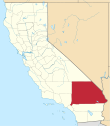
 Location in San Bernardino County and the state of California | |
 Highland Location in the United States | |
| Coordinates: 34°07′42″N 117°12′31″W / 34.12833°N 117.20861°WCoordinates: 34°07′42″N 117°12′31″W / 34.12833°N 117.20861°W[1] | |
| Country |
|
| State |
|
| County | San Bernardino |
| Incorporated | November 24, 1987[2] |
| Area[3] | |
| • Total | 18.890 sq mi (48.924 km2) |
| • Land | 18.755 sq mi (48.575 km2) |
| • Water | 0.135 sq mi (0.349 km2) 0.71% |
| Elevation[1] | 1,309 ft (399 m) |
| Population (2010) | |
| • Total | 53,014 |
| • Density | 2,800/sq mi (1,100/km2) |
| Time zone | PST (UTC-8) |
| • Summer (DST) | PDT (UTC-7) |
| ZIP code | 92346 |
| Area code(s) | 909 |
| FIPS code | 06-33588 |
| GNIS feature IDs | 1652722, 2410759 |
| Website |
www |

Highland is a city in San Bernardino County, California, United States. The population in 2010 (US Census) was 53,104, up from 44,605 at the 2000 census. The term Highland also refers to a geographical area of the city of San Bernardino (generally east of Del Rosa Avenue to the eastern city limits), and parts of unincorporated San Bernardino County.
Geography
Highland is located at 34°7′6″N 117°12′9″W / 34.11833°N 117.20250°W (34.118459, -117.202370).[4]
According to the United States Census Bureau, the city has a total area of 18.9 square miles (48.9 km²). 18.8 square miles (48.6 km²) of it is land and 0.1 square miles (0.3 km²) of it (0.71%) is water.
Demographics
| Historical population | |||
|---|---|---|---|
| Census | Pop. | %± | |
| 1970 | 12,669 | — | |
| 1980 | 10,908 | −13.9% | |
| 1990 | 34,439 | 215.7% | |
| 2000 | 44,605 | 29.5% | |
| 2010 | 53,104 | 19.1% | |
| Est. 2015 | 54,854 | [5] | 3.3% |
2010
The 2010 United States Census[7] reported that Highland had a population of 53,104. The population density was 2,811.3 people per square mile (1,085.4/km²). The racial makeup of Highland was 27,836 (52.4%) White (30.8% Non-Hispanic White),[8] 5,887 (11.1%) African American, 542 (1.0%) Native American, 3,954 (7.4%) Asian, 168 (0.3%) Pacific Islander, 11,826 (22.3%) from other races, and 2,891 (5.4%) from two or more races. Hispanic or Latino of any race were 25,556 persons (48.1%).
The Census reported that 52,932 people (99.7% of the population) lived in households, 76 (0.1%) lived in non-institutionalized group quarters, and 96 (0.2%) were institutionalized.
There were 15,471 households, out of which 7,922 (51.2%) had children under the age of 18 living in them, 8,475 (54.8%) were opposite-sex married couples living together, 2,884 (18.6%) had a female householder with no husband present, 1,183 (7.6%) had a male householder with no wife present. There were 1,129 (7.3%) unmarried opposite-sex partnerships, and 109 (0.7%) same-sex married couples or partnerships. 2,254 households (14.6%) were made up of individuals and 757 (4.9%) had someone living alone who was 65 years of age or older. The average household size was 3.42. There were 12,542 families (81.1% of all households); the average family size was 3.74.
The population was spread out with 16,916 people (31.9%) under the age of 18, 5,900 people (11.1%) aged 18 to 24, 13,837 people (26.1%) aged 25 to 44, 12,357 people (23.3%) aged 45 to 64, and 4,094 people (7.7%) who were 65 years of age or older. The median age was 30.6 years. For every 100 females there were 95.1 males. For every 100 females age 18 and over, there were 91.3 males.
There were 16,578 housing units at an average density of 877.6 per square mile (338.9/km²), of which 10,106 (65.3%) were owner-occupied, and 5,365 (34.7%) were occupied by renters. The homeowner vacancy rate was 2.2%; the rental vacancy rate was 8.7%. 33,361 people (62.8% of the population) lived in owner-occupied housing units and 19,571 people (36.9%) lived in rental housing units.
According to the 2010 United States Census, Highland had a median household income of $57,313, with 20.6% of the population living below the federal poverty line.[8]
2000
As of the census of 2000, there were 44,605 people, 13,478 households, and 10,782 families residing in the city.[9] The population density was 3,273.3 inhabitants per square mile (1,263.5/km²). There were 14,858 housing units at an average density of 1,090.3 per square mile (420.9/km²). The racial makeup of the city was 56.3% White, 12.1% African American, 1.3% Native American, 6.1% Asian, 0.3% Pacific Islander, 18.6% from other races, and 5.2% from two or more races. Hispanic or Latino of any race were 36.6% of the population.
There were 13,478 households out of which 47.9% had children under the age of 18 living with them, 55.1% were married couples living together, 19.0% had a female householder with no husband present, and 20.0% were non-families. 15.4% of all households were made up of individuals and 4.8% had someone living alone who was 65 years of age or older. The average household size was 3.3 and the average family size was 3.6.
In the city the population was spread out with 35.6% under the age of 18, 9.0% from 18 to 24, 30.0% from 25 to 44, 19.0% from 45 to 64, and 6.5% who were 65 years of age or older. The median age was 29 years. For every 100 females there were 95.4 males. For every 100 females age 18 and over, there were 91.9 males.
The median income for a household in the city was $41,230, and the median income for a family was $43,649. Males had a median income of $38,695 versus $27,308 for females. The per capita income for the city was $16,039. About 17.5% of families and 21.5% of the population were below the poverty line, including 29.2% of those under age 18 and 10.9% of those age 65 or over.
The city is split east to west of Boulder Ave. with the higher income area to the east and lower income area to the west. Demographics such as income levels and housing density are also split evenly by the geographic divider of Boulder Ave. Much of West Highland mirrors its sister city San Bernardino as East Highland is relatively new and only developed within the past fifteen years.
Climate
| Climate data for Highland, CA (1981–2010 normals) | |||||||||||||
|---|---|---|---|---|---|---|---|---|---|---|---|---|---|
| Month | Jan | Feb | Mar | Apr | May | Jun | Jul | Aug | Sep | Oct | Nov | Dec | Year |
| Average high °F (°C) | 70 (21) |
72 (22) |
75 (24) |
80 (27) |
85 (29) |
94 (34) |
100 (38) |
101 (38) |
99 (37) |
86 (30) |
79 (26) |
70 (21) |
84.3 (28.9) |
| Average low °F (°C) | 42 (6) |
43 (6) |
46 (8) |
50 (10) |
53 (12) |
59 (15) |
64 (18) |
66 (19) |
64 (18) |
59 (15) |
49 (9) |
43 (6) |
53.2 (11.8) |
| Source: [10] | |||||||||||||
Education
Highland is served by two public school districts: Redlands Unified and San Bernardino Unified School Districts (the boundaries are generally defined by City Creek; residents east of City Creek are in the Redlands Unified School District while those west of City Creek are served by San Bernardino City Unified School District).
Highland is home to a one of a kind library and environmental learning center. The Highland Sam J. Racadio Library and Environmental Learning Center is a gold rated L.E.E.D. (Leadership in Energy and Environmental Design)building. It holds thousands of books, cd's, DVD's, and other items. It offers free computer access and wifi. It has a rooftop garden and is home to animals, amphibians, and reptiles from around the globe.
Highland residents who attend college locally have a few choices: the two-campus San Bernardino Community College District (which includes Crafton Hills College in Yucaipa and San Bernardino Valley College), Loma Linda University, the private University of Redlands, and the California State University's San Bernardino campus.
Government
Local
Highland was founded as a townsite in 1891 and incorporated as a California general law city in November 1987. It follows a City Manager, City Council form of government with the City Manager appointed by the City Council.
State and federal
In the California State Legislature, Highland is the 23rd Senate District, represented by Republican Mike Morrell, and in the 40th Assembly District, represented by Republican Marc Steinorth.[11]
In the United States House of Representatives, Highland is split between California's 8th congressional district, represented by Republican Paul Cook and California's 31st congressional district, represented by Democrat Pete Aguilar.[12]
Public safety
The San Bernardino County Sheriff’s Department provides contracted police services to the city of Highland from their regional station located at 26985 Base Line Road. The new 30,000-square-foot (2,800 m2) police station was recently built and occupied in June, 2011.
The City has contracted with Cal Fire to operate its fire services (three stations) since its incorporation.
Sister cities
References
| Wikimedia Commons has media related to Highland, California. |
- 1 2 "Highland". Geographic Names Information System. United States Geological Survey. Retrieved November 12, 2014.
- ↑ "California Cities by Incorporation Date" (Word). California Association of Local Agency Formation Commissions. Retrieved August 25, 2014.
- ↑ "2010 Census U.S. Gazetteer Files – Places – California". United States Census Bureau.
- ↑ "US Gazetteer files: 2010, 2000, and 1990". United States Census Bureau. Feb 12, 2011. Retrieved Apr 23, 2011.
- ↑ "Annual Estimates of the Resident Population for Incorporated Places: April 1, 2010 to July 1, 2015". Retrieved July 2, 2016.
- ↑ "Census of Population and Housing". Census.gov. Archived from the original on May 11, 2015. Retrieved June 4, 2015.
- ↑ "2010 Census Interactive Population Search: CA - Highland city". U.S. Census Bureau. Retrieved July 12, 2014.
- 1 2 "State & County QuickFacts". United States Census Bureau. Dec 4, 2014. Retrieved Jan 19, 2015.
- ↑ "American FactFinder". United States Census Bureau. Archived from the original on 2013-09-11. Retrieved Jan 31, 2008.
- ↑ http://www.wrcc.dri.edu/cgi-bin/cliMAIN.pl-highland,ca-?ca1484. Missing or empty
|title=(help) - ↑ "Statewide Database". UC Regents. Retrieved November 23, 2014.
- ↑ "California's 8th Congressional District - Representatives & District Map". Civic Impulse, LLC.
External links
 |
San Bernardino | San Bernardino Mountains | San Bernardino Mountains | |
| San Bernardino | |
San Bernardino Mountains | ||
| ||||
| | ||||
| San Bernardino | Redlands | Redlands |