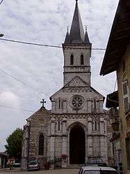
Saint-Martin-du-Mont, Ain
| Saint-Martin-du-Mont | |
|---|---|
 | |
 Saint-Martin-du-Mont | |
|
Location within Auvergne-Rhône-Alpes region  Saint-Martin-du-Mont | |
| Coordinates: 46°06′08″N 5°19′45″E / 46.1022°N 5.3292°ECoordinates: 46°06′08″N 5°19′45″E / 46.1022°N 5.3292°E | |
| Country | France |
| Region | Auvergne-Rhône-Alpes |
| Department | Ain |
| Arrondissement | Bourg-en-Bresse |
| Canton | Pont-d'Ain |
| Intercommunality | Bresse Dombes Sud Revermont |
| Government | |
| • Mayor (2008–2014) | Laurent Paucod |
| Area1 | 28.09 km2 (10.85 sq mi) |
| Population (2008)2 | 1,565 |
| • Density | 56/km2 (140/sq mi) |
| Time zone | CET (UTC+1) |
| • Summer (DST) | CEST (UTC+2) |
| INSEE/Postal code | 01374 / 01160 |
| Elevation |
246–556 m (807–1,824 ft) (avg. 340 m or 1,120 ft) |
|
1 French Land Register data, which excludes lakes, ponds, glaciers > 1 km² (0.386 sq mi or 247 acres) and river estuaries. 2 Population without double counting: residents of multiple communes (e.g., students and military personnel) only counted once. | |
Saint-Martin-du-Mont is a commune in the Ain department in the region of Auvergne-Rhône-Alpes in eastern France.
Population
| Historical population | ||
|---|---|---|
| Year | Pop. | ±% |
| 1793 | 1,673 | — |
| 1800 | 1,675 | +0.1% |
| 1806 | 1,753 | +4.7% |
| 1821 | 1,706 | −2.7% |
| 1831 | 1,686 | −1.2% |
| 1836 | 1,684 | −0.1% |
| 1841 | 1,726 | +2.5% |
| 1846 | 1,745 | +1.1% |
| 1851 | 1,764 | +1.1% |
| 1856 | 1,711 | −3.0% |
| 1861 | 1,690 | −1.2% |
| 1866 | 1,768 | +4.6% |
| 1872 | 1,718 | −2.8% |
| 1876 | 1,728 | +0.6% |
| 1881 | 1,697 | −1.8% |
| 1886 | 1,642 | −3.2% |
| 1891 | 1,517 | −7.6% |
| 1896 | 1,497 | −1.3% |
| 1901 | 1,521 | +1.6% |
| 1906 | 1,509 | −0.8% |
| 1911 | 1,510 | +0.1% |
| 1921 | 1,351 | −10.5% |
| 1926 | 1,273 | −5.8% |
| 1931 | 1,218 | −4.3% |
| 1936 | 1,112 | −8.7% |
| 1946 | 1,064 | −4.3% |
| 1954 | 1,038 | −2.4% |
| 1962 | 1,019 | −1.8% |
| 1968 | 1,007 | −1.2% |
| 1975 | 909 | −9.7% |
| 1982 | 1,078 | +18.6% |
| 1990 | 1,179 | +9.4% |
| 1999 | 1,302 | +10.4% |
| 2008 | 1,565 | +20.2% |
See also
References
| Wikimedia Commons has media related to Saint-Martin-du-Mont, Ain. |
This article is issued from Wikipedia - version of the 10/27/2016. The text is available under the Creative Commons Attribution/Share Alike but additional terms may apply for the media files.