Outriaz
| Outriaz | |
|---|---|
|
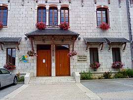
Town hall | |
 Outriaz | |
|
Location within Auvergne-Rhône-Alpes region  Outriaz | |
| Coordinates: 46°04′05″N 5°32′51″E / 46.0681°N 5.5475°ECoordinates: 46°04′05″N 5°32′51″E / 46.0681°N 5.5475°E | |
| Country | France |
| Region | Auvergne-Rhône-Alpes |
| Department | Ain |
| Arrondissement | Nantua |
| Canton | Brénod |
| Government | |
| • Mayor (2014–2020) | Claude Morel |
| Area1 | 5.91 km2 (2.28 sq mi) |
| Population (2013)2 | 256 |
| • Density | 43/km2 (110/sq mi) |
| Time zone | CET (UTC+1) |
| • Summer (DST) | CEST (UTC+2) |
| INSEE/Postal code | 01282 / 01430 |
| Elevation |
647–1,103 m (2,123–3,619 ft) (avg. 680 m or 2,230 ft) |
|
1 French Land Register data, which excludes lakes, ponds, glaciers > 1 km² (0.386 sq mi or 247 acres) and river estuaries. 2 Population without double counting: residents of multiple communes (e.g., students and military personnel) only counted once. | |
Outriaz is a commune in the Ain department in eastern France.
Inhabitants of Outriaz are called Triolins.[1]
Population
| Historical population | ||
|---|---|---|
| Year | Pop. | ±% |
| 1872 | 234 | — |
| 1876 | 233 | −0.4% |
| 1881 | 250 | +7.3% |
| 1886 | 254 | +1.6% |
| 1891 | 233 | −8.3% |
| 1896 | 237 | +1.7% |
| 1901 | 240 | +1.3% |
| 1906 | 223 | −7.1% |
| 1911 | 219 | −1.8% |
| 1921 | 213 | −2.7% |
| 1926 | 220 | +3.3% |
| 1931 | 223 | +1.4% |
| 1936 | 206 | −7.6% |
| 1946 | 190 | −7.8% |
| 1954 | 222 | +16.8% |
| 1962 | 236 | +6.3% |
| 1968 | 225 | −4.7% |
| 1975 | 204 | −9.3% |
| 1982 | 255 | +25.0% |
| 1990 | 275 | +7.8% |
| 1999 | 264 | −4.0% |
| 2008 | 266 | +0.8% |
| 2013 | 256 | −3.8% |
See also
References
| Wikimedia Commons has media related to Outriaz. |
This article is issued from Wikipedia - version of the 5/25/2016. The text is available under the Creative Commons Attribution/Share Alike but additional terms may apply for the media files.