Montluel
| Montluel | ||
|---|---|---|
 | ||
| ||
 Montluel | ||
|
Location within Auvergne-Rhône-Alpes region  Montluel | ||
| Coordinates: 45°51′00″N 5°03′18″E / 45.85°N 5.055°ECoordinates: 45°51′00″N 5°03′18″E / 45.85°N 5.055°E | ||
| Country | France | |
| Region | Auvergne-Rhône-Alpes | |
| Department | Ain | |
| Arrondissement | Bourg-en-Bresse | |
| Canton | Montluel | |
| Government | ||
| • Mayor (2008–2014) | Jacky Bernard | |
| Area1 | 40.11 km2 (15.49 sq mi) | |
| Population (2006)2 | 6,774 | |
| • Density | 170/km2 (440/sq mi) | |
| Time zone | CET (UTC+1) | |
| • Summer (DST) | CEST (UTC+2) | |
| INSEE/Postal code | 01262 / 01120 | |
| Elevation |
192–312 m (630–1,024 ft) (avg. 199 m or 653 ft) | |
|
1 French Land Register data, which excludes lakes, ponds, glaciers > 1 km² (0.386 sq mi or 247 acres) and river estuaries. 2 Population without double counting: residents of multiple communes (e.g., students and military personnel) only counted once. | ||
.svg.png)
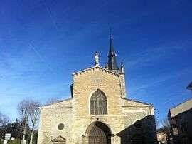
Montluel is a commune in the Ain department in eastern France.
It is situated on the outskirts of Lyon. The inhabitants are known as Montluistes.
Population
| Historical population | ||
|---|---|---|
| Year | Pop. | ±% |
| 1793 | 3,438 | — |
| 1800 | 3,652 | +6.2% |
| 1806 | 3,259 | −10.8% |
| 1821 | 3,547 | +8.8% |
| 1831 | 2,927 | −17.5% |
| 1836 | 2,955 | +1.0% |
| 1841 | 2,946 | −0.3% |
| 1846 | 3,171 | +7.6% |
| 1851 | 2,793 | −11.9% |
| 1856 | 2,610 | −6.6% |
| 1861 | 2,737 | +4.9% |
| 1866 | 2,981 | +8.9% |
| 1872 | 2,757 | −7.5% |
| 1876 | 2,829 | +2.6% |
| 1881 | 2,703 | −4.5% |
| 1886 | 2,755 | +1.9% |
| 1891 | 2,686 | −2.5% |
| 1896 | 2,589 | −3.6% |
| 1901 | 2,664 | +2.9% |
| 1906 | 2,564 | −3.8% |
| 1911 | 2,504 | −2.3% |
| 1921 | 2,153 | −14.0% |
| 1926 | 2,381 | +10.6% |
| 1931 | 2,460 | +3.3% |
| 1936 | 2,281 | −7.3% |
| 1946 | 2,213 | −3.0% |
| 1954 | 2,367 | +7.0% |
| 1962 | 2,785 | +17.7% |
| 1968 | 3,442 | +23.6% |
| 1975 | 4,604 | +33.8% |
| 1982 | 5,450 | +18.4% |
| 1990 | 5,954 | +9.2% |
| 1999 | 6,456 | +8.4% |
| 2008 | 6,774 | +4.9% |
Personalities
- Claude André (1743-1818), Catholic Bishop of Quimper
- André d'Arbelles (1767–1825), younger brother of the above, journalist and historiographer
- Pierre-Dominique Ségaud (1784–1821), writer and lawyer
- Joseph Crétin (1799-1857), Catholic Bishop of Saint Paul, Minnesota
- Paul Magaud (1805-?), botanist
- Pierre Cormorèche (1924–1999), politician
See also
References
External links
| Wikimedia Commons has media related to Montluel. |
This article is issued from Wikipedia - version of the 11/13/2016. The text is available under the Creative Commons Attribution/Share Alike but additional terms may apply for the media files.