Saint-Cyr-sur-Menthon
| Saint-Cyr-sur-Menthon | ||
|---|---|---|
 | ||
| ||
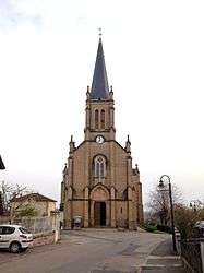
 Saint-Cyr-sur-Menthon | ||
|
Location within Auvergne-Rhône-Alpes region  Saint-Cyr-sur-Menthon | ||
| Coordinates: 46°16′35″N 4°58′24″E / 46.2764°N 4.9733°ECoordinates: 46°16′35″N 4°58′24″E / 46.2764°N 4.9733°E | ||
| Country | France | |
| Region | Auvergne-Rhône-Alpes | |
| Department | Ain | |
| Arrondissement | Bourg-en-Bresse | |
| Canton | Vonnas | |
| Intercommunality | Pont-de-Veyle | |
| Government | ||
| • Mayor (2014–2020) | Alain Chalton | |
| Area1 | 16.93 km2 (6.54 sq mi) | |
| Population (2013)2 | 1,719 | |
| • Density | 100/km2 (260/sq mi) | |
| Time zone | CET (UTC+1) | |
| • Summer (DST) | CEST (UTC+2) | |
| INSEE/Postal code | 01343 / 01380 | |
| Elevation |
181–217 m (594–712 ft) (avg. 180 m or 590 ft) | |
|
1 French Land Register data, which excludes lakes, ponds, glaciers > 1 km² (0.386 sq mi or 247 acres) and river estuaries. 2 Population without double counting: residents of multiple communes (e.g., students and military personnel) only counted once. | ||
.svg.png)
Saint-Cyr-sur-Menthon is a commune in the Ain department in eastern France.
Population
| Historical population | ||
|---|---|---|
| Year | Pop. | ±% |
| 1793 | 930 | — |
| 1800 | 907 | −2.5% |
| 1806 | 1,070 | +18.0% |
| 1821 | 1,135 | +6.1% |
| 1831 | 1,232 | +8.5% |
| 1836 | 1,279 | +3.8% |
| 1841 | 1,341 | +4.8% |
| 1846 | 1,345 | +0.3% |
| 1851 | 1,394 | +3.6% |
| 1856 | 1,414 | +1.4% |
| 1861 | 1,400 | −1.0% |
| 1866 | 1,404 | +0.3% |
| 1872 | 1,320 | −6.0% |
| 1876 | 1,300 | −1.5% |
| 1881 | 1,244 | −4.3% |
| 1886 | 1,182 | −5.0% |
| 1891 | 1,140 | −3.6% |
| 1896 | 1,124 | −1.4% |
| 1901 | 1,084 | −3.6% |
| 1906 | 1,055 | −2.7% |
| 1911 | 1,078 | +2.2% |
| 1921 | 969 | −10.1% |
| 1926 | 955 | −1.4% |
| 1931 | 924 | −3.2% |
| 1936 | 911 | −1.4% |
| 1946 | 898 | −1.4% |
| 1954 | 850 | −5.3% |
| 1962 | 811 | −4.6% |
| 1968 | 809 | −0.2% |
| 1975 | 822 | +1.6% |
| 1982 | 983 | +19.6% |
| 1990 | 1,243 | +26.4% |
| 1999 | 1,314 | +5.7% |
| 2008 | 1,563 | +18.9% |
| 2011 | 1,674 | +7.1% |
See also
References
| Wikimedia Commons has media related to Saint-Cyr-sur-Menthon. |
This article is issued from Wikipedia - version of the 12/3/2016. The text is available under the Creative Commons Attribution/Share Alike but additional terms may apply for the media files.