Chazey-sur-Ain
| Chazey | ||
|---|---|---|
|
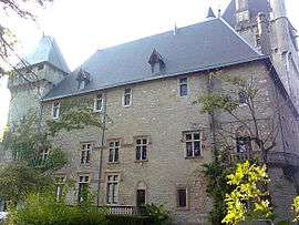
Chateau | ||
| ||
 Chazey | ||
|
Location within Auvergne-Rhône-Alpes region  Chazey | ||
| Coordinates: 45°53′36″N 5°15′21″E / 45.8933°N 5.2558°ECoordinates: 45°53′36″N 5°15′21″E / 45.8933°N 5.2558°E | ||
| Country | France | |
| Region | Auvergne-Rhône-Alpes | |
| Department | Ain | |
| Arrondissement | Belley | |
| Canton | Lagnieu | |
| Intercommunality | Plaine de l'Ain | |
| Government | ||
| • Mayor (2008–2014) | René Dulot | |
| Area1 | 21.95 km2 (8.47 sq mi) | |
| Population (2008)2 | 1,385 | |
| • Density | 63/km2 (160/sq mi) | |
| Time zone | CET (UTC+1) | |
| • Summer (DST) | CEST (UTC+2) | |
| INSEE/Postal code | 01099 / 01150 | |
| Elevation |
202–261 m (663–856 ft) (avg. 230 m or 750 ft) | |
|
1 French Land Register data, which excludes lakes, ponds, glaciers > 1 km² (0.386 sq mi or 247 acres) and river estuaries. 2 Population without double counting: residents of multiple communes (e.g., students and military personnel) only counted once. | ||
.svg.png)
Chazey is a commune in the Ain department in eastern France.
Population
| Historical population | ||
|---|---|---|
| Year | Pop. | ±% |
| 1793 | 713 | — |
| 1800 | 771 | +8.1% |
| 1806 | 940 | +21.9% |
| 1821 | 1,107 | +17.8% |
| 1831 | 1,120 | +1.2% |
| 1836 | 1,156 | +3.2% |
| 1841 | 1,102 | −4.7% |
| 1846 | 1,122 | +1.8% |
| 1851 | 1,161 | +3.5% |
| 1856 | 1,256 | +8.2% |
| 1861 | 1,161 | −7.6% |
| 1866 | 800 | −31.1% |
| 1872 | 771 | −3.6% |
| 1876 | 772 | +0.1% |
| 1881 | 698 | −9.6% |
| 1886 | 665 | −4.7% |
| 1891 | 646 | −2.9% |
| 1896 | 644 | −0.3% |
| 1901 | 650 | +0.9% |
| 1906 | 587 | −9.7% |
| 1911 | 570 | −2.9% |
| 1921 | 486 | −14.7% |
| 1926 | 438 | −9.9% |
| 1931 | 466 | +6.4% |
| 1936 | 469 | +0.6% |
| 1946 | 484 | +3.2% |
| 1954 | 478 | −1.2% |
| 1962 | 442 | −7.5% |
| 1968 | 524 | +18.6% |
| 1975 | 651 | +24.2% |
| 1982 | 695 | +6.8% |
| 1990 | 895 | +28.8% |
| 1999 | 1,200 | +34.1% |
| 2008 | 1,385 | +15.4% |
See also
References
| Wikimedia Commons has media related to Chazey-sur-Ain. |
This article is issued from Wikipedia - version of the 10/27/2016. The text is available under the Creative Commons Attribution/Share Alike but additional terms may apply for the media files.