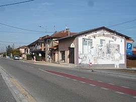
Villemotier
| Villemotier | |
|---|---|
 | |
 Villemotier | |
|
Location within Auvergne-Rhône-Alpes region  Villemotier | |
| Coordinates: 46°20′46″N 5°19′16″E / 46.3461°N 5.3211°ECoordinates: 46°20′46″N 5°19′16″E / 46.3461°N 5.3211°E | |
| Country | France |
| Region | Auvergne-Rhône-Alpes |
| Department | Ain |
| Arrondissement | Bourg-en-Bresse |
| Canton | Coligny |
| Intercommunality | Coligny |
| Government | |
| • Mayor (2008–2014) | Aimé Girard |
| Area1 | 13.86 km2 (5.35 sq mi) |
| Population (2008)2 | 597 |
| • Density | 43/km2 (110/sq mi) |
| Time zone | CET (UTC+1) |
| • Summer (DST) | CEST (UTC+2) |
| INSEE/Postal code | 01445 / 01270 |
| Elevation |
197–261 m (646–856 ft) (avg. 219 m or 719 ft) |
|
1 French Land Register data, which excludes lakes, ponds, glaciers > 1 km² (0.386 sq mi or 247 acres) and river estuaries. 2 Population without double counting: residents of multiple communes (e.g., students and military personnel) only counted once. | |
Villemotier is a commune in the Ain department in eastern France.
Geography
The Solnan forms parts of the commune's eastern and western borders; it flows southwest through the eastern part of the commune and north through its middle.
Population
| Historical population | ||
|---|---|---|
| Year | Pop. | ±% |
| 1793 | 810 | — |
| 1800 | 801 | −1.1% |
| 1806 | 828 | +3.4% |
| 1821 | 780 | −5.8% |
| 1831 | 739 | −5.3% |
| 1836 | 732 | −0.9% |
| 1841 | 794 | +8.5% |
| 1846 | 763 | −3.9% |
| 1851 | 784 | +2.8% |
| 1856 | 733 | −6.5% |
| 1861 | 729 | −0.5% |
| 1866 | 797 | +9.3% |
| 1872 | 801 | +0.5% |
| 1876 | 794 | −0.9% |
| 1881 | 784 | −1.3% |
| 1886 | 818 | +4.3% |
| 1891 | 762 | −6.8% |
| 1896 | 798 | +4.7% |
| 1901 | 725 | −9.1% |
| 1906 | 698 | −3.7% |
| 1911 | 720 | +3.2% |
| 1921 | 632 | −12.2% |
| 1926 | 623 | −1.4% |
| 1931 | 604 | −3.0% |
| 1936 | 590 | −2.3% |
| 1946 | 562 | −4.7% |
| 1954 | 504 | −10.3% |
| 1962 | 434 | −13.9% |
| 1968 | 403 | −7.1% |
| 1975 | 372 | −7.7% |
| 1982 | 384 | +3.2% |
| 1990 | 419 | +9.1% |
| 1999 | 455 | +8.6% |
| 2008 | 597 | +31.2% |
See also
References
| Wikimedia Commons has media related to Villemotier. |
This article is issued from Wikipedia - version of the 10/27/2016. The text is available under the Creative Commons Attribution/Share Alike but additional terms may apply for the media files.